43 Foot Searay Sinks

The friendliest place on the web for anyone who enjoys boating.
If you have answers, please help by responding to the unanswered posts.
My voyage planning rule of thumb (for entering/departing inlets the first time) is to always cross the COLREGS demarcation line as close to center channel as possible.
 
I'm with the chart voters. There is no excuse here. This is bravado and inexperience. Even experienced folks avoid entering inlets at night. I know I did, and I had every paper chart and electronic gizmo on the planet. That's Darwin in action right there.

Oh no not again! It's like politics or religion. No matter how strongly you believe in your opinion, you're not likely to convince the other side.
 
I'd agree that this inlet could be safely run at night, even without a chart. The buoyage is clear. It is likely that this boat had moving chart GPS displays and radar making it possible blindfolded. Could have been other confounding factors, but absent those, captain just ran the boat up on the rocks.


x2... If you know what buoys are for AND can follow a channel range marker (even easier to do at night) there is no reason for this to have happened in such a well marked channel. Tragedy..... glad no one was lost.
 
My feeling is that when approaching a possible hazard, on a strange boat, at night, just follow the channel buoys. Looking at the chart segment posted, it seems they would have made it home. Another recent experience I had was that after sailing for several decades I recently was on a friends cruiser doing 25KT in a very familiar area, in daylight, in perfect visibility conditions. The speed difference alone completely alters your perspective on everything.
 
Id love to see the video!
 
Id love to see the video!

Owner sinks his new boat at night taking it home for the first time. Manages to survive along with his wife and infant child.

But yeah, sure would be great to be entertained by the video.
 
I'm not going to make any assumptions or guesses about the root cause of this specific incident. I will however pontificate on a more general topic: Chart plotters cause overconfidence in newer boaters that was much less present in the 90's and before. They are certainly a great tool when fully understood and used properly, just like radar, compasses, binoculars and other navigational tools but they make navigation seem so much easier than prior to their prevalence.

Prior to affordable electronic chart plotters and aside from the fourth of July in the US (which is another whole topic), relatively few recreational boaters had the experience and confidence in identifying and following lighted ATONs to venture out at night or enter a harbor at night much less an unfamiliar one.

Even in broad daylight, extensive electronics can easily distract any boater and draws their eyes "inside" rather than "outside" of the boat. They should be a tool but in my opinion, they are too often abused as a crutch.
 
Last edited:
My voyage planning rule of thumb (for entering/departing inlets the first time) is to always cross the COLREGS demarcation line as close to center channel as possible.

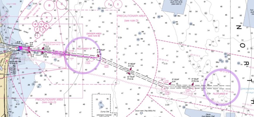
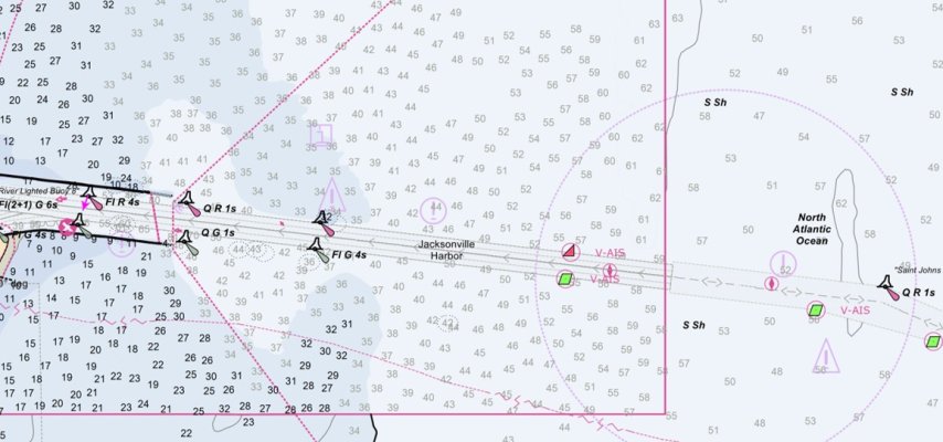
Here's the challenge - where should you enter this channel? There happens to be two pilotage zones - one at about 4-nms from the jetties, the other 10-nms.

JAX Commercial Channel.jpg

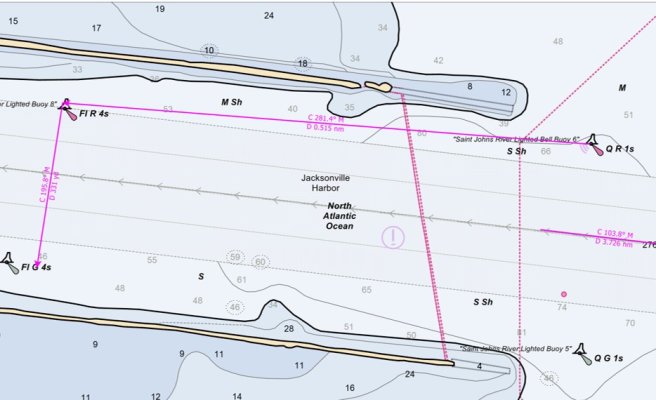
Here's a close-up from Pilot B (4-nms out). Note the use of AIS Virtual Buoys - as if there was another reason to have AIS (at least B/Receive). Do you go all the way out to there? Personally, the key for me are the "Q 1-sec" lights flashing continuous 1-second at the jetty. BTW - while this is all contained in Chart 1 (a pamphlet, not a chart), here is a decent URL that describes in kitchen-english.

JAX Enter Pilot B.jpg

Saying "I'll follow the ATONs" is safe guidance, but who among us would go out 10-nms to the outer channel buoy? Who would go out to the secondary pilotage section 4-nms out?

Peter
 

Attachments

  • JAX Entrace.jpg
    JAX Entrace.jpg
    90.5 KB · Views: 33
Here's the challenge - where should you enter this channel? There happens to be two pilotage zones - one at about 4-nms from the jetties, the other 10-nms.

Personally, I would enter at 10SJA because it is quick flashing and would be the easiest for me to recognize and then I could easily follow the range lights (leading lights) up the channel.
 
If I were entering this for the first time, at night, I’d go in at the 4 second lights. Otherwise, I’d probably use the 1 second lights, especially if coming in from the north. The south entrance at the 1 second lights looks good too if you have some experience with the area. I didn’t really study the scale though, so would look closer before any entrance.
 
Tough to judge when you were not there. The first time I traveled at night from Lake Washington to my berth in Ballard was straightforward. Calm night. No wind. Plenty of trips on the same route. No problem. Pass under the University bridge to enter Lake Union and.....WTF! Gill nets everywhere! Very few had the required flashing lights. My first instinct was to dodge. No way. Tried slowing. No way. Put in neutral and coasted over the top. My protected single engine prop was protected, so no snags. I didn't know they allowed indians to fish these waters on certain occasions. Only a handful of times in the last 20 years I've been here. My slow speed trawler saved me, which has been the case several times-able to see the threat and have time to react. In this case put it in neutral. Would be curious to know if there was something unpredictable involved with the Sea Ray.
 
Coming in unfamiliar with the entrance, I'd get into the channel somewhere seaward of "5" / "6". The rougher the conditions, the closer to "3" / "4" so I could be sure to be lined up well before the jetties. The only reason I'd go out further would be if subject to VTS, or if I needed the 50' afforded by the channel in from deeper water. And if I needed 50', I suspect I'd be subject to VTS anyway.
 
My only entry in the dark in a strange harbor was Cape Fear River...

Found buoys (pre-chart plotter), was "safely" in channel, and then the steering cable broke.

Dumped anchor and set up emergency tiller in a sporty seaway and proceeded in.

Even if its not a navigation issue other shite can, and will, happen.

Unless life and limb and other factors to really push me. Never again.
 
Is there vessel traffic service in that harbor?

No. The St. Johns Bar Pilots monitor significant traffic but have no traffic management authority. The pilots' dispatcher monitors channels 13/14/16. When underway, the pilot boat works 13/14. Note that the S.J. Bar pilots handle commercial traffic only. Warships and other traffic to and from the basin at Naval Station Mayport, immediately inside the south jetty, are served by Navy pilots. Mayport Harbor Control (that's the Navy) monitors channel 12.
 
Last edited:
Back
Top Bottom