43 Foot Searay Sinks

The friendliest place on the web for anyone who enjoys boating.
If you have answers, please help by responding to the unanswered posts.
It's been about 25 years since I've had an infant child. I would like to think, I would have taken possession of my new (to me) vessel and spent the night in Cape Canaveral and proceeded in the very early am. Either by myself or with a friend. Definitely not with my wife an infant child on board.

I personally like to test any new boat before I ever take loved ones or family riding.

I prefer to have local knowledge before I ever transition a pass at night.

I have reported or listened to enough channel marker issues to be careful especially at night.

Last but not least if I had to make that transition at night, my plain would be to use low speed. Only enough to allow steerage.

Because I am using my phone and missing 5 finger tips please excuse any inadvertent typos.
Thanks

Wow what happened to your five finger tips? That sounds like it hurt. And all that makes plenty of sense to me.


����
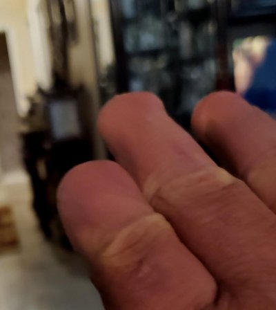
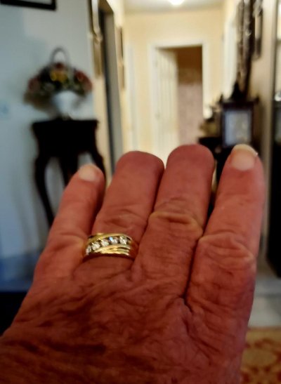
Yep they are still there, see attached photos
Any other questions?
I can post a picture of my 1/2 a left foot, not must right leg left to photograph.
 

Attachments

  • 20220912_185542.jpg
    20220912_185542.jpg
    66.8 KB · Views: 21
  • 20220912_185601.jpg
    20220912_185601.jpg
    71 KB · Views: 23
Last edited by a moderator:
One angle that I don't think has been mentioned is the time needed to gather information. The boat buying process is not instantaneous. You have a visit to just kick the tires and look around.....you have an engine survey....a hull survey....you arrange insurance and financing........We are talking 2-4 weeks of lead time knowing that at some point in the future you are going to have to enter your destination harbor. That is plenty of time for research and recon. Visit in the day time.......go for a sunset cruise out of that harbor.......walk the docks and talk to some commercial fishermen......spend a night at the marina bar.....

There is a HUGE difference between: "we need to enter that harbor now".......and "we will have to enter that harbor in a few weeks"

Do we know the skipper hadn't been in and out of this inlet 100 times?

He was bringing it "home". I can't say because I don't remember seeing that info posted.

It also depends on experience.... entering an inlet like Jax for someone with plenty of experience should be like an experienced driver on I-95 on some rural stretch with limited traffic. Again.... it's why I think the skipper made some decision outside of what is normally practiced.... whether an honest mistake or a mistake born out of fatigue, get-home-itis, loss of situational awareness, etc, etc. The inlet is almost as easy as it gets.....something else factored in is my guess...and a HUGE guess it is.
 
Under the right combination of conditions the seaward end of the Mayport jetties can be very lively and deceptive. Combine a strong ebb tide with a brisk wind out of the north or northeast, and you'll encounter water ripping around the tip of the north jetty, and pulling you down toward the south jetty with wind helping, while the waves become short and steep. Add darkness, exhaustion and lack of familiarity, and this skipper may have been creeping along cautiously, feeling his way past the red and green markers only to lose awareness that he was getting set down onto the dark rocks to port.

Maybe it happened differently - as Archie says, we're all just guessing. It must have been an awful experience for this skipper and his crew. So glad no one was lost.
 
Skippering at night is like driving very fast, you have to take baby steps.

While envious of a Sea Rays cruising speed, my cruising speed of 7 knots has bailed my ass out of more situations I care to admit.

I have planned several times to cut a channel, only to get a feeling and change my mind. Not anymore.
 
I've done something similar but with less disasterous results. I was in a popular anchorage with known submerged rocks in some areas. I watch several boats pass easily between a couple islands (probably locals) with no issues. When I left through the same passage, I glanced off a rock about 3 ft underwater. No damage, but scary. Later, looking at the chart, the rock was right there! What did I miss? My chart was zoomed in enough that I didn't see it. I didn't take the time to zoom out and get a bigger picture. Also, while moving, I probably wasn't looking at the chart as much as I was my surroundings so didn't see when it came up on the chart. I was somewhat familiar with the waters, but not completely knowledgeable of every rock. Yes, completely my fault, but sh!t happens for lots of reasons. In my case I can't even blame the dark as this was on a clear afternoon, but everything looked fine, just not enough attention to detail.
 
Any one who has studied accident investigations realizes that there are many "human factors" that weigh in why people do or don't do things.

We can narrow down WHY the boat hit the jetty, but unless the skipper provides an interview and reveals what was going on with him and what he was thinking.... the true cause will only be a wild guess unless it comes out it was a mechanical, electronic or external failure (GPS signal error....which around major military installations is not all that uncommon).

Good summary PS and I agree, having been there myself, as many of have in some degree.
 
psneeld

He purchased the boat on Merritt Island. He was bringing it home to the Jacksonville area.
How many times he went through that pass, I don't know but will ask his dad and try and find out.
 
Last edited by a moderator:
Any one who has studied accident investigations realizes that there are many "human factors" that weigh in why people do or don't do things.

We can narrow down WHY the boat hit the jetty, but unless the skipper provides an interview and reveals what was going on with him and what he was thinking.... the true cause will only be a wild guess unless it comes out it was a mechanical, electronic or external failure (GPS signal error....which around major military installations is not all that uncommon).
Yes, there are dozens of possibilities. But if you hear hoofbeats, think horses, not zebras. Or Ochams Razor - simplest solution is the most likely. Yea, could be anything, but this is not an accident tribunal. Nothing wrong with positing on various scenarios with an eye of learning something for future reference. Just trying to add a bit of learning as a silver lining to an otherwise awful piece of news.

The most common mistake is cutting the corner. Whether that applies to this precise situation, while important to LEO or insurance stakeholders, is not important to the armchair legions on forums like this.

A submerged jetty is, by definition, not visible. Operating outside a main commercial channel dredged to 40+ feet is common for recreational boats. The clear lesson here is what looks like an innocent passage may not be. I'd add that Backinblues rock-strike is a great example of being a bit blasé and it could happen to anyone (though some of us probably wouldn't admit it).

To reiterate, I am not speculating on the actions of the Searays helmsman. But I am saying that if you pursue certain practices such as not looking at a chart that is appropriately detailed, it could easily lead to a situation the Searay experienced.

Peter
 
Last edited:
https://safetyculture.com/topics/root-cause-analysis/

The root cause analysis definition revolves around the process of identifying the source of a problem and looking for a solution in a way that the problem is treated at the root level. This way, organizations and professionals can look beyond the symptoms of the problem and work on where the real cause exists.
 
A point not mentioned is that your chart plotter may omit some data if your zoom setting is too far out. I had that happen when transiting through the East River when delivering our current boat from RI to MD. Can't recall the specific spot but neither I nor the captain I had along with me were familiar enough to the older NavNet3D units that were on the boat at the time. Zoomed out as we'd been for most of the trip behind Long Island was not ideal as we got into shallower waters.

And using the navionics web portal for the St. Johns inlet area shows how information is sometimes not shown as effectively as you might want. You really do need to zoom in, in, in and out, out, out across the whole area to get a clearer idea of what's actually charted.
https://webapp.navionics.com/#boating/search@13&key=k|oxDr|roN

I have experienced this too. Just last week in fact. I run two garmin plotters, one zoomed in and one out wide. Paper chart on the table too for planning purposes. There was a red beacon on one plotter that didn’t show up on the other. I knew it was there, I saw it. It was on the paper chart too. I zoomed in to the same level as the other plotter and it still didn’t show. Zoomed in more and all the sudden it showed up. Change the zoom out one level and it was gone again.
Just reinforces my decision to keep paper charts on the nav table.

About a year ago a brand new $1M boat ran aground and sunk in Norwalk CT. It was being delivered by a hired capt from NJ to RI or something similar. I assume it had tha latest electronics and a capable capt, but still these things happen. Weather was rough so maybe they were running close to the coast to minimize the wind and waves, not sure.

Edit: I had some of the facts wrong, but the essence is still the same. Here's the news article.
https://cruisingodyssey.com/2020/05/13/tiara-hits-reef-off-norwalk-ct-sinks-police-rescue-2/
 
Last edited:
... or external failure (GPS signal error....which around major military installations is not all that uncommon).

One reason to overlay radar on the chart plotter - GPS or chart datum errors become obvious. Also magnetic compass errors - we saw a local variation of more than 20 degrees this summer. The instruments picked it up - sort of - as a large side current. The overlaid radar image showed it exactly. Who runs compass courses anymore? Your autopilot, for one.

Zoomed in more and all the sudden it showed up. Change the zoom out one level and it was gone again.
Just reinforces my decision to keep paper charts on the nav table.

This is an example of the ongoing disadvantage of computer drawn vs hand drawn charts. Most hand drawn (raster) charts, even at small scale, will depict any significant navigational hazard, even if it must be drawn at many times proportional size to fit it in. Vector renderers do this poorly today. You must zoom to a certain level for all hazards to appear. And how are you to know what that level must be?
 
Anyone want to begin a debate about the value of paper charts?
 
Good article in GCaptain today about a tug/barge that caused a train derailment back a few years ago on the Mississippi for encroaching on the tracks in an area recommended for pushing into the bank.

No paper or raster chart would have had the embedded note that erosion made the exact place the pilot chose as a "danger area" for that maneuver. Unfortunately the pilot didn't expand the tiny exclamation point on the vector chart that expanded the warning.

In that case the vector chart was VASTLY superior to paper or raster but the error of not using it correctly fell back to old school where paper/raster would have resulted in the same issue. The only other solution was how clear, current, relevant any NOTAM was. I say this only because I doubt the note was on a paper chart but maybe it was off in some margin, So the paper/raster still would have been a "good chart" but in situational awarenes, having the note/marks right at the correct spot are usually superior if you use the chart correctly.
 
Last edited:
I'm with the chart voters. There is no excuse here. This is bravado and inexperience. Even experienced folks avoid entering inlets at night. I know I did, and I had every paper chart and electronic gizmo on the planet. That's Darwin in action right there.
 
I'm with the chart voters. There is no excuse here. This is bravado and inexperience. Even experienced folks avoid entering inlets at night. I know I did, and I had every paper chart and electronic gizmo on the planet. That's Darwin in action right there.

What bravado and inexperience?

Not believing paper charts are necessary aboard? Not having the right chart? Not reading any of the charts correctly?

Not sure exactly what you are referring to.
 
Last edited:
Guys,
As a point of interest, I happened to transit the cut going offshore to fish a few days(?) after this incident and when we saw the vessel and circled back to approach it to check if anyone was onboard, the deck was well awash, and the vessel was almost abutting the rocks on the outside (south side)of the southern jetty, a good 100 -200 yards inshore (west) of the end of the jetty where it becomes submerged, so either something or someone moved it, or?
When I transited the cut the next weekend the vessel was nowhere to be seen.
Luckily it sounds like no one was badly hurt. I know I am always sickened when I see a vessel in a situation like this.
I suspect we may never know the circumstances that led to this outcome.
 
What bravado and inexperience?

Not believing paper charts are necessary aboard? Not having the right chart? Not reading any of the charts correctly?

Not sure exactly what you are referring to.

Well, what I meant is that no experienced captain would enter an inlet like that at night without the proper navigation equipment. You could do it if you had no electronics and only paper charts and a compass, but no one sane would do that unless they knew that inlet really, really well. A good skipper knows where he/she is at all times. That guy did not, obviously. So he was eithermacho and decided he could do it anyway, or not experienced and stupidly thought he could do it anyway. He must have been rushing for some odd reason, which you learn you never do. You can pick the time, or the place, but not both.
 
Five seconds on waterwayguide.com would have saved the boat. What's the first thing you do before entering an unfamiliar inlet at night?

First thing is don't enter or leave a new harbor at night ... only the most experienced captains or cruisers should attempt that.
 
Doesn't take much to sink a Searay! I would have thought since he is a man of god (aka decon), "god" would have advised him against a Searay.
 
While I fully understand the guidance to "never enter/depart an unfamilar harbor at night," I am going to push-back a bit on 'never.' I don't want to be overly encouraging, but running at night is not an Olympic-grade maneuver. Avoiding unfamiliar harbor entrances at night isn't a bad practice, but this one is immensly doable - would be a great first effort to enter an unknown harbor at night after some practice running at night in familiar waters (assuming benign weather, decent visibility, and awareness of ship's traffic).

I have no idea why this Searay hit the rocks. Could be a mechanical failure, could be a medical/health event. But a possible/likely scenario is they cut into the channel at a bad place and hit the submerged rocks. If you look at the pic attached - similar to a highway view many run, the jetty is shown, but could be easily dismissed.

What can't be easily dismissed is taking a path where a fast-flash (1-sec plus bell) ATON is on your port/left side.

Part of the allure of boating and cruising is the various conditions encountered. If someone wants to cruise distances, totally avoiding night arrivals is desireable for many reasons, but sooner or later, you'll be faced with a choice. There are some harbors I wouldn't approach in any condition; no matter the weather, day or night. There are many I have entered during the day but still would not enter at night because they are bit tricky. JAX/Mayport is not one of them - it's a straightforward entrance. I can't speak for whatever the marina may be, but this stretch of entrance? In typical conditions, is not a black-diamond approach. But you do have to navigate properly, and that means staying in the channel. Red-Right-Returning, etc.

Peter
JAX Entrace.jpg
 
Last edited:
Have spent a fair amount of time in areas where markers are privately maintained or publicly maintained on rare occasions. They drift as does the bottom. Or they’re absent. Usually the approach marker is more significant and stable in location. For 8 years most harbors and anchorages were brand new to us. Was taught line up at the most seaward marker. If not present at the position your chart says it should be. Pay attention to your depth. If there’s a discrepancy between the chart and your depth sounder believe your sounder. Stay midchannel if traffic allows or on the “high side” if there’s a cross current. Slow is pro. Approaching perpendicular to the landfall and slowly gives you time to sort things out. Like the radar running for markers but always hold in my mind both the markers and even the chart can mislead you.
Agree with PS. We don’t know the details so it’s all mental masturbation. Do know if his approach was far enough out to sea and he followed midchannel he’d be fine. Raster, vector, paper, dead reckoning whatever.

BTW- there’s been some places years past I actually prefer night. Plymouth/Duxbury/Kingston on a weekend can be a zoo. Ferries, whale watching boats, small and large fish boats, sailboats with rags up and engine off. It’s was our home port for awhile. At night it’s well marked, day signals light up on radar, range lights are good in spite of a lot of light pollution, buoys at course changes are light and have bells or horns. At night there’s rarely any traffic so much easier.
Same with barrington RI another pass home port.
 
Well, what I meant is that no experienced captain would enter an inlet like that at night without the proper navigation equipment. You could do it if you had no electronics and only paper charts and a compass, but no one sane would do that unless they knew that inlet really, really well. A good skipper knows where he/she is at all times. That guy did not, obviously. So he was eithermacho and decided he could do it anyway, or not experienced and stupidly thought he could do it anyway. He must have been rushing for some odd reason, which you learn you never do. You can pick the time, or the place, but not both.

You could easily enter that inlet, at night with no electronics as long as the ATON was correct and functioning, even without paper charts and certainly without a compass. Restricted visibly obviously not, but visually.....easy peezy as it is an all weather inlet transited by major shipping including the Navy. It's a straight shot, no breaking bar, lit/major ATON, a bit of a current so an onshore wind and outgoing would be choppy but still easy to nav, especially in a faster boat.

It's when you leave the vicinity of an inlet veering off inland that charts become way more important to know where you are....but just getting in is easy if you do it the way the ATON is designed to bring you in.

Again, no one really knows why it happened without an interview with the skipper.... cutting a corner is the likely scenario, but why would still be unanswered.
 
Last edited:
I don’t mind running at night out in open water when I know I won’t have to enter an inlet at night. I’ve left the inlet at Lake Worth at night headed to the Bahamas, and while it’s super wide and very well marked, it’s always confusing at night for me.
 
Going in and out of places at night isn't a hard no in my book. It really depends on the channel. Some places are easy at night even if you've never been there. Others I'd only want to do at night after seeing it in daylight. And some really shouldn't be tried at night unless you're quite familiar.

I also agree that when going in or out of somewhere unfamiliar it's a good idea to take a longer straight in run at the channel. It's only worth trying to save a few minutes when you really know it's ok to do.
 
There is no legitimate excuse. The captain was simply not up to the task. Night time navigating and piloting is WAY more demanding and this guy wasn’t ready for it.
 
There is no legitimate excuse. The captain was simply not up to the task. Night time navigating and piloting is WAY more demanding and this guy wasn’t ready for it.

We really don't know the root cause of the mishap.

He may or may not have been experienced, knowledgeable and capable but another factor might have been the root cause. I do agree that operating at night tends to be way more demanding..... I used to say 10X more at night to handle even simple emergencies when being trained in simulators.... but we may still not have the root cause in this mishap. Night might only be a causal factor.
 
There is no legitimate excuse. The captain was simply not up to the task. Night time navigating and piloting is WAY more demanding and this guy wasn’t ready for it.

It sounds harsh to say that, but it really is the most likely cause. Skill and experience needed,, simply exceeded skill and experience possessed.
 
I'd agree that this inlet could be safely run at night, even without a chart. The buoyage is clear. It is likely that this boat had moving chart GPS displays and radar making it possible blindfolded. Could have been other confounding factors, but absent those, captain just ran the boat up on the rocks.
 
Back
Top Bottom