|
|
10-12-2017, 08:05 AM
|
#1
|
Guru
City: Stuart FL
Vessel Name: Lucky Lucky
Vessel Model: Pacific Mariner 65
Join Date: Aug 2013
Posts: 2,726
|
Who to Believe
A friend turned me on to this weather website: www.ventusky.com. I must say it is a beautiful sight and my buddy who cruises a lot says it is the most accurate site he uses. So I logged on and was surprised (but not shocked) to see a marked variance relative to predicted wave heights. NOAA predictions appear to be much higher than Ventusky. Who do you believe and why?
__________________
Howard
Lucky Lucky
Stuart, FL
|
|
|
10-12-2017, 08:22 AM
|
#2
|
Guru
City: Fort Myers, FL... Summers in the Great Lakes
Vessel Name: Slow Hand
Vessel Model: Cherubini Independence 45
Join Date: Dec 2010
Posts: 12,455
|
What I see is what I believe. I focus more on wind speed, direction, and wind & wave data over the previous 24 hours.
Ted
|
|
|
10-12-2017, 09:23 AM
|
#3
|
TF Site Team
City: Westerly, RI
Vessel Name: N/A
Vessel Model: 1999 Mainship 350 Trawler
Join Date: Jan 2014
Posts: 4,000
|
Funny, because we already tend to find NOAA is somewhat conservative in their wave height predictions. I can't tell you the number of times reports of 2-4 were really 4-6. We were surprised a couple of years ago (though we really shouldn't have been). We were sitting on the dock waiting for a hurricane to pass well offshore. Wind was around 20-30. NOAA reported wave height as 3-5, which we thought was fairly low and definitely doable. When we got into the thick of it, it was 8 ft and breaking. More inline with what we expected but way off from what NOAA was reporting.
At that time I had a planing boat and knew measurements from waterline to eye level was 8 ft. When you're in the trough and staring at or up to the crests it's easy to tell wave height.
|
|
|
10-12-2017, 09:30 AM
|
#4
|
Guru
City: North Carolina for now
Join Date: Aug 2011
Posts: 6,348
|
Quote:
Originally Posted by O C Diver
What I see is what I believe. I focus more on wind speed, direction, and wind & wave data over the previous 24 hours.
Ted
|
Me too.
__________________
George
"There's the Right Way, the Wrong Way, and what some guy says he's gotten away with"
|
|
|
10-12-2017, 10:54 AM
|
#5
|
Member
City: Orlando, FL
Vessel Name: Barefoot Key
Vessel Model: Marine trader laBelle 40
Join Date: Feb 2015
Posts: 20
|
Ventusky
Quote:
Originally Posted by O C Diver
What I see is what I believe. I focus more on wind speed, direction, and wind & wave data over the previous 24 hours.
Ted
|
I agree with Ted, but I will add that I use ventusky a lot to go offshore here in the keys, waves have been as advertised. But I do go by wind speed and direction first.
|
|
|
10-12-2017, 02:18 PM
|
#6
|
Guru
City: Fort Lauderdale. Florida, USA
Join Date: Jan 2014
Posts: 21,449
|
Wifey B: None of the above. Look at forecasts sort of like hurricane tracking where you see all the different models. Well, thing of all forecasts like that and consider several. If one says 4' and another says 6' then hope for 4', expect 6' and don't be surprised by 8'.
|
|
|
10-12-2017, 03:02 PM
|
#7
|
Guru
City: Sunset Beach, NC
Vessel Name: Polly P.
Vessel Model: Monk 36
Join Date: Feb 2010
Posts: 555
|
I don't believe anyone any more. But I will tell you if I ever meet someone who works for NOAA I'm going to punch them in the mouth !
|
|
|
10-12-2017, 03:15 PM
|
#8
|
Guru
City: Fort Lauderdale. Florida, USA
Join Date: Jan 2014
Posts: 21,449
|
Quote:
Originally Posted by Egregious
I don't believe anyone any more. But I will tell you if I ever meet someone who works for NOAA I'm going to punch them in the mouth !
|
Well, the closest we have here is Richard of Dauntless fame. Hope he's prepared to duck if you come his way.
And why would you punch NOAA? They are forecasts with a high degree of anticipated error. Not promises. Better than 20 years ago, but still very far from perfect.
|
|
|
10-12-2017, 03:24 PM
|
#9
|
Guru
City: Pahrump, NV
Vessel Name: Pairadice
Vessel Model: Sold Selene 47
Join Date: Jul 2014
Posts: 1,959
|
We primarily use Windy, but we also check several other sources and try to make the best of the information to makes a decision. For the most part (like 95%) Windy has been spot on, but one time last trip We and ASD got caught in nasty stuff crossing Dixon entrance. The Canadian weather was the most accurate, and they have a history of being conservative.
So we have learned to take all the information, compile it and hope for the best. As noted above though, sometimes you have to be in the thick of things to know for sure.
|
|
|
10-12-2017, 03:25 PM
|
#10
|
TF Site Team
City: Jacksonville
Join Date: Nov 2008
Posts: 11,333
|
Most of the web weather sites are using some of the same computer models. This Ventusky uses HRRR, Icon, GFS and GEM. Which model they use and how they present the data is one of the differences between the sites. The models usually don't take into account local influences. Here's an explanation from Ventusky 's site on temperature:
Data: ICON, DWD (resolution 7 km)
Updated: 12:00 PM UTC (next update: 6:00 PM UTC - prepare)
Current time: 5:00 PM, 2017/10/12 (UTC−04:00)For this output data, temperature is shown for 2 m above ground. The calculations take into account the terrain (elevation), but with lower resolution than in reality. Therefore the models cannot differentiate, for instance, the temperature on a mountain peak or on a city square scorched by the sun. The general rule is that the centres of large cities are 1 °C to 3 °C warmer than the surrounding area or natural landscapes. Significant temperature differences over a small area are primarily caused in the winter by an inversion. A short yet noticeable cooling can also occur after a local summer storm.
We have access to grib files when we're out and once a week we get this email:
This grib file is extracted from a computer forecast model. While such computer data can provide useful guidance for general wind flow, there are limitations which must be understood. What you are receiving is a weather prediction generated by a computer run by NOAA/NCEP (GFS, WW3 models) or the US Navy (comaps, nogaps) and downloaded and processed by Saildocs (a service of Sailmail). The network is complex, and any computer network is subject to hardware and software failures or human error which can effect accuracy or availability of data. In particular, if our servers were not able to download a current data file then the grib-file may be based on old data. The file information is shown above and also contained in the file itself.
Also remember that grib data is not reviewed by forecasters before being made available. You are getting a small part of the raw model data that the forecasters themselves use when writing a forecast, and it is your responsibility to make sure that the data is consistent with your local conditions and with the professionally-generated forecasts (e.g. text bulletins and weather-fax charts).
Grib data also has limitations along shore, where local effects often dominate and may not be adequately modeled. In addition these models cannot provide adequate prediction for tropical systems, frontal activity or convergence zones. For example, while global models can provide useful data on the likely track of hurricanes, they grossly underestimate the strength of hurricanes because of their small size compared to the model grid. For hurricane/cyclone forecasts, carefully monitor the appropriate warning messages and do not rely on grib data from any source.
That all said, grib data can provide useful guidance not available elsewhere. Understand the limitations and use the data carefully. Grib data should be considered supplemental to other forecasts, and not be relied upon in lieu of professionally-generated charts or forecasts.
We go with a minimum of 2 sources when we're out. If they don't reasonably agree, we look at why knowing weather forecasting/modeling is not an exact science. For major passages we usually go with a professional.
|
|
|
10-12-2017, 03:26 PM
|
#11
|
Guru
City: Pahrump, NV
Vessel Name: Pairadice
Vessel Model: Sold Selene 47
Join Date: Jul 2014
Posts: 1,959
|
Quote:
Originally Posted by BandB
Well, the closest we have here is Richard of Dauntless fame. Hope he's prepared to duck if you come his way.
And why would you punch NOAA? They are forecasts with a high degree of anticipated error. Not promises. Better than 20 years ago, but still very far from perfect.
|
YEP!
And most weather sites get the info for their predictions from NOAA as well as a few other.
|
|
|
10-12-2017, 05:28 PM
|
#12
|
Senior Member
City: Bellingham, WA
Vessel Name: Excellent Adventure
Vessel Model: 1995 Jefferson Ker Shine 45
Join Date: Apr 2015
Posts: 395
|
In my experience the weather guessers never look out the window. How can what I am seeing be so different than what they see?
|
|
|
10-12-2017, 06:19 PM
|
#13
|
Senior Member
City: Houston
Join Date: May 2017
Posts: 333
|
It seems like various areas around the US coasts are easier and harder than others. I will say that the predictions for Harvey from development to landfall to the Houston rain event were absolutely dead-on. Obviously larger weather systems should be easier...day-to-day the Texas coast is about 75/25 for accuracy.
|
|
|
10-12-2017, 06:34 PM
|
#14
|
Senior Member
Join Date: Jan 2012
Posts: 172
|
Don't forget, thought, that sea state forecasts are giving the 'significant' wave height, which is the average of the highest 1/3 of the waves, and you will statistically see some during a sample that are much higher, sometimes as much as twice or more. And which ones are you going to remember?
|
|
|
10-13-2017, 07:12 PM
|
#15
|
Senior Member
City: Pensacola
Vessel Name: CLASSEA
Vessel Model: 1988 Defever 41
Join Date: Apr 2017
Posts: 160
|
Who to Believe
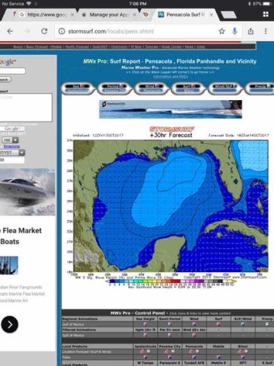
Nice link, will add it to my collection on my decision tree. We found http://stormsurf.com/locals/pens.shtml was helpful in a recent Gulf crossing from Venice to Governors Cut, was spot on, gives an 180 hour wave forecast, great for us 8 knotters!
|
|
|
10-13-2017, 08:23 PM
|
#16
|
Guru
City: Ft Pierce
Vessel Name: Sold
Vessel Model: Was an Albin/PSN 40
Join Date: Oct 2011
Posts: 27,434
|
I have yet to see any forecast stay consistent past about 4 days.... except once in awhile.
Especially wind forecasts which are critical for waves ......so while a 180 hr forecast might be fun to hope for and plan around...I would never take one too seriously.
Kinda like looking at hurricane forecasts out past 5 or 6 days.
Often the day of a trip the bouy reports are already making the wave forecast wince.
|
|
|
10-13-2017, 09:04 PM
|
#17
|
Guru
City: Fort Lauderdale. Florida, USA
Join Date: Jan 2014
Posts: 21,449
|
Quote:
Originally Posted by psneeld
I have yet to see any forecast stay consistent past about 4 days.... except once in awhile.
Especially wind forecasts which are critical for waves ......so while a 180 hr forecast might be fun to hope for and plan around...I would never take one too seriously.
Kinda like looking at hurricane forecasts out past 5 or 6 days.
Often the day of a trip the bouy reports are already making the wave forecast wince.
|
I've seen several stay materially on target beyond. For instance, when I looked at Windy on Sunday it showed decent conditions for FLL for this weekend and showed the mass of bad seas well north of here. I can't say that they had the wave heights exact or that they do even now. I'm also sure that the mass of bad has probably moved south or north from what they had. However, in anticipating the next two days would be good days to get out, it was right. Typically they show systems moving in and out further in advance, they just don't have them pinpointed.
Now, you never can fully depend on them because there are times they won't even be close. That's the reason to keep looking and use more than one source.
|
|
|
10-13-2017, 09:36 PM
|
#18
|
Guru
City: Between Oregon and Alaska
Vessel Name: Charlie Harper
Vessel Model: Wheeler Shipyard 83'
Join Date: Jun 2016
Posts: 2,960
|
I've been on the water most of my life and found marine weather reporting poor, but slightly better than 20 years ago. It seems to be better on the Atlantic side. Wind makes waves and learning to read weather maps over time will make you a better forecaster than NOAA. I assume it's all computer forecasts from instruments because none of the local guys apparently open the window.
|
|
|
10-14-2017, 05:15 AM
|
#19
|
Guru
Join Date: Oct 2007
Posts: 22,553
|
For 7K trawlers cruising in coastal waters the local over air TV will have all the info required to decide weather to go, or drop that second anchor.
|
|
|
10-14-2017, 06:02 AM
|
#20
|
Guru
City: Thibodaux, Louisiana
Vessel Name: Gumbo
Vessel Model: 2003 Monk 36
Join Date: Oct 2007
Posts: 3,882
|
So far we have had good luck with Stormsurf see post #15. But, we do check several and take a good look out the window, trusting eyes and ears most of all.
|
|
|
 |
|
Thread Tools |
Search this Thread |
|
|
Display Modes |
Linear Mode
|
Posting Rules
|
You may not post new threads
You may not post replies
You may not post attachments
You may not edit your posts
HTML code is Off
|
|
|
|
» Trawler Discussions |
|
|
|
|
|
|
|
|
|
|
|
|
|
|
|
|
|
|