OP
OP
man7sell
Senior Member
If anyone is still following this, I'd love to see what order you would install the following
VHF
Handheld VHF
Autopilot
Radar
Epirb
Night Vision
Stabilized Binoculars
Dingy w/ Motor
Crash pump
Air Conditioning.
Thanks
Well lets see
VHF - Yes
Handheld VHF - Yes have 2
Autopilot - Yes
Radar - yes
Epirb - No
Night Vision - Coming
Stabilized Binoculars - yes for my birthday (I hope)
Dingy w/ Motor - Yes
Crash pump - No
Air Conditioning. - No not needed here in the PNW
Add
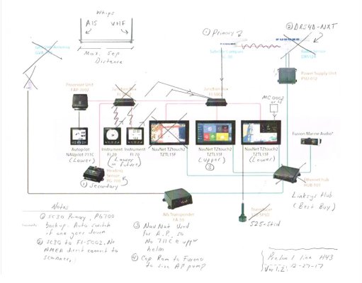
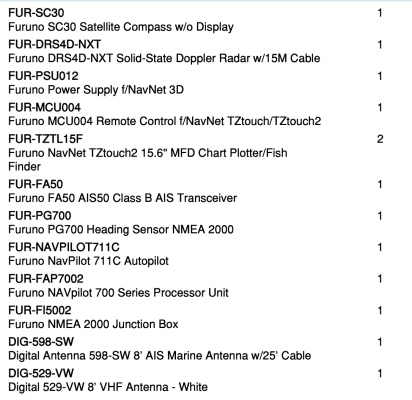
AIS - Yes
MFD - Chart Plotter/Radar - Yes
MFD - Cart plotter/fish finder - Yes