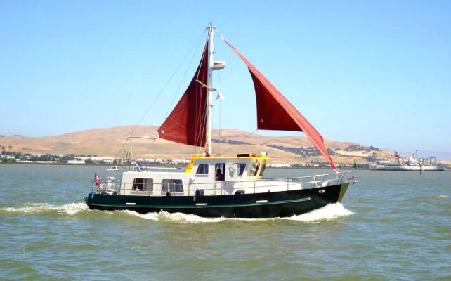
what makes a trawler suitable for ocean crossings?

The friendliest place on the web for anyone who enjoys boating.
If you have answers, please help by responding to the unanswered posts.
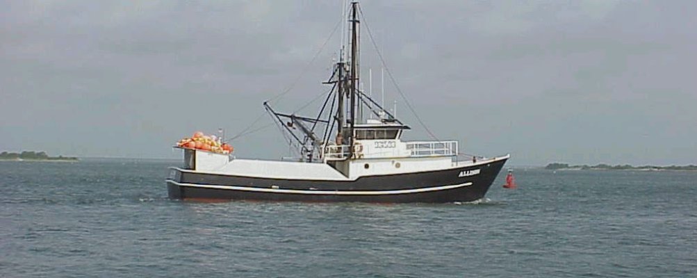
Aren't we reinventing the wheel here? There are thousands of commercial vessels that head out daily essentially regardless of conditions and often for weeks or months at a time. They certainly don't let $200,000 of catch or billable hours go to waste because conditions are not perfect. I'm struggling to think of a private use that would need this level of robustness.

While they may not be the prettiest, they often come with strong hulls, bullet proof equipment looong range and cavernous holds.

What more could you ask for? ��
 
I've seen/read several references that lead me to believe that many (most?) trawlers are considered to be better coastal short-ish range cruisers and not suitable for crossing oceans.
.

Most trawlers arent actually trawlers and are cruisers marketeers call trawlers.
Proper trawlers generally have all the attributes required
 
It’s all relative.

Two of my ex college class mates on the crew team rowed across the Pacific Ocean. Just some oars, guts, and determination. They were about 50 years old at the time and the oldest 2 man team to do it if I remember correctly.

Now that is blue water passage making.
 
Some here dont accept even the highest CE rating of CE-A. Ive submitted some of them and people have mocked them , saying only good for coastal waters.

The boat in our avatar is CE-A. It's a 44' Riva. Great boat and capable of rough seas but absolutely not a passagemaker. First, only 200 nm of range. Second with it's length on a 30 ' or so wave would really go deep in the trough. I own the boat and love it but would absolutely not recommend it for crossing oceans. So some CE-A can be mocked. I don't recall which ones you suggested, but were it a 44' Riva, I'd mock it.
 
Ive recently learned of trawlers that are only 59' long, but hold from 9k to 12k gallons of fuel. They dont say what their range is , nor even the discplaement of those steel hulled trawlers. Theyre designed for Alaskan waters, built in Oregon by Fred Wahl shipyard. Anybody out there know about these? Surely they would be good for long passages.

I would say the Fred Wahl 58' would be very capable of long passages. Not capable of much once you get there with the 13' draft. That definitely helps on ocean crossing though. Boat is 58' x 28'. A lot of boat.
 
Richard Bost, a few years ago, crossed the Atlantic in a KK42. Despite that, what is your opinion of a KK42's ability to, say, cross the Pacific? One thing I wonder about is the wooden pilothouse doors. Have others crossed the Pacific in one?
 
Richard Bost, a few years ago, crossed the Atlantic in a KK42. Despite that, what is your opinion of a KK42's ability to, say, cross the Pacific? One thing I wonder about is the wooden pilothouse doors. Have others crossed the Pacific in one?
In 1987, a Willard 36 went from San Diego to Hawaii, burning about 335 gals of diesel along the roughly 2300 nm passage. He averaged just over 6 kts. The boat was stabilized (Vospers, precursor to Naiads) and carried a modest sail. I would say the construction on a KK is better than a Willard. Given the number of KK42s out there, I would not be surprised if one ventured to Hawaii. A GB42 classic did it 15-20 years ago.

I can guarantee you that Willard did the trip to Hawaii in the mid/late October timeframe and angled slightly north towards the center of the Pacific High which is quite strong and stable during most years.

Peter
 
I would say the Fred Wahl 58' would be very capable of long passages. Not capable of much once you get there with the 13' draft. That definitely helps on ocean crossing though. Boat is 58' x 28'. A lot of boat.

I can't find a photo of a cruiser version online,but the ones I see have a very forward pilothouse and salon.... seems to this greenhorn like it would be very up and down in seas.....rough ride
 
Richard Bost, a few years ago, crossed the Atlantic in a KK42. Despite that, what is your opinion of a KK42's ability to, say, cross the Pacific? One thing I wonder about is the wooden pilothouse doors. Have others crossed the Pacific in one?


Based on the stories from his crossings, I'd say he was definitely pushing the upper bound of what's reasonable to do in that boat. You could get one to Hawaii at the right time of year, etc. But that's probably also towards the upper end of what it should do.
 
Capt Beebe wrote several excellent chapters defining the characteristics. However, in the last several decades another way to skin this cat has been proposed. Please read the discussions on Attainable Adventures concerning this approach.
Range-ultraefficient hulls allowing minimal power so maximal range. Since the Greeks we’ve known narrow, light long hulls are efficient. Add in computer analysis with wave piercing bows and other modifications you get hulls like the FPBs, Artnautica, and Arksens. With just a small non electronic Beta of 80-110hp you can drive a 58’ to 65’ hull to 12-14kts. and still have 6000nm range.
Green water/down flooding- if you have no bulwarks and nowhere for green water to collect (open transom, small cockpit , multiple scuppers etc) there’s no need for a high bow. In combination with enough reserve buoyancy in both of the ends and a favorable gyradius (engines/tankage in center of the boat) the boat will get less green water and clear it faster.
If design utilizes current best practices in adhesives, port lights, ventilation and materials it will survive any boarding seas or even a pitch pole or roll.
Since Herreshoff/ Hand/ Atkins we’ve known the implications of a Gz curve and how to construct to achieve most favorable outcomes. A commercial trawler isn’t as favorable as the designs mentioned above. Due to the need to have a fish hold with a space of varying load there’s a difficulty a recreational vessel or SAR or naval vessel doesn’t face. If you examine the later they tend to have engines, batteries and heavy stores in the middle where the fish hold is commonly placed. Ends are light. Also tankage is similarly placed often creating a double hull in those locales. Add in collision bulkheads fore and aft survivability increases. This is in distinction from the typical engine room aft in recreational trawlers.
In short to answer the OP for open ocean work imho the best vessel for recreational use isn’t a trawler but rather a light ice certified boat reflecting current naval architectural thinking. The draft ( both water and air) allows skinny water, the European canals and transpacific range. Safe and comfortable in the tropics or high latitudes.
We are in process of buying a nordhavn. This is a reflection of price point. However even they (PAE) recognize this trend in their most recent offerings which are much more slippery and narrow when compared to the earlier hulls at the same LOA. They’ve just started with very modest changes but expect the trend to accelerate with time.
 
Last edited:
Green water/down flooding- if you have no bulwarks and nowhere for green water to collect (open transom, small cockpit , multiple scuppers etc) there’s no need for a high bow. In combination with enough reserve buoyancy in both of the ends and a favorable gyradius (engines/tankage in center of the boat) the boat will get less green water and clear it faster.


I was thinking the same. A high, flared bow keeps things dryer, but can make for more violent pitching if the seas get steep. A lower, less flared bow may be more comfortable in those situations, but the decks, windows and doors near them, vent placement, etc. all need to be prepared to play submarine on a frequent basis.
 
QUOTE: "If design utilizes current best practices in adhesives, port lights, ventilation and materials it will survive any boarding seas or even a pitch pole or roll."

QUOTE: "....all need to be prepared to play submarine on a frequent basis."

The chance of these conditions go to near zero with an accommodating schedule and some decent weather knowledge. Circumnavigators routinely attest to the relatively benign conditions encountered, almost always complaining of calms, not freak storms. Crossing the Pacific to Hawaii is quite predictable at certain times of the year, unpredictable at others. Commercial traffic has no choice. Recreational traffic does.

Everyone has a choice. They can spend a half-million or more on a tank; or they can develop a plan that works with Mother Nature. Nothing wrong with doing both, but in my opinion, the PAEs' of the world are selling risk mitigation - their buyers are often new to the game and have watched too many Deadliest Catch episodes and believe they will routinely encounter them. Why anyone would do that is beyond me, but apparently they do. PAE is happy to requite.....for a fee.

Peter
 
Last edited:
Even with the best weather forecast, what starts out to be a perfect day, can turn sour without warning. The weather folks have been known to miss the localized weather and wave height.
Although a CE B rated boat is rated for good days, it is nice to know it can also take some 'not so perfect weather too.'
Sort of funny when "they" say 'out to 200 miles off shore'. What am I doing out 200 miles from shore.

Mother nature has a mind of her own and many times so likes to 'entertain' boat owners' You know, those "gotcha" moments.
 
Last edited:
Seems like a lot of responses to OP have gone full Naval Architect. But the reality is simpler. And I don't think the OP, with all due respect, understands what he's asking.

To cruise the US east coast and Bahamas to Caribbean, there are hundreds of models that can make the trip. You can do it all with day trips in many boats. If you decide you're going to run longer off shore overnight then that list gets shorter and is primarily limited by fuel capacity. But still lots of boats that could do it safely with a good weather eye.

But when you throw in "Cross the Atlantic" you've moved to an entirely different and MUCH smaller universe of vessels not to mention a higher required skill level for captain and crew. The Beebe book is great at breaking down the details. Generally they amount to full displacement design, method of stabilization, 3000mi fuel range. Boats with those criteria will usually be able to fulfill the rest of the requirements. Of course there are exceptions.

But there just are not that many recreational vessels under 80ft or so that could safely and consistently make that passage. In most cases it's 3+ weeks off shore. And the Atlantic may be the hardest crossing there is.
 
Ah yes, I remember my US Navy days. US to Med. Weather broke the boat so we had about a week in Rota Spain.
Sprung the chair locker door, destroyed all the toilet paper, no 'safe' paper products on board. LOL
Too rough for the carrier to launch helicopters to bring us emergency supply of toilet paper.
 
Ocean Navigator magazine has a good series of how-to articles on weather. The localized weather everyone on threads like these sees are just that - localized weather caused by land-mass interactions that often create highly local and somewhat unpredictable conditions. I say "somewhat" because as time goes by, they become more predictable. For example, the hurricane-force storms in Gulf of Teuhentepec and Papagayo were considered unpredictable until about 40-years ago when it was clear a HP system above a certain intensity formed over Texas would funnel winds across the backbone of Central America and accelerated winds (similar to Santa Anas in SoCal).

Here's an article on the 500mb charts. Why are these important? Quotes from the article:

On 500-mb charts, the 5,640-meter height contour is enhanced in bold. Some basic rules of thumb used by marine meteorologists concerning the 5640 contour and the 500-mb wind maxima are:

• In wintertime, the 5640 contour is an excellent indication of the southern extent of surface winds of Force 7 westerlies or greater. In summer, the 5640 height contour is more representative of Force 6 surface westerlies.

• The surface storm track is usually 300 to 600 nautical miles north and parallel to the 5640 height contour.​

Bottom line - there are several ways to reduce risk. Pay a literal boat-load of money on a tank of a boat (say, a Nordhavn). Or invest a few bucks in tools and an education. IridiumGO is under $1000, and a monthly subscription is under $150, and you can suspend the account between passages (not quite that simple, but possible). Now, you just need to understand what information to fetch, and how to interpret it.

Peter
 
Last edited:
Peter my experience is limited to the US east coast, eastern Caribbean and Canadian maritimes. This includes multiple races from New England to Bermuda and multiple passages from US mid Atlantic or New England to eastern Caribbean and back. Except for races where outside assistance wasn’t permitted have made use of daily grib files, 500mb, synoptic charts, public domain forecasts and two daily interactions with a weather router. This is what I know that remains the limitations in spite of having access via Fleet one satphone, Go and SSB. Even now all forecasting is not granular enough to allow you to escape local phenomena. Even mid ocean gribs aren’t and this gets worse in multiple coastal settings. I would estimate I personally have encountered significant weather <10% of the time and severe weather <2% of the time in recent years. But I’ve yet to make any passage over 7 days without facing at least line squalls. Believe I’m a true believer in the old saw there’s old sailors and bold sailors but no old,bold sailors but still encounter weather that causes concern. In spite of best efforts have been caught in T storms, from experience believe so called rogue waves are more frequent than previously appreciated and hyper local squalls can really pack a punch with the gribs showing nothing. Microbursts still sink boats.
Totally agree you can’t buy safety. Totally agree you should learn weather and have all tools available. Totally agree few boats are ever used to their design capabilities but respectively disagree that this issue is moot for the long range cruiser.
I know you’re a very accomplished mariner. Although a newbie here I do have tens and tens of thousands of miles of blue water under my keel as well.So know it’s not if but when any vessel doing typical passages in season such as I do or transoceanic or Mediterranean will be caught out on occasion. Furthermore you know it’s not the wind that kills you it’s the wave. Even without rogues or storms the stresses of open water transits make demands on a vessel over time not seen in the coastal environment. We’ve had a very friendly and informative back and forth that has been most helpful in solidifying my vessel selection. Please accept there are people where getting a boat conceived from when a line was first put to paper (or computer) to be used for passage making is money well spent.
 
Not all Trawlers are passage makers. It's like calling a vehicle a "Truck". There is a big difference between the capabilities of a Toyota Tacoma and a 10 wheeled Peterbilt or Mac Tractor (Tractor Trailer).

That said, a guy on the sister site Maxum Owners Club took a Maxum4100 Aft Cabin (think Aft Cabin Silverton or Carver) from Florida to Hondurus going straight across the Gulf of Mexico towing a center console with 4-5 50Gal. drums of diesel in the middle of July.

You really have to pick your weather window.
 
Old Dan look forward to Peter and hopefully others critique the following. In both power and sail working with rather than against current is more efficient, faster and easier on both boat and its occupants. Given the North Atlantic gyre that informs how you do things. From anywhere in the eastern Caribbean going anywhere on the US east coast it’s easier to leave your island (virtually all harbors are on the southern sides) and enter the trades north of the island chain making use of the lift the gyre provides. Similarly from most anywhere from the straits of Florida to Nova Scotia utilizing the Gulf Stream provides a fast and comfortable trip. Given you never want to experience wind against wave it’s best to hang close enough to one edge or the other of these major currents to be able to escape them before a washing machine starts up and cross them only in the most benign conditions. So Dan this often means you’re >200nm out.
The other direction is more problematic. Hence the gentleman’s way. This is done on the south side of the islands and often utilizing night transits to escape local thermal effects. Both power and sail if they have sufficient range will go directly across the Caribbean Sea and bypass all the interventing Islands until they get to the most eastward island that is where they want to start their cruise. This involves sections which are well away from any reliable SARS. From their landfall they slowly island hop on the south side in day trips westward leaving before hurricane season to get above 40 north.
When going south on the east coast as you know you can go inside or out. Out is much faster and of course there’s no air nor water draft restrictions. Some times you can make use of countercurrents from the stream. They vary widely in how far they are from land. Thermal and flow charts of the Stream are often helpful in figuring out if it’s worth the effort to do that exercise. In a lot of places you’re under 200m out but frequently 50-100 miles out. Sometimes you’re able to spit on the land in order to escape an unfavorable current.
Having that ability to think about velocity made good, comfort and time on passage requires a good seaboat with sufficient range.
I know nothing about the western Caribbean Sea other than to say friends seem to go surprisingly far north from spots along the mid western shore line to get to the leewards. Everyone I know says that can be a miserable trip. Apparently there’s a local clockwise gyre starting off the coast of Venezuela/Columbia that requires missing so a straight shot isn’t advised.
 
Last edited:
I dunno. There is so much emphasis on The Boat. Outside of general statements of "watch the weather," the implication is weather is unpredictable so you have to expect the worst. Weather varies, but it's not unpredictable. Severe localized weather will occur, and has the potential to generate extremely uncomfortable conditions, but because these are short duration, they will not generate the types of swell/height/breaking waves I suspect many people think they will have to endure. On the good side, these storms show-up fairly well on radar and can be tracked. If they form over your head, they will not have had developed yet. But eventually, you will get caught in one and you will need to slow-down, alter course, or both. And everything in your boat had best be well secured.

I just wish that every once in a while someone would talk about weather forecasting as an alternative to 1/2-inch tempered glass windows as a strategy to mitigate the effects of weather. Seriously, I've read dozens of interviews of circumnavigators. They all get asked the "whats the worst weather you've seen" question. Answer is always some flavor of 35-kts once or twice; or 'we knew better but left anyway, and had our ass handed to us as a result.' Not a one do I recall saying "man, did we screw-up. Should have had a stronger boat." Granted, they may have been lost at sea, but you get my point.

Peter
 
Last edited:
Old Dan look forward to Peter and hopefully others critique the following. In both power and sail working with rather than against current is more efficient, faster and easier on both boat and its occupants. Given the North Atlantic gyre that informs how you do things.

While I have transited the Caribbean from Panama, it was a delivery pace. I've spent a fair amount of time in the Bahamas, Florida, and sailing the BVI/AVI. But I can only speak knowledgeably of the Pacific. I'd imagine there are similarities, but I just haven't studied the Atlantic the way I have the Pacific.

There are significant differences in moving a sail vs power boat. Reading Cornell's World Cruising Routes is helpful, but once you get a couple layers down, the conditions a sailor hates and avoids - calm weather - is exactly what a powerboat looks for. Leaving in late October/November (the recommended good weather passage), a sailboat will sail a curved course from California to Hawaii to keep the Pacific High to starboard while winds shift from NW, to NE, to E. On the return, they remain on starboard tack as the loop north of the Pacific High. A powerboat will plot the rhumbline - going through the High means calm weather. There may be a big swell running from storms well north, but they are not a problem.

As far as currents, there is the Davidson Current that runs mostly southbound along the California coast. In all candor, while speed always varies, and over time it's clear there's been a current, I've always struggled to really tell. It's generally around 1/2 kt. Supposedly, there is a clockwise current in the Pacific that runs along the outer edges of the Pacific High.

Cornell and Pilot Charts are immensely helpful. Figuring out exactly which day to leave is always a challenge - there's always better weather tomorrow. When delivering, I figured out that if I waited for a complete weather window I'd never leave. So I'd wait for a window in a decent time frame. Now, I did not cross an ocean so I'd have to adapt that strategy. But I would not rely on Windy or similar products - I'd look to the NOAA synoptic charts where you can see the changes coming. The 500mb chart is very important - you may need to drive further south to avoid possible weather forming in a few days.

Peter
 
Enjoy dancing between squalls. One of the pleasures of being offshore. You’re right with intelligent use of radar you can miss most or at least be on the favorable side.
 
Capt Beebe wrote several excellent chapters defining the characteristics. However, in the last several decades another way to skin this cat has been proposed. Please read the discussions on Attainable Adventures concerning this approach.
Range-ultraefficient hulls allowing minimal power so maximal range. Since the Greeks we’ve known narrow, light long hulls are efficient. Add in computer analysis with wave piercing bows and other modifications you get hulls like the FPBs, Artnautica, and Arksens. With just a small non electronic Beta of 80-110hp you can drive a 58’ to 65’ hull to 12-14kts. and still have 6000nm range.
Green water/down flooding- if you have no bulwarks and nowhere for green water to collect (open transom, small cockpit , multiple scuppers etc) there’s no need for a high bow. In combination with enough reserve buoyancy in both of the ends and a favorable gyradius (engines/tankage in center of the boat) the boat will get less green water and clear it faster.
If design utilizes current best practices in adhesives, port lights, ventilation and materials it will survive any boarding seas or even a pitch pole or roll.
Since Herreshoff/ Hand/ Atkins we’ve known the implications of a Gz curve and how to construct to achieve most favorable outcomes. A commercial trawler isn’t as favorable as the designs mentioned above. Due to the need to have a fish hold with a space of varying load there’s a difficulty a recreational vessel or SAR or naval vessel doesn’t face. If you examine the later they tend to have engines, batteries and heavy stores in the middle where the fish hold is commonly placed. Ends are light. Also tankage is similarly placed often creating a double hull in those locales. Add in collision bulkheads fore and aft survivability increases. This is in distinction from the typical engine room aft in recreational trawlers.
In short to answer the OP for open ocean work imho the best vessel for recreational use isn’t a trawler but rather a light ice certified boat reflecting current naval architectural thinking. The draft ( both water and air) allows skinny water, the European canals and transpacific range. Safe and comfortable in the tropics or high latitudes.
We are in process of buying a nordhavn. This is a reflection of price point. However even they (PAE) recognize this trend in their most recent offerings which are much more slippery and narrow when compared to the earlier hulls at the same LOA. They’ve just started with very modest changes but expect the trend to accelerate with time.
I don't know what these light ice boats are, but I understand your point. recently saw a thing about an older gentleman, a swede I think, that was crossing oceans in what amounts to a torpedo that he can't even stand up in. Regardless...given that this crossing thing is overall a very minor part of my dream...with a much greater emphasis on enjoying life at anchor or at the pier in interesting places to explore....narrow doesn't sound very stable or comfortable to me.... I've been in rolly small boats...fine for a day...long term...no thanks.

QUOTE: "If design utilizes current best practices in adhesives, port lights, ventilation and materials it will survive any boarding seas or even a pitch pole or roll."

QUOTE: "....all need to be prepared to play submarine on a frequent basis."

The chance of these conditions go to near zero with an accommodating schedule and some decent weather knowledge. Circumnavigators routinely attest to the relatively benign conditions encountered, almost always complaining of calms, not freak storms. Crossing the Pacific to Hawaii is quite predictable at certain times of the year, unpredictable at others. Commercial traffic has no choice. Recreational traffic does.

Everyone has a choice. They can spend a half-million or more on a tank; or they can develop a plan that works with Mother Nature. Nothing wrong with doing both, but in my opinion, the PAEs' of the world are selling risk mitigation - their buyers are often new to the game and have watched too many Deadliest Catch episodes and believe they will routinely encounter them. Why anyone would do that is beyond me, but apparently they do. PAE is happy to requite.....for a fee.

Peter

That's been kinda my thinking as well.... these worst case scenarious.... sure, staying out a month...or going to known areas of constant rough.... but weather forecasting isn't even what it was 10 years ago.

Ocean Navigator magazine has a good series of how-to articles on weather. The localized weather everyone on threads like these sees are just that - localized weather caused by land-mass interactions that often create highly local and somewhat unpredictable conditions. I say "somewhat" because as time goes by, they become more predictable. For example, the hurricane-force storms in Gulf of Teuhentepec and Papagayo were considered unpredictable until about 40-years ago when it was clear a HP system above a certain intensity formed over Texas would funnel winds across the backbone of Central America and accelerated winds (similar to Santa Anas in SoCal).

Here's an article on the 500mb charts. Why are these important? Quotes from the article:

On 500-mb charts, the 5,640-meter height contour is enhanced in bold. Some basic rules of thumb used by marine meteorologists concerning the 5640 contour and the 500-mb wind maxima are:

• In wintertime, the 5640 contour is an excellent indication of the southern extent of surface winds of Force 7 westerlies or greater. In summer, the 5640 height contour is more representative of Force 6 surface westerlies.

• The surface storm track is usually 300 to 600 nautical miles north and parallel to the 5640 height contour.​

Bottom line - there are several ways to reduce risk. Pay a literal boat-load of money on a tank of a boat (say, a Nordhavn). Or invest a few bucks in tools and an education. IridiumGO is under $1000, and a monthly subscription is under $150, and you can suspend the account between passages (not quite that simple, but possible). Now, you just need to understand what information to fetch, and how to interpret it.

Peter

I'm an instrument rated private pilot and have been a low caliber weather nerd of sorts most of my adult life. I know, I know.... aviation weather is a different animal, but I've at least got a little bit of idea about it..... Seems to me with the right tools, flexibility to WAIT for the right season, etc... that a passage of 7-10 days or whatever ...at least any route that I'd seriously consider doing in my lifetime ... there should be able to have some reasonable confidence that you're not going to run into a categoried tropical storm!


The primary point I keep circling back to is that range issue. I recon forecasts out past 5-7 days can still often be a little sketchy. If I'd be cutting that range number close, and a 4-5 days in the weather turned...most likely if for the worse it wouldn't be catastrophic.... still...even if just for added pleasure for a bit smoother seas or whatever with a SV you can steer to give systems a wider berth even if it means it adds significant distance to the route...but a MV with short range would give a lot less in that option department....
 
There are significant differences in moving a sail vs power boat. Reading Cornell's World Cruising Routes is helpful, but once you get a couple layers down, the conditions a sailor hates and avoids - calm weather - is exactly what a powerboat looks for.

Exactly right! We were looking at a Caribbean to Portugal run a few years ago and looked at Cornell and others, and it became clear that the "good" routes were defined as being the best likelihood for good sailing - beam or quartering winds of 8-15kn. Azores High? Avoid it! etc.

I haven't found anything similar for power vessels, so the best seems to be is look at the raw data (weather, current, seas) and try and plot your own path. It means you may not be travelling near the sailing vessels, so buddying is harder, but should be much more comfortable.
 
Richard Bost, a few years ago, crossed the Atlantic in a KK42. Despite that, what is your opinion of a KK42's ability to, say, cross the Pacific? One thing I wonder about is the wooden pilothouse doors. Have others crossed the Pacific in one?

I would think the boat totally capable of a crossing, but doesn't mean I'd cross in it. Too small for me, but that's more comfort probably than safety. Now, my criticism of Richard and the only part of his travel I found unsafe is crossing single handed. It's a personal thing and he's entitled to his choice, but I find it unsafe and that, rather than the boat, put him at risk on his travels. I know plenty of sailors have done the same. Just because one survives doesn't mean it was necessarily safe to to. Similarly, when one doesn't safely make a crossing it doesn't mean it was an unwise decision to try. One has to weigh risks.

As to boat, we now know what a KK42 can handle. I know what my 44' Riva can handle. I also know conditions I don't want to be in while on either of those two boats. There's an interesting side question of when does uncomfortable become unsafe? Is there a magic line between the two that you cross and what makes you cross it? Exhaustion? Pain? Sickness? Or is the boat pushed one more degree as it rolls? Or in a strange way, discomfort probably pushes some of us to be safer, gets adrenaline pumping, helps us reach another level. I quite imagine Psneeld has experienced that in his career as perhaps have others.
 
Shellback

I crossed from Cape may NJ to capetown south Africa,myself and engineer on 86 foot laforce hull,7800 nm crossing 38 days steamin,only thing we ran out of was booze and wacky tobaccy,and Ice cream,there were times we didn't see another vessel for days and days beside other company boat that was sent also
 

Attachments

  • IMG_0073.JPG
    IMG_0073.JPG
    59.7 KB · Views: 34
Slyhwak, is yours a flag or a sail? Mine are sails:
 

Attachments

  • DSC02700-1.jpg
    DSC02700-1.jpg
    103.8 KB · Views: 24
haha...I'm just in the dreaming stage of cruising. My current boat is a small open boat, 110HP outboard without even a flag :)

I've sailed a bit through the years but I'm no sailor. It never used to appeal to me at all in my younger days.... but as I daydream about it I was originally drawn to the idea of a SV because as I near retirement I'm realizing that the travel would not always be pressed to any sort of rigid schedule so being able to go sometimes without the cost of fuel...and without the stress inducing sound and vibration from an engine seems really great.

As I continue to consider MV vs SV, I'm still drawn to the idea of motor sailors like yours for several reasons, even though I'm understanding they are not typically sailed alone without power.... I'm also very curious about kite sails, too.
 
Ocean Crossings

In all my years as an editor and publisher of boating magazines, I have seen next to no production trawlers designed for ocean crossings. All good comments here, but the biggest single liability is the vast expanse of glass in the cabin. Then there is the windage caused by the high freeboard and flybridge.
Many ocean capable trawlers are yacht conversions of commercial trawlers. Bruce Kessler's circumnavigating Zopilote was yacht conversion of a Delta 70 which was designed to fish the dangerous Gulf of Alaska. Take a look at Nordhavens. They are designed for open water.
 
Back
Top Bottom