Reply
 
Thread Tools Search this Thread Display Modes
 
Old 01-04-2018, 12:25 AM   #1
Guru
 
Steve91T's Avatar
 
City: Huntersville NC
Vessel Name: Abeona
Vessel Model: Marine Trader 47’ Sundeck
Join Date: Sep 2016
Posts: 898
What are a dozen ships doing off the coast of Savannah?

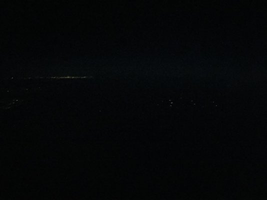
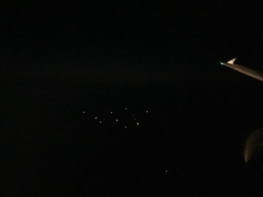
We just flew to Charlotte, NC from Miami and we saw a dozen large ships about 20 miles off the coast of Savannah, GA. I’ve never seen so many ships what looked to be anchored. They were all facing the same direction, so I’m assuming they were anchored.

Anyway, any ideas? I’m just curious and thought you guys would know. Maybe it has something to do with the storm?

First pic you can see the lights of the coast on the left and the group of ships on the right.

Second pic is a closer shot as we passed them. There actually a 13th ship that apparently wasn’t invited to the party.
Attached Thumbnails
75E858A1-CA72-4C9D-B907-F0EFA69FFFA7.jpg   AA66BCD3-39A3-4AAD-B922-04E1A3254F71.jpg  
Steve91T is offline   Reply With Quote
Old 01-04-2018, 04:38 AM   #2
Guru
 
firstbase's Avatar
 
City: Jupiter, Florida
Vessel Name: Black Eyed Susan
Vessel Model: Grand Banks 42' Classic
Join Date: Nov 2016
Posts: 1,644
Ships as in commercial ships?
firstbase is offline   Reply With Quote
Old 01-04-2018, 04:53 AM   #3
Guru
 
boathealer's Avatar
 
City: Looking
Vessel Name: --
Vessel Model: Between boats
Join Date: Aug 2017
Posts: 1,190
Port having trouble with the snow?
boathealer is offline   Reply With Quote
Old 01-04-2018, 05:11 AM   #4
Guru
 
City: Carefree, Arizona
Vessel Name: sunchaser V
Vessel Model: DeFever 48 (sold)
Join Date: Apr 2008
Posts: 10,186
Not uncommon around the world to see many ships anchored in one spot. Reasons could be lack of cargo, maintenance with shore loaders, port strike, full shore bulk storage spots etc. Were they all one type or different designs?

With the storm coming I wonder if they have latest anchor designs per TF discussions
sunchaser is offline   Reply With Quote
Old 01-04-2018, 05:26 AM   #5
Senior Member
 
JimW's Avatar
 
City: Pensacola
Vessel Name: CLASSEA
Vessel Model: 1988 Defever 41
Join Date: Apr 2017
Posts: 160
Probably connected with recovery efforts in PR and USVI. The supply chain is a mess, goods ready for shipment, no room to offload at destination = total stoppage. They are probably making more money at anchor than they would in transit! Yikes, that’s our money!
JimW is offline   Reply With Quote
Old 01-04-2018, 06:18 AM   #6
Newbie
 
City: Isle of Hope
Join Date: Jan 2018
Posts: 3
Ships are waiting for Port to reopen after a very rare day of snow. Expecting to start them in as conditions allow.
pilot21 is offline   Reply With Quote
Old 01-04-2018, 09:20 AM   #7
Guru
 
Cigatoo's Avatar
 
City: Narragansett Bay
Vessel Model: Grand Banks 36 Classic #715
Join Date: Sep 2016
Posts: 1,857
Here you go. Southern New England. Probably same scenarios where you are.

Commander
U.S. Coast Guard Sector Southeastern New England

1 Little Harbor Road
Woods Hole, MA 02543
Tel: 508-457-3211

MARINE SAFETY INFORMATION BULLETIN
[MSIB # 01-18]
03 January 2018
Winter Storm Grayson Safety Measures – Waterways of Southeastern New England

Winter Storm Grayson has been forecast to have a major impact on the waterways of Southeastern New England over the next several days. This major winter storm is expected to track directly through our area delivering sustained northwest winds of 45-60 mph, with gusts up to 70 mph. Blizzard conditions are possible at the height of the storm, with snow rates of up to 2-3 inches per hour and a wind chill of -35 degrees. Severe freezing spray may also be present.

Mariners are advised that severely cold temperatures over the last week have produced significant ice conditions in many of Southeastern New England's navigable waterways. Extreme caution should be exercised when vessels are required to operate in ice conditions. The post storm forecast anticipates continued colder than normal temperatures which will likely increase these conditions within navigable waterways.

Listed below are the most recent recommendations for navigation safety measures in the waterways of Southeastern New England:

1. The Coast Guard recommends daylight only transits with a minimum of one nautical mile visibility in all harbors throughout the Southeastern New England area.

2. All vessels transiting anywhere within the waters of Southeastern New England are reminded that prudent mariners should not rely solely on a single source of navigation aid, such as buoys, as they may be moved off station by the high winds and possible ice conditions. Mariners should have a reliable navigation system onboard, including but not limited to an electronic charting system that employs Differential Global Positioning System (DGPS) technology to continuously and accurately plot the vessel’s position. A properly operating radar should also be onboard your vessel and utilized as an additional tool during all transits.

3. The storm may necessitate the Army Corps of Engineers to close the Hurricane Barriers in Providence, RI and New Bedford, MA during the storm. Stay tuned to VHF channels 16 and 22A for any announcements of closure(s).

4. There is potential for specific safety measures for transit through the Cape Cod Canal. Mariners intending to transit the Cape Cod Canal should contact Canal Control on VHF channel 13 for the latest navigation safety information.

5. It is highly unlikely that pilotage will be available between 4:00 a.m. Thursday, January 4 through 8:00 a.m. Friday, January 5. All vessels should be prepared to divert or anchor out until conditions improve.

6. All fuel transfer operations scheduled to occur between 4:00 a.m. Thursday, January 4 through 8:00 a.m. Friday, January 5 must follow Advance Notice of Transfer reporting procedures and receive approval for each transfer from the Captain Of The Port prior to commencing.

7. Mariners should continue to monitor VHF marine radio for all Marine Safety Information Broadcasts for the latest information regarding buoys off-station for any federal navigation channel they intend to transit.


The recommendations listed above will remain in effect until the risks to navigation associated with the impending winter storm pass.

Mariners should monitor VHF channel 16 for Marine Safety Information Broadcasts to remain aware of the latest safety related navigation information. For maritime emergencies during this upcoming severe weather period, or to report ice or other factors affecting navigation, contact the Sector Southeastern New England Command Center via VHF channel 16, or by phone at 508-457-3211.

Questions regarding this Bulletin may be addressed to Mr. Edward G. LeBlanc at U.S. Coast Guard Sector Southeastern New England, 401-435-2351, or Edward.G.LeBlanc@uscg.mil.


R. J. Schultz
Captain, U.S. Coast Guard
Captain of the Port
Southeastern New England
Cigatoo is offline   Reply With Quote
Old 01-04-2018, 03:43 PM   #8
Guru
 
CaptTom's Avatar
 
City: Southern Maine
Vessel Model: Prairie 36 Coastal Cruiser
Join Date: Dec 2012
Posts: 2,717
Quote:
Originally Posted by Easting View Post
Commander
U.S. Coast Guard Sector Southeastern New England

1 Little Harbor Road
Woods Hole, MA 02543
Tel: 508-457-3211

MARINE SAFETY INFORMATION BULLETIN
[MSIB # 01-18]
03 January 2018
Winter Storm Grayson Safety Measures – Waterways of Southeastern New England
It's sad to see an officer of the US Coast Guard fall for the BS marketing ploy by the Weather Channel to start naming snowstorms.

From Wikipedia:
Quote:
Entities from the United States government which includes the National Oceanic and Atmospheric Administration (NOAA), and the National Weather Service (NWS) have also weighed in stating that they would not be naming winter storms, and have asked others to refrain from doing so. Despite the request though, the issue with naming winter storms continues to come up yearly with various names dubbed by the media.
CaptTom is offline   Reply With Quote
Old 01-04-2018, 03:49 PM   #9
Guru
 
OldDan1943's Avatar
 
City: Aventura FL
Vessel Name: Kinja
Vessel Model: American Tug 34 #116 2008
Join Date: Oct 2017
Posts: 10,595
Quote:
Originally Posted by boathealer View Post
Port having trouble with the snow?
Bingo.
__________________
Two days out the hospital after a week in the hospital because of a significant heart attack.
OldDan1943 is offline   Reply With Quote
Old 01-04-2018, 05:04 PM   #10
Senior Member
 
bnoft's Avatar
 
City: Lottsburg, Va
Vessel Name: Amazing Grace
Vessel Model: Ocean Alexander 52 Sedan
Join Date: Dec 2007
Posts: 318
I agree with you Capt Tom
bnoft is offline   Reply With Quote
Old 01-04-2018, 05:15 PM   #11
Guru
 
psneeld's Avatar
 
City: Ft Pierce
Vessel Name: Sold
Vessel Model: Was an Albin/PSN 40
Join Date: Oct 2011
Posts: 28,149
really?

maybe the USCG has good reasons to use the named storm....maybe just for simple public awareness....

maybe the USCG disagrees with DC and the insurance companies playing that game.

If I lose my boat to 75 knot winds or huge storm surge...what should it matter if named storm or not?

While I see your point, I am not sure I trust that name game BS after having so many friends get ripped off because of the Super Storm versus Hurricane Sandy.
psneeld is online now   Reply With Quote
Old 01-04-2018, 05:18 PM   #12
Guru
 
OldDan1943's Avatar
 
City: Aventura FL
Vessel Name: Kinja
Vessel Model: American Tug 34 #116 2008
Join Date: Oct 2017
Posts: 10,595
I remember, years ago, I was in Ft Lauderdale during a heavy blow. I was up in a hotel room overlooking the ocean. The port was closed due to the weather.... Cargo ships were off shore, I listened to the traffic on my handheld VHF. They were talking about having both anchors out, throttles full and still barely standing still. Now that was a pretty heavy blow. They didn't want to give up their place in line for when the port opened again.
__________________
Two days out the hospital after a week in the hospital because of a significant heart attack.
OldDan1943 is offline   Reply With Quote
Old 01-04-2018, 06:10 PM   #13
Senior Member
 
bnoft's Avatar
 
City: Lottsburg, Va
Vessel Name: Amazing Grace
Vessel Model: Ocean Alexander 52 Sedan
Join Date: Dec 2007
Posts: 318
psneeled,
Sandy was a hurricane, the logic behind the "super storm" designation escapes me. A named storm can let the insurers off the hook, but in this instance it would seem it worked in reverse; named super storm but not a hurricane. I can't really understand this.
But the weather channel's effort is marketing driven, designed to increase viewership and ad revenue. The USCG doesn't need to help the weather channel. Next they will be naming every thunderstorm.
bnoft is offline   Reply With Quote
Old 01-04-2018, 07:49 PM   #14
Guru
 
Maerin's Avatar
 
City: East Coast
Vessel Name: M/V Maerin (Sold)
Vessel Model: Solo 4303
Join Date: Jun 2013
Posts: 886
I'm nearly giddy with anticipation at the evolution of the next weather buzzword. I thought bombogenesis was soooo AWESOME, but then along came cyclone bomb, and who can guess how that'll be out-hyped next. Whatever happened to a good ole nor'easter?!
__________________
Steve Sipe

https://maerin.net
Maerin is offline   Reply With Quote
Old 01-04-2018, 07:55 PM   #15
Guru
 
firstbase's Avatar
 
City: Jupiter, Florida
Vessel Name: Black Eyed Susan
Vessel Model: Grand Banks 42' Classic
Join Date: Nov 2016
Posts: 1,644
It's already been pounded in the ground. I agree, where did this one come from? And what exactly does it mean? Haven't a clue but every friggin weatherman and newscaster is throwing it around like it's been around for 50 years.
firstbase is offline   Reply With Quote
Old 01-04-2018, 07:58 PM   #16
Guru
 
psneeld's Avatar
 
City: Ft Pierce
Vessel Name: Sold
Vessel Model: Was an Albin/PSN 40
Join Date: Oct 2011
Posts: 28,149
Quote:
Originally Posted by bnoft View Post
psneeled,
Sandy was a hurricane, the logic behind the "super storm" designation escapes me. A named storm can let the insurers off the hook, but in this instance it would seem it worked in reverse; named super storm but not a hurricane. I can't really understand this.
But the weather channel's effort is marketing driven, designed to increase viewership and ad revenue. The USCG doesn't need to help the weather channel. Next they will be naming every thunderstorm.
Sandy was downgraded or changed to extratropical shortly before landfall as far as I know.

I only have second hand info on it but from what some people i know told me, their "hurricane" insurance was denied.

Obviously policy wording and many in Jersey are more worried about Noreasters and storms like this than hurricanes and if insurance is different, then simple wording csn be disasterous to some and beneficial to others.

So there is a name game and I am not sure who is who when it comes to helping people, the real mission of govenment.

What the USCG put out in the statement is hardly affecting anyone except those of us that can refer to weather with high winds and flooding as a named storm and hold our insurers responsible as they should be. Naybe we SHOULD be getting the NWS in on the deal.

NWS Confirms Sandy Was Not a Hurricane At Landfall

By Andrew Freedman

***http://www.climatecentral.org/news/n...landfall-15589

Published:*February 12th, 2013 ,*Last Updated:*February 12th, 2013

In a*technical report*released on Tuesday, the National Oceanic and Atmospheric Administration (NOAA) reaffirmed its initial conclusion that Hurricane Sandy was no longer officially a hurricane when it made landfall on Oct. 29 near Brigantine, N.J., just north of Atlantic City. Instead, it was a “post-tropical cyclone” packing hurricane-force winds, the report said.
psneeld is online now   Reply With Quote
Old 01-05-2018, 10:36 AM   #17
Guru
 
JDCAVE's Avatar
 
City: North Vancouver
Vessel Name: Phoenix Hunter
Vessel Model: Kadey Krogen 42 (1985)
Join Date: Apr 2011
Posts: 2,877
What are a dozen ships doing off the coast of Savannah?

Quote:
Originally Posted by Maerin View Post
I'm nearly giddy with anticipation at the evolution of the next weather buzzword. I thought bombogenesis was soooo AWESOME, but then along came cyclone bomb, and who can guess how that'll be out-hyped next. Whatever happened to a good ole nor'easter?!

How about “King Tide”? Weather forecasters are all over that term up here.
JDCAVE is offline   Reply With Quote
Old 01-05-2018, 10:54 AM   #18
Guru
 
City: Carefree, Arizona
Vessel Name: sunchaser V
Vessel Model: DeFever 48 (sold)
Join Date: Apr 2008
Posts: 10,186
Quote:
Originally Posted by firstbase View Post
Haven't a clue but every friggin weatherman and newscaster is throwing it around like it's been around for 50 years.
Yes, the MSM has caught on to a not uncommon term. It adds color and reality.

I first heard the term weather bomb (intense tightly packed low pressure) about 30 years ago when digital weather maps were becoming common and weather fax a useful tool. Richard's the expert and can tell us more I'm sure. For sailors in the Southern Oceans the term was well understood to define an area of tight gradient to avoid at all costs. I found this term over 20 years ago in Australia

This was one of the points of investigation and contention for the infamous Sidney Hobart race where many perished due to bad weather that was not deemed by race organizers to be a bomb. Bruce K or others in Australia can add details to clear my hazy recollection.

In sailing and cruising guides "bomb proof" anchorages are listed and prized.
sunchaser is offline   Reply With Quote
Old 01-05-2018, 12:05 PM   #19
Guru
 
Airstream345's Avatar
 
City: Friday Harbor, WA USA
Vessel Name: FORTITUDE
Vessel Model: Kadey Krogen 54-8
Join Date: Jul 2017
Posts: 1,015
I remember flying into Singapore for the very first time. It was late or early (I can't remember) but either way it was dark outside.

After hours of nothing but blackness I noticed lights down below and thought "Oh, ground contact. We must be landing soon". We flew for at least another 20 minutes and I finally realized those lights weren't rural homes, they were ships waiting to get into port.
Airstream345 is offline   Reply With Quote
Old 01-05-2018, 02:40 PM   #20
Guru
 
CaptTom's Avatar
 
City: Southern Maine
Vessel Model: Prairie 36 Coastal Cruiser
Join Date: Dec 2012
Posts: 2,717
Quote:
Originally Posted by Maerin View Post
I thought bombogenesis was soooo AWESOME, but then along came cyclone bomb, and who can guess how that'll be out-hyped next. Whatever happened to a good ole nor'easter?!
Quote:
Originally Posted by JDCAVE View Post
How about “King Tide”? Weather forecasters are all over that term up here.
A rapidly developing low pressure center is boring. Rapid Cyclogenesis, or even Explosive Cyclogenesis, is too complicated to explain to the lemmings who watch TV news. Plus it makes people so proud to think they survived a "bomb." What BS!

And, of course, the masses don't understand that a "cyclone" is just rotational winds, not "a twister" as in the Wizard of Oz. So "cyclone bomb" just doubles the hype (and presumably, viewers.)

Don't forget "Super Moon" for people to lazy to expend the mental energy required to learn what a perigean new moon is.

Welcome to the age of hyperbole.
CaptTom is offline   Reply With Quote
Reply

Thread Tools Search this Thread
Search this Thread:

Advanced Search
Display Modes

Posting Rules
You may not post new threads
You may not post replies
You may not post attachments
You may not edit your posts

BB code is On
Smilies are On
[IMG] code is On
HTML code is Off
Trackbacks are Off
Pingbacks are Off
Refbacks are Off


» Trawler Port Captains
Port Captains are TF volunteers who can serve as local guides or assist with local arrangements and information. Search below to locate Port Captains near your destination. To learn more about this program read here: TF Port Captain Program


All times are GMT -5. The time now is 03:50 PM.


Powered by vBulletin® Version 3.8.8 Beta 4
Copyright ©2000 - 2024, vBulletin Solutions, Inc.
Search Engine Optimization by vBSEO 3.6.0
Copyright 2006 - 2012