Capt. Rodbone
Senior Member
- Joined
- Sep 6, 2020
- Messages
- 172
- Location
- U.S.
- Vessel Name
- SV Stella Polaris MV Sea Turtle
- Vessel Make
- 1978 VanDine Gaff rigged schooner, 1978 Grand Banks Classic Trawler
We have two IPADS and each has GPS and cellular. These were purchased last year when I learned that since my older one didn’t have cellular, and I hadn’t pre downloaded applicable charts for that sailing trip, it wasn’t going to do me any good.
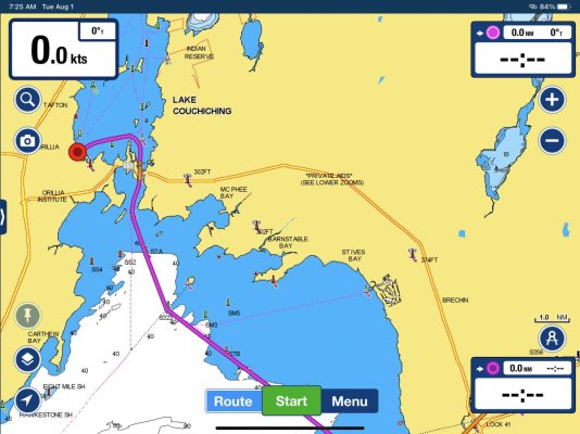
We have covered about 3,500 miles in this trip thus far. We have occasionally had lapses where Navionics would stop tracking. The triangle representing the boat stops, maybe spins, course trend line goes away, and all data in corner boxes disappears. See pic below. We pick up the IPAD, do a little dance, shake it around, and it then gets its signal back. We are in the Trent Severn Waterway in Ontario now, and this is getting worse. We worry that when we get to Georgian Bay it’s so remote that We won’t even be able to depend on Navionics.
I’ve downloaded the charts in the area we are in. The only thing I’m wondering about right now that could be a contributing factor, or the reason is this.
When you have downloaded charts for an area, does Navionics AUTOMATICALLY use those, or do I need to somehow tell it to? If so, then this might be my fix. If not. Then something else is going on, and I welcome thoughts and suggestions.
We have a spiral bound book on Georgian Bay, but when we get to Orillia ON today I’m going to look for and hopefully find paper charts to get us around in the bat and North Channel.
")