You are using an out of date browser. It may not display this or other websites correctly.
You should upgrade or use an alternative browser.
You should upgrade or use an alternative browser.
Slow Hand 2023 To Lake Superior and back
- Thread starter O C Diver
- Start date
The friendliest place on the web for anyone who enjoys boating.
If you have answers, please help by responding to the unanswered posts.
If you have answers, please help by responding to the unanswered posts.
O C Diver
Guru
- Joined
- Dec 16, 2010
- Messages
- 12,880
- Location
- USA
- Vessel Name
- Slow Hand
- Vessel Make
- Cherubini Independence 45
Yesterday's hike was from Lane cove to the Greenstone Ridge Trail and then Southwest from Mount Franklin (430' above the lake) to Mount Ojibway (470' above the lake) (2.5 miles). The Greenstone Ridge Trail follows the peaks of the main island from SW to NE. The total length is about 40 miles with almost all of it in tree cover. The section I did yesterday is mostly exposed to the North, South, and occasionally both. If you want to see great panoramic views, this is the section to hike.
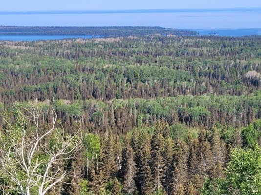
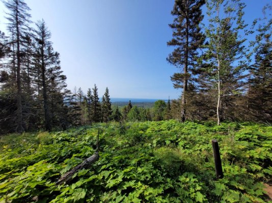
From the below picture, it appears that the trees were planted in neat rows. What you're actually seeing is a series of ridgelines that you have to traverse before you make your final ascent to the Greenstone. Visualize going up 75' and then going down 50' to cross a valley before up another 75' and down 50' more.
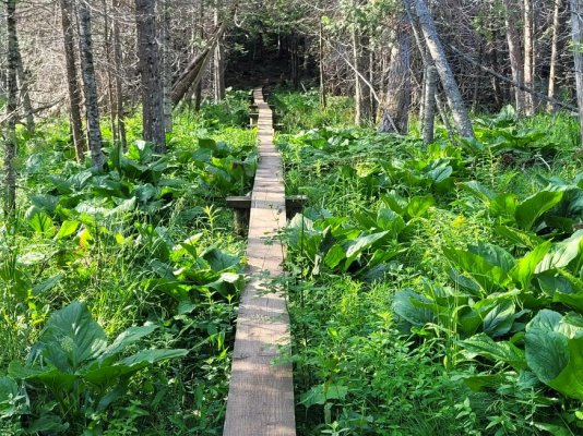
Sometimes the valleys are marsh with trees.
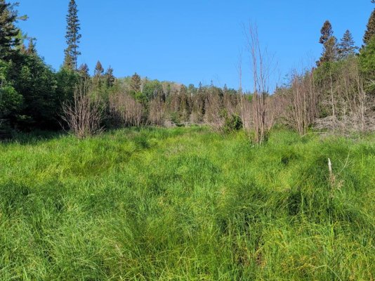
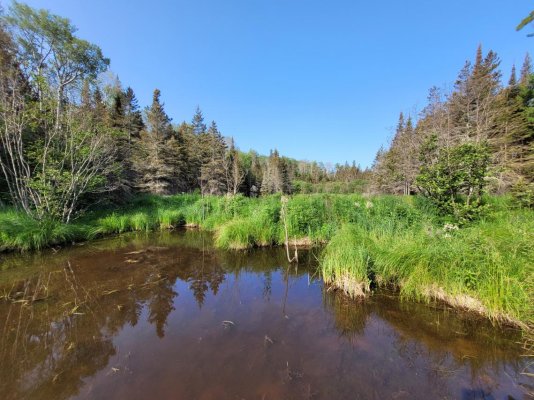
Other times the valleys are boggs with lush grass.
Still other times the foot bridges cross open water.
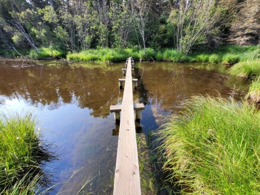
To the left (port) is down stream.
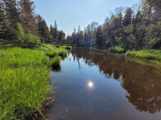
To the right (starboard) is upstream looking at the grassed beaver dam with the pond above it. Along the shoreline in the trees is where I saw the wolf. The beaver is one of the wolf's favorite meals.
The final ascent to the Greenstone is steeper with numerous switchbacks.
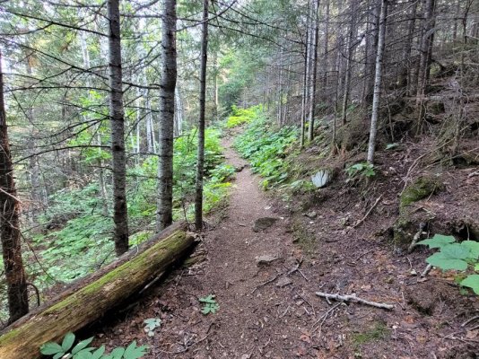
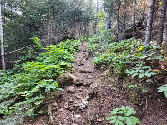
And then you crest the ridgeline.
Ted
From the below picture, it appears that the trees were planted in neat rows. What you're actually seeing is a series of ridgelines that you have to traverse before you make your final ascent to the Greenstone. Visualize going up 75' and then going down 50' to cross a valley before up another 75' and down 50' more.

Sometimes the valleys are marsh with trees.

Other times the valleys are boggs with lush grass.

Still other times the foot bridges cross open water.

To the left (port) is down stream.

To the right (starboard) is upstream looking at the grassed beaver dam with the pond above it. Along the shoreline in the trees is where I saw the wolf. The beaver is one of the wolf's favorite meals.

The final ascent to the Greenstone is steeper with numerous switchbacks.


And then you crest the ridgeline.

Ted
O C Diver
Guru
- Joined
- Dec 16, 2010
- Messages
- 12,880
- Location
- USA
- Vessel Name
- Slow Hand
- Vessel Make
- Cherubini Independence 45
Looks like fantastic crusing grounds. Just curious what depth's are those
bays/coves/inlets, and what sort of bottom?
Depths vary widely. You can be coming down Tobin Harbor in a narrow section with 250' of water beneath you and an island 100' to starboard. Bottoms can be nice sand /silt, rocks and reef, rocks covered with mud, or dead fall (tree trunks lying on the bottom. The water is usually clear enough to see the bottom at 15', so you have an idea before you drop the hook.
Bonnie Dahl's "Superior Way" is the cruising Bible to Lake Superior. The 4th addition was printed in 2008, but as far as natural features and anchoring, 99% is unchanged. Very hard to find and highly coveted!
Ted
O C Diver
Guru
- Joined
- Dec 16, 2010
- Messages
- 12,880
- Location
- USA
- Vessel Name
- Slow Hand
- Vessel Make
- Cherubini Independence 45
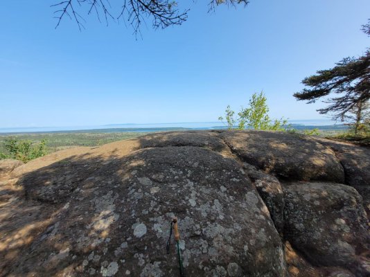
So this is Mount Franklin at 430' above the lake. Stepping out onto the boulder gives you about a 170 degree view of the North shore and on to Canada.
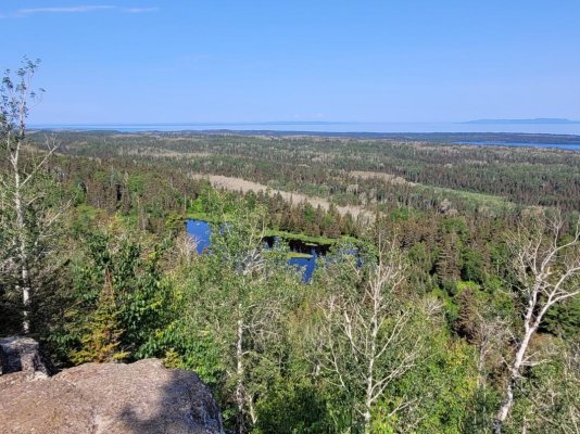
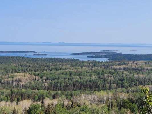
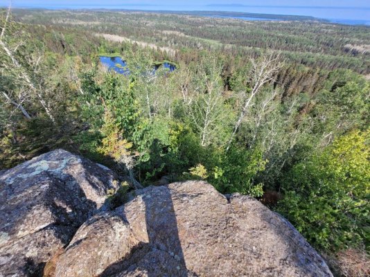
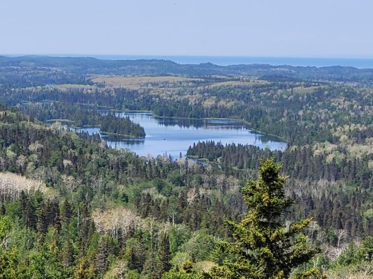
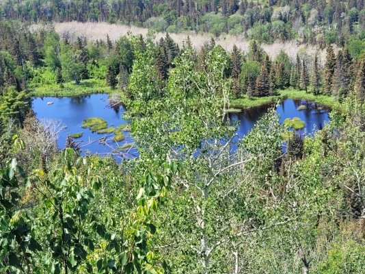
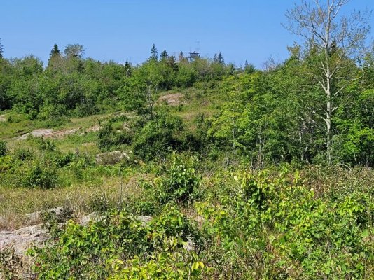
As you walk the Greenstone to Mount Ojibway, much of the ridgeline is low ground cover, giving you wonderful panoramic views.
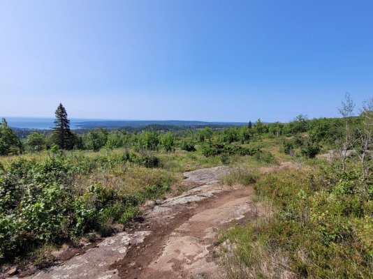
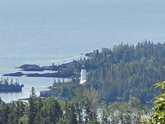
The Rock Harbor lighthouse at Middle Islands Passage. I'm about 3 miles from it on the Greenstone.
Ted


As you walk the Greenstone to Mount Ojibway, much of the ridgeline is low ground cover, giving you wonderful panoramic views.


The Rock Harbor lighthouse at Middle Islands Passage. I'm about 3 miles from it on the Greenstone.

Ted
O C Diver
Guru
- Joined
- Dec 16, 2010
- Messages
- 12,880
- Location
- USA
- Vessel Name
- Slow Hand
- Vessel Make
- Cherubini Independence 45
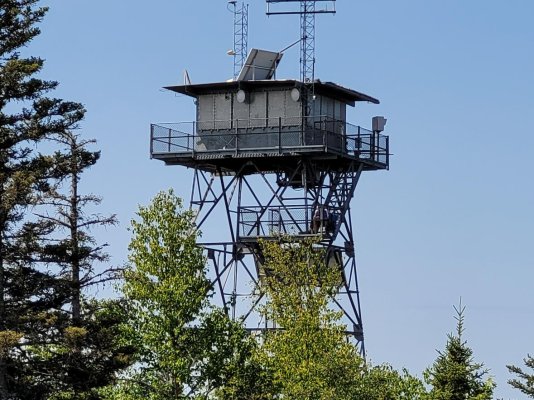
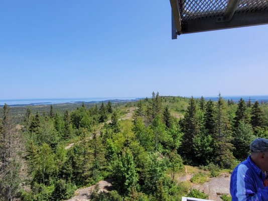
Then in the distance you see the observation tower at Mount Ojibway.
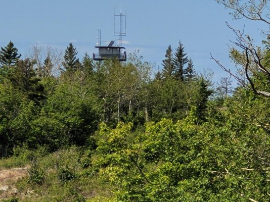
You can ascend several flights of stairs to sit just below the main platform and structure. Even when the wind is calm, there's always a breeze here. The view is about 320 degrees with the exception of the NE ridgeline. A great place to eat lunch and share conversations with the few who make it here.
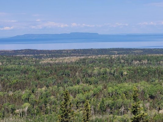
Sleeping Giant National Park in Canada.
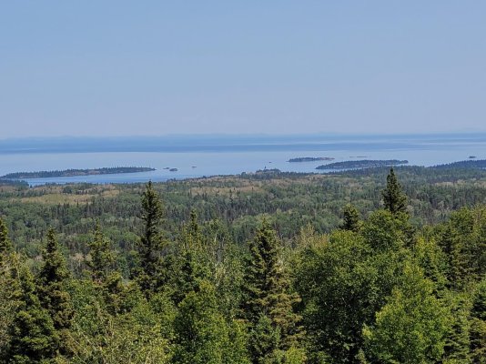
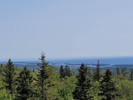
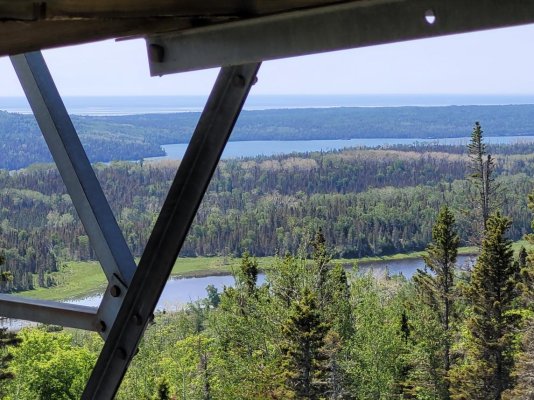
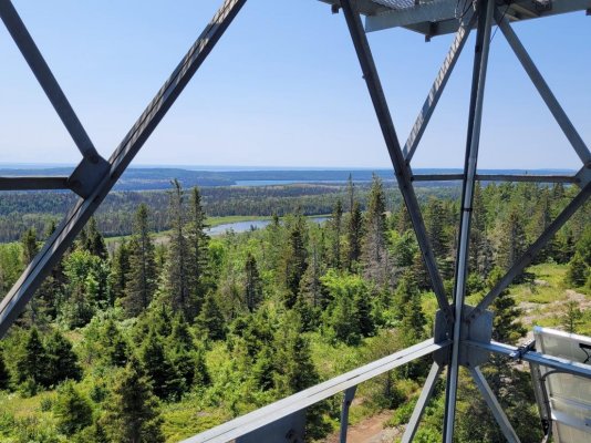
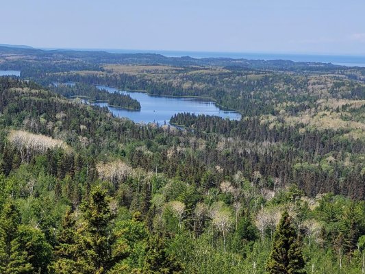
Ted

You can ascend several flights of stairs to sit just below the main platform and structure. Even when the wind is calm, there's always a breeze here. The view is about 320 degrees with the exception of the NE ridgeline. A great place to eat lunch and share conversations with the few who make it here.


Sleeping Giant National Park in Canada.


Ted
O C Diver
Guru
- Joined
- Dec 16, 2010
- Messages
- 12,880
- Location
- USA
- Vessel Name
- Slow Hand
- Vessel Make
- Cherubini Independence 45
Thanks for bringing us along Ted. Are there park docks for your tender or do you Beach it?
Most of the time I'm tying to a park dock. Occasionally I have a 30 pound drop weight on a line, to keep the stern out and then I'll tie a bow line to a tree. In situations like that, the water at mid ship is maybe knee deep. That's what I did at Lane Cove. Almost everywhere else has a dock where the inside or close to shore is too shallow for a regular boat, but fine if you draw less than a foot.
Ted
O C Diver
Guru
- Joined
- Dec 16, 2010
- Messages
- 12,880
- Location
- USA
- Vessel Name
- Slow Hand
- Vessel Make
- Cherubini Independence 45
The Wolf
When you come here the first time, NPS tell you what to do in defense, if you're confronted by a moose. After a few encounters you realize that the males need to be taken seriously and primarily during the fall rut. The moose are bigger than you and it can be intimidating until you realize they want to avoid you.
Several years ago NPS reintroduced the wolves to the park. They are larger than average, have adapted well, and have been prolific in their reproduction. NPS tell you to avoid them and what to do if they approach. And then there's this:
If a wolf attacks: Wolf attacks are extremely rare and unlikely to happen. But if it does, fight using any means necessary.
There are now around 25 wolves at Isle Royale. Hiking through the park solo, you have lots of time to think about what you will do if confronted. In the scuba diving business we had a joke, if confronted by a shark, cut your buddy with your dive knife and swim away as fast as you can. I never expected to see a wolf and thought I would eventually not worry about it.
I'm walk parallel to the water through the woods. You become focused on looking for movement to spot wildlife. Ahead of me near the water but still in the trees, I see it bound parallel to the water maybe 40' from me at the closest point. It's a silhouette as the water behind it is light and bright, and the wolf is running in the woods. The head is unmistakable as a wolf with long bushy tail parallel to his back. The speed is incredible, but there's not a sound as he bounds through the trees. If you didn't see him coming, you would never know he attacked.
Then you realize, they're in a prey rich environment and you would likely be a target or last choice. Too many beavers and other ground animals out during the summer to mess with a human. And so life goes on.
Some more pictures from the park.


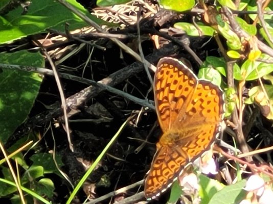

Wild blueberries?


Ted
When you come here the first time, NPS tell you what to do in defense, if you're confronted by a moose. After a few encounters you realize that the males need to be taken seriously and primarily during the fall rut. The moose are bigger than you and it can be intimidating until you realize they want to avoid you.
Several years ago NPS reintroduced the wolves to the park. They are larger than average, have adapted well, and have been prolific in their reproduction. NPS tell you to avoid them and what to do if they approach. And then there's this:
If a wolf attacks: Wolf attacks are extremely rare and unlikely to happen. But if it does, fight using any means necessary.
There are now around 25 wolves at Isle Royale. Hiking through the park solo, you have lots of time to think about what you will do if confronted. In the scuba diving business we had a joke, if confronted by a shark, cut your buddy with your dive knife and swim away as fast as you can. I never expected to see a wolf and thought I would eventually not worry about it.
I'm walk parallel to the water through the woods. You become focused on looking for movement to spot wildlife. Ahead of me near the water but still in the trees, I see it bound parallel to the water maybe 40' from me at the closest point. It's a silhouette as the water behind it is light and bright, and the wolf is running in the woods. The head is unmistakable as a wolf with long bushy tail parallel to his back. The speed is incredible, but there's not a sound as he bounds through the trees. If you didn't see him coming, you would never know he attacked.
Then you realize, they're in a prey rich environment and you would likely be a target or last choice. Too many beavers and other ground animals out during the summer to mess with a human. And so life goes on.
Some more pictures from the park.


Wild blueberries?


Ted
Old Sea Dog
Senior Member
- Joined
- May 13, 2022
- Messages
- 305
- Vessel Name
- "OLD BAY"
- Vessel Make
- 1979 Grand Banks #599
Absolutely stunning.
Thanks Ted.
Yes to Rocky and Bullwinkle.
Maybe a Roadrunner to keep the Wolf busy?
Works with the Coyote!
Thanks Ted.
Yes to Rocky and Bullwinkle.
Maybe a Roadrunner to keep the Wolf busy?
Works with the Coyote!
O C Diver
Guru
- Joined
- Dec 16, 2010
- Messages
- 12,880
- Location
- USA
- Vessel Name
- Slow Hand
- Vessel Make
- Cherubini Independence 45
This thread is steadily increasing my desire to get the boat to the upper Great Lakes for a few weeks one of these years...
Don't get me wrong, I love this area, but from Rochester, NY I could also be very happy in Georgian Bay and the North Channel.
Ted
O C Diver
Guru
- Joined
- Dec 16, 2010
- Messages
- 12,880
- Location
- USA
- Vessel Name
- Slow Hand
- Vessel Make
- Cherubini Independence 45
This is my first summer in 29 years without a boat.
Your pictures and descriptions certainly help ease my
withdrawal symptions. Thanks Ted.
Jim
Glad I could help! We doing lunch / dinner in October?
Ted
rslifkin
Guru
- Joined
- Aug 20, 2019
- Messages
- 7,599
- Location
- USA
- Vessel Name
- Hour Glass
- Vessel Make
- Chris Craft 381 Catalina
Don't get me wrong, I love this area, but from Rochester, NY I could also be very happy in Georgian Bay and the North Channel.
Ted
Those are on the list too when time permits and somewhere else doesn't end up higher on the list.
O C Diver
Guru
- Joined
- Dec 16, 2010
- Messages
- 12,880
- Location
- USA
- Vessel Name
- Slow Hand
- Vessel Make
- Cherubini Independence 45
Spent last night in Duncan Bay (lower left corner of the pic). It's usually a great spot to see wildlife and especially moose. Not much in the way of wildlife yesterday evening, but a peaceful night at anchor.
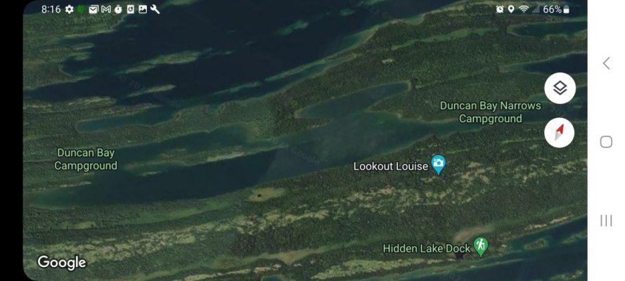
Woke up to thick morning fog. Normally fog doesn't postpone my start, but you have to go through Duncan Narrows coming and going. If you draw 4'+ of water, the narrows forces you into about a 30' wide slot between the stone reefs. It's a lot narrower that the picture shows.
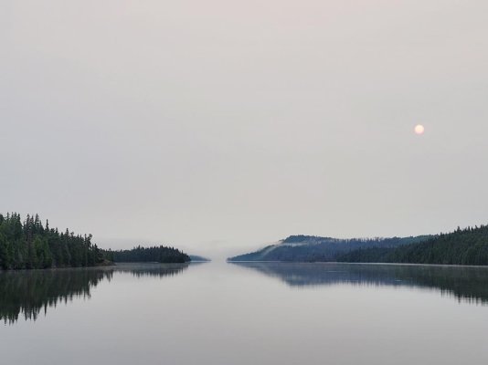
Next stop Passage Island.
Ted

Woke up to thick morning fog. Normally fog doesn't postpone my start, but you have to go through Duncan Narrows coming and going. If you draw 4'+ of water, the narrows forces you into about a 30' wide slot between the stone reefs. It's a lot narrower that the picture shows.

Next stop Passage Island.
Ted
O C Diver
Guru
- Joined
- Dec 16, 2010
- Messages
- 12,880
- Location
- USA
- Vessel Name
- Slow Hand
- Vessel Make
- Cherubini Independence 45
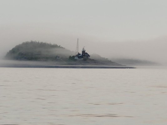
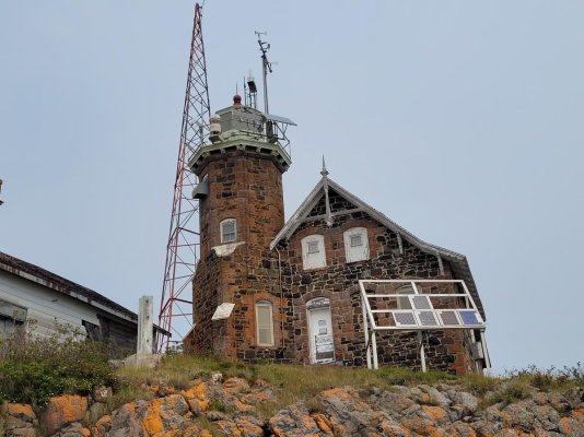
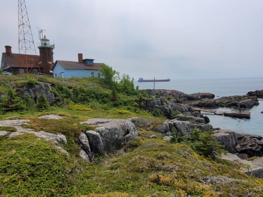
This is the lighthouse at Passage Island this morning. The shipping channel going to Thunder Bay goes between Isle Royale and Passage Island. I guess the channel itself is a mile or so wide. Back before electronics and all the sophisticated navigation equipment, it was important to have lighthouses to keep ships off the rocks on both Passage Island and Isle Royale. The lighthouse dates back to 1881 and has gone through several evolutions of upgrades. Currently it's all automated and run off of solar power.
Really like this picture of the island breaking through the fog.
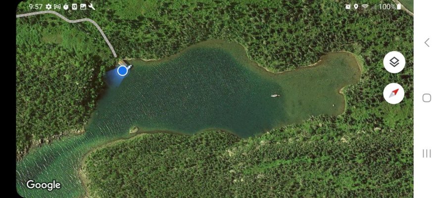
The satellite version shows the lighthouse at the west end and a natural channel and lake as a harbor of refuge for smaller boats.
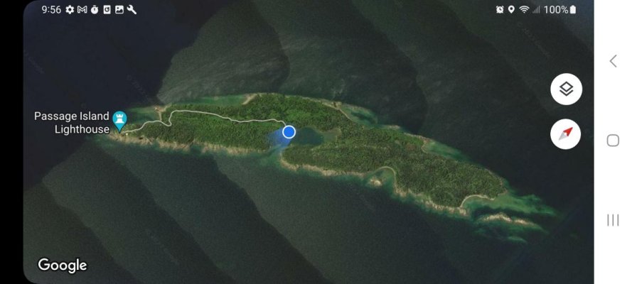
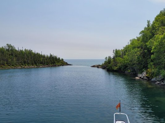
This is the lake and I'm tied to the dock to take the trail to the lighthouse. The lake is close to 80' in the dark area, but shallow enough to anchor on the East end where a boat is anchored. The navigable entrance is very narrow. Only the dark area in the center of the channel is deep enough for 4'+ draft. The deep water probably isn't more than 30' wide.
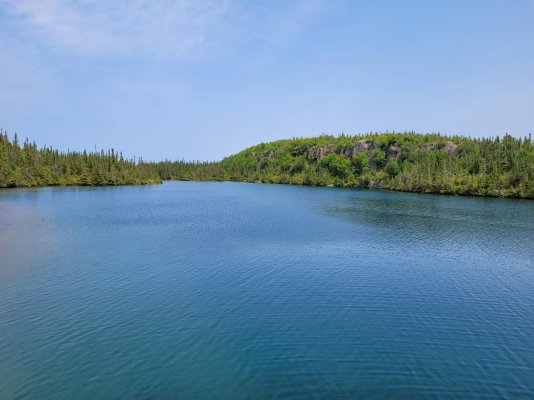
The lake is very protected with the natural rock walls going up 50 to over 100'.
The channel and reefs through the passage aren't for the faint of heart.
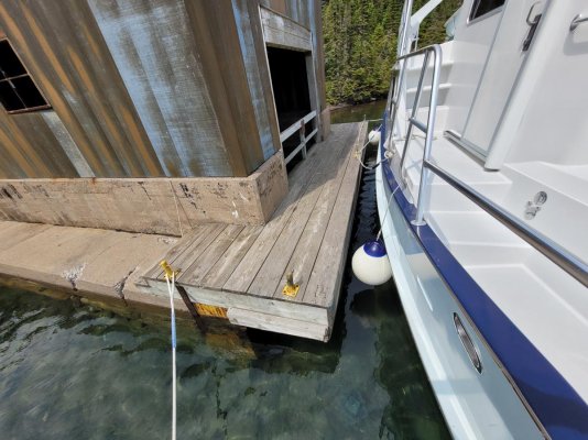
There's maybe 30' of dock to tie to, or anchor out and dinghy in. NPS also ferries people for a guided walk on M, W, and F.
The original lighthouse and keeper's housing.
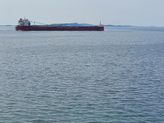
An ore carrier coming through the passage.
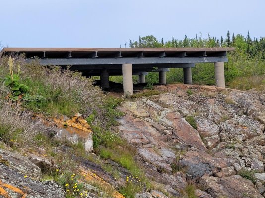
In 1988 with the automation of the light and fog signal, it was no longer necessary to have Keepers stationed on the island. It was however critical to repair failures of the light and fog signal as quickly as possible. The USCG decided it was better to fly maintenance and repair crews to the lighthouse as opposed to them traveling in <50' boats during the storm seasons. So they built a helipad.
Ted
Really like this picture of the island breaking through the fog.

The satellite version shows the lighthouse at the west end and a natural channel and lake as a harbor of refuge for smaller boats.

This is the lake and I'm tied to the dock to take the trail to the lighthouse. The lake is close to 80' in the dark area, but shallow enough to anchor on the East end where a boat is anchored. The navigable entrance is very narrow. Only the dark area in the center of the channel is deep enough for 4'+ draft. The deep water probably isn't more than 30' wide.

The lake is very protected with the natural rock walls going up 50 to over 100'.

The channel and reefs through the passage aren't for the faint of heart.

There's maybe 30' of dock to tie to, or anchor out and dinghy in. NPS also ferries people for a guided walk on M, W, and F.

The original lighthouse and keeper's housing.

An ore carrier coming through the passage.


In 1988 with the automation of the light and fog signal, it was no longer necessary to have Keepers stationed on the island. It was however critical to repair failures of the light and fog signal as quickly as possible. The USCG decided it was better to fly maintenance and repair crews to the lighthouse as opposed to them traveling in <50' boats during the storm seasons. So they built a helipad.

Ted
O C Diver
Guru
- Joined
- Dec 16, 2010
- Messages
- 12,880
- Location
- USA
- Vessel Name
- Slow Hand
- Vessel Make
- Cherubini Independence 45
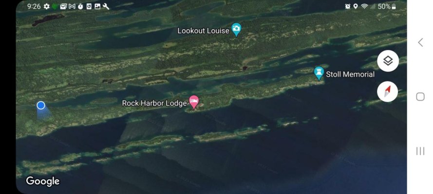
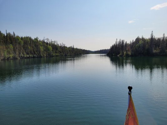
This evening and for a couple of days I'm in Tobin Harbor. It's about a 5 mile long channel running in from the lake with high wooded ridgelines on both sides. This is a wonderful place to dinghy ride, canoe, or kayak to look at wildlife. There are also several points from which to access different hiking trails.
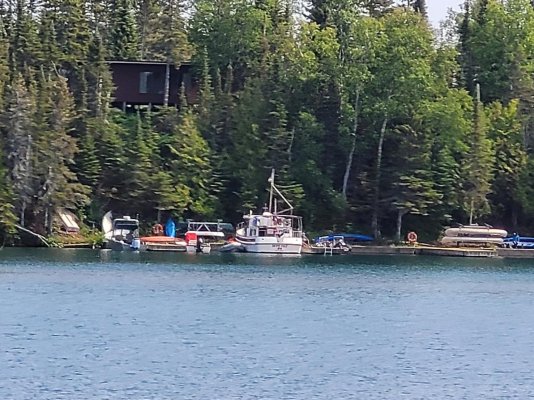
There is a series of docks here for those who want to use the facilities at Rock Harbor lodge in the next parallel channel. Think that's a Nordic Tug tied to the dock. There are also rental canoes available at this dock.
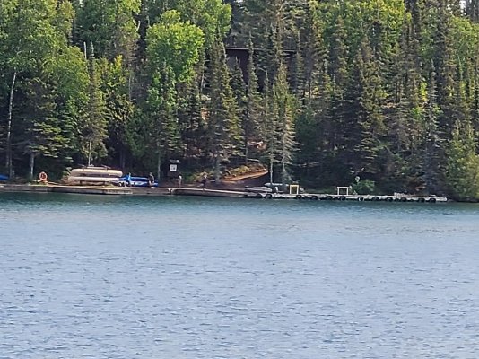
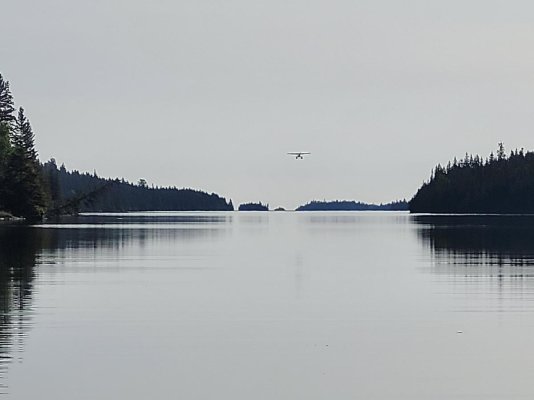
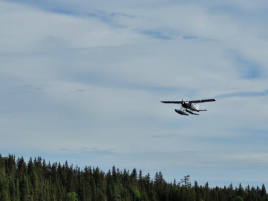
Next to the canoes is the seaplane dock. There's a one mile long authorized landing area for the seaplanes. Because of the high ridgelines and trees, the channel is almost always calm to very small waves. It is a little unnerving when a plane clears you by 100' and lands on the water ahead of you. They come and go several times a day unless there's fog.
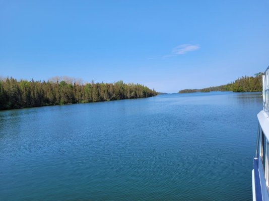
About 5 miles out to the lake.
Less than a half mile to the end of the channel. Anchored in 10' of water tonight.
Ted

There is a series of docks here for those who want to use the facilities at Rock Harbor lodge in the next parallel channel. Think that's a Nordic Tug tied to the dock. There are also rental canoes available at this dock.

Next to the canoes is the seaplane dock. There's a one mile long authorized landing area for the seaplanes. Because of the high ridgelines and trees, the channel is almost always calm to very small waves. It is a little unnerving when a plane clears you by 100' and lands on the water ahead of you. They come and go several times a day unless there's fog.

About 5 miles out to the lake.

Less than a half mile to the end of the channel. Anchored in 10' of water tonight.

Ted
BDofMSP
Guru
- Joined
- Sep 5, 2013
- Messages
- 905
- Location
- USA
- Vessel Name
- Gopher Broke
- Vessel Make
- Silverton 410 Sport Bridge
We loved our stay at Tobin Harbor. Fog the first day kept all flights out, so I was quite surprised to be buzzed by several planes as soon as it cleared. There were a lot of people who didn't read their contract that closely and were quite unhappy when they had to spend extra days on the island until fog cleared.
O C Diver
Guru
- Joined
- Dec 16, 2010
- Messages
- 12,880
- Location
- USA
- Vessel Name
- Slow Hand
- Vessel Make
- Cherubini Independence 45
We loved our stay at Tobin Harbor. Fog the first day kept all flights out, so I was quite surprised to be buzzed by several planes as soon as it cleared. There were a lot of people who didn't read their contract that closely and were quite unhappy when they had to spend extra days on the island until fog cleared.
Yes, Tobin Harbor is one of my favorites and usually fairly benign if it's blowing 30+ knots. Would really like to see the area from a plane, but I've become comfort focused. After a day of hiking, I want a shower, real food, and a real bed.
Ted
Absolutely!Glad I could help! We doing lunch / dinner in October?
Ted
We will probably have to start with lunch and continue through at least dinner the next day to hear about all your adventures on this trip!
Jim
HeadedToTexas
Guru
Stunning camera work, Ted. Much like the wolves there, it is a target rich environment for the camera. Inspiring stuff. Thank you.
O C Diver
Guru
- Joined
- Dec 16, 2010
- Messages
- 12,880
- Location
- USA
- Vessel Name
- Slow Hand
- Vessel Make
- Cherubini Independence 45
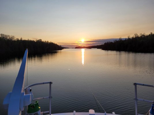
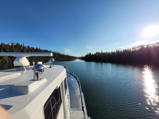
Waiting for the morning rain showers to pass through, so here are some pictures from Tobin Harbor:
Another tough morning at anchor.
Dinghy day out surveying the neighborhood.
De plane! De plane!
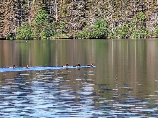
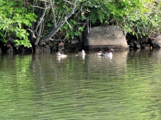
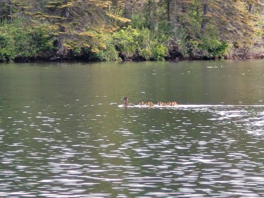
Duckys on parade! Saw 8 different species of waterfowl while out dinghing.
Wine o'clock on the upper deck. It's such a hard life.
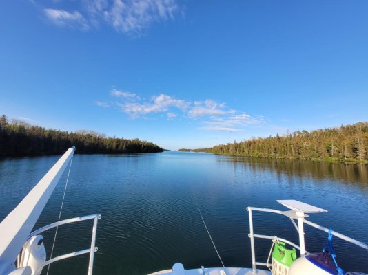
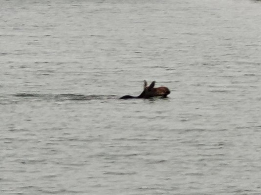
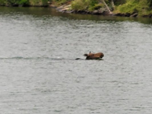
Sometimes you just have to look out the pilothouse windows to see a moose. I'm at anchor this morning; she's swimming across the harbor 75' in front of the boat; the generator is running! I guess I can say I have a "moose certified quiet" generator system.
Ted
Another tough morning at anchor.

Dinghy day out surveying the neighborhood.
De plane! De plane!


Duckys on parade! Saw 8 different species of waterfowl while out dinghing.


Wine o'clock on the upper deck. It's such a hard life.


Sometimes you just have to look out the pilothouse windows to see a moose. I'm at anchor this morning; she's swimming across the harbor 75' in front of the boat; the generator is running! I guess I can say I have a "moose certified quiet" generator system.


Ted
O C Diver
Guru
- Joined
- Dec 16, 2010
- Messages
- 12,880
- Location
- USA
- Vessel Name
- Slow Hand
- Vessel Make
- Cherubini Independence 45
Stunning camera work, Ted. Much like the wolves there, it is a target rich environment for the camera. Inspiring stuff. Thank you.
Glad you're enjoying my hard work.
Ted
Old Sea Dog
Senior Member
- Joined
- May 13, 2022
- Messages
- 305
- Vessel Name
- "OLD BAY"
- Vessel Make
- 1979 Grand Banks #599
Or.....
Planning on installing water tanks this week so we can at least do some Chesapeake.
Had to replace tankless water heater at house here in VA. Required running another 220 volt line and breakers.
Planning to start Loop next May.
Stay safe.
Totally enjoy your posts.
Planning on installing water tanks this week so we can at least do some Chesapeake.
Had to replace tankless water heater at house here in VA. Required running another 220 volt line and breakers.
Planning to start Loop next May.
Stay safe.
Totally enjoy your posts.
HeadedToTexas
Guru
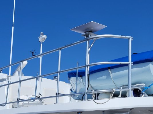
I take it Starlink is very effective up there? Is your antenna dynamic, or did you fix it in that position? Other than some superficial YouTube investigation, I am a complete Starlink novice.
O C Diver
Guru
- Joined
- Dec 16, 2010
- Messages
- 12,880
- Location
- USA
- Vessel Name
- Slow Hand
- Vessel Make
- Cherubini Independence 45
I take it Starlink is very effective up there? Is your antenna dynamic, or did you fix it in that position? Other than some superficial YouTube investigation, I am a complete Starlink novice.
I deactivated the tilt mechanism in mine. The reception, upload, and download speeds are better than I expected. Thought I might have some issues in the narrow channels, but it's been perfect. If I had to guess, probably some of my high speeds have to do with a close proximity to Thunder Bay.
Ted
Similar threads
- Replies
- 17
- Views
- 4K
- Replies
- 43
- Views
- 6K
- Replies
- 21
- Views
- 10K
Latest posts
-
Fixing boats in Exotic Places - are new boats really that bad?
- Latest: HeadMistress
-
-
-
-
-
-
-
-
-

