Slow Hand 2023 To Lake Superior and back

The friendliest place on the web for anyone who enjoys boating.
If you have answers, please help by responding to the unanswered posts.
Ranger, I'll probably be in that area in the next few weeks. Looks like a lot of nice anchorages.


Yep, anchorages everywhere. Give me a heads up when you're nearby.

Cheers, -Chris
 
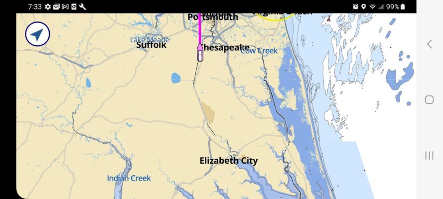
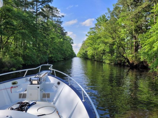
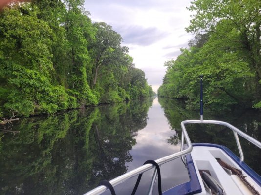
Welcome to the Dismal Swamp canal. The canal is about 22 miles between the South Mill lock and the Deep Creek lock. The canal connects the Albemarle Sound with Chesapeake Bay and dates back to about 1805.

Screenshot_20230430_073351_Aqua Map Marine.jpg

20230429_162900.jpg

20230430_072924.jpg

The canal is a very protected waterway than can be traveled in all but hurricane conditions. I go this way to see the wildlife as well. Spotted on this trip were bald eagles, herons, Canadian geese, mallards and other ducks, and turtles. On other trips I have also seen deer.

The state park is also an enjoyable walk that you can access from the welcome center free dock.

For more information on the Dismal Swamp canal and State park:

https://dismalswampwelcomecenter.com/state-park/

Ted
 
Wow - you're really making progress!
Dismal Swamp canal looks anything but "dismal"!
 
Dismal Swamp canal looks anything but "dismal"!

I enjoy going this way and taking a day off to walk the state park. April / May and October / November are quite nice as far as temperature and humidity.

Ted
 
Done both and each has their merits.
Dismal Swamp is now the preferred route since the Great Bridge Lock is on limited schedule openings due to power failure.
Hopefully you are snugged in somewhere today as it is a less than desirable travel day.
Stay safe and enjoy.
 
Unless really zoomed in on your map it looks like you would need to be in an airboat to run thru the swamp.
 
WOW! 14 days from Ft Myers to the Chesapeake. That's pretty good time for a 7 knot boat.
 
Appreciate the offer! Saw Vermont was your home. Do you boat on lake Champlain? May be going back again next summer.

Ted

Yes sir, we have a slip at Chipman Point Marina for another season, should be bottom painting this weekend and launch next week sometime.

We haven't been farther north than Burlington yet but will be this season. Last year was our first year of boat ownership.
 
WOW! 14 days from Ft Myers to the Chesapeake. That's pretty good time for a 7 knot boat.

Made to the dock in Crisfield, MD on day 15.

Screenshot_20230501_160121_Aqua Map Marine.jpg

Take a couple of days to clean the boat, boat bottom, and wait for the wind to settle down. Then hopefully back out on Thursday or Friday.

Ted
 
Underway from Galesville, MD at 2:30 AM.

At 5:30 AM the full moon is fading from last night with the Chesapeake Bay Bridge off to the left.

20230506_052438.jpg

Dawn is just starting to form to the East.

20230506_052544.jpg

20230506_052940.jpg

Other than a South bound tug below the Bay Bridge, not another boat underway. Life is good on the Chesapeake!

Ted
 
Underway from Galesville, MD at 2:30 AM.

At 5:30 AM the full moon is fading from last night with the Chesapeake Bay Bridge off to the left.

Ted
Now I know what it can look like!

We are rarely under way before 11:00-12:00...just before the marina is ready to kick us out so they have space for new customers ;-)


Serious question: Do you also change your oil filter during mid-cruise oil changes?
 
Serious question: Do you also change your oil filter during mid-cruise oil changes?

Yes, it's simple and easy to get to.

20230506_065942.jpg

BTW, I changed the oil last night, and 10 days before that. Oil, filter, and oil analysis is about $90. Negligible in the overall cost of boat ownership and cruising.

Ted
 
Ted,

Amazingly, I saw the same Moon last night, but ~50 miles inland from the coast, where I usually see it. Thanks for those lovely tranquil images.
 
Yep. Beautiful moon rising over Chincoteague bay. Sunrises are great too.
Safe travels Ted. Glad to meet you in Crisfield. 20211002_061511.jpg20211002_062937.jpg
 
Ted, following your trip with interest. Good stuff.

I've not (yet) had occasion to poke my nose into West River. Do you anchor there or make a marina stop?
 
Ted, following your trip with interest. Good stuff.

I've not (yet) had occasion to poke my nose into West River. Do you anchor there or make a marina stop?

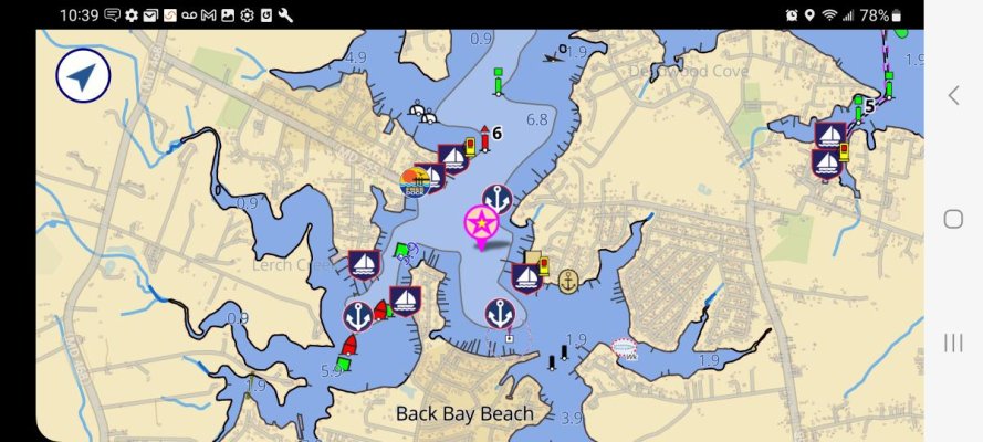
This was my first trip to have dinner with some TF friends. Ended up dropping the hook where the pink star is and dinghing over to Stan and Joe's Riverside (sort of Tiki Restaurant). It's just below the free dock marker and has a dinghy dock. Dinghy dock, food, and friends were all good.

Screenshot_20230506_103928_Aqua Map Marine.jpg

https://www.stanandjoessaloon.com/

Ted
 
:thumb:

Thanks
 
Underway from Galesville, MD at 2:30 AM.

At 5:30 AM the full moon is fading from last night with the Chesapeake Bay Bridge off to the left.


Good grief, oil change and then 0230 departure? Fourteen minutes worth of sleep?

:)

-Chris
 
I've not (yet) had occasion to poke my nose into West River. Do you anchor there or make a marina stop?

Options.

Anchorage closer to the town (village? hamlet?) of Galesville, or usually quieter anchorage on the Rhode River near Big Island. (Irony: avoid High Island, which is submerged.) Sometimes not quieter, depending on if there are a few big raft-ups, or an occasional SSCA affair in there.

Marinas in Galesville, one with power/water and with restaurant (Pirates Cove), one no water/power but with restaurant (Stan & Joe's), one with full service (Hartge Yacht Harbor) including onsite boat yard and Travel Lift (Hartge Yacht Yard) slightly further away from the pubs.

Mooring fields in Galesville. Closest to town, smaller vessels, don't know who controls. One at HYH, extensive, with dinghy dock.

There's also a condo marina just behind the fuel dock; can't predict any slip availability; dunno who runs it. That side also has a Travel Lift, too.

If you decide to come visit, give me a heads up...

-Chris
 
Thanks Chris

Still months away, if this season at all.
 
Good grief, oil change and then 0230 departure? Fourteen minutes worth of sleep?

:)

-Chris

Hey, I got almost 5 hours of sleep. :confused:

Managed to catch the incoming tide and road it all the way Summit Marina on the C & D canal before noon!

Need to go visit an old friend and then it's Cape May tomorrow afternoon.

Ted
 
Hey, I got almost 5 hours of sleep. :confused:

Managed to catch the incoming tide and road it all the way Summit Marina on the C & D canal before noon!

Need to go visit an old friend and then it's Cape May tomorrow afternoon.

5 whole hours! Wow! :)

I saw you're in Summit North; Deb had been wondering whether you'd try for all the way down to Cap May today or not...

We can do that trip in one day easily enough, but we've always split it into two... with an overnight usually at either Chesapeake City or Delaware City... and once at Summit, I think. Easy trips, if weather is OK on the Delaware side.

-Chris
 
Last edited:
5 whole hours! Wow! :)

I saw you're in Summit North; Deb had been wondering whether you'd try for all the way down to Cap May today or not...

We can do that trip in one day easily enough, but we've always split it into two... with an overnight usually at either Chesapeake City or Delaware City... and once at Summit, I think. Easy trips, if weather is OK on the Delaware side.

-Chris
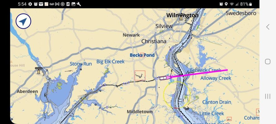
My buddy lives in Elkton, MD, so Summit works well. Too much drinking and partying for my taste at the marina in Chesapeake City.

Great meeting you and Deb yesterday. Hope you have a good summer!

Ted
 
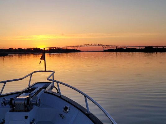
Sunrise on the C & D canal.

20230507_060008.jpg

The C & D is a 15 mile canal that connects the upper part of Chesapeake Bay with the upper part of Delaware Bay. Originally it was constructed as a canal with locks. Later it was dug deeper and wider to eliminate the locks. Because of the great difference in distance from the ocean for each bay, high and low tides don't coincide at each end of the canal. As a result, tidal currents can exceed 2 knots in the canal.

Screenshot_20230507_055457_Aqua Map Marine.jpg

Ted
 
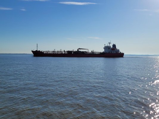
A significant portion of both the Chesapeake and Delaware Bays are too shallow to navigate. So there are stretches where you travel in or near the shipping lanes. It's important to keep track of what's coming at you and what's coming up behind you.

20230507_075349.jpg

Many of these smaller ships will cross between the Delaware and Chesapeake Bays on the C & D canal. AIS is a wonderful tool to see who's coming around the corner!

Ted
 
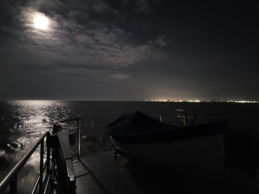
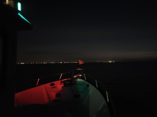
Underway at 3 AM before the tide turns in front of the Coastguard station in Cape May, NJ. 11 knots out of the WNW heading up the NJ coast at 4:30 AM.

Looking over the boat deck at the moon and Wildwood, NJ.
20230508_044601.jpg

Looking ahead at the sea, another NJ town, and the TF burgee flapping in the breeze.
20230508_044717.jpg

Dawn will be here soon, but it's nice being out on the Atlantic at night.

Life is good!

Ted
 
Last edited:
Nice Ted! You worked that cold front nicely. Being under way before first light is the absolute best. It’s like getting the jump on the rest of the world. Enjoy your photos. Keep ‘em coming.
 
Last edited:
Hard to know why anyone would want to be out here.

20230508_054200.jpg

20230508_055455.jpg

20230508_055619.jpg

Ted
 

Latest posts

Back
Top Bottom