What are the pink chickens on Navionics charts?

The friendliest place on the web for anyone who enjoys boating.
If you have answers, please help by responding to the unanswered posts.
Only in some areas. Some kind of bird sanctuary or something. No symbols like that here on Lake Michigan
 
Depending on your chart plotter, hover the crosshairs over the item and “choose” the item. “Enter” button might be the control. Up pops an explanation of the item.
 
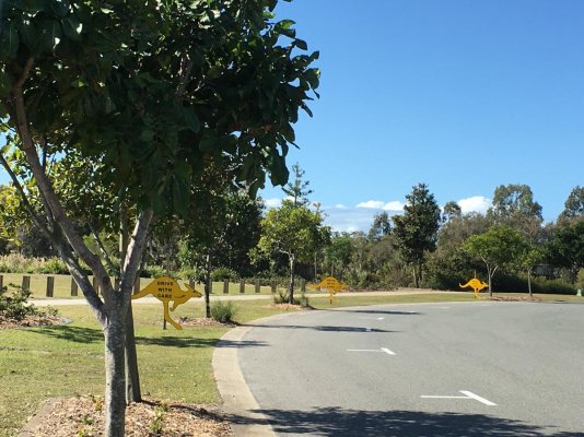
Ok, so they perform the same kind of warning function as these do near where I live. :D
 

Attachments

  • 2AE0CE80-1807-48AC-8644-94BDFFC6BA9F.jpg
    2AE0CE80-1807-48AC-8644-94BDFFC6BA9F.jpg
    188.5 KB · Views: 62
The pink ducks don’t light up with any explanation under the cursor crosshairs, at least not with the Navionics phone app version I’ve always used. They indicate (in my area) a marine park with seabird conservation. This constitutes most of my home waters. The duck symbols can be mistaken for rock symbols at a glance, and hence are quite annoying.
 
Last edited:
If you haven't discovered it yet, put your cursor on the symbol or dotted line or whatever you are curious about on your plotter. Click once and in the menu, select "Chart Objects" This will usually explain restricted areas, anchorage areas, nature reserves, firing ranges, etc.
 
If you haven't discovered it yet, put your cursor on the symbol or dotted line or whatever you are curious about on your plotter. Click once and in the menu, select "Chart Objects" This will usually explain restricted areas, anchorage areas, nature reserves, firing ranges, etc.
All plotters are not the same.
 
There is definitely no info available about the duckies, within the iphone app version.
 
Ok, so they perform the same kind of warning function as these do near where I live. :D

Where I live, we have yellow signs to tell the deer where it is safe to cross. "deer crossing". Elsewhere, they take their chances.
 
I used to think they meant flamingo parking.....
 
Back
Top Bottom