Magnetic compass

The friendliest place on the web for anyone who enjoys boating.
If you have answers, please help by responding to the unanswered posts.

RT Firefly

Enigma
Joined
Oct 21, 2007
Messages
16,626
Location
Bumpkin?
Greetings,
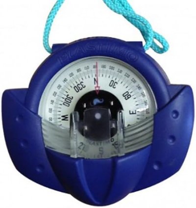
Our new boat has a magnetic compass mounted near enough to our Garmin GPS/radar screen to effect it's accurate operation. I would really like the compass as a backup in the event of electronic failure.


Is there any way to tune out the close effects of the electronics to increase the accuracy of the compass without moving either the compass or the electronics?


Both are mounted in the helm area in such a fashion that moving either will create a hole in the dash that will be both unsightly and difficult to patch.


Thanks.
 
Just how far off does it get?

Think its from electrically induced magnetism or just the box even when turned off?

Does the compass have magnet adjustments? If not try moving a couple small magnets around to see if you can compensate for the error.

If not, a deviation table is what will save your butt if the errors are more than 3-5 degrees on a smaller powerboat with a smaller compass.
 
Greetings,
Mr. ps. Not sure of the answers to any of you questions. I only remember that last year the indicated heading on the magnetic compass was off a significant amount as compared to GPS readings. We've only been on the water about 5 hours with her so she's REALLY a new boat to us and the memory dims.


I'm assuming that there ARE adjustments as most marine compasses do have them.
I can check if the compass is affected when the GPS is on or off.


As per any new boat owner we have "the list" and this was just one item that popped into my dimming mind as I sit here on TF. In this case, perhaps I'll defer the question until I have more information. Thanks.


Would like to get some items crossed off before we head away from the dock.
 
Get a satellite compass such as Garmin MSC10 or Furuno SCX20. They calculate heading based on the signals from multiple GPS units.


Aside from solving your problem, they have the advantage that the boat won't change course going through a bridge or over a tunnel. They also take out the effect of rolling. Highly recommended.


Jim
 
It is called swinging a compass. Was very popular when we were all much younger before loran came on the recreatioanal boating scene.

But, if you only want to know the accuracy after a loss of electronics then you do not need to do anything as the interference will be dead and gone.

:rofl: :D :rofl:
 
Back in the dark ages, I worked for Captain's Nautical Supply in Seattle. Probably one of the last businesses that would swing a compass. We usually did it on Lake Union, where sighting down Seattle's north/south streets above Gas Works Park helped get things aligned. A full deviation card was 24 headings (15 degree increments) and would require running back and forth, so 48 bearings. Took several hours.

I haven't bothered to do that on my own boat. It is on my to do list, but it ends up so far down that I only think of it once in a while. Even though it would be simple to do given the Garmin GPS also on the helm. Speaking of which, my Garmin had a little door that covered the mini-SD card slot. It snapped shut in a way that made me wonder if it was a magnetic latch. Yep. Made about a 10 degree difference on the compass (on some headings) whether opened or closed. Moving the compass further away is the only thing I've done to date re compass deviation.

The problem with relying on a compass in case of electrical failure is that one's "charts" are likely on the failed MFD (paper charts now being obsolete regardless of what the CG claims). Better than a compass (recently swung), accurate deviation card, and recently updated charts would be a second navigation app on one's phone, laptop, etc. That's why my compass has turned into something of a relic. Were I planning a circumnavigation (of the earth, not Vancouver Island), I would have reason to worry about the accuracy of my compass. I no longer keep track of local variation.

We gave the customer a nice nautical-looking frameable deviation card to be posted on the helm. Looked real salty. Like having one's ship station license posted by the VHF (and probably just as useful).
 
Greetings,

Mr. SK (post #5). Hahaha. Good point!

Mr. MF. I, for one, will always have paper charts aboard. Call me old fashioned but rather than zooming in and out of the electronics, paper gives me a better, immediate overview of location(s). With touch screens in a sporty seaway I find it VERY difficult to not multiple-touch to a screen/function I didn't want. It's also very possible that our compass has NEVER been swung.

A deviation/variation of 3 or 4 degrees will be quite sufficient for my purposes in the event of an electrical failure.

One change I plan on doing is modifying the GPS screen to display analog readings of engine conditions (temp, rpm, fuel etc.) in spite of the fact I have digital readouts of all necessary numbers. I really much prefer analog over digital.


Thanks all.
 
Last edited:
If it just a backup you are looking for you could just use a hand-held compass such a hand-bearing compass for which you might have other needs:
 

Attachments

  • compass.jpeg
    compass.jpeg
    22.1 KB · Views: 8
Congrats on your new boat!

Not long after I got my boat, I replaced the compass with a model that had compensation capability. A Plastimo model, so it didn't break the bank, but it provided what I needed in the space I had available. There were a couple of very useful documents that I downloaded at the time. I used one of them to guide me through creating my very first deviation curve. I attach them here, in case they might be of any help to you. Doesn't matter what make your compass is - but hopefully, it will have compensation screws.


P.S. They say you are supposed to check/update your deviation curve every year, as the magnetic field of the boat can change while in winter storage, for example. I confess I have not done this, though I have done a few cross checks to confirm that my original curve is still "good enough" for the coastal cruising I generally do.
 

Attachments

  • compass_inst(uk).pdf
    151.2 KB · Views: 13
  • Nav.jpg
    Nav.jpg
    161.8 KB · Views: 30
Can you post a picture of your helm layout? These days everyone has something within a foot of their compass. If you can’t adjust the deviation out then make a deviation table. TVMDC add West.
 
Greetings,
Mr. HW. I'll try tomorrow IF I can get aboard. It's raining buckets here in FLL. 4" yesterday at the airport. Probably similar today. Good idea on the table.
I strongly suspect there are adjustment screws. In order to swing the compass I would have to be away from the dock and given the weather AND the forecast it may not happen for another 2 or 3 days.

I might be able to use the compass on my phone to get rough directions. That and observing compass readings when the electronics are on and off should give me a better idea of the situation.
Thanks
 
Before I would get into swinging the compass I would query Garmin and see if they have anything to put on the power cables to suppress the interference. Also maybe put a shield on the cabling and see if that helps. Then if all else fails swing the compass. It can be a long process especially if you haven’t done it before. We used to be required to have a deviation table on our boats as CG Facilities. It would usually take all day and we had done it multiple times before.
 
Usually for magnetism I thought it was twisting wire pairs (parallel DC wire cause magnetic fields) to solve/prevent issues....less about shielding.

Nowadays with GPS, swinging a compass to reasonable specs is pretty quick if you can find an open body of water where you are not subject to current or wind leeway. The instructions are with new compasses or probably online.
 
Twisting the wires can help, using a ferrite core may help and sometimes shielding may help. The problem with using a GPS to swing the compass is that if the GPS is interfering with the magnetic compass how do you know the compass is swung properly. Maybe turn off the GPS and swing the compass. Then turn on the GPS and see how much difference there is.
 
Twisting the wires can help, using a ferrite core may help and sometimes shielding may help. The problem with using a GPS to swing the compass is that if the GPS is interfering with the magnetic compass how do you know the compass is swung properly. Maybe turn off the GPS and swing the compass. Then turn on the GPS and see how much difference there is.

It depends on what causes the deviation. I need to swing mine after a chartplotter replacement. But the new plotter causes the deviation just by being mounted close to the compass. Turning it on or off makes no difference, so using GPS COG for compensation would be fine.
 
It depends on what causes the deviation. I need to swing mine after a chartplotter replacement. But the new plotter causes the deviation just by being mounted close to the compass. Turning it on or off makes no difference, so using GPS COG for compensation would be fine.

The whole point of swinging a compass in my book....

Isn't it GPS heading really what you want versus COG? Of course the instructions usually say no find an area without set or leeway so your COG/heading are the same.

I have never heard that shielding affected magnetic fields on power cords and the other wires usually have shielding. I would like to see some data on that as we never learned about it in my factory marine electronic installer's certification courses.

If I wanted to see the difference between my chart plotter both on and off for swinging purposes, I would just use a compass app on my phone...good enough for small boat navigation. Either way, one is just wasting time doing compass swings the old way compared to good enough with a GPS.

In the last 35 years of recreational and commercial boat operation, the only time I used a magnetic compass was to make a turn on in limited vis or high speed at night. The actual heading was not important. I still always had one, and swung them (with GPS after it came out)...but never really needed one to navigate so can't get excited about them anymore.
 
Last edited:
The whole point of swinging a compass in my book....

Isn't it GPS heading really what you want versus COG? Of course the instructions usually say no find an area without set or leeway so your COG/heading are the same.

I have never heard that shielding affected magnetic fields on power cords and the other wires usually have shielding. I would like to see some data on that as we never learned about it in my factory marine electronic installer's certification courses.

If I wanted to see the difference between my chart plotter both on and off for swinging purposes, I would just use a compass app on my phone...good enough for small boat navigation. Either way, one is just wasting time doing compass swings the old way compared to good enough with a GPS.

In the last 35 years of recreational and commercial boat operation, the only time I used a magnetic compass was to make a turn on in limited vis or high speed at night. The actual heading was not important. I still always had one, and swung them (with GPS after it came out)...but never really needed one to navigate so can't get excited about them anymore.


If you have a good source of heading info that you know is accurate like a sat compass, yes, that will be best. But otherwise, CoG in an area with as little wind and current as possible will get you close enough that you probably can't read the compass any more accurately anyway.

I agree, about the only time I use the compass is to give the admiral a course to follow when hand steering.
 
Agreed.

What some instructions recommend, is to use a bearing between a known charted object where you start and another one you head for. I never really needed that as I usually found a calm wind moment with no current so for me it was easy to swing those compasses.
 
Having a compass showing cog and heading simultaneously is sometimes of benefit. It allows you to calculate set. Particularly helpful in open ocean when there’s no land visible to detect effects of currents. An example is entering and leaving the golf stream. You’re commonly at right angles to current so speed isn’t always effected . You want to make use of breakouts and swirls to increase days work. Also coastally when crossing repetitive headlands such as you see along Maine coast. Especially when using AP running off waypoints you make not appreciate the presence of set.

To my understanding - Any expanding and contracting electrical field will be associated with a comparable magnetic field. AC or DC both do this. It’s what makes electric motors (generators ) work and induces current passively in previously current non bearing wires. It screws up compasses, antennas (especially SSB) and other electronics. Goal with magnetic compasses be they for APs, hockey puck bearing or fixed location for navigation is to have little or no such magnetic fields near by. With the inverse square law minor increases in distance can be quite helpful. When using a handheld to get a bearing will do it twice in two locations. The small difference in location distance should not change bearing much if the object is far away.

Can you mount your magnetic compass on the overhead away from radios and the like? If so and adding few ferrites to decrease field size may make a huge difference. Given magnetic field strength and distance strongly effected swinging the compass may not be sufficient by itself as field intensities may vary. Look at everything. Even a small fan or windshield wiper motor can contribute.

So would place your compass where it’s least likely to be effected. Watch it with various things on and off. Ferrites or shielding or moving offending objects as necessary. Also pay attention to magnetic and non magnetic iron pieces as those can cause field distortion. Only then to the very important work of swinging it. Swinging it is key but can only give you a steady reading if disturbing things are eliminated or minimize first.
 
Last edited:
How about just setting the garmin to display magnetic instead of true heading? It would also make it easier to use a hand bearing compass or set of Binos with a compass for navigating.
 
Last edited:
How about just setting the garmin to display magnetic instead of true heading? It would also make it easier to use a hand bearing compass or set of Binos with a compass for navigating.

While that's true in it's own right and convenient for some methods of Nav, not sure what it addresses in the OP?
 
Last edited:
Ensure that the COG is magnetic, not True, to be used to compare with a magnetic compass. Then as mentioned ensure allowance for wind and current as COG will be coorect when the compass is affected by a boat crabbing.
 
Can figure out set with electronics as well. Put your AP on heading. Depending upon boat speed wait awhile. Usually a few miles is sufficient. Go do it again with AP set to NAV and to the same run at about the same speed. You should end up with a triangle but draw the short leg perpendicular to the NAV run. You’ll be a bit off as time will pass as you’re doing this all but the distance of the short perpendicular leg is your set and divided by time is the number to use to planning out a course.
Of course it’s much easier if you have an independent simultaneous cog and heading. No need to not continue on your way. Just get readings and positions at beginning and end of your run of sufficient time . You can do this with satellite compasses giving you both or magnetic on the AP and an old school independent compass. Just need to know distance, or speed and time ,heading and actual course to draw that triangle. I find unless it’s very calm I can’t just look at cog and heading at that time. Will need a few readings and average. AP will be constantly adjusting course and rudder angle changing.
Used to have to figure out set. But now a days it’s not usually necessary. Electronics adjust for it. Good nav programs will tell you if you ask.
Still I like having an old school magnetic compass. Agree with OP aesthetically pleasing and gives you a sense of redundancy. Excellent training to try to keep a compass course. Of course any steering slows you down and burns more fuel. Being able to stay on course with the smallest steering inputs possible is what a good helmsman does well. Unfortunately modern APs with machine learning and some some degree of AI do better than most humans.
 
Last edited:
Or just set a waypoint out ahead and steer a heading. when abeam the waypoint, there is your set.
 
Or just put in an electronic compass like Azimuth 1000. It is self calibrating, just run a couple of slow 360s and then you can check how good a compensation it did. Also it has the ability to be set for off the lubber line on an angle. I would then program in the offset to counter the local variation. Then you can steer true courses instead of magnetic courses.
 
Unfortunately, the Azimuth 1000 is no longer in production and an updated version is not in the works. I looked high and low for one. Lots of vendors listed them, but when I ordered one from them it came up out of stock. I finally found a slightly used one on Ebay. It does work as advertised, really like it.
 
Unfortunately, the Azimuth 1000 is no longer in production and an updated version is not in the works. I looked high and low for one. Lots of vendors listed them, but when I ordered one from them it came up out of stock. I finally found a slightly used one on Ebay. It does work as advertised, really like it.

What chartplotter or AP nowadays doesn't provide the same or better info? Probably why they aren't around anymore.
 
Last edited:
I wanted it as a backup in case the electronics fail. All it needs is a power source.
 
Unfortunately, the Azimuth 1000 is no longer in production and an updated version is not in the works. I looked high and low for one. Lots of vendors listed them, but when I ordered one from them it came up out of stock. I finally found a slightly used one on Ebay. It does work as advertised, really like it.

That is too bad. It was a very nice compass, I had them on 4 or 5 boats. I didn’t realize they were out of production.
 

Latest posts

Back
Top Bottom