Reply
 
Thread Tools Search this Thread Display Modes
 
Old 08-21-2012, 09:57 AM   #1
Moderator Emeritus
 
ksanders's Avatar
 
City: SEWARD ALASKA
Vessel Name: DOS PECES
Vessel Model: BAYLINER 4788
Join Date: Feb 2011
Posts: 5,914
This is the storm to keep an eye on

OK GOM, Florida and east coast boaters this is the storm to keep your eyes on.


000
WTNT44 KNHC 211450
TCDAT4

TROPICAL DEPRESSION NINE DISCUSSION NUMBER 2
NWS NATIONAL HURRICANE CENTER MIAMI FL AL092012
1100 AM AST TUE AUG 21 2012

A BURST OF CONVECTION CONTINUES JUST SOUTH OR SOUTHWEST OF THE
CENTER OF TROPICAL DEPRESSION NINE...ALTHOUGH THE OVERALL COVERAGE
HAS DECREASED DURING THE PAST FEW HOURS. SATELLITE INTENSITY
ESTIMATES ARE 35 KT FROM TAFB AND 30 KT FROM SAB. BASED ON THESE
DATA AND THE RELATIVELY HIGH PRESSURE OF 1010 MB AT NOAA BUOY
41040...THE INITIAL INTENSITY REMAINS 30 KT. AN AIR FORCE RESERVE
HURRICANE HUNTER AIRCRAFT IS SCHEDULED TO INVESTIGATE THE
DEPRESSION THIS AFTERNOON.

THE INITIAL MOTION REMAINS 270/17. THE DEPRESSION IS LOCATED SOUTH
OF A DEEP-LAYER SUBTROPICAL RIDGE THAT IS FORECAST TO REMAIN INTACT
FOR THE NEXT 72 HR...WHICH SHOULD KEEP THE CYCLONE MOVING GENERALLY
WESTWARD AS SHOWN BY THE TIGHTLY CLUSTERED TRACK MODEL GUIDANCE.
AFTER THAT...THE GLOBAL MODELS ARE FORECASTING A SHORTWAVE TROUGH
TO DIG SOUTHWARD OVER THE SOUTHEASTERN U.S. AND THE GULF OF
MEXICO...WHICH IS EXPECTED TO WEAKEN THE RIDGE ACROSS FLORIDA AND
THE BAHAMAS. THIS SHOULD ALLOW THE CYCLONE TO TURN WEST-
NORTHWESTWARD AND SLOW DOWN ACROSS THE NORTH-CENTRAL CARIBBEAN SEA.
THE GUIDANCE SHOWS MORE SPREAD DURING THIS PERIOD...WITH THE UKMET
ON THE RIGHT EDGE SHOWING THE CYCLONE MOVING ALONG THE NORTHERN
COAST OF HISPANIOLA...AND THE ECMWF AND GFS ON THE LEFT EDGE
SHOWING THE SYSTEM PASSING SOUTH OF HISPANIOLA. THE NEW FORECAST
TRACK IS SIMILAR TO THE PREVIOUS TRACK THROUGH 72 HR...THEN IS A
LITTLE TO THE RIGHT OF THE PREVIOUS TRACK AFTER THAT. THE TRACK IS
IN BEST AGREEMENT WITH A BLEND OF THE GFS AND ECMWF MODELS.

THE DEPRESSION IS CURRENTLY EXPERIENCING LIGHT/MODERATE
NORTHEASTERLY VERTICAL WIND SHEAR. THIS SHOULD DIMINISH DURING THE
NEXT 24 HR OR SO...LEAVING THE CYCLONE IN A FAVORABLE ENVIRONMENT
FOR DEVELOPMENT. THE NEW INTENSITY FORECAST IS THE SAME AS THE
PREVIOUS FORECAST THROUGH 72 HR...SHOWING THE SYSTEM BECOMING A
TROPICAL STORM IN 12 HR AND A HURRICANE IN 48 HR. AFTER 72
HR...THE FORECAST TRACK BRINGS THE SYSTEM CLOSER TO HISPANIOLA AND
CUBA THAN THE PREVIOUS TRACK. BASED ON THIS...THE INTENSITY
FORECAST DURING THAT TIME HAS BEEN LOWERED BY 5-10 KT.


FORECAST POSITIONS AND MAX WINDS

INIT 21/1500Z 15.1N 52.8W 30 KT 35 MPH
12H 22/0000Z 15.2N 55.3W 35 KT 40 MPH
24H 22/1200Z 15.5N 58.4W 40 KT 45 MPH
36H 23/0000Z 15.9N 61.5W 50 KT 60 MPH
48H 23/1200Z 16.2N 64.6W 65 KT 75 MPH
72H 24/1200Z 17.0N 70.0W 80 KT 90 MPH
96H 25/1200Z 18.5N 74.0W 90 KT 105 MPH...INLAND
120H 26/1200Z 20.5N 77.5W 85 KT 100 MPH...OVER WAT
ksanders is online now   Reply With Quote
Old 08-23-2012, 12:45 PM   #2
FF
Guru
 
FF's Avatar
 
Join Date: Oct 2007
Posts: 22,553
This looks like it might barely become a F1.

Big deal, thunderstorms happen almost EVERY PM with similar winds.

The only boats that will have problems are those "sold to the insurance co.".

We can use some rain!
FF is offline   Reply With Quote
Old 08-24-2012, 11:12 PM   #3
Guru
 
Carey's Avatar
 
City: Bellingham, WA
Vessel Name: Happy Destiny
Vessel Model: Custom Lobster Yacht
Join Date: Oct 2007
Posts: 1,101
Quote:
Originally Posted by FF View Post
This looks like it might barely become a F1.

Big deal, thunderstorms happen almost EVERY PM with similar winds.

The only boats that will have problems are those "sold to the insurance co.".

We can use some rain!
Lacking any actual Hurricane experts on this site, I guess we are supposed to take your prediction of F1 (A tornado rating), as an actual rating for a Hurricane, which would be correctly rated at Category one for the lowest level hurricane?

I am told that I and my coworkers should speak publicly only of that which we know. Not bad advice.
__________________
Carey Worthen
Master of Disaster
Carey is offline   Reply With Quote
Old 08-25-2012, 05:27 AM   #4
FF
Guru
 
FF's Avatar
 
Join Date: Oct 2007
Posts: 22,553
MY opinion on ANY subject is just that ,simply MY OPINION.

Here is a few maps to bring you up to speed.

Drawn by "experts". www.spaghettimodels.com

From the present plots Lake O is outside the hurricane area .

So in our Hurricane Hole (8 O Clock to Lake O ) will get some breeze , and probably loads of rain.

As we are in a slight drought the rain is very welcome , and since it looks like the eye will be 100 miles out from shore , 150+ distant from us , the breeze may blow away some mosquitoes but no boats.

FF
FF is offline   Reply With Quote
Old 08-25-2012, 01:41 PM   #5
Guru
 
Join Date: Aug 2011
Posts: 577
Oh there's always gonna be a few........If they don't break their mooring, they'll sink from the surge and tight lines.
__________________
TIME well wasted
1984 34' Mainship III
Arkan'tsaw
twiisted71 is offline   Reply With Quote
Old 08-25-2012, 01:42 PM   #6
Guru
 
Join Date: Aug 2011
Posts: 577
FF whadda ya charge if I'm concerned enough to run inland to ride one of these out?!
__________________
TIME well wasted
1984 34' Mainship III
Arkan'tsaw
twiisted71 is offline   Reply With Quote
Old 08-25-2012, 02:43 PM   #7
Veteran Member
 
waterfront's Avatar
 
City: Fairhope
Vessel Name: Waterfront
Vessel Model: Chein Hwa Present Sundeck 35
Join Date: Apr 2012
Posts: 54
Try this for minimal.Have someone drive down the hiway at 75mph in a rainstorm and put your head out thru the sunroof. That is minimal.!!!!
waterfront is offline   Reply With Quote
Old 08-25-2012, 03:05 PM   #8
Guru
 
Join Date: Aug 2011
Posts: 577
Quote:
Originally Posted by waterfront View Post
Try this for minimal.Have someone drive down the hiway at 75mph in a rainstorm and put your head out thru the sunroof. That is minimal.!!!!
Lol No be realistic. Have someone drive down the road in the conditions you describe backwards and open the door because you forgot to XXX and have to go out into the storm to take care of it! As the door is ripped from your hand and sprung backward, you begin to wonder if those folks in Wyoming might have something right after all! Now you hang as much of your body as possible out the door in your personal flogging outfit aka slickersuit! Oh what fun. I have a funny story about my ex and "It's just a Cat 1, why are you doing all that?"!!
__________________
TIME well wasted
1984 34' Mainship III
Arkan'tsaw
twiisted71 is offline   Reply With Quote
Old 08-26-2012, 01:49 AM   #9
Moderator Emeritus
 
ksanders's Avatar
 
City: SEWARD ALASKA
Vessel Name: DOS PECES
Vessel Model: BAYLINER 4788
Join Date: Feb 2011
Posts: 5,914
Quote:
Originally Posted by FF View Post
This looks like it might barely become a F1.

Big deal, thunderstorms happen almost EVERY PM with similar winds.

The only boats that will have problems are those "sold to the insurance co.".

We can use some rain!

Now it looks like it'll make Cat2, and I wouldn't be suprised if it went to cat3.

If it stays offshore then it could be bad. If it moves onshore in south Florida then it won't have much time to get too strong.

It really needs watching. Allot could happen.
ksanders is online now   Reply With Quote
Old 08-26-2012, 05:41 AM   #10
FF
Guru
 
FF's Avatar
 
Join Date: Oct 2007
Posts: 22,553
FF whadda ya charge if I'm concerned enough to run inland to ride one of these out?!

Most folks work an arangement out sometime in the fall.

All my heavy duty dock space is spoken for , as is the good spots my neighbors have.

There is a great anchoring spot just East of us , Google Map

Turkey Creek Ortona FL 33471 , and you will see a lolipop looking bit of water next canal to our East. About 60 ft deep , good sandy bottom and frequently empty.

You have to get past the bridges before the breeze gets to 35K .

FF
FF is offline   Reply With Quote
Old 08-26-2012, 07:46 AM   #11
Senior Member
 
Captain K's Avatar
 
City: Foley, Alabama
Vessel Name: GITANA
Vessel Model: Sea Ranger 47 Pilothouse
Join Date: Mar 2012
Posts: 309
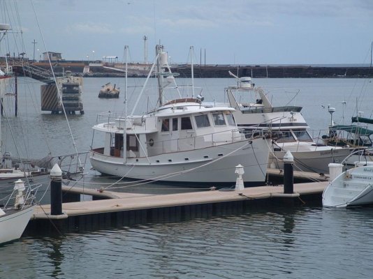
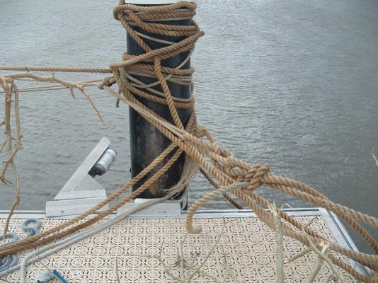
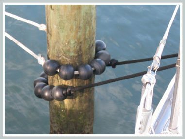
Greeings to all from the projected landfall bullseye...Gulf Shores, AL. We're holed up in Homeport Marina, one of the few places that doesn't drive off patrons when a named storm threatens. Even with floating docks, what concerns me most is someone breaking free during the storm and bouncing around the marina like an 8-ball. You should see how some of these yahoos have secured their vessels!
Captain K is offline   Reply With Quote
Old 08-26-2012, 07:54 AM   #12
Guru
 
rwidman's Avatar
 
City: North Charleston, SC
Join Date: Sep 2010
Posts: 4,774
Quote:
Originally Posted by Captain K View Post
Greeings to all from the projected landfall bullseye...Gulf Shores, AL. We're holed up in Homeport Marina, one of the few places that doesn't drive off patrons when a named storm threatens. Even with floating docks, what concerns me most is someone breaking free during the storm and bouncing around the marina like an 8-ball. You should see how some of these yahoos have secured their vessels!
Why doesn't the marina tie them up correctly to protect their docks and the other boats?
rwidman is offline   Reply With Quote
Old 08-26-2012, 08:33 AM   #13
Guru
 
City: Pensacola
Join Date: May 2012
Posts: 748
Captain K, good luck. I hauled out in Pensacola. Having rode out Ivan and Dennis, I would say we are in for some fun. Spent more time prepping the boat than the house! But then again this isnt the first rodeo..
You should do well. Tight lines! Landfall is at a rising tide so surge shouldnt be too bad for you that far inland. Hopefully Pirates Cove survives.
Blue Heron is offline   Reply With Quote
Old 08-26-2012, 10:23 AM   #14
Senior Member
 
Captain K's Avatar
 
City: Foley, Alabama
Vessel Name: GITANA
Vessel Model: Sea Ranger 47 Pilothouse
Join Date: Mar 2012
Posts: 309
If they don't see to it, somebody else might. Know what I mean?
Captain K is offline   Reply With Quote
Old 08-26-2012, 10:27 AM   #15
Senior Member
 
Captain K's Avatar
 
City: Foley, Alabama
Vessel Name: GITANA
Vessel Model: Sea Ranger 47 Pilothouse
Join Date: Mar 2012
Posts: 309
Hi Blue Heron--thanks for the well wishes. Same back at you. I was at Island Cove Marina in Bayou Chico there in Pensacola when Ivan came through in '04. Nasty as hell, but made it through without a scratch. Then I was in Gulf Shores when Katrina and Dennis hit us in '05. Lucked out then too. There's no such thing as a good hurricane, but at least Isaac looks mild compared to both Ivan and Katrina...for whatever that's worth!
Captain K is offline   Reply With Quote
Old 08-26-2012, 03:20 PM   #16
Guru
 
healhustler's Avatar
 
City: Longboat Key, FL
Vessel Name: Bucky
Vessel Model: Krogen Manatee 36 North Sea
Join Date: Oct 2009
Posts: 5,186
After a lot of preparation for the predicted winds and rain of the NE part of the storm, I awoke about 3:50 AM with a 55 mph recording that lasted about three minutes. There was more after that, but actually I never saw anything worse than that up to now. I'm looking at the back half of the storm circulation for us here in Key Biscayne (Miami), and I don't see much organization. Key West reported that for them, the storm has been a dud. I had completely tarped the roof and window area of my pilothouse and the wind never really challenged it. There are still the tornado warnings, but I think we won't be getting much more. I'll be praying that the storm saves most of its moisture for the drought areas.
healhustler is offline   Reply With Quote
Old 08-26-2012, 05:05 PM   #17
Guru
 
Forkliftt's Avatar
 
City: Diberville Mississippi
Vessel Name: KnotDoneYet
Vessel Model: 1983 42' Present Sundeck
Join Date: Oct 2007
Posts: 2,450
Update for Patricia Louise. While securing new dock lines about 3 hours ago the dock master informed me that my hurricane plan was not acceptable. Everyone had to go. We are currently in the Gulf heading west. Slidell tonight, then to our slip in the Tchefuncte River tomorrow. This thing is getting to be a PITA!
Forkliftt is offline   Reply With Quote
Old 08-26-2012, 06:33 PM   #18
Guru
 
City: Pensacola
Join Date: May 2012
Posts: 748
Good luck Fork!
Blue Heron is offline   Reply With Quote
Old 08-26-2012, 06:52 PM   #19
Master and Commander
 
markpierce's Avatar
 
City: Vallejo CA
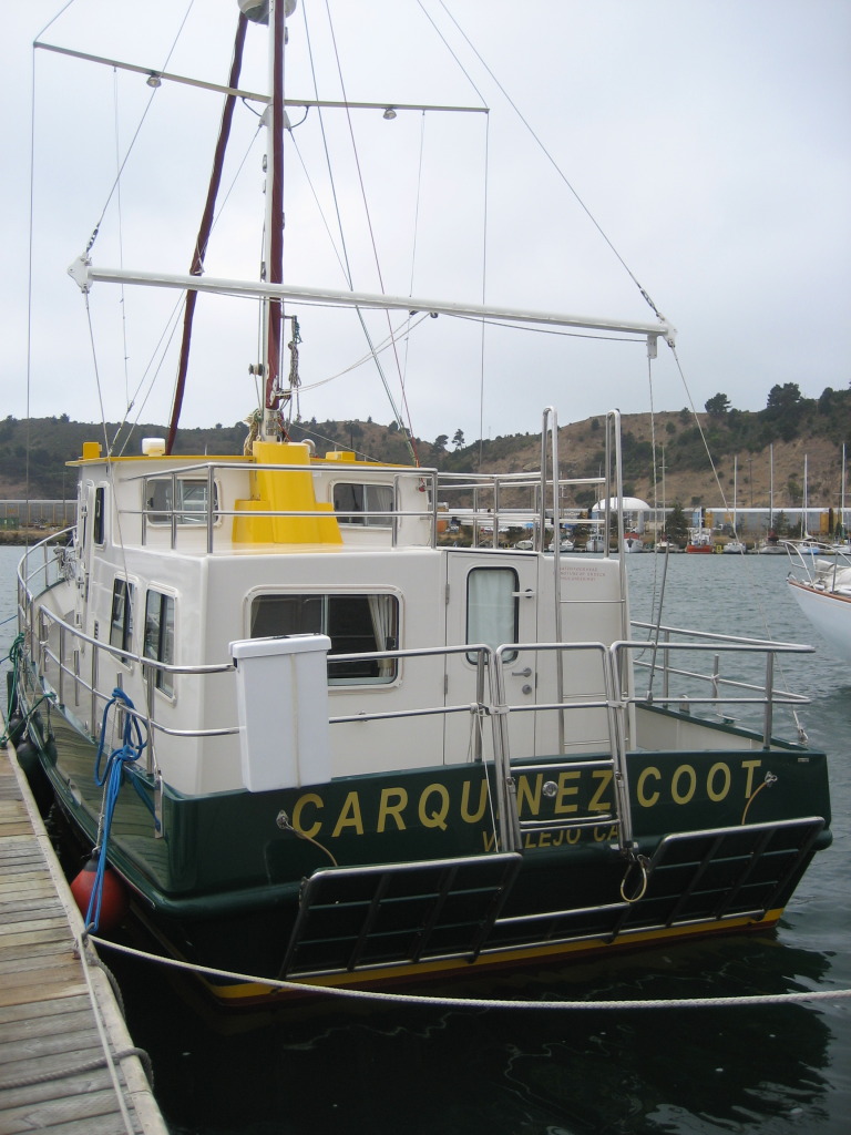
Vessel Name: Carquinez Coot
Vessel Model: penultimate Seahorse Marine Coot hull #6
Join Date: Sep 2010
Posts: 12,523
You have my sympathy. Makes me appreciate I needn't winterize or hurricanize here in heavily regulated and taxed California.


In KKMI boatyard's berthage in Santa Fe Channel, Pt. Richmond, CA yesterday.
__________________
Kar-KEEN-ez Koot
markpierce is offline   Reply With Quote
Old 08-26-2012, 07:25 PM   #20
Guru
 
Forkliftt's Avatar
 
City: Diberville Mississippi
Vessel Name: KnotDoneYet
Vessel Model: 1983 42' Present Sundeck
Join Date: Oct 2007
Posts: 2,450
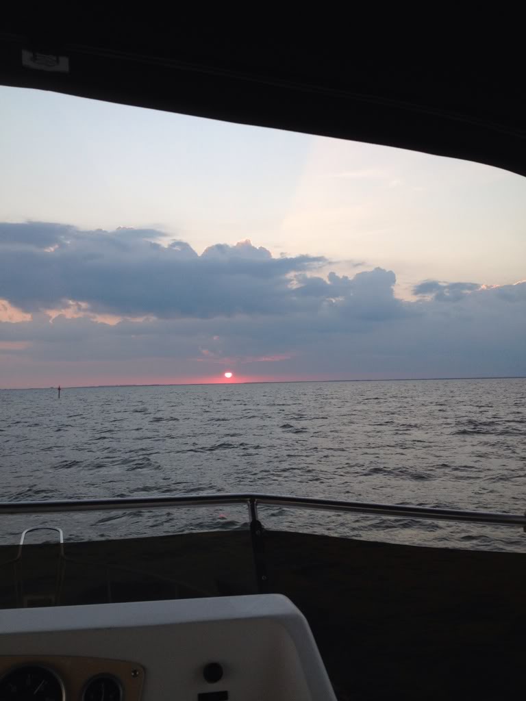
Thanks BH. Things are going smooth. Seas not bad at all. Sunset!
Forkliftt is offline   Reply With Quote
Reply

Thread Tools Search this Thread
Search this Thread:

Advanced Search
Display Modes

Posting Rules
You may not post new threads
You may not post replies
You may not post attachments
You may not edit your posts

BB code is On
Smilies are On
[IMG] code is On
HTML code is Off
Trackbacks are Off
Pingbacks are Off
Refbacks are Off


» Trawler Port Captains
Port Captains are TF volunteers who can serve as local guides or assist with local arrangements and information. Search below to locate Port Captains near your destination. To learn more about this program read here: TF Port Captain Program


All times are GMT -5. The time now is 10:35 PM.


Powered by vBulletin® Version 3.8.8 Beta 4
Copyright ©2000 - 2023, vBulletin Solutions, Inc.
Search Engine Optimization by vBSEO 3.6.0
Copyright 2006 - 2012