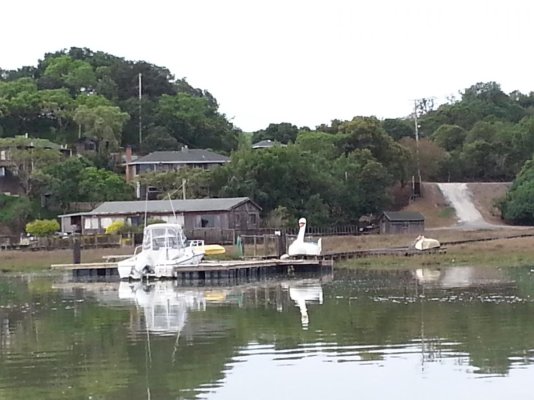
Would you go with 3 feet of clearance?

The friendliest place on the web for anyone who enjoys boating.
If you have answers, please help by responding to the unanswered posts.
Thanks for the responses. We have Navionics on our iPad and a relatively new Garmin Chartplotter and used those. Part of the reason for that destination is having our dogs with us and our elder 10.5 y/o boxer hasn't tackled the dinghy yet, making remote docks a bit more appealing. Who knew about those nukes?!

We actually don't know whether our depth sounder is set at water level or keel depth - next step is to make sure we figure that out. Yes, we could definitely benefit from more instruction - it's a steep learning curve but I'm enjoying the challenge. I'm a repetitive learner, getting some on the first try but the 2nd/3rd time I hear it / do it, it often gels. I like hearing your thought processes. We don't have much intuition and so it feels more dangerous because we don't have a frame of reference. These types of conversations are very helpful!
 
Maybe I'm jaded by living in Florida with nothing but skinny water. Rising tide, decent weather. Slow bells. Standard precautions. Maybe go on a Saturday when likely more boats in and out.
Not jaded. Insulated maybe.

It’s just the West Coast, especially WA, BC and AK cruising can be quite different from eastern creek cruising.

It is not at all unusual for the charts to show, oh lets say 10 feet and the sounder agrees. What the charts don’t always show out here, are the stumps, cable piles, donkey drums and engines rising up 6 feet from the bottom.
 
We have been into Mystery Bay several times. The first time it was on a fairly low tide, we followed the channel buoys with my with on the bow in case I wandered out of the channel. Now it's not a big deal there is enough water if you stay in the channel, I would watch the tides and you can usually pick up a mooring buoy at Ft. Flagler to wait for the tide
 
Heck I have a 6'4" draft and go into places like there the clearance is inches and a tide of 1 foot

Same here, with protected running gear and on a rising tide. But when exploring skinny waters around Florida and the Bahamas, which I really like to do, the bottom tends to be more forgiving than the rocks found in the PNW, or the corals found around much of the Caribbean.
 
Perhaps I am the only one who is worried about ‘water under the keel’ so I offset the depth sounder to reflex that, then and now. I dont want to do the math when in skinny water.
I also ‘cheat’. My boat, empty, draft 3.5ft. I call it 4ft.

That's us as well but with 7.5 ft draft calling it 8
 
Again, this is where OpenCPN is great
You can use georeferenced satellite images to help with depths.
 
We actually don't know whether our depth sounder is set at water level or keel depth - next step is to make sure we figure that out.

If you keep the boat in shallow enough water with a hard enough bottom a bit of line and weight will give you the offset between sounder reading and water depth.
 
What bugs me is that many/most navigational charts are based on decades-old surveys. Best to have keel-protected rudder and propeller, as well as getting local knowledge.
 

Attachments

  • friends looking at sp trains.jpg
    friends looking at sp trains.jpg
    123.5 KB · Views: 20
  • Petaluma swan.jpg
    Petaluma swan.jpg
    113.2 KB · Views: 24
Last edited:
The place he is considering has no marina, at least none I've seen. There is an entrance bar and then a rather circuitous, though adequately marked, channel through a very shallow bay. I've taken a dinghy in there a couple times, but the real question would be "why?". In the words of Gertrude Stein, " there is no there there." Unless, of course, you count the nuclear munitions stockpiled on the unapproachable western shore.


The above was written by someone with no local knowledge. Indian Island has no nuclear munitions, Bangor is a different story and location.


Hollywood
 
Mystery bay inside Kilisut Harbor is a nice place to visit. One does need to be mindful of the tide, the part of the route is mud where the water is skinny. I have plowed a bit of mud myself on occasion when I pushed it on a 6' draft boat, but still made it through.

Been through over 100 times and never stranded or hit anything hard yet.

Hollywood
 
Heck I have a 6'4" draft and go into places like there the clearance is inches and a tide of 1 foot

If you dont bump or get stuck, you have enough water. Yes, you have to make allowances for the tide too.
 
Even with my exposed running gear, I've cut it as close as 1.5 feet of clearance in a couple of places. Only because I knew pretty well what to expect depth-wise, and I knew what was on the bottom. I did very slightly ding a prop once though. Unknown piece of debris had appeared recently (none of the locals knew about it yet) and was sticking up just enough for me to just barely clip it.


I don't like having less than 3 feet under the boat typically, more if the bottom is likely to be questionable with lots of stuff sticking up. I keep the depth alarm set for 8 feet, which gives me the "pay attention" warning with 4.5 feet below us (our draft is 3.5).
 
The above was written by someone with no local knowledge. Indian Island has no nuclear munitions, Bangor is a different story and location.


Hollywood


Actually, I wasn't referring to the BIG weapons kept aboard at Subbase Bangor, but to the nuclear torpedo warheads which I have on good authority are kept with the conventional ordnance at Indian Island. ...but who knows for certain?
 
Last edited:
Actually, I wasn't referring to the BIG weapons kept aboard at Subbase Bangor, but to the nuclear torpedo warheads which I have on good authority are kept with the conventional ordnance at Indian Island. ...but who knows for certain?


Nope,
Enough ordinance to blow the island to oblivion but its all conventional.

They don't trust nuc storage security to rent a cops.
The storage at Bangor has some impressive security.


HW
 
This all seems like guesstimates. MLLW is a mean, which means that values will be above and below whatever the MLLW is reported to be. Perhaps the standard deviation is small because it's a mean of lower low water for the past 19 (?) years, but it's still a mean and so it is likely not accurate.

Another guestimate is our current draft. Is our draft really 3' 11" per our specs (I round to 4')? Probably not once we add 2 adults, 2 dogs, water, gas and all our other crap, but by how much? Based on calcs from other sites, probably not that much and rounding to 4' or more can take care of that.

I guess my thought being relative to new to all this is that we don't have a frame of reference for how these affect decisions when margins are relatively small. I'm sure this is where local knowledge and experience is helpful. The discussion re: type of water depth to keel/surface is also helpful as is the call out to OpenCPN (new to us) - very appreciated.

@portage_bay - we are at lockhaven marina in seattle which is fairly shallow and should work to give us the offset - thanks for the tip.

@Ka_sea_ta and hollywood, thanks for the local info
 
I think you will find MLLW pretty reliable. What will impact it is weather that is pushing water into a dead end water way, or pushing it out. But it's got to be blowing pretty hard. From there, tide charts are your friend, and are also pretty accurate.


I think you are wise to round up your draft to 4'. With that, you know how much depth you need. In your area the tide swing is 10-12' or so, so most of the time there will be a good bit more water everywhere. But watch out for those negative tides. It can go 3' or more BELOW the charted depths.


If you are at Lockhaven, that brings up another thing which is the controlling depth of Lake Union/Washington/Salmon Bay. I often keep my boat in there too and honestly don't know where the lake level is published. Obviously tides don't impact it. It does go up and down seasonally by a foot or more (low in Winter)
 
If you can't find a local expert to ask on the radio, just take a look at the boats which have already made the trip. If the area is full of sailboats and larger power boats you are probably safe. Watch the tide though.

pete
 
Thanks for the responses. We have Navionics on our iPad and a relatively new Garmin Chartplotter and used those. Part of the reason for that destination is having our dogs with us and our elder 10.5 y/o boxer hasn't tackled the dinghy yet, making remote docks a bit more appealing. Who knew about those nukes?!

We actually don't know whether our depth sounder is set at water level or keel depth - next step is to make sure we figure that out. Yes, we could definitely benefit from more instruction - it's a steep learning curve but I'm enjoying the challenge. I'm a repetitive learner, getting some on the first try but the 2nd/3rd time I hear it / do it, it often gels. I like hearing your thought processes. We don't have much intuition and so it feels more dangerous because we don't have a frame of reference. These types of conversations are very helpful!

You can look it up in the Garmin manual, but on many of their units there is an easier way to check: the keel offset affects the "big" number reading that shows up on the sonar screen and guages, while the actual sonar display small scale shows the depth below the transducer on its small scale.

For example, if the big number says 10' and the sonar chart shows apparent bottom at 10' then you have the default 0' offset. If the sonar scale shows the bottom at 13' but the big number reads 10' then you have a -3' offset. This is also an easy way to check that the "big number" shows what you want after you change it.

As for this situation, I agree it is good to be extra cautious when in doubt (and you should have been fine, but there is plenty of alternative boating when in doubt!) We often use a line with lead weight to check and/or an extending boat hook that I marked with depths.

For anyone wanting a detailed self-study nav course, the Coastal Navigation course from Starpath was excellent when I did it several years ago. https://www.starpath.com/catalog/courses/1703c.htm OTOH it may be more than some recreational boaters want; their courses are very thorough and geared to various certification exams.
 
Nope,
Enough ordinance to blow the island to oblivion but its all conventional.

They don't trust nuc storage security to rent a cops.
The storage at Bangor has some impressive security.


HW


No need to dispute your knowledge, you being in the neighborhood and all, but my baby brother who spent several years as a diver at Silverdale/Nanoose is my source.
 
No need to dispute your knowledge, you being in the neighborhood and all, but my baby brother who spent several years as a diver at Silverdale/Nanoose is my source.


Mine was a friend who also was the commander of the base.
HW
 
Never trust any ‘local knowledge’ near any installation nuclear storage naval facility facility. Just quietly turn around and exit the area.
Sort of like Government Cut in FL, where all the cruise ships dock. I questioned the CG twice, they repeated what they were told to say so I turned around and took the detour.
No further contact was necessary. SMIRK
 

Latest posts

Back
Top Bottom