Day Dreaming Northern BC

The friendliest place on the web for anyone who enjoys boating.
If you have answers, please help by responding to the unanswered posts.
Joined
Jul 6, 2012
Messages
8,063
Location
USA
Vessel Name
Alaskan Sea-Duction
Vessel Make
1988 M/Y Camargue YachtFisher
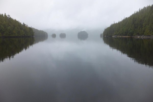
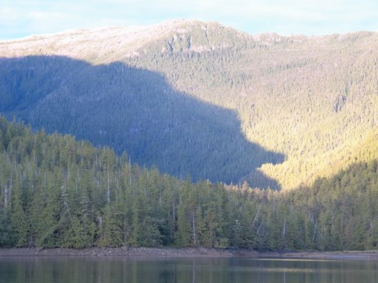
Rainy day so opened my 2020 Waggoner to page 461 and started plotting courses and anchorages. One thing we wanted to do was bypass Greenville Channel and go up Principe Channel and Petrel Channel.

Has anyone done this route? Good anchorages or bad.
 
We have gone outside several times. Good anchorages, less boats, very different landscape.
 
Head outside through Meyers Passage and back in just south of Rupert. Only real bummer is you miss the hot springs.
 
Tom, There are many good anchorages on the west side of Campania island. Further up, on the east side Precipe channel (west side of Pitt island) there are good spots, Monkton is one of them. In Petrel Channel, Newcome inlet has good protection. We've had good fishing at the ocean entrances in that area. When heading west through Meyers passage to get outside, there's a nice cove right at the narrows, near the red bouy.
 
Last edited:
Murray Anchorage, west side of the Estevan Group is one place on my bucket list before we swallow the anchor.

The southern most basin in Betteridge Inlet, Campania Island, is tight, twisty, shallow, and littered with rocks, but worth it. I've never seen so many clam shells over as large an area as we found in there.

Kitkatla Inlet is out of the way, but worth it as well. Impressive skies compared to where I live 60 miles up Douglas Channel, which has mountains everywhere blocking the horizon/sky.
 
Last edited:
We came down that way when we moved back to Washington State.

I wanted to stop at Oona River where there’s a real basic boat building comunity. It’s up a shallow bay and it was low tide.
We went on to Ire Inlet. the entrance is on the east side of Anger Is. That place is strange. Saw HUGE worms swiming by the boat and on the fish finder it looked like a forest from 10’ down to the bottom (40-50’) so anchored at the far end of the Inlet. There was a big rock (about 4’ showing) and of course I let out too much scope and banged into it at 2am. I was frantically pulling in line in my shorts. But the yacht club people missed the show.

Woke to a very red sunrise and there was already a breeze at 7am. Beat prop for
Patterson Inlet as it was the best anchorage that we could reach at our 6 knots. Anchored in Patterson Inlet where we anchored in 03 w our Albin 25. Nice anchorage. Take the left channel. We rode out a 50 knot gale w higher gusts.

The next night we anchored in Monckton Inlet .. a very beautiful place.

Wanted to go to Gilen Anchorage. Look for Banks Is. Then Trutch Is. Look at Dewdney Is and see the Inlet one enters from the south. The
Hemingway book calls this anchorage “bombproof”.
But Chris had had enough excitement and wanted to go back to the regular route. Anyway in calm weather w kayaks or other small boats one could have a good time exploring all the little channels just north of Dewdney Is. Some are probably chocked w kelp. But stay safe. This in not the bush. This is beyond the bush. We saw no houses or cabins south of Browning Entrance.

pictures,
1 Entering Ire Inlet.
2 The big worm.
3 Ire Inlet in the am.
4 Patterson Inlet just before the gale.
5 Monckton Inlet.
 

Attachments

  • DSCF0353.jpg
    DSCF0353.jpg
    177.5 KB · Views: 49
  • DSCF0359 copy.jpg
    DSCF0359 copy.jpg
    85.7 KB · Views: 49
  • DSCF0360.jpg
    DSCF0360.jpg
    85.4 KB · Views: 52
  • DSCF0363 copy.jpg
    DSCF0363 copy.jpg
    102.8 KB · Views: 49
  • DSCF0382.jpg
    DSCF0382.jpg
    41.9 KB · Views: 51
Last edited:
We came back down Principe Channel on year. Very worth while. Saw one other boat in two days. One thing to be aware of though, I have never seen so much drift wood in the water and on the beaches. It all comes down that river just south of Prince Rupert (Skeena?) and flows out to sea via those channels. Cruise ships also use that channel. We were there when the pinks were running and caught fish until our arms were sore.
 
Last edited:
We've gone through Meyers Passage, and Higgins Passage at high tide. Anchored in both, and in the mouth of Quigley Creek, the cove on the NW of Kohl Island, Penn Harbor in Surf Inlet, McMicking, Weinberg, Monckton, Patterson, the unnamed cove NE of Anger Island, Newcombe, several places near Spicer Island, and Welcome Harbour. There are lots more.
 
Last edited:
If you want to wander east of the Inside Passage and deep into the Coast Mountains...Gardner Canal.
 
Wow thank you. Just dreaming and explore next year.
 
Europa Hot Springs in Gardner Canal is our favourite of the three hot springs in the Douglas Channel area, and has waaaay less visitors than the Bishop Bay gong show.

Spot Messenger or similar device recommended...no radio reception once about 1/3 the way up Gardner and very few boats.
 
It’s stunning up that route. Chappel Inlet, McMicking, Weinberg. Beware of Patterson. We experienced some serious Willywas one night there. And damn but did it refer rain!

I want my ashes spread in McMicking. Murray has agreed to help with this!
 
JDCAVE,
Re Patterson Inlet I wonder if it could be what many boaters call a “blow hole”.

I anchored in benign weather in “Windfall Harbor”. With the calm weather I didn’t even connect the name w possible wind. It blew 35 to 40 all night long and all I put out was my 13lb Danforth. It held fine but I would like to have had another anchor out.
Up the coast winds are hard to predict. The vast area of (relatively cold) mountains to the east and the warm Pacific Ocean promote lots of air movement back and forth. However the “north pacific high” pressure in the gulf usually keeps the two air masses in check in the summer. Then there’s all the little mountains on the coast that create many blow holes like the one I just mentioned above.

The Aleutian Islands have that problem “big time” as the sea north of the islands is 20 degrees different than the Pacific Ocean to the south. I worked at a Cannery on Unimak Is. and the wind blew nearly 100 mph once when I was there and much other wind also. There was a lot of rather calm weather too.
 
Last edited:
The Aleutian Islands have that problem “big time” as the sea north of the islands is 20 degrees different than the Pacific Ocean to the south. I worked at a Cannery on Unimak Is. and the wind blew nearly 100 mph once when I was there and much other wind also. There was a lot of rather calm weather too.

When I was in the Navy during Vietnam, we would sometimes land our P3 Orion aircraft at Adak in the Aleutian chain. There were several times that the wind was over 100 mph and we'd be stuck there for days, one time a week. As I recall, most of the base is underground...living facilities, mess hall. Ungodly wind there in the winter.:eek:
 
Last edited:
Ken I was in VP 31 in SanDiego and landed in a P2V there.
That was VP 31 the “rag” squadron. We had p-5’s and P-2’s. And two HU 16 Grumman.
I was an AN-2 electronics ASW.
 
When I was in the Navy during Vietnam, we would sometimes land our P3 Orion aircraft at Adak in the Aleutian chain. There were several times that the wind was over 100 mph and we'd be stuck there for days, one time a week. As I recall, most of the base is underground...living facilities, mess hall. Ungodly wind there in the winter.:eek:
My dad was a weather forecaster on Adak in WWII. When it wasn't blowing too bad, sometimes they would go for a walk to see "the tree". When it was blowing, with very low visibility, or the forecast looked like that, sometimes the brass would try to convince him it couldn't be all that bad, so that they could talk themselves into flying.
 
Ken I was in VP 31 in SanDiego and landed in a P2V there.
That was VP 31 the “rag” squadron. We had p-5’s and P-2’s. And two HU 16 Grumman.
I was an AN-2 electronics ASW.

Small world, Eric. I was in VP-17, Barbers Point HI. We had P3 A's and B's. The P3 C's were just coming in when I got out in 1972. I was an AW-2 and operated the low-frequency detection with sonobuoys. Barbers Point is now condo's, so I understand. Made two deployments to the Vietnam theater, one to Sangley Point, across the bay from Manila, and a second to Naha Okinawa. We'd often be in and out of Thailand, Taiwan, Korea, and sometimes Guam. And Adak. P3's had long legs and some of our hops were 12 hours.
 
...I want my ashes spread in McMicking. Murray has agreed to help with this!

On the beach, inside the Inlet, or in the bonsai forest? Gotta get it right!
 
Guru,

We took this route last summer and recommend it highly. We did it southbound. From Prince Rupert we took Ogden Channel to Petrel Channel, Principe Channel between Banks and Pitt Islands, across Caamano Sound to Laredo Channel and Meyers Passage. There are many lovely, well-protected anchorages on this route. We found Waggoner to be a reliable cruising guide.
In many anchorages you will be the only occupant, and when you do have neighbors they will usually be Canada-flagged vessels.

Touche'
American Tug 34
 
Bill, my brother gave me this book, The Rescue of Foxtrot Alfa, knowing that I had been in and out of Adak in P-3's during Vietnam. The book had me on the edge of my seat and I was in the plane with them as it ditched in the horrific waters of the Bering Sea.
 
When you offered to return it, I suggested you pass it along. Did you?

You cruising this year?
--Bill
 
Yes, given to a friend. Cruising plans uncertain, presently in Arizona but on the way hone.
 
I spent a 4th of July on Adak. Navy put on a fireworks show. The rockets would take off, the howling wind would catch them, and they would go screaming along the beach. The highest rocket explosion was probably only 40 feet.

We went up Laredo Inlet on Princess Royal Island last summer looking for spirit bears (we were too early in the season). Here is a picture of the only one we saw.
 

Attachments

  • 102_0199.JPG
    102_0199.JPG
    154.7 KB · Views: 9
  • Like
Reactions: Ted
Back
Top Bottom