Nomad Willy
Guru
Old Salt was or is a TF member. He extensively cruised Western Canada and SE Alaska.
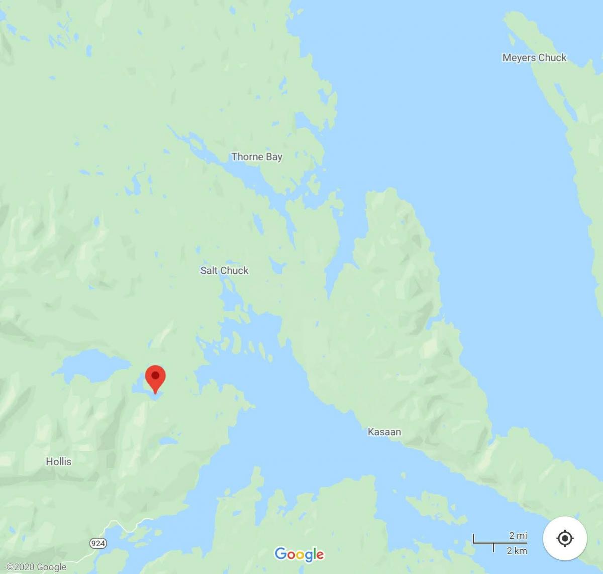
This was made up from our log running north to the house we had just bought in Thorne Bay. No pics just the daily record slightly enhanced.
I inserted the numbers 1-5 to help find your place.
Old Salt asked me to do this so the following is an account of our trip home to SE Alaska on our 30' Willard Nomad as shown in my avitar. We left Everett Wash at o dark thirty in the morning in order to reach Provost Hbr by nightfall. We spent the majority of the day at 5.whatever knots bucking this current and that tide. We went through La Conner where we had spent last summer working on the boat. We also had a wonderful time socializing on other people's boats, going to dinner in the dinghy ect ect. At Anacortes we finaly made our normal cruise speed of 6.15 knots. There's only one way to get somwhere in a very slow boat and thats to put in hours and hours at the helm .. days and days or even weeks, depending on how far one wants to go. As it turned out we would be needing 24 days to get home. One thing I like very much about being underway in southern waters is the amazing parade of interesting boats one sees also underway. Walking the docks ( one of my favorite pastimes ) is more fun as there is no gate and the boats are more interesting. What we would see for the next 16 days or so we would see from our own boat for the last time so everything seemed a bit more special. Hours at the helm paid off and we arrived at Provost Hbr and found our friend Jim Briggs tied to the dock .. we rafted to his Albin 25 .. a very nice evening after a long nice day .. the stuff to sleep on .. and we did.
The next morning we got our first taste of choppy water crossing Harro Strait for Bedwell Hbr and customs. All of us, the cat ( ours ) and two boats passed legally into canadian waters. It seemed like the beginning of the trip again as we motored on to Maple Bay. Saw many campers and tents in the sunshine. As we entered Sansum Narrows saw much dancing water and light eddies. We were going to a gathering with the Albineers of British Columbia ( we are members ) and presumably the last we would attend. The Albineers are a wonderful group of Canadian boaters that we will miss. As we left Maple Bay I became more anxious about an unpleasant noise in the stern. Had the boat hauled and all seemed well. We proceeded north stopping short of Dodd Narrows to wait for slacker water. We noticed other boats were going thgough so we headed out and soon we were making 11.5 knots in our 6 knot boat staying to the center of the channel avoiding the whirlpools to the sides of the channel and the main bore of the current just past the gut. Moored in the exciting little city of Namiamo. It's always fun to be in Nanaimo. We had dinner at the same place we did in 03 on our first trip together ( in our Albin 25 ) to Alaska. That boat was 1.25 knots faster but the trip much longer as we had to come BACK as all of you do. We also spent some time in the Queen Charolette Islands where I taught school in the 70s. We ment some friends from the Albineers club and they gave us all the info on the Whisky Golf millitary operations area we would be traversing the next day. End of chapter one.
1.
We had much to do in the morning .. groceries, fuel, phone calls, Port business and showers so didn't get underway untill 11:45. The Whisky Golf millitary area was active so we were close in picking our way around the Islets, Islands and rocks when a loud rattleing noise emerged from the engine compartment. Turned out not to be a serious problem ( alternator pully came very loose ) but was adrift while fixing it and a large yacht came by at twenty some knots and ( you guessed it ) we were caught abeam to his wake. Put some lock tight on it and all seemed fine. A course to the south end of Texada Is would have but us abeam to the wind and sea so we set a course NE to the north end of Lasquetti Is. It was lumpy going out in the center of Georgia Strait. It was only a fair anchorage and several boats were already there so we had to anchor in 75 ' of water. Then a 100 ' yacht entered the bay and spent an hour going back and forth anchoring only to pull up his rode and leave .. just before dark. We ate dinner during all this enterainment out on the aft deck in the sun. The next morning .. not so great. We used the head and some went out the over flow all over the stbd deck. What a mess .. that has NOT happened again .. learning curve steep there. Then soon we were in 4 ' head seas and wind. I throttled back to 2000 rpm ( as slow as I ever go ) and were making about 4.5 knots. We did this for hours and I eventually got used to the rythum of the seas but the cat had growling eyes the whole time. My anchor chest on the foredeck came a bit loose and I feared worse things may happen so ducked behind Dick Island ( the only protection on the west side of Texada Is ). Chris held us on station untill I made things secure and out we went again. We rounded the north end of Texada Is but still too rough to have anything but fruit for lunch. After about an hour more I bumped the throttle up to our normal cruise of 2300. Soon we were in almost calm seas and with much traffic asumeably most going to Desolation Sound. Late in the day we arrived at Squrrill Cove. We went to town and the resturant for dinner as a reward for our hard earned miles. I did a strange thing and bought a mounted photograph. After dinner we went through the gut and into the anchorage of Squirrll cove. What a fantastic anchorage. Some guy on a red sail boat came in at about 3 knots, droped the anchor and rode and let it stop the boat .. never saw an anchor set like that before. The next morning we arrived at Yukulta ( pronounced Youkata ) and Dent Rapids at just the right time. Went through with a bit of extra speed ( always good in a Willard ) and fell in with several other boats going the same speed. None were displacement boats so I assume they were under loading and saving fuel. The people along the way said there was far less traffic this year on the Inside Passage. We liked Big Bay in the past and were sad that it went private ( sold ). We saw large slow moving eddys and boils from time to time in the back channel. Went through Green Point and Whirlpool rapids with some current still with 2 other boats going 6 knots when we entered Johnstone Strait. We failed to find a good place to anchor in Port Harvey so anchored behiend some small islands further up the channel ( Wallace Group .. I think ).
2.
Out into Johnstone Strait, trading off the helm, sitting on the aft deck, reading novel ect. A lazy day on the water. Passing Port Neville and on to Alert Bay. I like to cross Johnstone Strait diagonally, south to north and west to east. Spend the night in Miles Inlet or in the vicinity. We liked Port McNiel a lot. Small and not very classy but very friendly. Ment numerous entertaining, unusual and endearing people. Stores, resturants, laundry and even made slight use of the hospital/ health clinic. Filled water tanks in the pm and left fuel for the am. We left in the morning under a " high wind warning " report. Figured we'd probably get slamed a bit in the afternoon with 25 knot winds but was quite a nice crossing. Got a bit lumpy as we aproached the entrance to Allison Hbr with considerable ocean swell. Picked our way through the rocks and occaisional boomer with GPS, sounder and binoculars into Allison Hbr. Not much of a sight seeing place but a good anchorage. We knew the Gale would keep us anchor bound all the next day so we set the new high performance anchor backing down hard on a 7 to 8-1 rode .. shortened way up and settled in for the blow. We were yawing back and forth on the anchor with the wind whistling around the cabin. The next day ( mon July 28 ) we watched the wind, rain, fog and fast moving clouds all day. Read books and drank tea. The next day ate breakfast, decided weather still too foggy and nasty .. went back to bed. Station report reported 28 knots at Egg Is. At 0945 we went out to see what it looked like. Looked better than a 30 knot sea to me. Decided we could take 3 or 4 hrs of it so off we went at rough water throttle ( 2000 rpm ). Several big squalls here and there and dark clouds with dark seas under. The ocean swells were large now showing the horizon about 30 to 35 % of the time. Just north of Slingsby Channel the wind switched and the seas got worse fast. I suddenly wanted no part of it and turned around. I didn't want to go back to Allison Hbr so we went up Slingsby Channel on the flood tide at about 9 knots. I had just told Chris what a bad reputation Slingsby Channel had so she wasn't too pleased about going up there but she got over it when we anchored in lovely Treadwell Bay near the entrance to Nakwackto Rapids. We enjoyed the beauty of this place with two large yachts. The am forecast was not good but we wanted to look so up went the anchor and out the Bay only to hear the warning buzzer sound off. Went back in the Bay waching the insturments and droped the hook. The Murphy Switch saved us from God knows what when the engine surely would have overheated near Cape Caution in moderately heavy seas with onshore winds. I thought we were going to have to radio for help but we found the parts, finally, to fix the plumbing and make the engine 100%. We lost the hot water heater and Red Dot type heater but didn't really need that. With all ready we slid down Slingsby Channel on the ebb out into the dancing square waves at the entrance. Was a bit of a wild ride for a few minutes but out on the dying seas of the passing storm it wasn't so bad. Was'nt so good either. Soon a squall in front of us promised wind and bad visibility. Wer'e at Cape Caution. Saw tugs, barges and several grey whales. Egg Is. Dark clouds and seas but little wind and no rain .. squall fissiled. Conditions moderated as we approached Millbrook Cove .. our anchorage for the night. Fairly small anchorage and a tight and confusing entrance. One other boat that had an amazing anchor rode bridle that kept them quite motionless .. no swinging at all.
3.
Came out of Milbrook Cove at 0550 near Egg Is. in the south end of Fitz Hugh Sound running NNW on a fairly small head sea. The Willard is at her best. If she was not so full in the stern I think there would be more pitching considering her short length. Her mass seems to be about right. More mass would result in a wet boat or even a diver and less mass would probably produce an uncomfortably quick motion. There are no spray rails on the Willard and I assumed I would need to install same at some point but not so. The Willard don'nt go fast enough to produce spray .. even when a head sea runs clear up to the top of her stem. The deflected water is just slop and the wind dosn't blow it over the boat. We have Lexan windows and no windshield wiper but almost never seem to need anything different. I'm very prone to modify things but this boat has made me more prone to try things the way they come first. As we ran north the sky was much broken up with considerable blue and the east was dark and low status. There was no rain. Numerous Humpback whales to the west and porpoise seemingly everywhere. As we entered Lama Passage we remembered our trip in 03 here in extreemly heavy rain. Lots of whispy clouds klung to the mountian sides as we came closer to Bella Bella. WE went to Shearwater Marina next to Bella Bella where most folks go as there isn't much in the way of facilities at Bella Bella. Went to the Fuel dock and got 84 ltrs at $1.56 per ltr. We had breakfast in the resturant over looking the hbr. and did showers and laundry later. Ment an interesting couple on a large sailboat out of Vancouver BC that later stoped in Thorne Bay. We went to Bella Bella to get water as Shearwater's water was contaminated. We also went to the store in town to find a high level of junk food. We left Bella Bella with full everything execpt ice. Actually we did get some crushed ice but no block ice. Going out Seaforth Channel we were passed by a barge. Just short of Ivory Is we turned up Reid Passage. I always enjoy meeting other vessels in this narrow channel .. always seems to two or more. We were in Perceval narrows bucking considerable tide. Was planning to cross over to Finlayson Channel through Oscar Passage but we wern't even making 4 knots. Moss passage was right to port and very narrow with rocks to avoid. Also we'd be going with the current ( probably strong ) so I was very reluctant but it looked doable on the GPS so off we went. It was tight and fast but not very threatening so this put us at the bottom end of Finlayson Channel. It was beautiful. Scattered cumulus clouds were leaving thier shadows on the mountian sides. The sea was a bit open to the ocean but calm and all the boats ( including the new BC ferry ( looks too much like a cruise ship to suite me )) were heading south. Didn't stop at Klemtu ( first time ever ) as we were on the east side of Finlayson Channel heading to Bottleneck Inlet an anchoring jewel. We spent the night with five other boats ( one was even a Willard ) in total security and pristine beauty. Under way on a proper summer day through Hiekish Narrows. We saw many Bonaparte Seagulls ( black head and red feet ). We were now back in the main inside passage route with Ferries, barges and all other boats found on the coast. In Graham Reach we swung in close by Butedale, an old cannery that has been falling into the sea for decades. Thousands of boaters have been watching it fall for years .. but it's still there. Waterfalls in this area cascade into the air at 2000' elev and many more at the waters edge. It was a long run up Frazer Reach against the tide ( about 4.5 knots ) on our way to Hartley Bay. The last time we were here several very young Indian girls were cutting peices off the head of a moose under the floats. Role playing I guess. We saw Gray Whales today and got to Hartley Bay in time to find a place to tie. Went for a long walk on the extensive boardwalks in town and talked to many young Indians ( mostly girls ).
4.
Day 18. I knew it would be a long run to Prince Rupert and anchorages near PR are few at best so I was up before 0500. After our experence at Queen Charlotte Sound I opened the hatches every morning and checked many things in the engine compartment. Under way at 0440. We ate one at a time and entered Grenville Channel at 0600. It was August 3 but felt like fall with a bit of chill in the air. The current I was expecting didn't materalize untill 0800 when we were making only 4.2 knots. Calculated we were 65 miles from PR and wouldn't make it at this rate. I was contemplating arriving at PR well after dark but by 0840 we were making 7 knots. Here come the flood! In ten minutes we were down to 4 knots .. must be eddies from bank to bank. A large BC ferry came by right in a narrow section of the channel. His wake was like going over ocean swells and then the aftershocks of the wake bouncing between rock wall sides of the channel produced a slightly uncomfortable motion. By the time we reached the mouth of the Skeena River our speed was back but we were in choppy white capped water very light brown from the river and whipped up by the wind into steep short seas. Slugged on for 2 1/2 hours. 2000 hrs .. arrived at the public floats amid much traffic comming and going and after several forays arround rafted to a fish boat as there were no open places to tie up. The engine was finally silent before we walked to Cow Bay to have dinner at a seafood place that has been there since the 30s .. always a joy.
Day 19. Slept in till 0830. Walked back to Cow Bay ( we really like Cow Bay ) to a hippie like place called Cowpuccino Cafe. Another favorite. I passed on the " sex in a pan " and had crunchy stuff in a pan with lots of berries and real good coffee. Under way again at 1115 hrs after getting block ice at the fuel dock. no fuel .. didn't need it. In Metlakatla Pass ( or Ven Passage ) we watched the GPS plotter attentively at low tide and made our way through the short cut (north) into Chatham Sound. Many fishermen had thier gear in the water in the shallows as we made our way north. I originally set a course for Winter Inlet ( up Pearse Canal ) but decided it was too far so changed course to Wales Harbour. After an hour or so of running Dixon Entrance looked so very nice I couldn't resist so changed course to Tree Point and Foggy Bay. Hadn't been under way for 10 minutes on our new heading when Dixon Entrance blew up into a froth of dancing white horses and forced another course change to Brundage Inlet. I hate this place as it's the buggyest place on the coast. Good anchorage though. Brundage is a long narrow inlet and to avoid the fresh water at it's head ( river ) I went into a nearly hidden bay on the left side of the channel and anchored in 3 fathoms. Was I ever pleased to find there was hardly any bugs. There was enough bugs so we didn't eat on the fantail however.
Day 20. 0500. Leaving Brundage Inlet. Bueautiful sunshine but as we motored down the channel we saw fog at the far end. Thick fog. Decided to run on insturments. A course just slightly west of north took us out into the most open part of the Dixon Entrance passage. I was extreemly pleased with my compass. Without autopilot the old fashioned compass was the best way of maintaining a reasonably straight course. With so little time in this mode it took lots of attention to stay on course. We were headed toward the west side of Duke Island and could see Prince of Wales Island after the fog cleared. Running 5 or 6 miles west of most all traffic I didn't see anything on the radar and I had everything well adjusted. There was an extreemly beaten up plastic dinghy right out in the middle. Was calm untill the fog lifted but our passage was fairly comfortable in the big open water. Went through a narrow channel on the west end of Mary Island. Usually one goes to the east end by the " Mary Island Light " . I was tired and gave the helm to Chris to Revillagigado Channel. I can actually pronounce that! When we arrived at Ketchikan a stiff wind blew up 3' seas right in the harbor. Banged my knuckles getting the boat into the slip at Bar Harbor. The Willy Displaces 8 tons and draws 3.5' and we still got blown around some. Did the customs thing .. dinner and bed.
5.
Spent a whole extra day in Ketchikan. Getting showers, shopping for a larger "O" ring for the fuel filler caps, shopping, eating, playing tourist. After only a few days in the wilderness I seem to revel in getting urbanism all over me. Sat on the rail at the dock alongside a cruise ship and watched the people. Now and then you'd see an Alaskan in amongst them. Even though the Alaskans were the minority the tourists stood out as foreign. The tourists looked like generally nice people. Some of our Alaskan friends don't look so nice and have some mildly rude habbits but many of them actually are the nicest people I've known. Day 22. 1035 hrs under way from the fuel dock with 43 gal at 4.56 a gal. Wind was comming right up Tongass Narrows so I thought we'd have a nice ride home on the following seas .. wrong. Wind and seas turned SW at Gaurd Is. Seas also came from the ENE down Behm Cannal. Every minute or so the boat fell into a hole sideways on the stb side. The fwd cabin floor was covered with stuff and we thought we were quite secure. Another 5 min of that and we changed course that took us to the east side of Clarence Strait and Camano PT. Always the optomist I figured things would get better but in front of Camano pt we couldn't hold our course west enough to pass the point to the west. Had to go a bit up Behm Canal, then turn west to get west of Camano pt so we could go gracefully north .. sort of . I spread my legs wide apart, got savage with the helm, swore a bit ( OK a lot ) and slowly we won our northward passage. It was a long haul up the west end of Cleavland Peninsula. In time the seas moderated a bit and we headed across Clarence Strait tward Tolstoi pt and the entrance to Thorne Bay. The long ride home was a done deal. I was already looking forward to a long peacefull winter. The weather has delivered in that no unusally harsh stuff has come our way. My recent stepdaughter and grandson (6) are coming to stay with us .. at least through the winter. To make a trip like this you need to go beyond your skills, experience and judgment, or you won't make it .. the trip. After all .. how did you get to where you are now? If you come this way keep in mind that it is a wery long way and the slower you go the harder it will be to find good anchorages. You can do it in a rowboat or a very large yacht .. both have their disadvantages .. but the best size of boat is 30 to 40 feet. Learn to navigate, listen to the radio, anchor and maintian your boat. The rest is a matter of weather, luck and good judgement. It woudd be fun to share fact, opnion or experience but keep in mind that I'm just the one talking .. there are a lot of guys that know more about this than me .. even on this site .. like Old salt. Cruising styles vary widely ( for example I never use waypoints ) and we can learn from each other, much that we can't learn ourselves. As a prize for listening to me run along at my keyboard I invite you all to my home if you come, more or less one at a time as I'm down to one guest room. If you want to know what it's like here ask Old Salt .. He's been to Thorne Bay and he's been to many places in SE that I have not .. but I'm out to narrow the gap.
Last edited: