Currents at Slack Tide

The friendliest place on the web for anyone who enjoys boating.
If you have answers, please help by responding to the unanswered posts.

MurrayM

Guru
Joined
Jul 22, 2012
Messages
5,946
Location
Canada
Vessel Name
Badger
Vessel Make
30' Sundowner Tug
Read these posts in the "Victoria BC to Portland, Or" thread and thought it might make for an interesting discussion because of the varied landscapes TF members live in:

I didn't catch that - there was another recent thread where there was confusion about low tide being synonymous with slack current (despite it being intuitive and related, they do not correlate). I forget if it was off Noyo River (Ft Bragg) or Coos Bay, but the USCG got pretty concerned about a mariner who could not get it through their skull that the times for slack water did not correlate with high tide (or low tide, I forget which).
What do you use for Current? I opened up Coastal Explorer for the area and really only found tides. I also have an App on my android but also gives tides, not currents? Any suggestions?

Thanks

Peter

I know a few experienced boaters, even a licensed pro who can't get it through his head high and low don't necessarily coincide with slack. He even recommends only crossing bars at high slack, whatever he means by that because he doesn't understand the difference between high and slack.

I made a different kind of rookie mistake. Not reading the current graph correctly in OpenCPN.

Since Nobeltec bought and shutdown Tides and Currents software years ago I don't have any good recommendations for stand alone tide and current predictions.

To correct myself today I used NOAAs current predictions off the web.

We live on BC's north coast at the head of a 60 mile long channel that cuts into the Coast Mountains. It's off the Inside Passage, which because of the topography has some weird currents.

Prior to getting Badger we sea kayaked for decades, where if you read the currents properly you get a boost to your speed over ground, but if you read them wrong you pay for the mistake in increased effort or get into wild water you weren't planning on.

Channels here are 500' to 1000' deep. If you think of the momentum that much mass has, you can visualize how the water will keep flowing in despite the tide starting to go down.

It's actually written on the waters surface on calm days. Have you ever noticed thin lines of white foam that parallel the shores of a channel? Have you noticed how they first form along the shoreline when the tide turns, then slowly move towards each other in mid channel?

They mark the line where the two opposing currents pass each other. When you paddle across them your bow takes a definite nudge one way or the other, and the line is so distinct you sometimes see twigs going around in circles. Watch the waves on windy days and you can see the difference there as well.

In bays things can get weird as old back eddies compete with new ones trying to set up. Speaking of weird; seeing where the incoming tide meets itself coming around a large island on a calm day is truly bizarre...there's broad band of jumpy little wavelets across the whole width of the channel in otherwise flat water. On charts it'll say, "tides meet"

Things are pretty straightforward here, in that once you can estimate how long a current will be moving contrary to the tide and can read signs on the waters surface, you can avoid lumpier conditions. We don't have bar crossings here, but knowing when slack occurs when crossing one must be vital!
 
Last edited:
Predicted Log contestants use NOAA current predictions. After twenty odd years of competing, I have found the NOAA predictions to be close, but no cigar.
 
I understand high slack and I have been around the block.


I know the difference between tide and tidal current.


High slack is before the current reverses from flood to ebb...low slack from ebb to flood.


But the description of no tidal movement is "stand" meaning no more rise or fall while word to describe the period of no current is "slack" tidal current...and yes in many places the two don't necessarily occur at the same time of day.
 
Last edited:
...
High slack is before the current reverses from flood to ebb...low slack from ebb to flood...

Ahhh, but words are slippery things, aren't they?

Tide refers to the vertical rise and fall of water, whereas current or tidal stream refers to horizontal movement...therefore...describing a flooding current after high slack tide would be correct, yes?

As noted earlier, the water here doesn't really 'stand' because the current changes from the shallows to deeper water which takes longer to lose its momentum. The water mid channel floods toward the head of a channel for quite a while (sometimes an hour or more) after the tide starts dropping.
 
Last edited:
Good post Murray.

Once I enter Juan De Fuca I don't pay too much attention to "Tides" unless I am anchoring/letting out rode.

My CE shows the currents in BC very nicely as an arrow pointing in the direction of the current. The bigger the arrow the more current. As a back up I use Waggoner's Ports and Passes. They have improved it over the past few years
 
Last edited:
When I first started traveling the Inside Passage, we used the NOAA books, fumbled our way through corrections, and sometimes came up with times that were pretty close. When Ports and Passes came out, we switched to using that as it seemed the information was the same as the NOAA books but the format was easier to use.
One thing that took a while to realize, and that we still haven’t found a reasonable way to integrate into corrections, is flood conditions on the big rivers. We had a situation where we put the boat on the rocks (an uncharted area with a bad set of circumstances) but one of the factors that led to our trouble was the Taku River at flood stage, causing high tide and slack water to both be more than an hour later than it should have been. There are quite a few very large rivers that empty into the Inside Passage, and the amount of water they are adding to the local areas around them will affect tide levels and slack timing.
 
There is a stand anywhere tides reverse, high or low slack described the "time" of a current....


not slippery at all...no crossover between vertical or horizontal movement concept....just describing when.


stand is whenever the going down or up is reversed.
 
Last edited:
There is a stand anywhere tides reverse, high or low slack described the "time" of a current....


not slippery at all...no crossover between vertical or horizontal movement concept....just describing when.


stand is whenever the going down or up is reversed.


It appears we're both wrong (must be tons of local variations on this) at least according to the NOAA link given by Portage Bay;


The vertical rise and fall of the tides, created by the gravitational force of the Moon and Sun acting on the oceans water, also creates a horizontal motion of the water in the bays, harbors and estuaries. These are tidal currents. In general, as the tides rise there will be a current flowing from the oceans into the bays, harbors and estuaries; this is termed a "flood current". As the tides fall there will be a current flowing towards the oceans; this is termed an "ebb current". There are also periods when there is little or no horizontal motion of the water; this is called "slack water".
https://tidesandcurrents.noaa.gov/faq4.html#15
 
Last edited:
Ahhh, but words are slippery things, aren't they?

Tide refers to the vertical rise and fall of water, whereas current or tidal stream refers to horizontal movement...therefore...describing a flooding current after high slack tide would be correct, yes?

As noted earlier, the water here doesn't really 'stand' because the current changes from the shallows to deeper water which takes longer to lose its momentum. The water mid channel floods toward the head of a channel for quite a while (sometimes an hour or more) after the tide starts dropping.

All my learnin' is that there is a high and low tide, those are at a time and level. There are rates of rise and fall, but as boater's we don't measure those rates other than to note that a steep rise or fall of tide will have the obvious higher current implications. In referring to the height of the tide (or depth of the water) we are talking about high or low, or state of tide at a given time. That state is simply the measured (by us locally, with lead line or instruments) or predicted vertical level.

For currents there is the ebb and flood, and each have times of max and times of slack. As the discussion above indicates they are because of, but don't match, the times of high or low tide. Everything I've learned indicates those times are called "max (or min) flood" and "max (or min) ebb", and "slack before flood" and "slack before ebb."

Mr. Psneed, the term "high slack" seems a misnomer to me; unless it is specifically referring to the time that the "rate of rise of the tide", ie in vertical measure, is at a pause. It doesn't make sense to use that term to me because of the confusion with a "high slack current" time being different from "high tide" time. Does the "high slack" come from someplace? Or is that one of the regional differences this thread is trying to discern?

I agree with ASD, mostly. I'm mainly in that area inside the Juan de Fuca Strait. I do look at the tide first, but do most of my trip/route/weather planning and go/no-go based on current. I look at tide because right now, our marina is a little shallow at a 0 tide, and the Swinomish Channel I have to leave through doesn't really have a reliable current prediction, but a rule of thumb based more on whether the tide is rising or falling close to high tide or low tide. After that, my main need for tide data is anchoring. It seems that every activity I've every been involved in in the salt water here in the Puget Sound/ Salish Sea areas relies heavily on knowing and understanding the current predictions and how other conditions can modify those (Ie the huge river runoff mentioned earlier.)
 
Not sure why someone thinks what I have posted is wrong?


What I have posted is not only a lifetime of water related jobs but also what the USCG teaches and I taught it for almost 15 years....


High Slack is a bit of nautical slang....not everyone uses it...but it's not really confusing or incorrect. I've never had anyone that really understood tides and currents to not get it pretty quick.


There are slack tidal currents that occur sometime between high and low tides...one between ebb and flood and one between flood and ebb. So why is using high slack or low slack that confusing? Slack before flood (low slack) and slack before ebb (high slack) are very common too....
 
Last edited:
What I have posted is not only a lifetime of water related jobs but also what the USCG teaches and I taught it for almost 15 years...


I am shocked. shocked I say, that there is not homogenization between governmental organizations.
 
I am shocked. shocked I say, that there is not homogenization between governmental organizations.

I don't know what difference you are talking about then....and if different...it's different just in the last few years and many organizations haven't adopted NOAAs new version.
 
It appears we're both wrong (must be tons of local variations on this) at least according to the NOAA link given by Portage Bay;


https://tidesandcurrents.noaa.gov/faq4.html#15

I don't know what difference you are talking about then....and if different...it's different just in the last few years and many organizations haven't adopted NOAAs new version.

Hard to argue with the government written word!!!!

Dang Murray was RIGHT? Is the sky falling? Is the rising in the west?:D:eek:

Just kidding buddy
 
Here's a good explanation from NOAA What is the relationship between "Tides" and "Tidal Currents"

Knowing the difference can be trivial or it can be important.

This is an excellent link and I now understand why, in some locations, slack water occurs when you might expect maximum current if you were just looking at tide tables and not at current data.

"The relationship between the times of high/low tide and the times of slack water or maximum current is not a simple one. There are three "base case" conditions. The first is a "standing wave" type of current. In a standing wave the times of slack water will be nearly the same time as the high and low tides, with the maximum flood and ebb current occurring mid way between the high and low tides. The second is a "progressive wave" current. In a progressive wave, the maximum flood and ebb will occur around the times of the high and low tides, with the slack water occurring between the times of high and low tide. The third case is a "hydraulic current". In a hydraulic current, the current is created by the difference in height of the tides at two locations joined by a waterway. The current will be at its maximum flood or ebb when the difference in the two heights are the greatest. The slack water will occur when the height of the tide at the two locations in nearly the same.

Progressive currents are most common at the oceanic entrance to many bays and harbors


A couple years ago in SE AK, we were transiting Tlevak Narrows, south of Craig, heading for Cordova Bay. Tlevak is near the north end of Dall Island and very near an opening to the ocean. Cordova Bay to the south also fronts the ocean, Dixon Entrance. In my haste to run these narrows to get to where we wanted to fish, I presumed that high slack water would give me minimal current.... which was dead wrong. Obviously, these are progressive currents in this area and at slack tide, the current was running like hell...the channel buoys were bent over and leaving a wake like a ski boat. We waited until the current slowed down before going through, but I was really scratching my head on how I could have been so far off in my current prediction. Tides in this area are in the 20+ foot range, which makes the effects even worse. :banghead:
 
Last edited:
"Slack before flood" "and slack before ebb" are the terms I've always used and heard or seen used by professionals, experienced amateurs and the government agencies. Exactly to avoid the confusion between tide height and current. For tide height, simply high tide and low tide as the baselines.

Maybe a revisit of Chapman's or Bowditch would be useful for review.

By the way, note that the direction of set usually is not a 180 degree opposite from ebb to flood. Current vectors anyone?
 
Hard to argue with the government written word!!!!

Dang Murray was RIGHT? Is the sky falling? Is the rising in the west?:D:eek:

Just kidding buddy

Still wondering where the basics is different other than maybe the description of progressive and standing waves which has been known and recorded...just not separately discussed through the ages.
 
Last edited:
A quick google revealed these from other people on the water A LOT.....


Diving at high-water slack means that the water may be approximately 4 to 6 feet (2 to 3 m) deeper than at low-water slack.
https://scubadiverlife.com/training-fundamentals-diving-tidal-region/


As Richardson pointed out, the No. 1 remedy for anglers facing a slack tide is to avoid it altogether by running to another portion of the tide cycle. On just about any coast, it's possible to run away from either a dead-low or dead-high slack tide by studying tide charts and out-maneuvering the sluggish periods.
https://www.flwfishing.com/tips/2007-04-05-making-the-most-of-dead-tides
 
Dang Murray was RIGHT? Is the sky falling?


Haven't you been following along? The tide was falling...or was it the current velocity? By "current" velocity I of course meant not the current speed of the tidal stream at this precise moment, but the more or less horizontal movement of...crap...never mind :facepalm: :D


As stated earlier, words are slippery things and I would never lie to you, but I may massage the truth as needed.
 
Last edited:
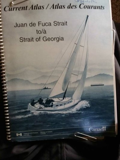
Almost all of my boating is in the waters of Georgia Straights, Gulf Islands particularly, with the occasional foray into the Desolation Sound area or San Juans. Almost all of the currents are nicely covered by a publication from the Canadian Hydrographic Service called "Current Atlas/ Juan de Fuca Strait to Strait of Georgia" these show local current variations on an hourly basis times in hours before and after tide changes.
Even a short glance shows the currents don't coincide with the tide times and even conflict with the direction you might think they should flow at a given time. The example in the photo is 20 minutes after LHW. Common thought would lead you to think all the arrows (current) should be headed towards the open ocean at the bottom right of the chart clip. (North is indicated as being to the left in the photo.) 1582501505681~01.jpeg1582501876542.jpeg
 
My CE shows the currents in BC very nicely as an arrow pointing in the direction of the current. The bigger the arrow the more current. As a back up I use Waggoner's Ports and Passes. They have improved it over the past few years

We've come a long way haven't we?

I remember the NOAA or CG printed current charts with the current arrows for different stages of current.

Then Captain Jack's Current and Tides books.

Currents on PC and app based navigation.

The Windy app on a phone.

What's next?
 
"Ports and Passes" is popular in BC as it does the time thing change for you, but you are wise to follow it up with a tides chart to verify your findings. I read an older article where the couple was transiting Hole in the Wall and Ports and Passes mistakenly gave the timing as a plus factor when it should have been a minus factor for slack. I shouldn't say they transited Hole in the Wall as by the time they got close to the narrow area the current was quite strong and they had to wait another 6 hours to tackle it.

Hole In The Wall And Double Checking The Data
JOHN BEATTYUPDATED:APR 21, 2017ORIGINAL:AUG 24, 2012
The channel seemed almost calm—“Hole in the Wall” is an apt name for this place, just up the road from Desolation Sound in British Columbia. We were surrounded with the beautiful steep walls we have come to take for granted, sheltered from the wind, and under sunny skies. This trip was not quite routine for two reasons. First, we were on our way to the Octopus Islands Provincial Park for our first visit. A new place is exciting and requires some preparation concerning route planning and familiarity with potential hazards such as water depth at the entrance. The second reason is this was to be our first time passing through “Hole in the Wall.”

We are not new to ‘rapids.’ In this part of B. C. the channels and passages are narrow. A large volume of water has to get in and out of the Georgia Straits each time the tide changes. Nautical charts of all cruising areas have several names for narrow bodies of water like Trincomali Channel, Discovery Passage, and Dodd Narrows. In this area, we see the designation—Rapids—so named because when the current is running at its strongest, it truly looks like rapids in a river. One might think that an 8-knot boat could motor against a 7-knot current; it would just take a long time. This might work in a canal or test tank with smooth uniform banks and an even bottom. This is not the case in the real world of rapids. The edges of these passes are irregular and the depths vary. Back eddies and whirlpools add spice to the mix. Sailing directions and cruising guides strongly suggest that no matter what type of boat you are operating, you should calculate slack water and go through the rapids close to that time.


CLOSE TO SLACK WATER
The phrase ‘close to slack water’ means different things at different times at different rapids. During spring tides where larger water level changes require greater volumes of water to get through a given space, close to slack means darn close. Neap tides and less restrictive channels may allow more leeway when it comes to timing. Have there been recent heavy rains or very warm temperatures melting nearby glaciers? This increases the amount of water that has to pass and will affect the speed the water moves. At some rapids, plus or minus 10 minutes will work. There are other places where 45 minutes of slack is pretty comfortable. You need to time it properly on your own. Be cautious at first, then refine it.

At the west end of Hole in the Wall is a rapid. The slack time between water moving rapidly northeast and moving rapidly southwest is short. What I mean is neither the 45-minute possibility nor the 10-minute options are available. You really should hit ‘the hole’ within two or three minutes of slack unless you are a thrill seeker and have Red Bull as a sponsor.

Determining when slack water occurs is normally straightforward. On this trip, I used a tide and current table we bought at the boat show. It was better than the Canadian hydrographic tables because it converts standard time to daylight savings time in the spring. The time of slack water where we were going is based on the slack at Surge Narrows. To this Surge Narrows time, one applies a correction of plus 50 minutes. Slack at surge is 1344, so Hole in the Wall is slack at 1434. It’s easy math—as long as your data is good.


So, I figured out a good time to leave Refuge Cove (where we picked up our daughter, Jenny). At normal cruise we would arrive at Hole in the Wall a little early. It’s best not to be late. We could always loiter a while and go through right on the money. I put a waypoint on the chart plotter at Hole in the Wall’s west end.

WE CONTINUE ON
The channel leading to the rapids was still calm, and the beautiful scenery was still with us. There was sun and no wind, and we were still going to arrive at the rapids right on time. As we got closer I noticed a little water taxi skim toward us through the narrow pass. They didn’t seem to have to wait until slack. A different hydrodynamic is involved. He waved and scooted by. This was new territory for us. That water seemed to be moving fairly fast considering that slack was scheduled to happen in about seven minutes. Something did not look right. My wife and daughter chimed in and commented that it did not look close to slack where we were going. I assured them that I had done the calculation and checked three times. We were moving along to Hole in the Wall with a 4-knot push. At some point, I was not able to turn our boat around to keep from going into the rapids that were clearly running at a speed that would have us out of control. Discretion being the better part of valor, I made the turn and we slowly, very slowly, headed back up and away from the very, very, rapid rapids.

AFTER ACTION ANALYSIS
The trip to the Octopus Islands was off. The next possible slack was six hours later and we did not wish to delay and arrive at an anchorage that late, so we picked another destination. I rechecked my math. I had not erred. Had we had cell phone coverage, I would have been on the phone to the tide and current book’s publishers in a big way. The next day we reached them (I am sure they wish to remain anonymous). I had cooled off considerably. The problem? The sign before the 50-minute correction from Surge Narrows slack water should have been a minus, not a plus. We were an hour and forty minutes late for slack. To their credit, they had emailed people to inform them about the typo. We were not on their list. They said we could have a free book next year at the boat show.

MORAL OF THE STORY
Back when this happened we did not have two sources to check the current and time of slack water. Now we use Nobeltec, which has tide and current information elegantly displayed. We always check computer information against the tide and current tables. As we found, it is possible for current tables to be wrong. But computer software provided data—could that ever be wrong? Our laptop running Nobeltec has nothing else loaded on it and therefore never goes online. If I forget to tell Mr. Nobeltec what the proper time is when I turn the laptop on, he will give me bad tide and current information. Garbage in, garbage out. Now, I always double-check charts against computers.

TAGSTIDEWATERBOATCURRENT
BY JOHN BEATTY

And this is at slack:

 
Last edited:
Once again folks, we are talking about currents here and the effects they have on a mariner's navigation at various times in the cycle. If you are comfortable using and mixing terms that describe tide level in discussing currents, well have at it.
 
The vertical movement (tide) does not matter at all when transiting.
The horizontal movement (current) will make a positive or negative difference to your travels.
 
The vertical movement (tide) does not matter at all when transiting.
The horizontal movement (current) will make a positive or negative difference to your travels.


Pretty much the opposite along the east coast...a little less so now that major shallows have been dredged and it's only a few areas currents are a true issue.
 
The vertical movement (tide) does not matter at all when transiting.
The horizontal movement (current) will make a positive or negative difference to your travels.


Pretty much the opposite along the east coast...a little less so now that major shallows have been dredged and it's only a few areas currents are a true issue.


See what I mean about words being slippery things? You have to write detailed responses like a contract lawyer!


I think Soo-Valley meant on speed made good...of course water level comes into play, especially when there is 20' more variation in height than Florida :eek:
 
Last edited:
I think I know exactly what he meant.....no confusion on my part.

Deep waters (generally) but strong currents and whirlpools in the PNW and shallows and tidal currents that are not that big of a deal east.

I still don't get the confusion most of the time...but yes there are times a word or combo of words might give the wrong impression.

And yes..that's why I often use the word "depends" as so many of us experience thing in different ways and environments as boaters. Those that have boated many different areas and ways probably pick up that a bit faster.
 
Last edited:

Latest posts

Back
Top Bottom