bshillam
Guru
- Joined
- May 18, 2013
- Messages
- 801
- Location
- USA
- Vessel Name
- Our Heaven
- Vessel Make
- 1997 4800 Navigator
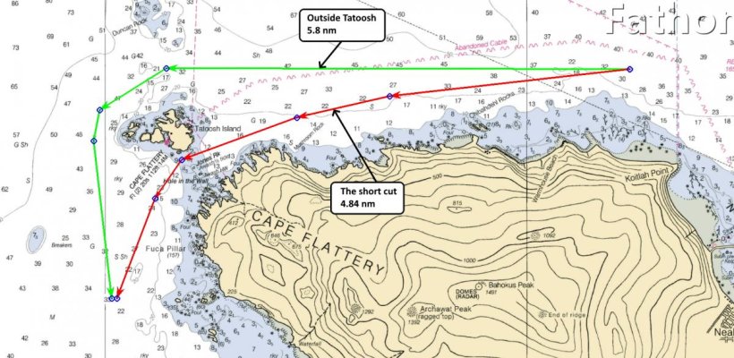
Starting to plan to move the boat South. Looking really rough right now but I won't be able to move it until after Jan 7th. I'll make sure to keep everyone abreast. I have the time to wait until the weather allows me to move it safely!