Has anyone gone across Okeechobee recently?

The friendliest place on the web for anyone who enjoys boating.
If you have answers, please help by responding to the unanswered posts.

Steve91T

Guru
Joined
Sep 12, 2016
Messages
898
Location
USA
Vessel Name
Abeona
Vessel Make
Marine Trader 47’ Sundeck
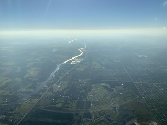
We are currently in Cape Coral and want to get to the east coast and start making our way north to make the commute easier. We draft 3 1/2 feet or so. This will. R our first time taking the Okeechobee route and I don’t know much about it. Where can I read up on everything I need to know about it? Also I’ve read it’s too shallow right now but I’ve also read that it’s fine. Not sure who to believe.

I’ve also heard you can go straight across the lake instead of taking the southern rim.

Any help will be appreciated.

Thanks guys.
 
If you stay in the well marked channel with your 3.5' draft, you will have no problems. I crossed in April with a 4.5' draft.

Current Lake Level

Most chart software will have all the navigation marks you will need. Have you gone through a lock before?

Ted
 
Yesterday I was speaking with the tow boat-us operator Captain Mike from Labelle, Fl, he reports that if you stay middle of the channel trawlers should be okay, he noted on the on Rim route from Okeechobee waterway to Roland Martin’s favor the rip rap side center of canal.
 
Ok thanks guy. I’ve never done locks. What can I expect?

It’s about a 3 day trip? Where are some good marinas to spend the night? Kid friendly with pools would be great. There’s no where to anchor for the night, right?
 
Last edited:
Ok thanks guy. I’ve never done locks. What can I expect?

It’s about a 3 day trip? Where are some good marinas to spend the night? Kid friendly with pools would be great. There’s no where to anchor for the night, right?

There are many places where you can anchor, and there are posts above and below each lock where you can tie for the night.
Suggest you consult a guidebook or ActiveCaptain for marina locations. We like the two River Forest's and the Moore Haven municipal dock. Roland Martin's is popular too. No pools at any of them, but there is a children's park across the street at Moore Haven.
 
Ok thanks guy. I’ve never done locks. What can I expect?

It’s about a 3 day trip? Where are some good marinas to spend the night? Kid friendly with pools would be great. There’s no where to anchor for the night, right?


Five locks with the lake so low, I’ll assume that one or two will just be open. Locks monitor Chanel 13, call on radio when close, Bridges on channel 9,

Strong request to wear life jackets on for everyone! 1st lock for you is Franklin it was under a two foot change in elevation yesterday .

Easy if you have 2 “deck” hands one on the bow one stern, lock keeper will toss longer line if you can’t reach the line hanging.

Lots of options to tie up over night, ..a couple of suggestions to start your research. A free dock in downtown LeBelle or close by a old old time Florida Marina Belle Hatchhe marina cost ? Listed # 863-675-4371 has a new owner previous owner was a hoarder of everything boat related... ... has a pool that maybe open.

The photos entrance looks like a Tarzan movie the wooden cannon one the of the “treasures”
 

Attachments

  • 38C5E969-B7ED-4643-8426-1B8B79D27C7C.jpg
    38C5E969-B7ED-4643-8426-1B8B79D27C7C.jpg
    196 KB · Views: 93
  • D774F9C1-8FF0-4D3A-9884-C599F1CD9886.jpg
    D774F9C1-8FF0-4D3A-9884-C599F1CD9886.jpg
    186.7 KB · Views: 79
Last edited:
Thank you, great info. How much should we allow to get across? With kids we don’t like to do more than about 5 hrs at a time but we can if it makes sense to. We cruise at 8 1/2 kts.
 
Thank you, great info. How much should we allow to get across? With kids we don’t like to do more than about 5 hrs at a time but we can if it makes sense to. We cruise at 8 1/2 kts.
Time will vary based on where you start, finish, no wake zones, waiting for bridges, and waiting for locks. My marina is across the river from the Goodman municipal Yacht basin. Depending on the Franklin lock and a few bridges you might reach Labelle the first day. Second day might get you to Morre Haven or Clewiston if you want to stay in a marina. 3rd day could get you across the Lake to Indian Town marina. 4th day would put you in Stuart.

For locking, make sure you have at least 3 BIG fenders, I prefer the 30" diameter balls. Don't want to get any Lock rash from going up against the wall. You will be required to turn off your engine(s) once secure to the wall. Don't know if that includes the generator or not. Might want to ask the lock operator before going in and kindly explain you would like to keep the kids inside in the air conditioning. Most of the lock operators are easy to work with if you are polite and ask in advance. You should be able to keep your fenders on the starboard side the whole way across from West to East. Again, call the operator on the radio when you first see the lock and ask if the starboard side is ok. You will be required to use the starboard side going East in some locks unless there are too many boats. Some of the locks don't care which side you use.

When you first call the lock, it's done as follows:
Franklin lock, this is the East bound vessel "Abeona ". This allows them to call you by name and to know which direction to look for you. Keep in mind, the lock operators are using handheld radios, so turn the squelch off until you establish contact and be within line of sight of the lock.

You will come to a swing bridge the first day. It's pronounced Fort DeKnow. Some of the operators don't appreciate "DeNaught"

Ted
 
Last edited:
No locks are open, we crossed eastbound 3 days ago on Route 1, the "cross the lake" route. We had 15kts on the nose, even with the fetch it was a smooth ride just some spray over the bow when on the lake.

Charlotte Harbor (Burnt Store Marina) through Franklin Lock, one day.

Franklin Lock to Indiantown Marina, one day.

Indiantown to Vero Beach, one day.

For those runs I paid the fuel bill to run 8 knots regardless of current/wind.

The shallowest water we saw was just before the channel markers (eastbound) coming in to Port Mayaca coming off the lake. About 5' depth on the sounder, pool was 11.25'. I have my sounder alarm set to 5', that's the only time it went off. We draw 4'3".

Be advised that all locks now require you to shut down your engines before you can lock through. Carbon monoxide concerns. Ridiculous, especially for all diesel boats, but that's the new rules to protect you from yourself.
 
Great info everyone, thank you. That really helps.

So an interesting thing is my chart Aqua Map doesn’t show the straight across route. Guess I’ll have to look into new charts.
 
Great info everyone, thank you. That really helps.

So an interesting thing is my chart Aqua Map doesn’t show the straight across route. Guess I’ll have to look into new charts.

Route 1, the "straight across" route, isn't really straight across. You still take the canal down to Clewiston. But then you turn out across the lake, with a couple of jogs to avoid sand bars. You end up running across the bottom 1/3 of the lake.

It's well marked with channel markers, and is an easy run unless the wind is really high. We had sustained 15kt easterlies and it was still a pretty smooth ride.
 
"you might reach Labelle the first day."


It is a good stop, free city dock,with 15A of electric, Wi Fi from the library a few ft away , and an eatery an easy walk .
 
I am planning on crossing the lake in the next few days, but I keep watching the lake levels drop. However, I only draw 4 feet and I see the safe level according to the website I’m looking at is 5 feet, so I guess I’m still good?

Is this 5 feet, or whatever the minimum is shown on the website, good in all areas of the lake or is there some other go/no go level I should be aware of if I draw 4’.

I am not interested in going around the rim, but going across the lake. I guess basically what I’m asking is as long as the minimum shown on the website does not drop below 4 feet, am I still OK?
 
I am probably more cautious than most so factor that in. I would not do it with 1’ of clearance. There is debris and some rock that if you are not in the right place it will potentially wreck your running gear.
 
There are a couple of spots on route one (just before the Port Mayaca lock and as you're leaving Clewiston going on to the lake) where you can find less than rated depth on the edge of the channel. I contend that if you avoid the Active Captain hazards, you will have more than a foot of additional depth over the advertised depth in the channel.

I crossed the lake in early April when the advertised depth was 5.5'. My draft is 4.5' and my depth alarm is set at 6.5'. It never went off. Today's advertised depth is 5'. Can you run aground on the edge of the channel, sure. Can you cross with a 5' draft boat without bumping, probably. If you're really concerned, go slow from Clewiston until you get into deeper water and as you approach the first channel marker until you enter the lock at Port Mayaca lock.

Ted
 
We crossed 4 days ago. We draw 5 feet and were fine. Moorehaven lock was wide open.
 
Lots of rocks.markers far apart. Be careful crossing lake.
Lots of places to just pull over and anchor on West side of lake. Button up for mosquitos. A little common courtesy goes a long with lock masters. Absolutely amazing how some people talk to them. Leave a pie or something on top of the lock wall.
 
I have locked through the lake many times singlehanded on a 43 trawler. Only line that matters is the bow or in my case the one just forward of midship. The current will keep the stern tight to the wall.
Biggest mistake is to pull the stern in too close and allowing the bow to swing outward. That let's the current push you away with great force.
Have the line under the cleat but not cleated and pay out or pull in as required.
Never done the rim route. Not necessary.
Just make sure when you see a marker it is the right one. Good binoculars are required because of the zig zag nature of the route
 
I went through a couple of weeks ago, west to east. No problem with 3 1/2' draft. Skinny places were coming out of Clewiston and west approach to Port Myacca. All locks were utilized. Did it n two days: Ft. Myers - Clewiston - Stuart.
 
Delivered a sport fish from Lauderdale to Sarasota yesterday ,stopped in Martin Rollands last night . Draw 5 feet no problems.
 
One more thing. Going eastbound, we were raised at Port Myacca to above lake level.
 
It’s official...we’re heading out Tuesday of next week! Flew over the western part of the route this morning, looks like it’ll be a fun trip! E’re going to take our time and do it in several days.
 

Attachments

  • CE74EFB3-BC39-4A72-8BCB-373A9233B921.jpg
    CE74EFB3-BC39-4A72-8BCB-373A9233B921.jpg
    81.8 KB · Views: 44
Very cool! We are heading towards Okeechobee Sunday I think.
 
We are headed across today. Just went through Franklin lock.

I would like to make it all the way across the lake today but can’t make that last lock by 5. Has anyone anchored out in the lake next to the last lock by Indiantown ? I see an anchor icon on active captain.
 

Latest posts

Back
Top Bottom