Lake Okeechobee?

The friendliest place on the web for anyone who enjoys boating.
If you have answers, please help by responding to the unanswered posts.

DCDC

Senior Member
Joined
Sep 1, 2017
Messages
272
Location
USA
Vessel Name
Stella
Vessel Make
Seaton 56
We are closing in on Ft Meyers and have to choose Lake O or go around the Keys. Would like to cross the Lake and stay a while in Stuart before the Bahamas. The lake has been fairly steady at 6.7’, with some rain in the forecast. We draw 5.7’ so would need a calm day.

Any experiences/advice? Thanks.
 
If you hit bottom do you just bump the keel or mangle props?
Does your draft measurement include warm, fresh water which is less dense than salt?
 
You'd be missing a lot of very nice cruising grounds if you skipped the Keys, 10,000 Islands etc. . They also make a nice segue into island life. I take it you have some compelling personal reasons for needing to be in Stuart for awhile. ? And yes at 6.7 you'll be puckering as you cross the lake, though my guess is that a Seaton will have protected running gear, so nothing really bad can happen.
 
You'd be missing a lot of very nice cruising grounds if you skipped the Keys, 10,000 Islands etc. . They also make a nice segue into island life. I take it you have some compelling personal reasons for needing to be in Stuart for awhile. ? And yes at 6.7 you'll be puckering as you cross the lake, though my guess is that a Seaton will have protected running gear, so nothing really bad can happen.
It is not the entire lake that is problematic, just the four miles or so in the channel going east from Clewiston. We transited five days ago when the lake had a minimum depth of 6.6 feet. We draft five feet. No touches. Once clear of the channel one can relax the rest of the way. Yes, some nice cruising will be missed by not going around the Keys. We had no desire to do so. If you do go across the lake, keep yours eyes peeled for the Honey Fitz, the former presidential yacht used by Truman through Nixon. It is named after JFK's grandfather. You will pass by her on the St. Lucie Canal about 20 miles west of Stuart. By the way, except for the boredom of the 28 miles crossing the lake itself, the trip is quite pleasant. Be sure to spend a night at Roland Martin Marina in Clewiston. Great tiki bar there. Courtesy car also.
 
Thanks for the replies and information.

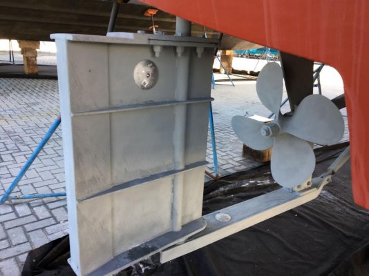
We measured draft from the waterline when on the hard at 5'10" and are now riding 4" below waterline in salt water. Stella has a full keel with props/rudder protection above bottom of keel.

We purchased the boat in Stuart and spent a month on maintenance, including a few weeks at Whiticar's South Yard. Highly recommend. We enjoyed the area and made some friends. Still need to do a few jobs before the Bahamas and Stuart has all the parts.

Also thinking of showing up, informally, at the Ft. Pierce get together later this month.
 

Attachments

  • IMG_1515res.jpg
    IMG_1515res.jpg
    112.1 KB · Views: 144
Last edited:
I'm looking at the latest report from WWG:

FL: Lake Okeechobee Lake Stage and Marine Weather Forecast
Date Reported: Apr 6, 2019
Reporter: Ted Stehle
Source: USACE Jacksonville
Description:
Today's Lake Okeechobee Stage = 11.81 (Feet-NGVD29)

Today's Route 1 Navigational Depth 5.75 Feet
Today's Route 2 Navigational Depth 3.95 Feet

I've read somewhere that the only shallow area is to be concerned about is between R2 and G19, just east of Clewiston. Is this an accurate observation or are there more low spots I need to be concerned about?

I draw 4'.

https://drive.google.com/file/d/1NYMBWfUSGINwP3SzF5pyOjTEfl_rH0PF/view?usp=sharing
 
Last edited:
I draw 4.5' and did the straight across route today. Watched the death gauges carefully and saw less than 8' bot not less than 7'. I'm guessing there is a 1' safety buffer between actual and advertised depth. Depth alarms are set at 7' and never went off.

Ted
 
I'm looking at the latest report from WWG:


I've read somewhere that the only shallow area is to be concerned about is between R2 and G19, just east of Clewiston. Is this an accurate observation or are there more low spots I need to be concerned about?

I draw 4'.

https://drive.google.com/file/d/1NYMBWfUSGINwP3SzF5pyOjTEfl_rH0PF/view?usp=sharing

It is also shallow near G1 east of Clewiston. There is a second shallow spot, same depth, just west of Port Mayaca lock. Ted is correct. The depths are slightly more than what is reported.

We have crossed the lake many times, and have always enjoyed the trip. We can recommend an overnight stop at Moorehaven town dock, buck a foot includes electricity.

Thanks for the tip on G1. I added a waypoint on my chart and see the AC hazard marker, as well. As per your recommendation, I'll keep an eye on the west side of the Port Mayaca lock. I can clearly see the shallow section you're referring to. For some reason no one reported anything on AC in that area.

I crossed the lake last year, but there level was in the 14' range. So, obviously depth wasn't a concern.

Today's report is different:

Today's Lake Okeechobee Stage = 11.62 (Feet-NGVD29)

Today's Route 1 Navigational Depth ≈ 5.56 Feet
Today's Route 2 Navigational Depth ≈ 3.76 Feet
 
I have a doubt, between Lake Okeechobee or Matathon to go to Ft Myers, but now I’d rather Marathon [emoji6]
 
I’ve crossed the lake before with no problems in my 4’ draft (but don’t remember lake levels), and was planning to cross again in June.

Should I rethink my plans? Seems like the 5.56 depth is OK, or no?
 
Thanks. Will keep watching it.

Surprised the level is dropping. I thought it rained every day in Fl. ?
 
We came through there 4 weeks ago. Lock master said it was 6.5 we draw 6'. Were going E to W. 100 yards west of the eastern lock we hit a hard reef and powered over it. The lake was deep enough so no problems there.
2 miles out of Clewiston in the center of the channel we GROUNDED hard and had to call for a tow. It took 3 hours to get us in the 2 miles.

WAIT FOR MORE WATER!


Captain F. Lee
Just curious, what company tows in Lake O and from where? I've always wondered where to go if crossing and break down.
 

Latest posts

Back
Top Bottom