Tablet Navigation

The friendliest place on the web for anyone who enjoys boating.
If you have answers, please help by responding to the unanswered posts.
Christ I must be getting ancient !
I'm still on 'steam navigation' charts and pilot books with a Garmin GPS 72 being more accurate than a swinging compass.
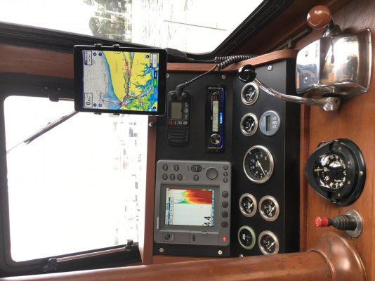
I found Navionics charts were often out of date or inaccurate (despite the latest updates) in the European canals so I simply don't bother switching it on anymore.

From a personal point of view, if I read and plot a course using the charts, my mind builds and retain a 'mental picture' of the route. With Navionics its instant but my mind doesn't retain the route 'image' in the brain.
I guess I'm just old fashioned, BUT I've never got lost, run aground or missed a port.
 
I agree with the effects boating has on equipment. I always keep my portable electronics in its travel case. I think any kind of permanent install is subjecting iPads to the elements for sure. I never leave it laying “out” or exposed to outdoor weather. Spending an extra dollar on a carrying case is worthwhile. But light brightness should correct the glare n direct sun.
 
We too now use a Samsung tablet, 9.6" with Navionics loaded and almost in front of me . MY wife has her tablet also with Navionics.
I have an older Nexus 7 with Navionics which I will use as backup and sometime run close by.

THese have supplanted the dedicated Garmin fancy GPS only feeding a laptop which freed up a lot of dash space. Due to lack of space this older laptop was way off to the side so even though the screen was much larger it was not as readily seen as my smaller Samsung.

We do still have that Garmin as it still has some usefull routes loaded and it does one thing the others are not so good at. I can set the screen to read the actual GPS co-ordinates in 1" high letters. Very easily read. I have heard to many folk fumbling to get those co-ordinates when they need to then change screens and those characters are small.

I still use my paper charts which are in constant use although I no longer plot a course. But i definitely track where I am and I can see easily the overall picture which the electronics may not be so good at without a bunch of fiddling.
 
Last edited:
I have a Garmin combination unit at the inside helm and use an android tablet at the outside aft helm station. The tablet connects via wifi to the Garmin with a Garmin app, shows the Garmin screen and allows control of the Garmin. I usually have another navigation app running on the tablet at the same time and I can compare the two.
 
Here is my setup and I love it!
 

Attachments

  • 365B0C0B-1EA8-4D18-87D5-EA935B0784A5.jpg
    365B0C0B-1EA8-4D18-87D5-EA935B0784A5.jpg
    125.4 KB · Views: 72
I’m really surprised how many boaters have as much confidence in the Navionics program on the iPad. I’ve spoken to lots of boaters in my marina about this set up and they have no interest.
I’m glad to be a member of the Forum.
 
I've been using Navionics on an iPad.
I also have a Sonar Phone depth finder which displays (overlays?) on the Navionics app. The Sonar Phone transducer is mounted on the transom. It is wired to a box (mounted in the engine room) that the iPad connects to via WiFi signal. Depth is displayed as a split screen on the Navionics app. Works great.
An interesting feature of the Sonar Phone depth finder is that it can read the bottom and update the Navionics chart in real time.
 
I've been reading bob423's blog ("Fleetwing," Beneteau 423) where he journals his trips up and down the ICW with his wife for the past 7 or 8 years. He's writing an ICW cruising guide with a new version each year and is the Atlantic ICW editor for Waterway Guide. Bob was slow to adopt an iPad as a navigation device, originally thinking it a toy, but he has more than warmed up to it over the past 4 or 5 years. He wrote a well-researched and thorough review of all iPad navigation apps.

I'm a Samsung tablet user, my wife has an iPad, and we've both used Navionics on our respective devices cruising the Chesapeake for the past 3 seasons. I'm experimenting with AquaMap, previously mentioned in this thread. I don't have enough experience with AquaMap to recommend it, but Navionics has its shortcomings - including an annual cost to use - for which AquaMap may have solutions. I'm looking forward to using it next season.

Our boat has a dated but working, full-featured Raymarine MFD on the flybridge with chart plotter (Navionics charts), radar, and fish finder-quality depth sounder with a second, more modern chart plotter (also Navionics charts) in the pilothouse. We use the MFD primarily for the sounder and radar displays and as a backup chart plotter, but we wouldn't miss the fixed chart plotters if they quit working.

Having trusted backup chart plotters contributes to peace of mind - the more plotters, the more peace - but the number of backups required and which are backups and which are primary are personal decisions. We keep the charts on the primary plotters up to date - usually simpler with the tablet applications - and update the backups when the budget allows.

I have AquaMaps and really like it. Ive never tried Navionics and have been wondering if I should switch. Since you are using both, think there’s any reason to?
 
Should you switch?


I honestly can't say yet. I installed AquaMap after I started a big engine room project, and I haven't even been on the water with it yet, but I do really like the look of it. AquaMap is reasonably priced which varies depending on which charts you need, bob423 speaks highly of it (but leaves his readers to make their own decisions), the AquaMap development team is motivated to improve the product (for now), and world-wide charts with environmental details are available. With that, I'm not sure why you wouldn't give it a try and decide for yourself.
 
They make good back-ups for us, though. FWIW, we typically use Plan2Nav (C-Map vector charts), MX Mariner (NOAA raster charts), and we're experimenting with Transas iSailor... although that last seems to have a bug that I've reported and that they're (maybe) working on. Of those, MX Mariner incorporates ActiveCaptain markers.


After-action report on the iSailor "bug" -- Transas guidance (yesterday) on how to correctly use (ahem!) the app solved that. IOW, it wasn't a bug, just a training issue.

In my defense, I really had RTFM (a lot!) and found no mention of how to make pop-ups go away <sigh>... and all the other "semi-intuitive" (or not) approaches I tried hadn't worked.

FWIW, with limited use so far, iSailor looks OK, to me. Can't compare to many other apps that I've not tried, but it seems about as good as Plan2Nav. I usually don't use vector charts as my primary, so can't really offer a comparison of Transas to C-Map charts yet.

I suspect many have newer installed electronics than ours, wireless connectivity, etc. I see also that some folks do a boatload of prior route planning, make waypoints, etc. In that case, I'd suspect newer connectivity, from tablet to installed (e.g., plotter and autopilot), would be more useful.

OTOH, we don't routinely sweat the small stuff that much in advance... I can easily make routes/waypoints in advance on our laptop with TimeZero, but aside from learning how to do it, haven't really bothered doing all that much work in advance.

Instead, we usually just set the predicted course line on our installed plotter/AP to be generally the shortest distance between two points... inspect the charts at all zoom levels -- and have at it. Correct for set and drift along the way as necessary.

-Chris
 
How many are using a tablet as their primary GPS Navigation tool? If so have you found any significant limitations?


Primary system is coastal explorer on a PC in the pilothouse but we don't have anything up on the fly bridge. So when I pilot from up there (not often and usually just for docking) i use an iPad with navionics.

Recently I saw TZ iboat mentioned in another forum and I started trying that out on the ipad. I like that it can slurp in AIS over the boat's Wi-Fi network from the vesper unit. I'm using raster charts so the look and feel is more similar to CA than navionics but in shallows I do like the Sonarchart mode of navionics.

-tozz
 
For those using tablets / pads as primary navigation devices.

10 Tips for Safe Navigation With Phones and Tablets

I am unable to find an older link from a land surveyor comparing survey grade GPS system accuracy to iPad / iPhone accuracy. So I'll dredge my memory for the important points. For my discussion here I'll assume, yes I know the risk of assume.... that survey grade and marine grade GPS receivers are similar and phone/tablet/pad are another thing all together.


  1. The inherent accuracy of the GPS systems are similar. That is to say the author put an iPhone next to a survey grade GPS receiver and eventually the accuracy was nearly as good for the iPhone.
  2. Eventually is the key. Survey grade receivers and I assume marine receivers prize accuracy over speed to fix. iPhones etc prize speed to fix over accuracy.
  3. iPhones, at the time the atricle was written, would when GPS signal was weak use cell tower triangulation to augment speed to fix. This is more than good enough when you are using a road app and the app can 'snap to' the nearest road.
  4. Most portable devices will not inform you when using cell towers to augment fix.
Food for thought if you're using a tablet for primary navigation device.

That’s why pairing a phone or tablet to something like a BadElf is a great idea.
 
That’s why pairing a phone or tablet to something like a BadElf is a great idea.


Yes that can solve the accuracy issue. But there remain the issues of waterproof and shock proof. I use a tablet & a phone, but not as primary.
 
I would think there are numerous options for waterproofing. As for shock, I would also think that my use on a flybridge or lower helm wouldn't come close to what I put a phone or tablet through in my daily activities. But...there I go thinking again. Not a good idea. :) Also, I have no real idea of what I am talking about as, so far, I have not used either for nav on the boat. Thinking about it though.
 
Really, how accurate do you need them to be.
They are meant as an "aid" to navigation, not a black out the windows and blindly go in with instruments only.
 
My buddy had a habit of jumping in the lake with his phone in his pocket. He now has his phone in a life proof case and I’ve personally seen him go swimming with his phone and it was totally fine.
 
Most boaters cant drive their boat as accurately as a phone or tablet can show them where they are... augmented or not.... :D
 
Really, how accurate do you need them to be.
They are meant as an "aid" to navigation, not a black out the windows and blindly go in with instruments only.

Yup. Keep my eye equally on the depth sounder when in skinny water!
 
Most boaters cant drive their boat as accurately as a phone or tablet can show them where they are... augmented or not.... :D

I have to give the helm to my wife. Mans gotta know his limitations
 
Easting I noticed my wife keenly listening to the new chats about navigating. She’s already read this months BoatUS Magazine. In it there’s a question on the cover”what do women really want?” Lol. It’s about the helm. Haha. I think she’s gonna go for it. Or, maybe you just have to read the article.
 
That’s why pairing a phone or tablet to something like a BadElf is a great idea.


BadElf has seemed pretty accurate, but is definitely slow to acquire enough satellites to satisfy it.

I use iSailor and AquaMap on the iPad. Between the two, I think I like AquaMap better. However, I don’t use the iPad as primary. Since I have good Raymarine MFDs, I see no reason to NOT use them as primary.
 
Really, how accurate do you need them to be.
They are meant as an "aid" to navigation, not a black out the windows and blindly go in with instruments only.


I agree, however there are places around here when having an accurate GPS can be very helpful when going to through narrow channels with nasty rocks. These rocks are very accurately charted and an accurate GPS can do a much better job than I can at knowing where I am.

My older RM GPS antenna is accurate within 5m. The BadElf dongle claims accuracy “up to” 2.5m. There is a big difference between “up to 2.5” and “better than 5m accuracy”.

While I am not sure, I think that both of those are more accurate than an iPhone not connected to a cell network.
 

Latest posts

Back
Top Bottom