Crossing Georgia Strait

The friendliest place on the web for anyone who enjoys boating.
If you have answers, please help by responding to the unanswered posts.

koliver

Guru
Site Team
Joined
Nov 23, 2007
Messages
5,662
Location
BC, canada
Vessel Name
Retreat
Vessel Make
C&L 44
Yesterday was the day Retreat was to return to her shelter in Coal Harbour, after 6 months of outside moorage and cruising. I mentioned the crossing coming up to a couple of friends so I had 2 volunteer crew coming along. It was to be a 5 to 6 hr trip, up current the whole way. Windy.com said the winds we should expect out in the middle would be 9 to 12 knots. Enviro Can agreed. At that windspeed, waves should be minimal.
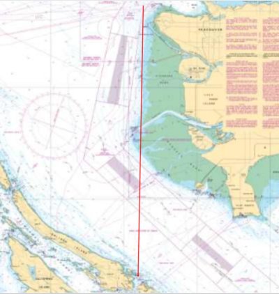
Active Pass presents a 2 mile shorter route than Porlier pass, though the 3.5 to 4.5 knot adverse current in Active is longer than the same in Porlier.
Departure was set for 08:00.
As we pulled away from the dock in Long Harbour, a vote among crew resulted in the route settling on Active Pass. BoatBeacon showed where all the ferries are, and Active pass would remain clear for us.
After transiting Active Pass, we entered Georgia Strait, on course for Sand Heads, but the wave height and period produced a most uncomfortable ride. Retreat usually responds well to a 15° course change, so I asked my helmsman to come 15° right. That only made the motion worse so we came right a second 15°. After less than 2 miles crashing into waves that were increasing to about 5', the comfort level of this voyage had deteriorated to the point that we evaluated our options: continue, go back through Active, up Trincomali to Porlier and try again, or abort. Those waves were coming out of Boundary Bay and building on an East wind. The fetch at our location was about 15 miles. Whitecapping was significant, so I estimate the wind speed at 20 to 25.
We chose to continue 1 more mile and see what happened.
It didn't get any better, so we aborted.
I am now looking at the forecast for Friday (busy today and tomorrow so not looking at those days).

I am not used to getting beat up when both Windy and EnviroCan say that conditions are OK. Usually their combined errors are the other way, as I often see a prediction for some wind and get out there into flat calm, which I don't mind, but this error the other way reduces my desire to consult those sources. Looking out the window seems more likely to yield the best prediction.
 
Last edited:
Yup been there before
we always go through Portier
It makes it more scenic and its more protected
But when you come out of ether pass you encounter the current also that runs down the island any waves are amplified and change as you get out farther
Using halibut bank weather station is sometime misleading because its a ways away in the middle "Cool they have a new forecast active rain map on page"
I know you turn 15 d and then another then another and then back 45 and ride it
I remember a couple of year ago a 30 foot sail leaving Silva bay only to call a mayday 30 min out no wind inside but once out The first 1/4 of the crossing can suck
 
You weren’t going to Sand Heads .. just a temporary course to ride the seas better .. right?

Weather forecast is always just a forecast.
Good call as it would probably would have been many more hours and darkness comes much sooner this time of year.
That was our limitation to winter cruising in SE Ak ... lack of daylight hours and a slow boat.
We were heading to Petersburg from the south.
I remember entering Coffman Cove in near dark w 5’ seas. Blew 40 knots + for a day and a half w heavy rain. Then the window opened for Wrangell Narrows but the tide was ebbing during all daylight hours. Wrangell Narrows is a maze of nav-aids and their colored lights at night. I’ve seen them many times aboard the Ak state ferries. We went home.
 
Last edited:
Eric:
Have to set Sand Heads as a waypoint, as the direct course to the bellbouy at Pt Grey would put us inside Sand Heads a little. The temp course to ride better was more towards Roberts Bank.
As Ron says, 15° + another 15° and another, then 45° back.
 
Keith

You are a very experienced skipper and if you say rough I believe you. Friday looks pretty peaceful. But as you noted no good tides. How about Porlier about 9:45 AM Friday and loaf across to Vancouver to catch Burrard Inlet around 4:30 PM.
 
Like the saying goes:
"The definition of a captain with great seamanship skills is he always avoids putting himself in a position to use them"

Or as Ann and I ("perhaps not possessed of all the skills" (Howard Cosell) say:

"We're pleasure boaters, in that order"

Good work there, skipper!
 
With our boat moored in Pt. Roberts we are always looking at forecasts for the "Strait". I've all but given up on Env. Canada and now use predictwind.com. I find it much more accurate and true.
I would agree that even from the South 1 or 2 miles outside of Active Pass can have it's own wave pattern and at times really uncomfortable.
Pridictwind's forecast for all day Friday looks pretty good.
 
Keith

You are a very experienced skipper and if you say rough I believe you. Friday looks pretty peaceful. But as you noted no good tides. How about Porlier about 9:45 AM Friday and loaf across to Vancouver to catch Burrard Inlet around 4:30 PM.

Tom:


Actually Friday should be OK. I am planning a 07:30 departure, through Porlier on the last of the flood, First Narrows on the first of the ebb, so should be into Coal Harbour by 13:00, then home again on the 3:20 ferry out of Tsawwassen.
Not that I trust them, but Windy is saying 6 knots in central Georgia Strait Friday at 11, Environment Can says "Wind light becoming northwest 5 to 15 knots in the afternoon.", so basically agrees with Windy. I am hoping for the error to be in the right direction this time. Odds, you know.

This isn't the first time I have aborted. When I was heading for Saltspring in April, 2015 I encountered conditions that turned me around off Spanish Banks. I returned to base, had lunch at the club, chatted with the guys, picked up tips and an app called "Sail Flow" that became my favorite till I found Windy, set out again after lunch, and after the tide change, and had no issues all the way home. Having the time to abort and wait a few hours or a few days is the key.

When I was working, it was so much more difficult to re-adjust the schedule I found myself in conditions that will now turn me around but that I pushed through then, as not getting to work Monday morning wasn't an available option.
 
Keith,
I thought you were headed for coal harbor? Sand Heads is way south of Burrard Inlet and Coal Harbour. I’m just confused.

Georgia Straight has lots of fetch NW and SE. And that of course is how the wind blows .. mostly SE and NW. The worst seas we ever saw on our trip to Alaska on our Albin 25 was from Nanaimo to Texada Is. And my engine out (years later) occurred in Georgia Straight. I’m wary of that water.

But even w much less fetch and wind out of the east big nasty seas occur. The last time I poked my nose out into Georgia Straight from Nanaimo for a long run north it looked a little questionable .. and I turned around. My engine quitting was fairly fresh in my mind too. I’m getting (gotten) old and hopefully wise. Going back hardly ever feels good but we were in Nanaimo and we like it there. Despite the price we always go to the floats downtown. It’s always fun.
 
We got beaten up a bunch of years ago. Long before Windy or Predict.

I was running to Howe sound out of Active Pass. The wind was N.W. The river amplified the seas substantially. A straight line actually runs you fairly close and we paid for it. The whole trip was not nice but it was noticeably worse as we got near the river.

I wonder if you got some of the same but with a SE wind. I would think it might not since yours would be more SE but the river can can make any wave action worse.

Porlier can be bad in an opposing wind but at least the river will have minimal effect. Not so out of Active.
 
Eric:
The direct route from Gossip Shoal light (Active Pass) to the Point Grey bellbouy would cut inside the Sand Heads, so one needs to set the route outside Sand Heads. Then to the end of the North Arm jetty, the bellbouy, and in through First Narrows, around Brocton Point, past the fuel barge, in to Coal Harbour.

C L:
We flew home from YVR the other day, directly over Sand Heads, so I got to see where the muddy Fraser discharge ends. It doesn't extend much more than a mile past Sand Heads, so wasn't a factor in influencing the waves we were in yesterday as we hadn't done more than get a very few miles out of Active Pass.
The route from Porlier will take me into the effects of the North Arm, but that should help, rather than hinder. I have noted currents well away from the river and well away from the Gulf Islands, that can add or subtract over a knot from boat speed. They don't always go the direction you would expect, as I have had a lift from current on the crossing from Porlier to English Bay, even on an ebb. I have also experienced a lift on that same route on a flood. Just have to look at total elapsed time when I get there to see what the benefit/hindrance has been.
 
Keith,
I thought you were headed for coal harbor? Sand Heads is way south of Burrard Inlet and Coal Harbour. I’m just confused.
.....................................................................................
...................................................................................................
 

Attachments

  • 3463.jpg
    3463.jpg
    55.7 KB · Views: 101
Presently out in the middle. Came through Porlier on the tail of the flood, present wave height 0.0m wind NW <5. Good crossing!
Windy agrees. Environmen Can says"Wind light becoming northwest 5 to 15 knots late this morning then becoming light this evening".
 
And you have Blue Sky and Sunshine!!!!
Doesn't get any better than that
Have Fun!
 
TR,
Oh yes it does. Blue sky, sunshine and no wind.

Keith I just looked up my geography and I haven't been up there enough lately. Active Pass is way so of where I was thinking. Sorry
 
That must have been a rough crossing today. Good news that it is going well.
 
It took a Google search for me to figure our that the Georgia Strait ain’t in Georgia. **heavy sigh**
 
Tom,
There’s so many of us in the PNW we tend to forget others. But then east coasters do it too talking about places I’ve never heard of. I think though we PNW guys post so much others tend to get familar w the area. There’s alligators, Brown Bears, AC, and lots of other geographic specific topics that I’ve always been hoping the line for “city” under our avatar pic should say city and state. Or just “State or country”. Often weneed to know approximate locations to respond to posts.
 
TR,
Oh yes it does. Blue sky, sunshine and no wind.

Keith I just looked up my geography and I haven't been up there enough lately. Active Pass is way so of where I was thinking. Sorry

Eric:

What really takes some getting used to is that, when heading for Active pass, from Vancouver, you actually have to steer East of South once past Sand Heads. Not only far south of where you would expect it to be, but also east of where you might expect to find it.

Today's crossing was notable for its great weather. Also for the extreme amount of debris in the water, after a series of high tides while the moon was full, clearing lots of floating wood off of the beaches. Off the North Arm jetty, dolphins.

Retreat is now back in her shelter for the winter.
 
Late to the thread but glad you had a smooth crossing. After several very unpleasant crossings this summer, I think I am going to be more cautious.
 
The straights of Georgia were particularly mean this year. Usually they are bad one day in ten during the summer. This year it seemed they were good one day in ten. I got stuck in Silva Bay for days.
 
The blow-boaters were happy 9 of those 10 days by the sound of it.
 
"The blow-boaters were happy 9 of those 10 days by the sound of it.''

Ha! When I was one of them, before coming to the dark side, the best crossings ever were when the wind was NW 20 to 25, on the quarter when coming from Nanaimo. What a blast! Now, on the quarter I don't mind what the wind is, or the wave height. On the beam is worst, but getting beat up with it on the nose is no fun. My crew yesterday had spent 2 months in SE AK this summer, in a blow boat without a full cover over the cockpit. He was very happy to be inside, chugging across a very flat, calm sea.
 

Latest posts

Back
Top Bottom