Wind forecast accuracy

The friendliest place on the web for anyone who enjoys boating.
If you have answers, please help by responding to the unanswered posts.

MurrayM

Guru
Joined
Jul 22, 2012
Messages
5,946
Location
Canada
Vessel Name
Badger
Vessel Make
30' Sundowner Tug
How accurate is the wind forecasting in your area?

Here in Douglas Channel on BC's north coast they seem to consistently call for winds 10 knots stronger than what actually occurs. This is more than annoying and potentially dangerous.

To make matters worse, the weather buoy at Nanakwa Shoal can't read wave height if the wave frequency is shorter than 20 seconds...it can be blowing 50 knots and it will read .3 of a meter because of the steep & close nature of the waves in this area.

We bailed on a planned trip this weekend because of the forecast...was going to have my mother-in-law as well as a 7 month old baby aboard so we decided that discretion was the better part of valour.

Today's winds are 15 knots less than what was called for.

Grrrrrr...
 
Isn't weather forecasting done by government? Enough said.
 
It seems as if in the Juan de Fuca Strait, they often forecast higher winds than what actually materialize. I think it is better to be safe than sorry, but it can lead to to the cry wolf phenomenon if we start discounting the forecasts, as in "they are calling for 20-30 it's if wind, but they are always 15 it's high in their for cast so I am going t go anyway".
 
Contrary to Murray's observations and which may relate to a specific area of concern, I use the Canadian North forecast out of Prince Rupert and find it often far more actuate than our NOAA Clarence Strait weather for local marine conditions. I don't totally discount NOAA I do reference it in conjunction with the Canadian forecast sometimes with skepticisms .


I would add that I use 'Windytd.com' as the controlling factor as I have found this app to have by far, been the determination of a 'Go or No Go'.


Both the Canadian and NOAA are used to confirm or support the 'Windy' data.
I might add that if the wind is forecast South East then I add 6 hours to the Canadian forecast, if from the Northern sectors, we are already in play.


Evem with the accuracy of 'Windy'. there is a level of common se and local knowledge required as it relates to a narrow specific area adjacent or near the Windy projected forecast. i.e.. if Windy projects 20 knots at ocean entrance and shows that, yet in the narrow confine of a near inlet one has to assume that there will be an effect even if the screen shows calm. That is common sense.
I would suspect that Murray, might find Windy app lacking ability to address inland wind much as I indicate that we have areas that are not accessed by the app. Again, common sense comes into play. Murray demonstrated his good judgment in spite of the disappointment. Safe is safe.


Al-Ketchikan
 
I agree, the wind and weather forecast on the Chesapeake can frequently appear to be the work of a legal team, not scientists. We were planning a trip up the bay 2 weeks ago and held off due to the forecast of, "winds 5-10 its with gusts to 20, small craft conditions may be necessary." Gusts to 20? from 5-10? After 3 days of reading this and checking buoy readings that agreed with the 5-10 but never saw a gust over 10 its, I came to the conclusion that the forecast for high gusts was in the event a thunderstorm developed. I don't think the chance of storms was greater than 20% and we saw none. Thanks for the Windy .com, always looking for more info. We have used predict wind.com which offers 4 different model forecasts that are usually accurate, especially when the models agree.
 
I seldom use NOAA. Mostly use the Intellicast wind maps. Seem to be more reliable and only go out 3 days. NOAA for some reason thinks they can predict winds 5+ days in advance when they're seldom right 2 days in advance.

Intellicast Wind Cast

Don't know if the Seattle map reaches far enough up for you. They don't appear to have an Alaska map.

Ted
 
I find that NOAA predictions to be as accurate as anyones. They just aren't specific.

An example is the Delaware Bay. Odd shaped, 24 hrs in a day. The forecasts are for day and night, but when is the transition 6 pm or dark? Part of the bay is wide open, part necks down and more river like. Then there is the river part that turns sharply.

Most wind forecasts seem to be for a general area that is devoid of terrain. Add terrain and there is shadowing, funneling, changes is direction, etc.

If I look at wind map projections, and they are in several hour increments....it is much easier to see the changes due to time of day and terrain as well as where the break in sind strength is.

So while the two forecasts aren't really in conflict it is easier to see why the generic forecast is giving info that may seem much different than what you are experiencing.

There are even more local effects than even what the base wind maps show. Every time in the last 4 years going past Cove Point in the Chesapeake, I noticed at least 5 knot increase in wind where the bay necks down. That can be significant in wave action if it is getting above 15 knots and opposing the tide.

I would think wind forecasts would almost be useless in many places in the North West. Having flown helos in most of Alaska , understanding the wind was all about reading it from what we could see in every valley, cut, sound, whatever terrain we were in for the moment. Forecast winds were only useful for wide open areas.
 
I use Fishweather.com and I'll give it 90 percent positive score out 72 hours in NJ and FL. Be sure to select "Forecast Map". Shows Canada too but I cant vouch for accuracy.
 
I use Fishweather.com and I'll give it 90 percent positive score out 72 hours in NJ and FL. Be sure to select "Forecast Map". Shows Canada too but I cant vouch for accuracy.

You do realize they are copying the NOAA marine weather forecast word for word don't you?

Ted
 
Most wind forecasts seem to be for a general area that is devoid of terrain. Add terrain and there is shadowing, funneling, changes is direction, etc.( Exactly:thumb:-Windy forecast for the most part is devoid of specific winds in channels and inlets. One has to make assumptions based on the overall of the closest wind reflections)

If I look at wind map projections, and they are in several hour increments....it is much easier to see the changes due to time of day and terrain as well as where the break in sind strength is.(This opinion reflects the view taken as a decision to go or not is determined .)


I noticed at least 5 knot increase in wind where the bay necks down. That can be significant in wave action if it is getting above 15 knots and opposing the tide.(Right!! local knowledge and history)

I would think wind forecasts would almost be useless in many places in the North West. Having flown helos in most of Alaska , understanding the wind was all about reading it from what we could see in every valley, cut, sound, whatever terrain we were in for the moment. Forecast winds were only useful for wide open areas. (As on views 'Windy' the forecast as psneed points out, focuses more on the open area, there is enough wind direction in slight detail to give a moment of thought when you extrapolate the forecast in that nearby open area to the more confining area of operation. again, it is a bit of local and historical knowledge)

Al-Ketchikan 27' Marben Pocket CRUISER
 
You do realize they are copying the NOAA marine weather forecast word for word don't you?

Ted

Look at the forecast MAP based on computer models not the text forecast.
Here is a sample:
 

Attachments

  • FWsample.PNG
    FWsample.PNG
    190.6 KB · Views: 106
Last edited:
Totally agree with comments about 'local knowledge' and the lack of accuracy of the windy site when it comes to complex waterways.

Douglas Channel is the only channel or inlet cutting into the mainland (other than Howe Sound on Vancouver's doorstep) to have a weather buoy and/or forecasts on BC's whole coast that I know of, so you'd think it would be fairly accurate.

Nanakwa Shoal is 20 Kilometers (14.5 miles) south of Kitimat.

https://weather.gc.ca/marine/region_e.html?mapID=01

Douglas Channel - North Coast - Environment Canada

Maybe I'll start tracking the forecasted vs measured wind speeds at Nanakwa Shoal for the next while, just to get a sense of how much it can actually be trusted...
 
I use the Buoy Weather App. Same people who developed Surfline for swell, wind, etc., and the gold standard in the surfing world.


I have to say BW has let me down a few times, and I have taken a pummeling when it called for calm wind/swell. But, it appears they draw most of their data from NOAA, and other gov sources, and package it in a more user friendly interface so I am not sure how much blame they can get for inaccurate forecasts.
 
Look at the forecast MAP based on computer models not the text forecast.
Here is a sample:

Ok, see that. Same idea as the Intellicast Wind Cast maps. I like how they can tell me what the wind map will be at 12pm on Monday the 29th (7 days from now) :rolleyes:
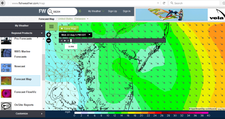
. Windfinder.com has the same map graphics also. Fishweather.com does have a more user friendly layout.

Ted
 
Our marine wind predictions are generally fairly accurate (+/- 10 knots) over 2-3 days of forecast. Sure, there are local variations, especially close to land. Occasionally, when there are fast moving systems coming in some unpredicted things happen. Forecasts over 3 days are a guesstimate at best.


Windytd.com and similar sites are great for seeing the overall structure of weather patterns, but for wind speed of a particular area, I use the government bureau of meteorology forecast, with personal local knowledge mixed in.

I once got hit by a 50+knot wind (which only lasted for 10 minutes) 12 hours ahead of a forecasted wind warning. I expect small localised systems like this to be very difficult to predict. I don't ever expect technology to be able to decipher mother nature 100%. There are just too many variables.
 
I don't ever expect technology to be able to decipher mother nature 100%. There are just too many variables.

Agree, we have a tendency to think we are smarter than we actually are, especially with all of the latest electronic gadgets. We are just transient visitors, and she is in control, and she likes to periodically remind us of that fact.
 
Murray: I had this very discussion with Environment Canada's weather people at the Vancouver Boat Show last January. I asked them if they put a precautionary spin on the weather forecasts and they replied they did not do that. They said the range in the forecast winds was +/- 5 knots about the point-estimate. So when they forecast 15-25 knots it is simply +/- 5 knots about the point estimate. I "lost them" when I asked them whether the range was derived from a Bayesian PDF (Probability Density Function). I am still suspicious that they put a precautionary spin on things but they are not admitting to it. Note that you can talk to a weather forecaster for a fee. Evidently towing companies use this opportunity regularly.

I had a further discussion with Richard on Dauntless about this. He maintained that the weather models for the major areas use the same basic input information, regardless of the country of origin. Of course with his background, Richard consults the weather maps and makes his own decisions accordingly. This is one such map that might be useful:
http://www.opc.ncep.noaa.gov/P_e_sfc_color.png

Richard also mentioned that near shore areas are much more difficult to forecast because of the local geography has a very strong influence. (Richard: I hope I didn't misrepresent our discussions!)

Jim
 
Regarding the NOAA forecasts:

When I started in the industry the joke about the Gulf of Mexico forecasts was: take the forecast sea hts (5-9' seas) and add them together to get the real number of expected sea height.

However about 20 years ago a family out of New Jersey went out and got killed. Their heirs sued the national weather service (and won!). Because they argued that the noaa forecast was too 'underestimating' the prognosis. And some judge agreed.

The effect was noticeable on weather forecasting. The forecasts were adjusted to be more conservative and had higher winds and seas reported.

Also around the same time a 110' scalloper went out and 'iced up' capsized and I do believe the noaa forecast was blamed because there was 'no severe icing' predicted.

'Modern' computer modeling is so accurate it is quite phenomenal.

Regarding 'how accurate is the current forecast?' I can't overestimate the importance of NDBC buoy reports to give hourly(in most cases) updates to sea and/or wind actual conditions to confirm (or refute) forecasts. I compare forecast wind directions to NDBC actual readings for about 24 hours previous. See how close they have been, compared to previously forecast conditions. This is also useful to see when a weather pattern will 'break'.

Also, knowing that prevailing weather (at least in the location I generally operate in) helps me know where to look for NDBC reports to 'see what's coming'. While I work predominantly in NY I know that the wind and seas that I am having off NY harbor will generally be off Massachusetts in 12 to 18 hours. Same with winds and seas from the buoy 64 miles off of the Chesapeake. 12 to 18 hours later we will get comparatively the same wind and seas in NY.

If we have a hurricane brush by us on the east coast it will be pretty crappy in Ireland in about 5 days (more rain and wind than usual). Cause and effect.
 
Not sure how overpredicting wind to be higher than actual could be 'dangerous'. I could see if they predicted 5-10, and you got out to find 25+kts.

Either I'm a bad guess at wind speed, or the predicted speeds in my area are always lower than actual speeds.

We go out anyway. We go by the old adage "This is New England, if you listened to the weather you'd never go out". 20kts is not really that big of a deal around here. We don't get the swell on the east coat that I've seen off of Vancouver and Alaska, however.
 
I'd agree that local knowledge is valuable.

Weather prediction is a crap shoot, no matter who does it. And often it's over a broad area and you could be boating even 10 miles from the forecast area and be much different.

So many factors....

However, there's ways to somewhat predict the likelihood of nasty stuff, and one can do a bit of their own predicting. Need to start with actual data, weather stations, bouys, etc., and know where the weather station is. There are a lot of private weather stations that are poor, not mounted properly and don't give good data. Airports, bouys, stations on bridges without obstructions are usually excellent. Also, the radio sound info from the weather balloons is handy, launched twice daily, but can be hard to interpret.

Know the weather patterns... highs, lows, troughs, pressure, temp, wind patterns (18000 ft is a good indication of flows). Know the local situations.... hills, valleys, seas, lakes.

Often making last minute changes to plans is necessary because the forecast didn't come thru. It's pretty hard to predict accurate winds (and weather) much more than a day out, and even that changes.

And, there's private weather services, that sometimes do a better job than government ones, but ya pay for them.
 
Murray

I agree that for the west coast of Canada, the forecast winds are frequently over-predicted. If I can get hold of alternative forecasts, I consider all of them.

For southern BC & Washington I have found the University of Washington model to be very good. I access this through Big Wave Dave's weather site:
Latest Reports - Windsurfing, Kiteboarding, marine weather, Victoria, Vancouver Island, coastal British Columbia, BC, Canada, windsurf, kiteboard, webcams, surfing, photos, kayaking

For the North Coast I used the Spot WX site this summer en route to Haida Gwaii and had consistently good results. On the SPOT site, you select a location and then get a time-series for that location.
SpotWx | Home

We had a number of locations on the North Coast where there was no cell, weather radio or CCG/VHF reception (like right at Kitkatla!). I used a DeLorme InReach to get a friend in Newfoundland to text weather. I wish Coast Guard would give more attention to filling there VHF holes
 
Thanks for the link...I'll keep an eye on it to see how accurate it is. Since the Douglas Channel weather buoy is just south of town, you'd think predictions would be 'somewhat' accurate for that location at least...

*Nanakwa Shoal buoy hasn't been able to read wave height for years, in case you're checking it for wave height data.
 

Latest posts

Back
Top Bottom