Max Simmons
Guru
- Joined
- Oct 15, 2007
- Messages
- 805
- Vessel Make
- Ocean Alexander 38'
I think it' a thong.**The tutu effect is just his.* *Err shadow?Delfin wrote:
Good grief, Max.* Are you wearing a tutu and ballet slippers in that picture?

Cut it out I can't stop laughing.jleonard wrote:
Hey SD..quit showin off your a$$.
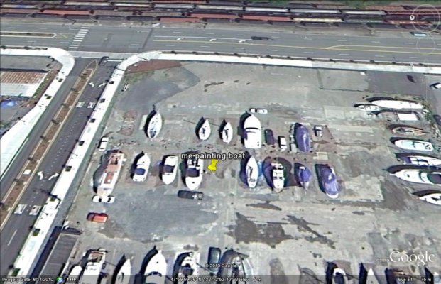
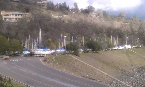
Sad but true, this is my marina.* Right now I am boating vicariously.Max Simmons wrote:
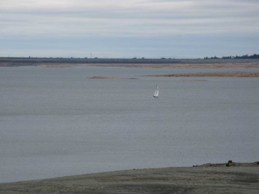
I thoiught this was prtty cool.* Just messing around looking at our local cruising grounds on Google Earth yesterday and zoomed in on our marina.* Lo and behold, there I am, putting on bottom paint in the yard.
jleonard wrote:
Hey SD..quit showin off your a$$.
")

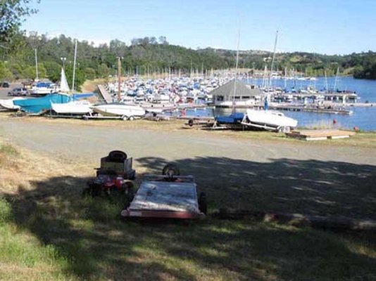
Again, sad to say, it's a lake. It doubles as a reservoir for the city downstream and*gets emptied*every fall in preparation for the winter rains and spring run off. By April it will be full again.dwhatty wrote:
That's one heck of a tide.
Sad but true, this is my marina.* Right now I am boating vicariously.KJ wrote:
*
Max Simmons wrote:
I thoiught this was prtty cool.* Just messing around looking at our local cruising grounds on Google Earth yesterday and zoomed in on our marina.* Lo and behold, there I am, putting on bottom paint in the yard.
'Ae mahalo!Giggitoni wrote:
Folsom!
You'll have to show us another shot when the tide is in - looks like a nice spot. (Yes, I know that it's actually a lake.)*
**
KJ wrote:Sad but true, this is my marina.* Right now I am boating vicariously.

*
You'll have to show us another shot when the tide is in - looks like a nice spot. (Yes, I know that it's actually a lake.)KJ wrote:
*
*
KJ wrote:Sad but true, this is my marina.* Right now I am boating vicariously.
*
You'll have to show us another shot when the tide is in - looks like a nice spot. (Yes, I know that it's actually a lake.)Conrad wrote:
KJ wrote:
*
*
KJ wrote:Sad but true, this is my marina.* Right now I am boating vicariously.
*
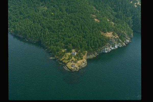
MarinDid you notice the age of the Squalicum Harbor photo? There are two rows of boathouses back in my corner.Marin wrote:
For a pre-Google look at this sort of thing, here's a website that has aerial photographs along all the shorelines in Washington, both Puget Sound and the Pacific coast. The site is http://apps.ecy.wa.gov/shorephotos/
What someone did is fly around the entire salt water coastline (including the islands) in the state in a plane and take overlapping photos. I used to do this sort of thing in Hawaii for a real estate company although we did it at a much higher altitude (15,000') and we used a huge 11" x 14" vertical mapping camera instead of an oblique camera. While what this site offers has been greatly eclipsed by Google Earth, it still provides an interesting look at things.
Here are three sample shots from the site. First is part of our marina, second is Turn Point on Stuart Island, and third is Moclips out on the Pacific coast.
Yeah, I have no idea when the photos were taken.* The shot of Moclips is quite old, too.*Before we got the GB we used to go there a lot and stay in a funky orange motel right on the beach.* It's still there but has been a different color for a long time and the three-sided motel across the street burned down many years ago.Carey wrote:
Marin
Did you notice the age of the Squalicum Harbor photo? There are two rows of boathouses back in my corner.