New Member in NC, USA

The friendliest place on the web for anyone who enjoys boating.
If you have answers, please help by responding to the unanswered posts.

Ski in NC

Technical Guru
Joined
Jan 18, 2014
Messages
6,194
Location
USA
Vessel Name
Louisa
Vessel Make
Custom Built 38
Hi all. Just joined. Custom built 38' cold molded. Heading down to the Keys and maybe Bahamas in spring (??). No stranger to traveling on the boat, but only limited Bahama experience, as I've only been as crew. Lookin' to pick y'all's brains on charts and nav computers.

I can also help out with engines, I post often on Boatdiesel under the same name.

Eric
 
Hi all. Just joined. Custom built 38' cold molded. Heading down to the Keys and maybe Bahamas in spring (??). No stranger to traveling on the boat, but only limited Bahama experience, as I've only been as crew. Lookin' to pick y'all's brains on charts and nav computers. I can also help out with engines, I post often on Boatdiesel under the same name. Eric
Welcome aboard. The Bahamas is pretty simple to navigate for the most part, with modern chart-plotters that is. Which part of the Bahamas did you want to go?
 
Thanks, all. Depends on the weather, as I understand it is dicey in the spring. Abacos, and maybe Eluthera. I've crewed all over the Abacos on a Bert 54, so pretty comfortable there.

My boat is pretty shallow draft (32") but prop is lowest bit, so I have to be careful!!

I've nav'd with a laptop in pilothouse using Maptech offshore navigator lite, uses those cd's from the chart packages and usb garmin antenna. Loved the way it worked... when it worked. System would lock up often, and the gps signal would randomly decide to not talk to the computer. Irritating.

I'd like to keep using a laptop and was willing to buy the upgraded Maptech software, but it seems on their site they are no longer marketing it.

Anyone got ideas on what is a good laptop based nav package?

Last gulfstream trip a bud brought an ipad, it sorta worked but ended up being annoying and glitchy.

Marine plotters like Garmin are nice, but very pricey for the big ones, and the little ones use charts that seem poor quality.

Thanks!

Edit: I'm incapable of sorting computer issues on my own. It must be idiot proof!!
 
Thanks, all. Depends on the weather, as I understand it is dicey in the spring. Abacos, and maybe Eluthera. I've crewed all over the Abacos on a Bert 54, so pretty comfortable there. My boat is pretty shallow draft (32") but prop is lowest bit, so I have to be careful!! I've nav'd with a laptop in pilothouse using Maptech offshore navigator lite, uses those cd's from the chart packages and usb garmin antenna. Loved the way it worked... when it worked. System would lock up often, and the gps signal would randomly decide to not talk to the computer. Irritating. I'd like to keep using a laptop and was willing to buy the upgraded Maptech software, but it seems on their site they are no longer marketing it. Anyone got ideas on what is a good laptop based nav package? Last gulfstream trip a bud brought an ipad, it sorta worked but ended up being annoying and glitchy. Marine plotters like Garmin are nice, but very pricey for the big ones, and the little ones use charts that seem poor quality. Thanks!
Abaco's and Eleuthera are excellent. We did the abaco's 2 times in our camano which had a 3ft draft no problem. We plan to do the Abaco's, Eleuthera, and the Exumas this summer with our Nordy which has a 6ft draft that we'll have to be carful in certain places but for the most part not worry. As for PC software I would take a look at Nobletec Trident or others depending on your specific needs. Also I don't see a problem with Garmins charts, we just bought two 741xs' with the Bluechart 3D and think there charts are great.
 
Eric:

Welcome to Trawler Forum. I have enjoyed you wisdom on boatdiesel, so now is our chance to reciprocate.

And if you get really bored you can participate in some of our more inane discussions- like overpropping for fuel economy, two props vs one, whether it is better to lock or freewheel your non powered twin prop, and other scintillating topics.

But back to your question:

Some laptops suffer from connectivity issues with a USB remote GPS. You can get them to work reliably, but it takes a bit of a kludge- Xport is a small utility that provides a virtual serial port that is reliable.

OpnCpn is my hands down favorite for a free, full featured charting application for PCs. It is well supported by a bunch of gurus on Cruisers Forums.

But for a low cost semi-dedicated chart plotting solution, how about an Android tablet. The Nexus 7 is now in the low $200s and works very well. I have used two different charting apps on it:

MxMariner which is related to OpenCpn for PCs. It works with NOAA downloaded raster or vector charts and is free or nearly free. But it does not cover the Bahamas (easily).

Plan2Nav, a Jeppesen product, is vector based but works well. It uses proprietary Jeppesen charts that you have to pay to download but the whole US east coast and the Bahamas is less than $20. I have skimmed through the Abacos which I know reasonably well and their charts are accurate as far as I can tell.

Plan2Nav lets you download Active Captain crowd sourced data on marinas and anchorages. I found that the Bahamas data is surprisingly accurate and complete.

Both of these are easily downloaded from the Google Play store if you have an android device.

The Explorer based charts are probably better, but I don't know if anyone sells them for a tablet app. And for all I know, that is what Jeppesen uses.

In any case do buy the Explorer paper chartbook if you go down there. It comes in three versions: Abacos, Exumas and Eluthera I think. It shows safe routes across the banks, reliable waypoints and tips for getting there, dealing with customs, weather and the like.

David
 
Last edited:
Welcome.

I'll put in a plug for Coastal Explorer. It's about $300 and includes all the US raster and vector charts, including automatic synchronization of updates. Also includes the full active captain database, tides, current, etc. You can purchase the C-map vector charts for the Bahamas which are based on the Explorer charts, but include a bunch of additional waypoints and routes. I've recently come down through the Abacos and across the Eleuthra and so far they have been spot on.
 
Hi all. Just joined. Custom built 38' cold molded. Heading down to the Keys and maybe Bahamas in spring (??). No stranger to traveling on the boat, but only limited Bahama experience, as I've only been as crew. Lookin' to pick y'all's brains on charts and nav computers.

I can also help out with engines, I post often on Boatdiesel under the same name.

Eric

Hi Eric,

I'm in Wilmington too. I moved here six months ago from Raleigh, our boat is in Oriental on a lease that is up in June. Welcome aboard! Where are you berthed? I was looking at Bennett Brothers so the boat would be close enough to work on. My admiral wants a more beachy location, but I may have convinced her the ride down the Cape Fear is not so bad.

Last year we were in Joyner a few months. Convenient spot.

Cheers.

Ben
 
Eric:................... And if you get really bored you can participate in some of our more inane discussions- like overpropping for fuel economy, two props vs one, whether it is better to lock or freewheel your non powered twin prop, and other scintillating topics..

Or anchor balls and proper installation of navigation lights. ;)
 
............. Marine plotters like Garmin are nice, but very pricey for the big ones, and the little ones use charts that seem poor quality. ...............

Yes, marine plotters are expensive but not really compared to what you spend to buy, operate and maintain your boat. If you like "projects" there are cheaper ways to go, but if you would rather "boat" than fool around with PCs and external devices, install a good chart plotter with depth sounder and be on your way.

I like Garmin because you can buy a $30 software program and view your charts and plan trips on a PC then upload the trips to the plotter.
 
Hi Eric,

I'm in Wilmington too. I moved here six months ago from Raleigh, our boat is in Oriental on a lease that is up in June. Welcome aboard! Where are you berthed? I was looking at Bennett Brothers so the boat would be close enough to work on. My admiral wants a more beachy location, but I may have convinced her the ride down the Cape Fear is not so bad.

Last year we were in Joyner a few months. Convenient spot.

Cheers.

Ben

Ben- A couple of other places to check: Inlet watch, Masonboro Marina, Mason Landing, Harbor Village. Those are nearby and more "blue water" than the river. The river is convenient, but I really like the blue water. Harbor village (Hampstead) is a long run to a good inlet. Topsail is in poor shape I've heard.

I keep mine on a private dock next to Middle Sound Marina. MSM may have slips, but are probably full. In same basin is Anchor's Bend, but they are (supposedly) starting a big dock renovation and are basically shut down now. I just squeak under the WB bridge at 17' with antenna up, any higher than that and you have to wait for hourly opening.

One advantage of the river is very little bottom growth, and being near to downtown.

Anything Wrightsville Beach is super pricey, and also basically all docks have current. Current makes docking fun, and encourages bottom growth too.
 
ImageUploadedByTrawler Forum1402827528.269817.jpg
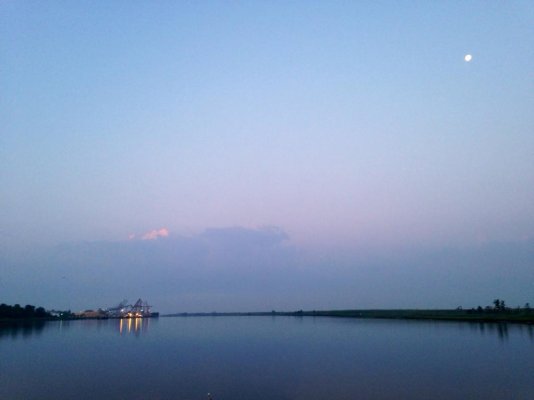
Headed to Inlet Watch this morning...
:)
 
Garmin uses the same charts on their small plotters as the large units. My 741xs uses the same charts as my 6212. I'm just saying and I have never had even my 740s lock up unlike computer based navigation systems.
Bill
 

Latest posts

Back
Top Bottom