AIS systems

The friendliest place on the web for anyone who enjoys boating.
If you have answers, please help by responding to the unanswered posts.

Frankb

Member
Joined
Aug 26, 2013
Messages
5
Location
US
As I understand it, AIS systems are mounted with one of two options, receive only or receive and transmit. There might be a third option of switching the transmit on or off (I don't know).

It appears to me to be a very handy additional tool containing information for consideration in dynamic close quarters navigation, but it will not nor will it ever ensure SAFE navigation.

Your thoughts and experiences..?
 
Use it every day. Very necessary in my world in and around commercial Ports. It cut down "security calls" by probably 60% in NY . Made Coast Guard VTS operators life easier. All around great safety tool.
 
An AIS receiver is a safety item for a cruising boat. The ability to hail an oncoming ship by name is important (they have to answer). Whether the ability to transmit is valuable or not is a personal decision. Currently, I am a little tired of 40 foot sailboats sending out an AIS signal which I must check to see if it is a 1000 ft freighter.

Marty
 
I have an AIS that sends and receives and think its a great safety tool

We use it to "see" around islands that radar can't see around.

We also use it to address boats that are on a converging course to determine port to port or starboard to starboard passing, in the many narrows we have in our area.

Ours integrates with out chart plotter and our radar, putting a boat symbol on the screen. Hovering over the symbol displays the boats information.

Personally I wish more people had transmitters, little boats, big boats, it doesn't matter.
If I know there's a boat around the corner, we are both safer.
 
Boatbeacon is an AIS app that transmits and receives, but does it all via the internet, in real time. Best $10 app I have. None of the commercial guys will see me, unless they are using an internet tool, so I don't ever rely on being seen. It is very useful for checking the speed, course, CPA of any approaching commercial vessel, as it provides good information to plan your course so as to avoid close encounters. Knowing the name of that approaching vessel also comes in handy.
This $10 purchase puts off the day (maybe forever) for spending $300 to $1000 on the real thing.
 
An AIS receiver is a safety item for a cruising boat. The ability to hail an oncoming ship by name is important (they have to answer). Whether the ability to transmit is valuable or not is a personal decision. Currently, I am a little tired of 40 foot sailboats sending out an AIS signal which I must check to see if it is a 1000 ft freighter.

Marty
Just like RADAR...what does it matter that it is a 40 foot boat or a 1000 foot freighter???? I don't recommend you ram either one....:D
 
Just keep in mind that all the internet AIS applications like MarineTraffic.com only show targets that are close to arbitrarily placed, land based receivers, most of which are operated by volunteers. What you see are boats that are near those receivers, not necessarily boats that are close to you which is what really matters. AIS, by design, does the best job showing boats close to you. The internet apps are fun to look at, and a convenient way to track you friends, but there are significant holes in coverage and it really can't be relied on for navigation.
 
So far what I have experienced is ....AIS is great if you are traveling in heavily travelled commercial traffic lanes...

If you even just barely run outside of the channels or avoid major lanes...looking outside in clear weather or listening outside with an alert ear gets you about as much useful info as AIS...not about the commercial targets that are probably talking on the radio and showing up on Radar...but all the other little vessels out there that aren't required to have AIS yet.

Great tool???? You bet...just like my offset, metric box end wrenches that I use once in a blue moon...

I would use but never bet my life on AIS in the goo...RADAR is about 100 times more useful in my opinion at this stage of the AIS game.
 
I use both Radar and AIS every trip regardless of meteorological conditions or time of day.

Radar is good because it shows all the targets and gives some size perspective.

AIS excels in several areas:

First, it tells you instantly what the target is, what it's doing: moving, anchored or underway not making way, actual course and speed. It also gives you their closest point of approach. You can deduce this from radar in minutes, AIS in seconds.

Second, it tells you the name of most of your targets (commercial ones anyway) so you can contact them by name (much faster than saying "freighter at such and such location").

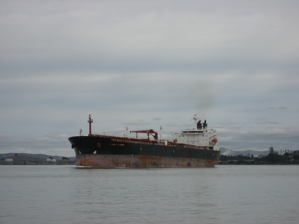
Third, because I broadcast, it tells targets about my vessel. It tells them the name of my boat (for hailing purposes), that I'm at anchor, that I'm conducting underwater operation. On the ocean it does this 1 to 2 hours before the big ships get to me. They pick me up at 24 to 48+ miles away and can observe that my status is not changing for over an hour. They make a slight course correction 10 miles away and pass with a large separation.

Use to have 1 or 2 near misses every year from large ships not realizing I'm anchored with divers in the water. For the last 3 seasons with AIS, no close calls and I know who to hail if they were (IMO) on too close a heading. My system (Simrad) has a small plotter and the antenna is elevated on an extension. Total cost was <$1,200 and worth every penny!

Ted
 
Last edited:
Size of boat, 1,000 ft freighter versus 40 pleasure boat. Should explain this. AIS is important to me when the ship is at a distance to judge whether I will need to take evasive action. At five miles I am concerned with a freighter that will cross my path or come within a 1/4 mile of me. With pleasure boats I usually start being concerned when they are within close visual range.

Marty

Not really...in a small maneuverable boat it really doesn't matter to me...maybe it's just me but being 5 miles..or for that matter 3 miles from a freighter/tanker and I can still easily maneuver around. I don't worry about pleasure boats under 65 feet until I can read their registration numbers by eye...usually they are so erratic...taking action early just keeps varying the collision course. Even within 1/2 mile they are easily steered around.

In the fog I can tell by the target return the relative size of the vessel..and if it's a sailboat with the worlds best reflector on it...so what..I'm still going to take action to avoid.

I definitely agree with OC Diver in his situation...a great safety tool for an anchored vessel in/near shipping lanes. Even if you have to constantly cruise in/near them and don't anchor...

But while useful...the average coastal cruiser not constantly using shipping lanes is likely to encounter 100 targets or more to one without AIS than with it...
 
Just installed my new Standard Horizon GX-2150 & wired it into the CP300i. On the river I wanted it for identifying tows & other vessels that may also be equipped so I can hail them by name if need be, the avoidance part here is by eye or radar when caught out at night or in fog.
 
Just installed my new Standard Horizon GX-2150 & wired it into the CP300i. On the river I wanted it for identifying tows & other vessels that may also be equipped so I can hail them by name if need be, the avoidance part here is by eye or radar when caught out at night or in fog.

I would definitely have AIS for the big river systems as there is no way to avoid the commercial traffic in many places and talking to them is great.
 
Just installed my new Standard Horizon GX-2150 & wired it into the CP300i...

I was thinking that a LOWRANCE LINK-8, or a similar model such as this GX-2150 would be a great way to add an AIS receiver to my navigation system.

It looks like they simply output NMEA strings that could be consumed, and that I wouldn't need to worry about a 2nd antenna or a splitter.

Am I right? Anyone have any additional comments or notes on these VHFs with built in AIS?

I've installed the Link-8. Love it! No new antenna required.

The only problem I had was getting to to work using RS-232, or RS-422, with my Simrad plotter (another Navico product!!). In the end, I fed the radio with GPS data from my old Garmin plotter. I think the problem is with the NSS8, not the Link-8. The RS-232 AIS output feeds my laptop with OpenCPN, which really does a nice job with AIS -- much better than the NSS8!

To get the Link-8 to talk to the NSS8, I finally had to build a custom NMEA N2K cable. I didn't want to go through and install a full N2K system with backbone cables, terminators etc. It would have been too large, and way too expensive just to connect two devices. In the end I bought three short DeviceNet cables off of eBay for less than $20, cut off the ends with the connectors I didn't want, spliced the two cables together with a 60 ohm resistor across the data lines, and brought out the power and ground.

It turns out that even on devices that don't get their power from the network cable, power is still required to "enable" the bus.

Now the Link-8 has two sources of GPS which I can select between in the Link-8 menus, N2K and RS-232

devicenet0.JPG

devicenet.JPG
 
Somehow, I believe the professionals would mostly prefer we just stay the heck out of their way without having to bring up a conversation.

img_178289_0_8d06990626dc4e269c7dfff59546e07c.jpg
 
Last edited:
I was thinking that a LOWRANCE LINK-8, or a similar model such as this GX-2150 would be a great way to add an AIS receiver to my navigation system.

It looks like they simply output NMEA strings that could be consumed, and that I wouldn't need to worry about a 2nd antenna or a splitter.

Am I right? Anyone have any additional comments or notes on these VHFs with built in AIS?

After using it I love it, your right just NMEA 0183 input & output, no dedicated antenna. The range can be adjusted to suit you situation, I set mine to 5nm which seemed to work very well on the river. Being able to know where the tows, dredges or cruise boats are and hail them by name is worth the cost, let alone their position from the locks. The GX-2150 was simple to install, intuitive to use & will do much more than I'll ever need. The intercom function using the ram mic is one that I had on the old SH VHF & the new 2150 works just as well or better.
 
I've installed the Link-8. Love it! No new antenna required.

Fantastic! :dance:

The only problem I had was getting to to work using RS-232, or RS-422, with my Simrad plotter (another Navico product!!). In the end, I fed the radio with GPS data from my old Garmin plotter. I think the problem is with the NSS8, not the Link-8. The RS-232 AIS output feeds my laptop with OpenCPN, which really does a nice job with AIS -- much better than the NSS8!

Even better! :thumb:

Was this bi-directional NMEA 0183 talking to OpenCPN across the RS-232 cable? I'd like to send the GPS from the chartplotter to the Link-8 across that same cable if possible.
 
Somehow, I believe the professionals would mostly prefer we just stay the heck out of their way without having to bring up a conversation.

Agree 100%. In my area we have a fairly busy shipping port, and staying out of the way of the commercial vessels is really not that hard if you are paying any attention at all.

From a safety standpoint, it'd be nice to know that a containership doing 20+ knots is just around the corner. They throw some tall, steep wakes, and I don't like to spill my coffee. :socool:

From a geek and coolness standpoint, I'd like to tell my family/guests that "that ship over there is just arriving from Taiwan". :blush:

These VHF radios with built in AIS are cheaper than dedicated AIS receivers, and it sounds like they are easier to install as well.
 
Somehow I believe the professionals would mostly prefer we just stay the heck out of their way without having to bring up a conversation.

I just had a situation crossing Rosairo Straight where I had a tanker headed south while I was trying to cross the shipping channels. The AIS/OpenCPN was pretty consistent with an estimate that the ship would pass more than 1/2 mile behind me. After I passed the tanker, it suddenly started turning towards me. I didn't know if the tanker was going to stay southbound, or turn into Guemes. The skipper hadn't reset his AIS to indicate where he was going, his destination was where he had just come from.

I called him on the radio to get his advice on how I could best stay out of his way. He let me know that my current course was OK (even though he was headed straight towards me. It turns out that he had changed course to avoid the ferry that was crossing the shipping channels in the opposite direction from me.

As you can see from the picture, I couldn't see the ship's name. That I got from AIS.

tanker.jpg
 
Was this bi-directional NMEA 0183 talking to OpenCPN across the RS-232 cable? I'd like to send the GPS from the chartplotter to the Link-8 across that same cable if possible.

That should work. The problem I had was that I couldn't get the NSS to talk and listen to the Link-8 using either 422 or 232. I never had a problem with the Link-8 talking to OpenCPN via RS-232. As far as the radio, it doesn' know where the GPS data is coming from. It's all on the same cable.

You don't have to hook GPS up to the radio to get the AIS strings. However, I would suggest that you do (it's may even be illegal not to). Having the GPS data on the Link-8 display is handy.
 
But Bob, you had plenty of room/time to get out of his way.

Yes, yes, yes. AIS would be nice to have.
 
But Bob, you had plenty of room/time to get out of his way.

Yes, yes, yes. AIS would be nice to have.

Probably, but as he was only 1/2 mile away when he temporarily turned towards me and going much faster than you and I can go. I was quickly losing my 1/2 mile buffer. I can't ever recall feeling the need to contact a large ship before -- with, or without AIS.

I honestly hadn't expected him to turn. His was coming from the Cherry Point refinery to the north, so I hadn't expected him to turn towards the Anacortes refineries to the east.
 
Somehow, I believe the professionals would mostly prefer we just stay the heck out of their way without having to bring up a conversation.

Some areas on the river they appreciate knowing our intentions. Last weekend while locking a small 2 barge tow traveling the same direction called me back and asked if I would wait so he could enter the lock 1st. Believe me avoiding anything bigger than me is the highest priority.
 
Bob, I'm fortunate that in my waters the ships need to keep to channels, and there are plenty of shallower waters to seek refuge.

232323232%7Ffp54349%3Enu%3D3363%3E33%3A%3E57%3B%3EWSNRCG%3D3978765497336nu0mrj
 
Last edited:

Latest posts

Back
Top Bottom