BriBri
Member
- Joined
- Aug 27, 2013
- Messages
- 17
- Location
- USA
- Vessel Name
- Not For Sail
- Vessel Make
- Chris Craft Catalina 281
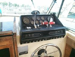
I have the Garmin 521s chartplotter with a transducer hooked up, which came with the boat when I bought it. And, while I am happy with the unit's functions/capabilities, I am not happy with the 5" display size. Split-screens are pointless as you can't really see much detail, and when in chartplotting view, I have to scroll, zoom, and move the screen around more than I would like to when underway.
I would like to stick with Garmin, and I have been considering up-sizing to either the 720s or even splurging a bit and getting a GPSMAP 4210, and using the 521s as just a separate depthsounder display. However, I am wondering if I could use the NMEA 2000 connection point on the 521s to somehow hookup an external display (or even use my laptop). I am a NMEA network newbie, so I am a bit ignorant as to its capabilities. I have only begun to read about NMEA 2000 networks.
Anyone have any thoughts on this? I pilot my boat through about 2.5 miles of long, narrow, and shallow spots from my dock to open water, and I am keen on knowing and (clearly) seeing my vessel's relationship to the underwater environment.
 ) . Thanks for the info.
")