Bridge panic

The friendliest place on the web for anyone who enjoys boating.
If you have answers, please help by responding to the unanswered posts.

markpierce

Master and Commander
Joined
Sep 25, 2010
Messages
12,557
Location
USA
Vessel Name
Carquinez Coot
Vessel Make
penultimate Seahorse Marine Coot hull #6
This last Sunday, went up the Napa River. While passing under the Mare Island Causeway Bridge, my passenger/guest feared the Coot's mast would strike the raised bridge and quickly moved from the cockpit to the saloon. Vertical heights are difficult to judge from close up.

232323232%7Ffp6357%3A%3Enu%3D3363%3E33%3A%3E57%3B%3EWSNRCG%3D37%3A3%3A3368%3B336nu0mrj


232323232%7Ffp635%3B8%3Enu%3D3363%3E33%3A%3E57%3B%3EWSNRCG%3D37%3A3%3A34%3B46336nu0mrj


img_135996_2_94064bba46e6e17e3d03356013a0dd36.jpg
 
Last edited:
Your chart should show height above high water when lowered, and when raised. With those numbers you should be able to estimate the height at each of the crossbars on the towers.
 
Your chart should show height above high water when lowered, and when raised. With those numbers you should be able to estimate the height at each of the crossbars on the towers.

Yeah, he knew that. ,he was just looking for a 'scuse to post more pics of his fancy mast, eh Mark.
 
When in the lowered position, there isn't sufficient bridge clearance for the Coot under any circumstance. The bridge isn't raised to its highest position if the bridge attendant doesn't believe it is necessary. In the Coot's instance, the bridge isn't raised to the maximum height. So, those chart numbers are irrelevant. Heck, how tall is the Coot?

Did I say I paniced?
 
Yeah, he knew that. ,he was just looking for a 'scuse to post more pics of his fancy mast, eh Mark.

Paid a lot for it. So why not?
 
.....he was just looking for a 'scuse to post more pics of his fancy mast, eh Mark.

That's OK with me...I enjoy the pics! (And so do you, Peter.:thumb:)
 
Mark – Your unlimited, clear picts are part of the substance of TF - - > :thumb:

Keep Em Commen!! ;)
 
About 30 years ago, I was sent down to Napa to observe and make recommendations on a tug/barge transit between the Leslie salt flats in Napa to/from Pittsburg, which included navigating through the pictured area. The navigation challenge was safely making the bridge opening with a 300' x 50' tug/barge unit with the prevailing winds sweeping across the channel. Made several trips through here and it was always pucker time

How far up the Napa River did you get/normally cruise?
 
In a situation like that I've just asked the bridge operator what his clearance is, or better yet told him what my air draft is. Takes the pucker out, at least in theory.
 
Another alternative could be to mount a small waterproof video camera pointing forward on the top of the mast and graphic overlay module that can generate a horizontal line at what ever pixel row you select. With a little calibration you could get the horizontal line to indicate the level of the top of the mast. That should eliminate the guesswork and provide a good lookout.
 
I agree that judging height is very difficult. When I had a sailboat, the mast height was about 48', but I would pass under the 65' fixed bridges on the ICW and it'd always look like I was barely scraping by.
 
Just curious - does everyone know their air draft? We have a bridge here with an operator who we all fondly call the "bridge Nazi". He's constantly busting people's chops over not knowing their air draft. Lots of people want him to open when they can get under just fine. It's the second busiest draw bridge on the eastern seaboard, so I can understand his frustration.

Lots of places air draft doesn't matter at all, but in other areas, like the NY and Canadian canal systems, it matters a lot.
 
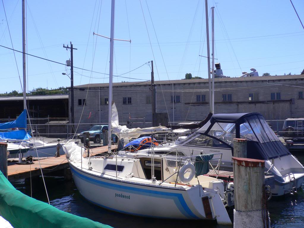
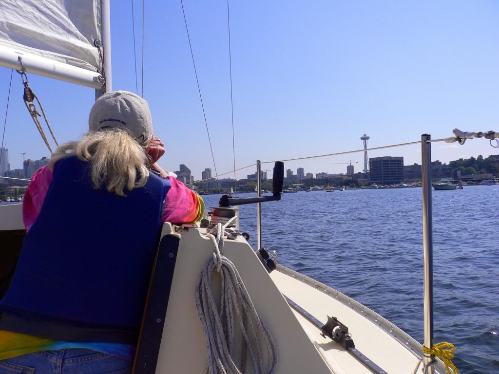
In Seattle the only bridge I could not pass under with our small San Juan 23 sailboat was the Freemont Bridge. The Freemont has a clearance of 30' in the center, and my mast is 32'. Never had to wait more than 5-10 min. for the operator to open the bridge.

img_136100_0_18b84b5e676b082c8b5a4d14a816fb7e.jpg


img_136100_1_9907c4c9e6deff66f7c64ff78cc1749a.jpg
 
Last edited:
In Seattle the only bridge I could not pass under with our small San Juan 23 sailboat was the Freemont Bridge. The Freemont has a clearance of 30' in the center, and my mast is 32'. Never had to wait more than 5-10 min. for the operator to open the bridge.

img_136107_0_18b84b5e676b082c8b5a4d14a816fb7e.jpg


img_136107_1_9907c4c9e6deff66f7c64ff78cc1749a.jpg

I cut the mast of the Eagle so we could get under the bridges with out waiting. I hated darn sails boats as they sually took up the center of the chnale and many time were cross wise. PITA. :hide::whistling::D
 
The reason we got a great buy on our sailboat several years ago is because the dreaded previous owner--an airline pilot--used to get liquored up after a long duty rotation and pass out below while his wife--not a boater--would motor all over the lake. The boat had a tall rig, with 45 feet of air draft, and one day she ran it into a power line. Not as much damage as you might expect--a burned genoa and partially melted forestay--but at least they weren't dismasted or electrocuted. Shortly after that, they had a "fire sale."
 
A burned genoa? :eek::confused:

Genoa is that a social thing, :confused: IF I had genoa, I probable would want to get rid of it to, but having it burned off sound painful. :eek::rofl:
 
A burned genoa? :eek::confused:

Genoa is that a social thing, :confused: IF I had genoa, I probable would want to get rid of it to, but having it burned off sound painful. :eek::rofl:

His forestay melted too! Now THAT sounds painful, glad I don't have one. Thanks mom & dad.
 
Another alternative could be to mount a small waterproof video camera pointing forward on the top of the mast and graphic overlay module that can generate a horizontal line at what ever pixel row you select. With a little calibration you could get the horizontal line to indicate the level of the top of the mast. That should eliminate the guesswork and provide a good lookout.
a small change in trim may affect that idea...:eek:
 
Just curious - does everyone know their air draft? We have a bridge here with an operator who we all fondly call the "bridge Nazi". He's constantly busting people's chops over not knowing their air draft. Lots of people want him to open when they can get under just fine. It's the second busiest draw bridge on the eastern seaboard, so I can understand his frustration.

Lots of places air draft doesn't matter at all, but in other areas, like the NY and Canadian canal systems, it matters a lot.

27 to top of antennas, 24 to top of mast, 17 to top of bimini, 13 to top of flybridge cowling.:D

Every bridge from NJ to Florida verfied and notes in cruising guide (as they are often wrong)...every note from changes in sceduled openings to tidal variations and actual measurement marker errors and "extra" nav height if bridge is not flat on the bottom.:thumb:

No stopping for me if I don't have'ta...;)
 
a small change in trim may affect that idea...:eek:

I would use a PC/104 based live video overlay board such as http://www.ampltd.com/dload/vmix104.pdf and integrate an inclinometer. The horizontal reference line could be adjusted in near real time (actual latency would be about 33 milliseconds). The PC/104 board stack should be enclosed in a sealed cantainer such as Tri-M Can-Tainer - PC104 Container/Chassis/Enclosure Designed For Hostile Environments to protect it from the marine environment.

If that is too complex, mount the camera on a small platform that rotates in pitch with a counter weight mounted below on a rigid arm so that the camera platform is gravity stabilized. Don't forget to include a viscous damper to eliminate overshoot.
 
Usually to the former Kaiser pipe plant.

232323232%7Ffp63588%3Enu%3D3363%3E33%3A%3E57%3B%3EWSNRCG%3D37%3A3%3A336%3A%3B336nu0mrj

Really? Not into downtown by the Third St bridge? I hear they re-did the town dock up there. Used to make a great day trip, but I needed a designated captain. That was back when Copia was still open, but needless to say we hit a few other places downtown regardless.

The trickiest piece of navigation was right past the power lines after the bridgem where the channel swung around and the markers somewhat ambiguous, including the green in the middle of a mud flat.
 
Last edited:
Another alternative could be to mount a small waterproof video camera pointing forward on the top of the mast and graphic overlay module that can generate a horizontal line at what ever pixel row you select. With a little calibration you could get the horizontal line to indicate the level of the top of the mast. That should eliminate the guesswork and provide a good lookout.

Actually, no marks or graphic is needed. With a camera on the masthead, it's easy to tell if you'll clear the bridge. As you approach, if the obstruction is rising in the video image, you'll clear; if it's not rising, you won't clear.
 
Really? Not into downtown by the Third St bridge? I hear they re-did the town dock up there. Used to make a great day trip, but I needed a designated captain. That was back when Copia was still open, but needless to say we hit a few other places downtown regardless.

The trickiest piece of navigation was right past the power lines after the bridgem where the channel swung around and the markers somewhat ambiguous, including the green in the middle of a mud flat.

Beyond the old Kaiser plant, I'm leery to proceed without local knowledge. Also, Napa City doesn't have the money to dredge the turning basin and put in a dock.

The wide, lower part of the river, consisting of two "S" curves, is mostly very shallow, with navigation limited to a poorly marked, natural channel. One needs to not get closer than 50 to 100 yards from any channel marker and weave toward one marker to another as a straight course from one marker to another can/will make you scrape bottom.

Here's a short article on boating on the river. The dock at Napa downtown mentioned in the article was removed in 2005.

http://www.deltacalifornia.com/napa_river_info.htm

Edit: according to this article, the city now has the money to construct a dock.

http://friendsofthenapariver.org/

Another Napa River article:

http://www.boatingsf.com/article/cruising-the-napa-river
 
Last edited:
I was given to believe the dock is there now; it's been awhile but we never had issues past the turn off into the Kaiser plant with 4 ft draft. You could call Napa Marina or the Yacht club if you're paranoid (which is an OK thing to be in these matters)
I made this trip many times, but not for the last 5 years. It's fun, you go through the Carneros district for a good part of the trip which can be viewed from the flying bridge or by standing on top of the deck house of a non-FB boat.

Your links describe what I was saying exactly about getting through the wide section after the power lines.

Edit: just looked at a Google earth image dated 9/12.. no dock. All the other improvements and development are there, you can see the pilings from the old dock. Of course, you could just anchor out and dinghy or kayak over since the bridge marks the end of navigation. A guy in some sort of express cruiser did that once when we were there and there was no room at the dock. Or just tie up to the pilings if they are still there.
 
Last edited:
Actually, no marks or graphic is needed. With a camera on the masthead, it's easy to tell if you'll clear the bridge. As you approach, if the obstruction is rising in the video image, you'll clear; if it's not rising, you won't clear.

Good point, and it works regardless of trim. :thumb:
 
What an interesting place to boat. Just spent a little time on Navionics looking at charts. Now I understand why you call it the delta. Thanks for sharing.
 

Latest posts

Back
Top Bottom