ksanders
Moderator Emeritus
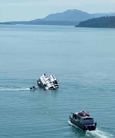
It looks like a recreational boat has sunk in Glacier Bay
https://www.alaskasnewssource.com/2022/07/02/4-rescued-after-boat-capsizes-glacier-bay/
Anybody know the owners?
https://www.alaskasnewssource.com/2022/07/02/4-rescued-after-boat-capsizes-glacier-bay/
Anybody know the owners?
")