AKFish
Veteran Member
I'm just getting to the installation of a Furuno SC30 GPS compass. My Maretron SSC200 is effected by the steel hull, to the extent that when heeled to port, there is a 20 deg swing in heading as the mass of the hull moves out of the way. I should mention that I had to install that compass on the mast away from the hull.
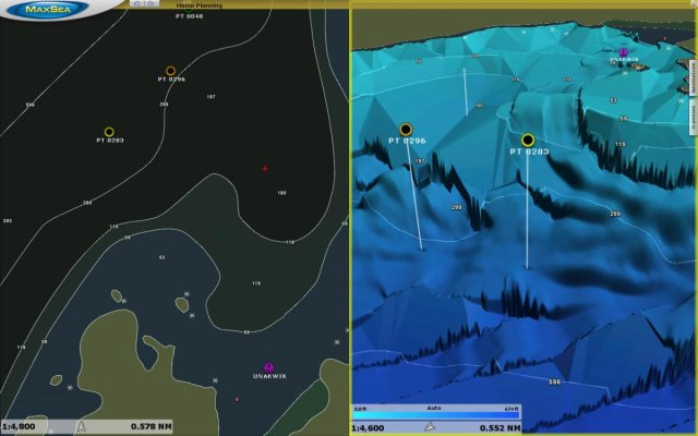
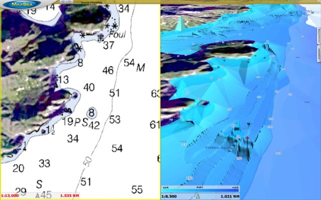
I hated to have to bite the bullet, but it was getting hard to nav via auto pilot due to course recovery upon heeling. Probably the best ancillary feature is the heave compensation while plotting on my personal bathemetry generator. It should smooth out the sawtooth from swells and paint a more accurate bottom profile.
Anyone else make the jump to this instrument?