Raymarine chart confusion - Someone just tell me what to buy!

The friendliest place on the web for anyone who enjoys boating.
If you have answers, please help by responding to the unanswered posts.

mncruiser

Senior Member
Joined
Aug 6, 2017
Messages
345
Location
United States
Vessel Name
Phoenix
Vessel Make
Mainship 390
I've got a Raymarine c95/c97 setup with Radar, Autopilot....everything I guess...and it seems to work ok. I'm running the latest (last) version of Lighthouse 2.

When I bought the boat I updated things, really didn't know what I was doing. For whatever reason I purchased Navionics Charts (now Garmin?) because when we were moving the boat it was the easiest for me to get working and downloaded to the unit.

Last weekend the MFD units flashed me a nasty gram, saying stuff would stop working in 22 days, the Navionics charts.

This morning I'm looking around for charts. It seems Raymarine has zero support for any part of my c95/c97 units running the Lighthouse 2 software. Even if I wanted to buy their charts, or a few broken links to a company called Imray, it seems I can't unless I have newer Raymarine stuff.

Should I just buy the Navionics stuff again?

Our primary boating area is the great lakes....for now not many super long trips out of the area. Right now I can do most of my navigation via "not for navigation" placemats bought at the gift stores, but I do want to update the charts.

What should I do?
 
I can't help with Raymarine because I'm not familiar with their gear.

What I can do is strongly suggest that no matter what system you are running you should have a backup. And suggest that because you are already comfortable with using Navionics that you install Navionics app on a tablet. The app is inexpensive even if you have to buy an Android tablet which are also inexpensive. Just be sure that the tablet you will use has built in GPS.

Agreed. I've got it on my phone and ipad.

Thanks!
 
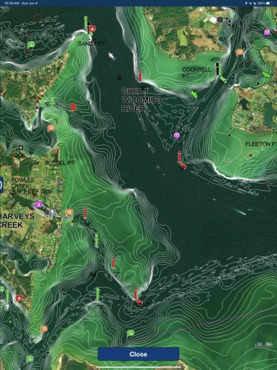
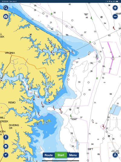
I have been a software and systems engineer for 35 years. I had similar issues like yours and have finally washed my hands of them forever. I now have two iPad Pros 12.9" with their own mounts up on my flybridge and down in the lower helm. They both go with me to whatever helm I'm using. They mount in seconds and one has the Navionics App up with my current route and the other is for looking up marinas, planning ahead, checking out warnings, looking at maps of surrounding land, finding restaurants, etc, etc. When I am doing none of that I have the routing one zoomed in to the normal level and the other way out for context. This setup is excellent and I can't recommend it enough. Downsides, Not waterproof (I have a nice plastic case handy that they both fit in just in case I am surprised by rain). Screen brightness and glare (Under my top it's shaded and I have anti glare film on them). Heat (shade). Power (I have a ROKK 2 port charger at both helms). Buying new maps is a $30~$60 payment per year. The software update process is idiot-proof. The interface is by far the best. If one dies I can get one same day or next delivered. Each one is not just a dumb screen but one of the fastest personal computers that allows me to install any of millions of apps. I still have the old Raymarine MFD sitting down below for the radar but removed the one on the flybridge a long time ago. Furuno already makes a radar that directly sends the data to it's ipad app and within 3 years at most the same will be true of sonar and all other systems. If your AIS has wifi, it already sends data to the navionics app to post up targets. If your sonar has wifi the same is true and it sends your soundings to update the navionics bathymetric chart for everyone.

IMG_0224.jpg

IMG_0222.jpg
 
Last edited:
Hi Hyperion - could you share how you mount your ipads - I am using a similar system on our GB42 - but no mounting yet!
 
IMG_0225.jpg

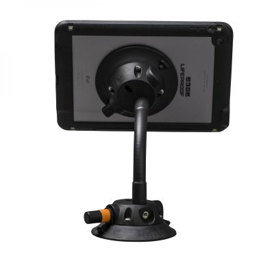
Sure. I use two sea sucker arms but instead of a sucker to mount to vessel I added an imbedded thread. Mine are white though.

You buy one of these:
Mount

Since it comes with two suckers I just bought one of these to accommodate my setup:
Flex Arm

You can do double suckers if you don't want to mess with adding a threaded hardware bit to helm.
 
Even with an expired subscription the Navionics charts should still work. You just won't be able to use auto routing or put the card in a PC and download updated charts until you renew the subscription.
 
Last weekend the MFD units flashed me a nasty gram, saying stuff would stop working in 22 days, the Navionics charts.


Seems odd, if that means charts actually disappear. "No longer the most current -- but still works" seems to be more common.

The only "it won't work any more" thing I remember was about GPS satellite roll-over dates... and that sometimes was just about needing a software update... or in one case, I had to physically replace a 20-year-old (Furuno) GPS thing.

I dunno much about Raymarine stuff, though.

-Chris
 
Even with an expired subscription the Navionics charts should still work. You just won't be able to use auto routing or put the card in a PC and download updated charts until you renew the subscription.


I guess I didn’t read the message that closely, I bet you are right. Every time I fired up the MFD it gave me the same warning, which I only partially read.

I’ll have to take a close look next time.

Thanks
 
I am running TZ IBoat on a 12.9” iPad. The gps seems to stop for several seconds, leaving you blind. We also run naviionics and aqua maps on the same iPad. There was a post on the AGLCA site about the problem this morning. Apparently the newer iPad don’t have the tech to keep the gps up to the second. Our older iPad works fine.
 
Quick side note. Not all iPads have gps receivers, only cell ones do. You don't need to have cell service to use gps but wifi only don't have the hardware. That said, if you have a wifi only ipad you can still use navigation aps by incorporating am external gps receiver. You can even add one to ipads that have gps to have it be more accurate:

Bluetooth GPS
 
Agree that the charts should still work but some functions may not. I have used expired Navionics on Raymarine with no problems but that was before Garmin acquired Navionics. Now not sure…
 
I guess I didn’t read the message that closely, I bet you are right. Every time I fired up the MFD it gave me the same warning, which I only partially read.

I’ll have to take a close look next time.

Thanks

It will give you that warning on every cold start, but they will continue to work (except as has been stated, autoroute and update).

The peculiar thing about Navionics ne Garmin, is that with all the pestering, you cannot update your subscription in advance. It has a countdown for something like 30 days warning you, yet if you try to put the card in a PC and re-up the subscription, there is not way to do it until AFTER it has expired. There is no penalty for waiting, except I was away from a fast internet connection for weeks after the expiration and had to dismiss the nagging every morning.

Another peculiar thing is that once you re-subscribe and start an update, it does ERASE the whole chart database, and it must be reloaded - 7 GB worth for the US/Canada chip. It is not just updated with a few patches. In addition to that, if you want the bathymetric charts, that is an ADDITIONAL 14 GB. This takes many hours on a fast WiFi connection. Once you start, you must continue, if interrupted you must start again.

This is really bad design, but be ready for it if you update. Once subscribed and updated, you can update just a small area which is far less data. The initial re-subscription update gives you the impression, by displaying the selectable area, that you can do the same, but it erases and rewrites the whole thing regardless of what area you select.
 
Over the winter my Raymarine chart chip somehow got corrupted. I called them and talked to the second level of support. He just sent me a new chip free. Great service.
 
Even with an expired subscription the Navionics charts should still work. You just won't be able to use auto routing or put the card in a PC and download updated charts until you renew the subscription.

This is my experience, I let my Navionics subscription lapse and was unable to update my existing chip. I had to navigate through SE Alaska on old data, some of which wasn't complete because I didn't download the area I was traveling through before my subscription lapsed.

My iPad had a current subscription and covered all of the areas I didn't download on my MFD chip, so the transit was not an issue at all. Everything worked fine except I couldn't download current data to my expired chip. Everything downloaded to the chip functioned perfectly except the tides and currents were expired.
 
Back
Top Bottom