I start with auto tune, but often tweak from there.
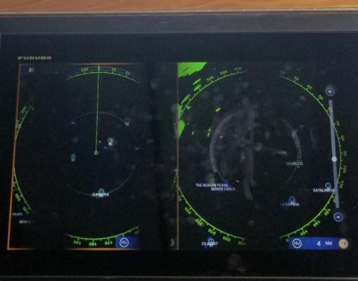
I used to overlay radar on my charts, but found two interesting things along the way.
First is that too many times I found confusion between the radar overlay and the underlying chart. Noise in the radar return was obscuring anything red on the chart, and making it hard to read depths and other notation. Too many times I found myself missing something because I thought it was a radar return when it was a chart feature, or vice versa. When the displays are separate, it's easier to compare the two and know for certain what you are seeing.
Second is that I realized my desire to overlay radar was really a crutch because I wasn't very good are reading and interpreting the radar return. With the radar co-displayed with a chart, it was much easier to correlate the two. But over time I got better are reading the radar return, and could more quickly and dependably identify what I was seeing, and correlating it with the chart. It was simply a matter of practice and experience. So I abandoned the crutch, and permanently separated them (my last and current boat aren't even capable of overlay), and have never gone back.
Other than visually identifying things on the radar, there are a few other tools for checking it against your chart. Bearing lines and range rings, or even just a cursor placement on your radar will locate something both by range and bearing, as well as lat/lon (assuming you have your electronics all hooked up correctly). You can then do the same on your chart to correlate against your radar view.
Target tracking is also incredibly useful. Again, when properly set up, anything you track with ARPA on your radar will show up as an icon on your plotter. Those are inherently the things you care about the most, and they, and only they take up space on your charts. It's kind of the ideal filter for what portion of your radar return to show on your chart. Target tracking is also useful for picking out returns that are buoys vs other boats, as they are sometimes hard to distinguish when close together.