loran comeback?

The friendliest place on the web for anyone who enjoys boating.
If you have answers, please help by responding to the unanswered posts.
Without a 3D nav system that is trustworthy, landing aircraft will have to revert to older less able systems.

With a portable radio and a depth sounder most boats could navigate,

but the days of landing in 100ft alt & 1/4 mile viz are probably over.

All major and many small airports in the US have ground based approach systems. Our best approaches, the zero viz and auto land systems, don't use GPS. While GPS has done wonders to reduce the FAA's cost of maintaining enroute and rural approach facilities, the airlines and big airports could function just fine without it.
 
"We are famous for planning for something that will not happen in our life time."


True , but most are happy to carry signal flares , install bilge pumps , and even carry a life raft we hope never to use.
 
Hate to seem like a luddite,but have we all forgotten about RDF's? I built a Heathkit in '78 and used it to navigate across Lake Michigan multiple times.

It was clumsy to use,wife had to steer and call out compass readings, I had to plot on the dinette table, but the positions were quite accurate. Blew her mind when we came in sight of the precise points I predicted!

I bought a boat in 1985 that came with a little RDF set. We actually used it back then a few times at night, tuned into radio stations. You really could triangulate your position pretty well by tracking two or three stations. Those and the hand bearing compass in the daytime, was what told me where I was a lot of the time back then!
 
I suspect the US has figured out a way to defeat the Russian form of GPS.
Soon we will have at least 3 forms of GPS, depending on where you venture; the US, Russian and the European versions.
 
GPS Backup Finally Moving Closer

There is a growing consensus in the United States and Europe that entire economies are overly dependent on GPS and analogous forms of global navigation satellite systems (GNSS). All forms of navigation (aviation, motor vehicle, maritime, etc.) depend on GNSS. GNSS precise timing signals underlie global telecommunications networks, banking transactions, electric transmission systems, and numerous other applications. It’s not just an aviation problem, and an aviation-only solution is a diversion from solving the overall problem.

In this country, the Department of Defense and Department of Transportation jointly developed the National Positioning, Navigation, and Timing (PNT) Architecture, which envisions multiple sources for these three vital functions. Last year, DOD went further, releasing its own PNT strategy document in August 2019. DOD envisions three layers: a global layer of GNSS, a regional layer based on terrestrial technologies such as eLoran, and a local layer using a variety of other technologies. The European Space Agency has developed a backup architecture for United Kingdom maritime commerce. The MarRINav report produced a hybrid approach using GNSS, eLoran, and short-range R-mode VDES.

In the National Timing Resilience and Security Act of 2018, Congress required DOT to test a variety of terrestrial precise-timing systems to back up GPS timing signals. Such systems were to be expandable to provide navigation services. As Bill Carey reported in Aviation Week (Nov. 9-22, 2020), DOT’s field tests of 11 such systems were carried out in March at two facilities—NASA Langley in Virginia and a Volpe National Transportation Systems Center facility in Massachusetts. Carey reports that as of late October, DOT’s analysis of the results had completed an interagency technical review, but there is not yet a projected release date for DOT’s report on the demonstrations.

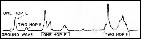
Carey talked with people from some of the companies that took part, including two whose proposed systems are based on eLoran—UrsaNav and Hellen Systems. He summarized their proposed roll-out plans for PNT systems based on that technology, emphasizing the merits of a signal vastly stronger than that of GPS and in an entirely different part of the spectrum. Hellen Systems estimates that it could refurbish the 19 legacy Loran-C transmitter sites over a several-year period for $300-400 million, less than the cost of a single GPS III satellite. Their team includes L3Harris Technologies, which operates the Automatic Dependent Surveillance-Broadcast (ADS–B) ground network for FAA.

Carey’s article also notes that FAA’s current Navigation Roadmap remains increasingly dependent on GPS. For example, it is counting on the expanded use of GPS-based wide-area augmentation system (WAAS) for airport landing systems, refusing to invest in the latest generation of instrument landing systems (ILS) that are far more effective than legacy ILS. The same course is being followed in Europe via the expanded use of GNSS-dependent European Geostationary Navigation Overlay Service (EGNOS) for landing systems. (Note: I discussed FAA resistance to new-generation ILS in “A Rebirth for Instrument Landing Systems?” in the March 2020 issue of this newsletter.)

FAA continues to focus on an aviation-only approach to GPS backup, including a reversal of the original NextGen plan to phase out legacy VOR ground stations in order to retain a minimum operational network of about 600 by 2030. That plus an expanded network of distance measuring equipment (DME) ground stations will provide an emergency capability to enable aircraft to keep flying in the event of a serious GPS failure. Far better would be a robust multi-layer, economy-wide PNT capability, as called for by Congress and the National PNT Architecture. DOT should require FAA to get with that program, rather than continuing to focus on a crude aviation-only GPS backup.
 
I suspect the US has figured out a way to defeat the Russian form of GPS.
Soon we will have at least 3 forms of GPS, depending on where you venture; the US, Russian and the European versions.

China also has gnns up and running (BeiDou). US has military has jam proof receivers. Your mfd? probably not.
 
China also has gnns up and running (BeiDou). US has military has jam proof receivers. Your mfd? probably not.

Back to Plan A. Update your position hourly to your paper charts. AKA Dead Reckoning
 
to your paper charts.

That's the crazy part. I essentially have every West Coast chart, including rivers and lakes, on my MFD. In a scale of my own choosing. With no need for a parallel ruler, dividers, pencil, eraser, chart table, desk light, GPS, LORAN, etc. Take two or three magnetic bearings and enter the info in the MFD. In less than a minute I could have my position. Do the same 10 minutes later and I would have my new position plus COG and SOG. No need for dead reckoning when basic piloting would be more accurate. And unlike a paper chart, with the push of a button the old track and bearings could be "erased" and I have a clean new chart.
 
While I agree paper charts or electronic charts are essentially the same and are separate from GPS.... I am pretty sure ded reckoning is part of piloting...the part between fixes....


Plus no track if you didn't have GPS unless your MFD has the ded reckoning feature where you enter your estimated speed and course. I think I remember one or two that had the feature.
 
Last edited:
I found a system that allows entering magnetic or true bearings to get an LOP. It is included in a Furuno radar system so that you can enter the bearing and distance (from the radar) of a single point to get your position. The system has its own screen on a dais, so it is for the bridge of a large vessel. And it is $34,000.

I think most nav systems have a feature where you can touch a point on the screen, set it as a waypoint, and the MFD can give you the magnetic bearing, i.e., the course to steer (based on it knowing your position from GPS). This would just be the opposite of that. Touch the screen on a navigation aid and you enter the magnetic bearing. It then gives you an LOP on the screen. Do it twice and you have your location without GPS. Seems like a good safety feature.

One could also touch the marker as a waypoint and then "double the angle on the bow" to get a running fix, with the MFD doing the plotting. Some of this might depend on where the navigation system gets its time data. Satellite? GPS Satellite?
 
I agree...if some systems and all in the future have that software it would be great...but it is still only as good as your ability to take bearings with radar or optical equipment.


It is no different than old fashion piloting and ded reckoning between when you take the bearings and plot them.
 
I spent the 1970's staggering around the Atlantic Ocean in my trusty P3 aircraft armed only with the AN/APN70 loran A/C and a periscopic sextant. Loran accuracy was a quarter mile at best, reception was adversely affected by atmospherics such as thunderstorms, and large chunks of the world had limited or no coverage. Major cruising areas like the Bahamas and the Caribbean were located in the base line extensions of the land based transmitting sites, and fixing information was not available. We took our first trip to the Bahamas in 1994 carrying both Loran C and GPS receivers, and Loran was unreliable south of Miami. So Loran was not a panacea. Of course, the sun, moon and stars are still operational, and visual piloting and dead reckoning techniques remain valid. Of course, they require a pencil, protracter and a chart, items which have fallen out of favor in today's cruising boats. I would recommend reliance on basic time tested navigation techniques as a backup to a highly unlikely interruption in GPS service. Self sufficiency cannot be jammed, rendered obsolete, or suffer equipment failure. Hang on to your paper charts, or find some old DRT overlays and make your own.
 
Loran is never coming back. All the transmitters and towers are scrapped. While Loran was still operating, the navy was looking for other systems that had better range, more accuracy, and required fewer transmitters. While I was in the navy, I went to school for a couple systems that never made it past the prototype stage. Each Loran signal required 2 transmitters many miles apart. As I remember, the West Coast had 5 separate signals, Alaska at least 2, Hawaii 3, and so on. The ground signal only went about 500 miles. After that you were reading skywaves that bounced off the ionosphere. Only the 1st bounce was accurate and it took skill to pick out the proper wave. In the middle of the Pacific, Loran A was only accurate to a mile or more, Loran C was accurate in hundreds of feet. Within the range of ground waves it was more accurate, but no where near GPS accuracy you're use to. You can buy a receiver or puck that receives all 4 GPS brands. Hopefully all 4 owners won't be at war at the same time.
 

Attachments

  • LORAN-A_radio_signal.jpg
    LORAN-A_radio_signal.jpg
    14.8 KB · Views: 9
Has anyone seen an app for the site reduction tables?
Maybe that will help take the sting out of the future, GNSS less world.
 
Back
Top Bottom