JDCAVE
Guru
- Joined
- Apr 3, 2011
- Messages
- 2,911
- Location
- Canada
- Vessel Name
- Phoenix Hunter
- Vessel Make
- Kadey Krogen 42 (1985)
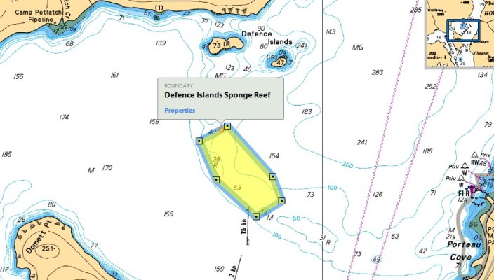
There are numerous "Closed Areas" for Fisheries in British Columbia. These include "Rockfish Conservation Areas" and "Sponge Reef" and "Bottom Contact" Fishery Closed Areas. Putting these areas into Coastal Explorer using "New", "Boundary Circle Line/Area" is an incredibly tedious procedure. It would be useful to import something. I have used a CSV to KML converter, first by imputing the coordinates into a spreadsheet and then copying and pasting into a converter. I use this one:
CSV To KML Converter
I then can import these into Google Maps or Google Earth. However Coastal Explorer does not support the import of KML objects--or am I missing something?
Quite Frankly, I don't really care what converter or file format to use, but it must allow for data input from CSV.
There must be a way. Anyone?
On another note. It would be incredibly useful for the people at Rosepoint to obtain all of this information from the Fisheries Agencies, in Canada that would be the Canadian Hydrographic Service. I raised this with both the Department of Fisheries and Oceans as well as the Canadian Hydrographic Service. One group of fisheries officers told me they had to input these data into their own navigation programs themselves. I find that "incredible" and astoundingly inefficient and told them so.
Jim
Last edited:
 )
)