bligh
Guru
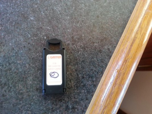
Our new to us NT has two rather old (old in electronics) circa 2005 10" Garmin 2010C chartplotters. They actually seem like pretty good chartplotters from their era. However they dont have any local charts in them. I checked the Garmin website and they dont sell charts for them anymore. I pulled the card out of it and a picture of it is below.
I also found this in amazon, but I am unsure if it is the same card or not.
http://www.amazon.com/Garmin-Bluech...d=1397599048&sr=8-1&keywords=garmin+bluechart
Can anyone advise me as to whether the card from amazon will
a)work at all.
b) just plug into the chartplotter and work
or c) need to somehow transfer the data from the amazon card to the existing card.
I am planning on buying new electronics for the boat, I am just hoping to stave it off till next year when I have more moolah.