C-Map: Worth It?

The friendliest place on the web for anyone who enjoys boating.
If you have answers, please help by responding to the unanswered posts.

angus99

Guru
Joined
Feb 19, 2012
Messages
2,742
Location
US
Vessel Name
Stella Maris
Vessel Make
Defever 44
We’re in Canada, where I learned my Furuno TZTouch2 chart-plotters won’t display their pre-loaded Canadian charts without getting an unlock code from C-Map. When I called C-Map to order the code, a very gruff guy accusingly asked if I’d called earlier (I didn’t) and demanded do you want the $300 first-time code or the $150 upgrade? I said “neither, if you’re selling them” and hung up.

It’s not about the money; it’s about rude behavior (to quote Tommy Lee Jones) and clueless customer relations.

I would like to be able to have redundant plotting options. Currently I’m using AquaMap on my iPad, which is excellent. But I need a backup . . . and I hate the idea that this expensive equipment is useless as a chart-plotter when I need it.

So, how does C-Map compare to AquaMap or other Furuno-compatible maps?

Are there other iPad-based charting apps that people like?

Thanks.
 
I’m using cmap and pretty happy with it, it was an easy sell for me since I’m running 2 tzts and time zero pro. One license covered all of them. The only thing I’ve compared them to is navionics.
 
I have Furuno Navnet vx2 running C-Map. Our boating is in British Columbia and SE Alaska. I can't speak to your question on Aquamap, nevery having used it. I did, however, have Navionics on this system and switched to C-Map because of more detailed depth information in parts of BC and Alaska. I still have Navionics on a tablet as a backup system. I can't help you on the IPad front, being all Android.
 
We’re in Canada, where I learned my Furuno TZTouch2 chart-plotters won’t display their pre-loaded Canadian charts without getting an unlock code from C-Map. When I called C-Map to order the code, a very gruff guy accusingly asked if I’d called earlier (I didn’t) and demanded do you want the $300 first-time code or the $150 upgrade? I said “neither, if you’re selling them” and hung up.


Does the TZTouch2 not handle Canadian government charts?

Our older NAVnet 3D system (used in the U.S.) supports free NOAA charts, so C-Map and Navionics something-or-other paid charts are completely optional...

-Chris
 
The problem is that Canada doesn’t provide free charts so i believe there are licensing costs. In my quest for the right electronics setup I tried several pc software solutions and a bunch of iPad ones, almost all of them included basic US charts with the program and for every one of them Canada charts were an expensive add on (except navionics on iOS).
 
Thanks for the thoughts.

Think you’re right, Arthurc. That’s what I’ve been told as well.

Is Navionics for the iPad any better than AquaMap or have I started an anchor thread here?

How about C-Map vs Navionics?
 
Thanks for the thoughts.

Think you’re right, Arthurc. That’s what I’ve been told as well.

Is Navionics for the iPad any better than AquaMap or have I started an anchor thread here?

How about C-Map vs Navionics?

Both of my sons, boat owners themselves for 5 + yrs, have ipads with navionics. They tell me the paid Navionics app has good charts for Canadian waters and they cost only a little, not near the price quoted to you by C-Map.
My Flybridge plotter runs on C-Map. I have navionics on my phone. I rate the chart detail and accuracy as equal. Neither has the detail and accuracy that I have on the CHS charts that I use on my CAPN nav program on my laptop, but I did have to spend $300 for those CHS charts.
 
I have Navionics and C-Map charts (the Platinum and 4d which are the highest spec) for Puget Sound/Salish Sea/Vancouver island area. At least in that area, the Navionics are far superior. Most of the time though, I use the NOAA and CHS raster hand drawn charts (displayed on the chartplotter) as vector charts have yet to catch up with human drawn one in readability and relevance.
 
I agree with the above and would say the navionics is slightly better than cmap in Canada (I have the highest end cmap package Furuno sold). That said both are great. I find that I use navionics to explore, look at routing and timing/etc but don’t look at them at all underway, the lack of Nmea integration is the biggest issue. There are two other chart solutions I’ve used on the iPad (iNavX and iSailor) which were ok and had nmea over udp. I’ve also started playing with the Furuno tzt app, if you have a navnet boat that’s going to be the best solution pretty soon as they appear to be investing heavily in it.
 
How about C-Map vs Navionics?
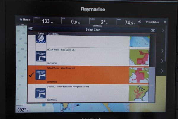
I have Lighthouse II, C-map & Navionics
on my boat and almost always use Navionics. Easy to use, auto routing, etc. Love it!

I don't however, cruise in Canada!
 

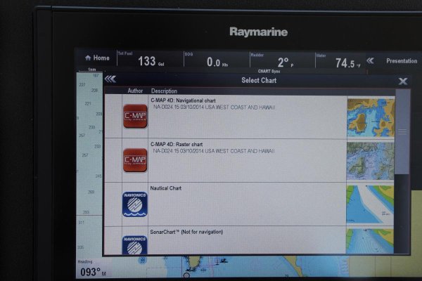
Attachments

  • IMG_1549.jpg
    IMG_1549.jpg
    97.4 KB · Views: 112
  • IMG_1550.jpg
    IMG_1550.jpg
    83.4 KB · Views: 111
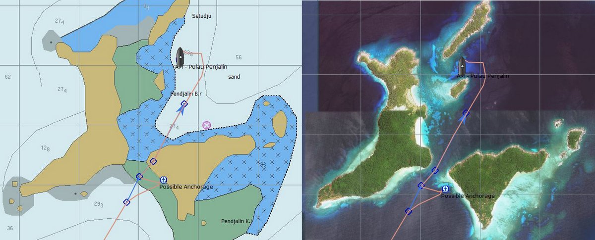
Commercial grade CM93 charts and open cpn running through a laptop.
Can't complain about the price and the whole world is at my fingertips.
Add in all the freely available satellite imagery, overlays and other cruisers updated information allowing you to do the below and it no contest.

AnambasPenjalinChartAndKAP.jpg


Dedicated chart plotter with cmap is my secondary system.
Navionics is my 3rd system, prefer not to use it due to well documented inaccuracy.
 
Last edited:
Commercial grade CM93 charts and open cpn running through a laptop.
Can't complain about the price and the whole world is at my fingertips.
Add in all the freely available satellite imagery, overlays and other cruisers updated information allowing you to do the below and it no contest.

AnambasPenjalinChartAndKAP.jpg


Dedicated chart plotter with cmap is my secondary system.
Navionics is my 3rd system, prefer not to use it due to well documented inaccuracy.


Where are the land details on those charts? My general complaint with ENCs: no land details, contours, features, etc. That’s why I always toggle back and forth between rasters and ENCs I’m Coastal Explorer.

Jim
 
I'm not driving my boat on land so have little to no interest of land details.

They may be there and I am pretty sure they are as they probably are on my dedicated cmap plotter but I have what i consider irrelevant and distracting info toggled off.
 
I think between C-Map and Navionics, the specific area is important. One better than the other, but it depends. Navionics was not very good in the Bahamas. C-Map not very good in the Salish Sea.

Human drawn raster charts, better than either for most use, even if less detailed. The reason is the human has emphasized the hazards. Small (but very important) rocks will still be drawn on the large area chart.

Raymarine in their LHII and LHIII have done a great service in allowing all options. You can put a split screen with Navionics/C-Map on one side and NOAA/CHS on the other which I have done on tight passages. The most interesting areas being where they disagree.
 
I use CE running C-Map as primary. Navionics on 12" tablet as secondary. In close coastal cruising, like in complicated areas, much like the Pac NW, I always use both.

In North America so far, I find them about equal. I've never seen a significant hazard on one, but not the other, though sometimes the way it's depicted is better on one, usually Navionics.

I settled on C-Map as my main chart because I found them to be the most cost effective for large areas of global coverage. I think this is still true for combined USA and Canada.
 
Raymarine in their LHII and LHIII have done a great service in allowing all options. You can put a split screen with Navionics/C-Map on one side and NOAA/CHS on the other which I have done on tight passages..

I agree and that's the way I use them. :blush:
 
Some versions of C-Map have integrated Active Captain data. Could be a plus for some folks.

Ken
 
So I spent $54 yesterday on a navionics+ subscription just for the auto routing feature on my cell phone.


So far it wont auto route using the ICW, it goes out the nearest pass and then via open water then back in the nearest pass to the destination you choose (in the ICW).


Now I wonder if Cmap does this too.
 
Have you checked your minimum/safe depth settings, etc?
 
So I spent $54 yesterday on a navionics+ subscription just for the auto routing feature on my cell phone.


So far it wont auto route using the ICW, it goes out the nearest pass and then via open water then back in the nearest pass to the destination you choose (in the ICW).


Now I wonder if Cmap does this too.

I got the 15-day free trial for Navionix for the iPad. When I tried to set up a 50-mile auto-route for the Small Craft Channel in Georgian Bay, it plotted about half of it and gave up, running the rest in a straight line overland. The error message was “too many points.” I’m wondering if the trial is limited in that way or if that level of complexity is just beyond auto-routing. (It could also be operator error.)
 
I got the 15-day free trial for Navionix for the iPad. When I tried to set up a 50-mile auto-route for the Small Craft Channel in Georgian Bay, it plotted about half of it and gave up, running the rest in a straight line overland. The error message was “too many points.” I’m wondering if the trial is limited in that way or if that level of complexity is just beyond auto-routing. (It could also be operator error.)

That's a lot of waypoints. Probably beyond design spec.

Some parts of that channel require a white knuckle on the helm and dead slow speed in our boats. I think I'd start with a simpler test case :)

Edit: I was thinking of having auto routing drive the autopilot. But why else would you try to set it up as a route? I mean you have the routes already in the plotter. Just curious.
 
Last edited:
That's a lot of waypoints. Probably beyond design spec.

Some parts of that channel require a white knuckle on the helm and dead slow speed in our boats. I think I'd start with a simpler test case :)

Edit: I was thinking of having auto routing drive the autopilot. But why else would you try to set it up as a route? I mean you have the routes already in the plotter. Just curious.

I just did it as a test case; the route was already drawn on the AquaMap and paper charts I was using. Think you’re right; it just choked on the volume of data.
 
I got the 15-day free trial for Navionix for the iPad. When I tried to set up a 50-mile auto-route for the Small Craft Channel in Georgian Bay, it plotted about half of it and gave up, running the rest in a straight line overland. The error message was “too many points.” I’m wondering if the trial is limited in that way or if that level of complexity is just beyond auto-routing. (It could also be operator error.)


the auto route is limited to 200 or 250 waypoints.


Here's my problem with it. I plan to run from Tx. to FL via the gulf ICW, but I cant get the router to stay in the intercoastal. Its really weird.
11128-albums589-picture4736.jpg
 
I am using Navionics auto routing feature to plan my daily runs and it is a feature I really like. If the route is very complex I may add some waypoint on the way to get it follow the path I want but I find this a ally nice feature.

L
 
I am using Navionics auto routing feature to plan my daily runs and it is a feature I really like. If the route is very complex I may add some waypoint on the way to get it follow the path I want but I find this a ally nice feature.

L
Yep I agree. I love the autotoute feature. It's like Google maps that tells you how to get somewhere.
 
As an old time steam navigation skipper I tried Navionics and whilst I readily accept modern technology I find it useful as a back up but not the b all and end all as lots of the 'updates' are not really accurate on the ground.
I found that the human brain doesn't retain the detail and orientation when using digital systems as opposed to a chart on which you have plotted the course and in doing so imprinted it on the subconscious memory.
Maybe I'm just an old fashioned fart but hey were all different and use whatever suits us to get the job done.
 
well no fix for navionics auto route. Bummer.


[FONT=Arial,Sans-Serif]Navionics appreciates the time taken to provide us with your input. We have investigated your report and concluded that at this time we are not able to perform a prompt update. This case has now been handed over to our Sourcing Department in order to obtain the necessary validated source information. If this data becomes available and an update is released we will contact you with instructions to obtain the update. Please do not hesitate to contact us if you have any questions.
[/FONT][FONT=Arial,Sans-Serif] [/FONT]


Just saw raymarines lighthouse 3.4 now has autorouting. So maybe there's hope yet.
 
Last edited:
You'd be crazy to trust auto routing IMHO.
 

Latest posts

Back
Top Bottom