Alternative to Coastal Explorer

The friendliest place on the web for anyone who enjoys boating.
If you have answers, please help by responding to the unanswered posts.

ctjstr

Senior Member
Joined
Nov 24, 2017
Messages
399
Location
United States
Vessel Name
"Convergence"
Vessel Make
Camano Troll
First, let me apologize in advance. I'm sure this has been asked and discussed, but I'm one step up from complete ignorance when it comes to searching something out. But I tried...

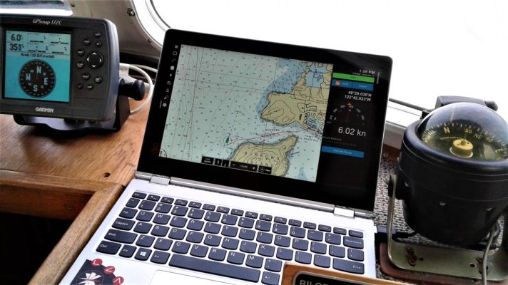
I've used Coastal Explorer on my last boat for several years. I sold my last version and the laptop it was on with the boat. (Yeah..I know...don't say it.) I really am used to, and like, pc based nav software. Use it in addition to my chart plotter.

On the new (to me) boat, I'm just about to purchase a new copy of CE, but thought I'd take a shot to see if there is any really cool new stuff there that leaves CE in the dirt. Please keep in mind that I am stump stupid when it comes to anything electronic. It was a monumental task for me to figure out how to make my original set up work, so I'm not about to buy anything new unless its EASY....REAL EASY to figure out. I"m perfectly ok getting another CE, but just in case...

AGain, my apologies for what I'm sure is a common question. Thanks for any help you can provide.

toni
 
A little over a year ago we purchased a boat that had CE on a Big Bay laptop. We did a software license transfer, and later purchased the upgrade to the latest version of CE. Could not be happier. The folks at CE are easy to work with. We never have any problem getting someone on the phone, and that means a lot to me. Their terms allow for 3 licenses, so I have added a tablet for back-up, and still have 1 license left to use no another device.
 

Attachments

  • coastal explorer.jpg
    coastal explorer.jpg
    125.7 KB · Views: 112
I can steer you to a lot of nav software that is cheaper. I run both Navionics and SEAiq on my iPad. Neither of them are as good as CE.

I bought my copy of CE the first year they showed up at the Seattle boat show and I am about to purchase my 3rd upgrade(no brainer at $99).

I prefer using my raymarine chart plotter for most my navigating, however the CE is exceptional at handeling crossing vectors with commercial traffic. I can usually tell 30 minutes out if I have a crossing issue.

On my previous boat I even had CE set to run the autopilot.

At the time I bought CE I had been using a borrowed laptop with nobeltec. I like CE much better.
 
This brings up a good point for me as well. I inherited nobletec on mine. Haven't played with it much yet but gets me to where I'm going. I've been using laptop navigation off roading and city as well since the late nineties with fugawi. Read a lot about CE and curious as to a reason to change. I hate change, unless its a real benefit. Is the difference simply interface related or is there something more that ive missed?
 
CE it is. You like it which is 90% of the battle.
not sure anything is better.

I have it displaying on 24" LCD monitors and it's wonderful.
 
So this has piqued my interest.

I was looking to use Navionics (when I eventually get a boat!); but looking at the coastal explorer website, I am intrigued.

Might someone be able to explain the primary differences between Navioncs and Coastal Explorer and why one might be "better" than the other. OR is it just what you like and are used to?

Thanks.

Tim
 
I have only used navionics on my iPad a computer based version might be different. Paid $54 for navionics and CE is now in the $400 range.

Both do chart plotting and routes.
CE does heading vectors for boat and AIS targets
Both do tracks, routes, wpts
CE runs autopilot.
CE does AIS not sure about navionics
CE does active captain
 
I have had CE for the past two summers and found it very useful here in the PNW with currents and tides. I also have navionics on my MFDs. CE (even the new version) does not have auto routing. Crusty used navinics on an iPad and there were differences. The other feature I like if the Canadian charts CE. Costs $100 a year but well worth it.
 
thanks for all the comments. Think I'll stick with CE. I"m used to it and like it, so why change.
toni
 
I have 3 systems right now running kinda in parallel.
1) CE on a computer with full integration to Furuno gear
2) Navionics and iSailor on iPad using Rosepoint NEMO for NMEA data
3) Full Furuno NavNet setup with TZT12, and very soon TimeZero Pro software

Overall the CE system is great but has a few limitations, the integration with AutoPilot aren't as rich, also a total lack of radar overlay, etc and no AIS integration beyond just display of targets.

The iPad setup is nice but can be a bit finicky. wouldn't use as my primary system.

The NavNet and TZ solution is hands down the best, BUT... its super expensive and requires all Furuno gear, that said if you have all Furuno gear its incredibly slick, easy to use and tons of valuable features and routing ability I need to learn.

Long term I think I will use TimeZero as my primary, with CE as a backup should something fail. I have yet to test out the iPad app for TZ but hear its good.

For your past experience, I think CE sounds like the right choice and is a great product. The rose point folks are awesome.

AC
 
Last edited:
This is what I have used and like:

Windows PC
Coastal Explorer- Full featured, reliable, $$
OpenCpn- Full featured, reliable, NOAA charts, no$
Both require an external GPS puck and for some reason OpenCpn doesn't work well with the most popular one.

iPad
SEAiq- Limited features, NOAA charts, little$

Android
MxMariner- Ok features, NOAA charts, no$

I have used both Coastal Explorer and MxMariner to navigate for hundreds of miles along the East Coat, no problems. I use MxMariner while I navigate with the boat's chart plotter to look forward and plan the route.

David
 
Last edited:
About OpenCPN, is there anybody using it in Canada and if yes which chart are you using?

L
 
I have started using OpenCPN with a GlobalSat BU-353S4 USB GPS Receiver. About 25 bucks from Amazon.

GPS hooks right up, sees lots of satellites fast and OpenCPN sees it right away.

Free NOAA Chart download, ENC and raster.

It took a bit of learning but is really a nice program.

I run it on a Windows 10 ASUS Zenbook.
 
About OpenCPN, is there anybody using it in Canada and if yes which chart are you using?

L

Used OpenCPN now for serveral years. It works well, no real problems. I purchase the Canadian Hydrograhic Services raster charts. Also works with NOOA vector charts.
 
I have TZ Navigator and OpenCPN on a backup computer. TZ is better on older, slower computers as far as speed in zooming, etc. Easier to add autopilot, sounders, but OpenCPN not that much harder. As far as normal navigation, I find them about the same. I bought TZ when Furuno was selling it and all Furuno products are easy to connect.
TZ requires predatory (expensive oem) charts. OpenCPN runs free to download US, NZ and other free charts from enlightened nations.
 
Used OpenCPN now for serveral years. It works well, no real problems. I purchase the Canadian Hydrograhic Services raster charts. Also works with NOOA vector charts.


How much are the CHS charts for OpenCPN? The CHS raster charts for CE are $99 US. The CHS vector charts are another $99.
 
How much are the CHS charts for OpenCPN? The CHS raster charts for CE are $99 US. The CHS vector charts are another $99.

The charts that OpenCPN uses are the official CHS charts: $CDN 174.95 per collection for the RNC (raster navigational charts); four collections cover the west coast.

The ENC (electronic navigational charts) are $CDN 599.95 per collection, with two collections covering the west coast.

Rose Point have a sweet deal with those $99 collections; the savings on Canadian charts alone pays for the software.

By the way, Milltech Marine are currently running a Seattle Boat Show special pricing for CE: $299.00. I think it's going through the end of the month...not positive about that though....
 
The charts that OpenCPN uses are the official CHS charts: $CDN 174.95 per collection for the RNC (raster navigational charts); four collections cover the west coast.


The ENC (electronic navigational charts) are $CDN 599.95 per collection, with two collections covering the west coast.


Rose Point have a sweet deal with those $99 collections; the savings on Canadian charts alone pays for the software.


By the way, Milltech Marine are currently running a Seattle Boat Show special pricing for CE: $299.00. I think it's going through the end of the month...not positive about that though....


...that’s $99 for CHS raster charts for all 3 areas of the BC coast for CE and the same for the vector charts. It is a great deal.
 
...that’s $99 for CHS raster charts for all 3 areas of the BC coast for CE and the same for the vector charts. It is a great deal.

:dance: It certainly is. I am unaware of any other vendor discounting the price of CHS charts. The price is for a 1 year subscription and includes updates for that period. Like those purchased directly from CHS the charts will continue to work after the subscription period.
I wonder if the charts have been modified to only work with CE
 
Back
Top Bottom