East to West Coast Range Requirements

The friendliest place on the web for anyone who enjoys boating.
If you have answers, please help by responding to the unanswered posts.

mattinri

Veteran Member
Joined
Mar 2, 2014
Messages
26
Location
USA
Vessel Name
First Light
Vessel Make
Nordhavn 46
Thinking about the retirement boat and weighing the benefits of a displacement trawler vs. a semi-displacement Downeast type hull. I'd like to be able to transit the Panama Canal and up the West Coast. What sort of range would be required for a trip like this to hit ports with good shelter and reliable diesel fuel?
 
Minimum 800 miles IMHO. That way you can do an easy 3 day trip without looking for a fuel fill up. A hard 3 day run should get you well ahead of any bad weather that could be brewing in hurricane country
 
There was just a TF member Larry M who just completed the trip.

He indicated that there were NO places that required a fuel endurance (on the route he took) of over 250NM.

I am reading a series of books by Melanie Wood and her husband John who have made the eastern portion of that trip and are right now in Rotan Honduras, in their 38' Bayliner.

I have not been able to find any data that actually indicates that you need a range of over 300NM to make that journey, and I've spent considerable time trying.

Heck, even if you did not island hop, Key west to Isla Mujeres Mexico is only 340NM.

If Melanie and John could do it in their Bayliner, I could do it in mine, and you could do it in almost any boat you choose. So, buy something you like, and something that will not delay your retirement.
 
Last edited:
The distance problem is not on the East side, but the west side. While Panama and Costa Rica have plenty of place to pull in and find fuels, services etc., the rest of the West Coast of Central America is pretty sketchy all the way up to the Central coast of Mexico. El Salvador only has two ports where cruisers may be welcomes at all. Nicaragua is a definite avoid-no place to stop, no reason to stop. Honduras has no place to stop. Guatamala is sketchy with very, very little on the Pacific Coast. With the drug issues in southern Mexico, Chiapas, very dicey area. You may want to get up as far as Acapulco before heading in in Mexico.

Those are some pretty long runs (I haven't actually looked at the exact distances), you need to at least have the capability to make them comfortably if the need is there.

I have friends who run the west coast along Mexico to Panama, and they report only El Salvador as sketchy (due to gang members deported from the US) Guatemala is quite cruiser friendly. I'm led to believe that it's the entire Caribbean side south of Guatemala to Colon Panama that has pirate/crime issues which you want to bypass. Yacht traffic is fairly heavy along the Yucatan, Belize, into the Rio Dulce, but the coast of Honduras and Nicaragua is very long with few ports, and questionable safety (the tourist islands of Honduras are dicey vs Belize or Guatemala IMHO) Even my German and Latin friends who live in Costa Rica circumvent that stretch. There's also islands and reefs pretty far offshore making night runs tricky. Too bad as from the air one see's hundreds of miles of virgin coastline, rivers inland, that would make for great cruising along that coast, but that's why its also such a great place for pirates. Non US citizens will use Cuba to jump off of, or go direct to/from Panama. All Americans I know have made either straight shots from/to Jamaica or have Island hopped all the way down the Island chains to Aruba, then go to Cartagena- THEN to Panama. Fuel and Civilization the whole way.
Word is the Pacific side is much better in comparison. The reason? Blame cotton and Sugarcane.
I've always been curious about those Colombian owned islands off the Nicaragua coast named San Andres and Providencia but haven't ever met anybody who can tell me anything about them, much less have been there. Anybody here been there? They're certainly geographically poised as a good stepping stone to bypass that coast. I mean I don't even see ships here in Miami with those names on them, or read/hear any news from them. All the Colombians I know live on the mainland, and have never even heard of these Islands. Plus all the smugglers I've known tell me they've been using ships and containers for 20 something years now, so I'm not getting any navigation feedback from them anymore. :>) I'm curious about those Islands.
 
Last edited:
Thinking about the retirement boat and weighing the benefits of a displacement trawler vs. a semi-displacement Downeast type hull. I'd like to be able to transit the Panama Canal and up the West Coast. What sort of range would be required for a trip like this to hit ports with good shelter and reliable diesel fuel?

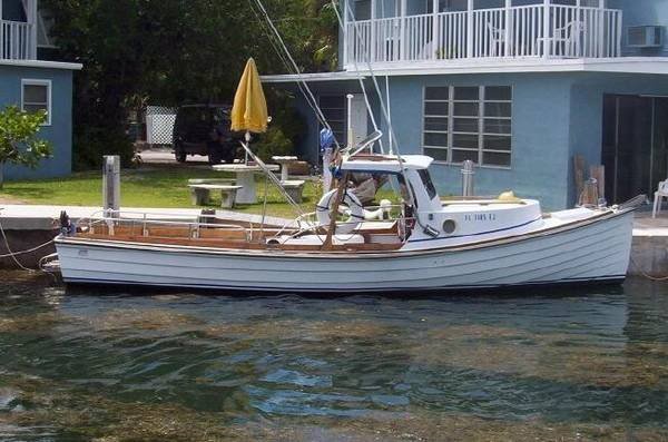
We did the reverse trip, the PNW to Florida (via Colombia and Blanquilla, Venezuela). In 16,000 miles, we had 24 legs that were over 100 miles. 12 legs that were over 150 miles, with our longest passage 250 miles.

Anchorages are many but reliable fuel? I would read Capt Pat Raines book which is pretty current.

Cruising Ports: the Central American Route 6.5: Capt. Pat Rains, GPS charts, color photos: 9780963847027: Amazon.com: Books
 
Here's my read on some the areas previously mentioned. Granted it's a little dated (2011).

El Salvador has 2 cruiser friendly marinas/stops at Bahia Del Sol, Estero de Jaltepeque and Barillas Marina, Bahia de Jiguilisco. Tamarindo, Golfo de Fonseca is a good anchorage.

Nicaragua, Bahia San Juan Del Sur is the southernmost port of entry/exit. All the officials are right there and it's a good provisioning stop as it is a bit of a tourist town. And if you're a surfer, even better and don't forget to stock up on Flor de Cana 7 Year Old Grand Reserve rum. Marina Puesta del Sol, just south of the Golfo de Fonseca is a good stop. All the officials come to the marina for check in or out.

Honduras, Amapala, El Tigre Island. It was like stopping back in time.

Guatemala, has a marina at Puerto Quetzal. It can have a good surge and is expensive. People leave their boats there land travel. El Salvador worked better for us to leave the boat.

Chiapas has a new marina with a 60 ton travel lift and some of the cheapest fuel (no dock fees) in Mexico. We were there before it opened and spent 2 weeks at anchor. It is also the best staging area to cross the Gulf of Tehuantepec. Enrique who had managed the marina at Huatulco for many years before moving to Chiapas is the best source of weather for the Gulf.

Huatulco (Bahias de Huatulco), A good marina in a resort town.

The longest leg from Panama to Acapulco is under 250 miles and a lot shorter ones. We anchored at 40+ different locations over a 5.5 month period. There's some great people and you can even visit some locations that are named after some famous CIA people. :)
 
Thanks for the info. My current boat is a 35' Duffy Downeast cruiser. Say 200 gallons useable fuel and 1.2 nm per gallon at 13 kts or 3.5 nmpg at 7 kts. Would you consider a boat like this up to the trip?
 
Here's my read on some the areas previously mentioned. Granted it's a little dated (2011).


Honduras, Amapala, El Tigre Island. It was like stepping back in time
)

Sign me up! Thanks for the excellent reports. Anybody here run the stretch along the Caribbean coast between Panama and Roatan? It's an area much discussed with friends and clients for 30 years, but no first hand reports.
 
My GB42 made that trip from Miami to Marina Del Rey, CA. My boat holds 550 gallons and that gives me a comfortable range of 1100 nautical miles. The benefit of more fuel is safety and finding a good reliable clean fuel stop.

One can always tie 55 gal plastic drums in the cockpit or buy a fuel bladder for extra fuel. I've seen that done many times.
 
Thanks for the info. My current boat is a 35' Duffy Downeast cruiser. Say 200 gallons useable fuel and 1.2 nm per gallon at 13 kts or 3.5 nmpg at 7 kts. Would you consider a boat like this up to the trip?

Absolutely, your boat would be fine. The big issue isn't the size but paying attention to the seasons and weather. We sat waiting out weather for the Gulf of Tehuantepec crossing and then again for the Papagayos. The winds can blow!

Tehuantepecer - Wikipedia, the free encyclopedia
 
Great read- thanks! Although it reinforced my thoughts for a faster boat, and was really surprised they ended up in St. Petersburg. Thought for sure Miami would had been the logical choice to keep a foot in that Latin culture they so enjoyed and be able to regularly speak the language they learned. It's just so "cracker" up there say's the Anglo born in Texas, and raised in Alabama and Georgia. I'm spoiled here. I can get in my car and go visit several different countries within a 20 mile radius INCLUDING redneck world (out in the Glades next to the Indian reservation) and be back to clear water, 2 International Airports, a Cruise Ship Terminal, and incredible shopping at Bal Harbour shoppes. You ain't got that up yonder in Pinellas County.
 
Last edited:
There was just a TF member Larry M who just completed the trip.

I have not been able to find any data that actually indicates that you need a range of over 300NM to make that journey, and I've spent considerable time trying. .

Larry's Hobo has a range of 2000 miles or so, easy for him to have no concern about range. Better yet, smart of him to have a vessel that can safely handle Mexico's west coast winds, currents and iffy fuel stops.

The most common run is San Diego to Cabo San Lucas or La Paz. A look at the MVs anchored and berthed that do this routinely will find few if any that have a range with 1/3 remaining of less than 500 miles.

Once around the tip of Baja and headed into the Gulf, Mulege and Loretta are great stops. Venturing further south towards Costa Rica requires some forward thinking and planning regarding weather windows and security. To do this in a vessel that requires daily fuel stops is not my cup of tea.
 
Thanks for the info. My current boat is a 35' Duffy Downeast cruiser. Say 200 gallons useable fuel and 1.2 nm per gallon at 13 kts or 3.5 nmpg at 7 kts. Would you consider a boat like this up to the trip?

The boat probably is...but are you? It's a long trip to do it all at once. If you pace yourself and stay in spots long enough (and weather may help you there) to stretch out so to speak..maybe it will be a lot more fun than grueling.

I could see doing it in a 35 downeaster...some charter fishing boats make the trip every year and they aren't any more seaworthy than yours...but I would only do it if I really was going to drag my feet and make sure all the stops had what I needed to be comfortable in replenishing and entertainment. Plus had the time to wait out weather for the longer runs.

I can't remember the make right now...but that one guy did take his 28 (I think) fiberglass downeaster across the Atlantic quite a few years back (guessing he had a fuel supply ship...maybe not).
 
Larry's Hobo has a range of 2000 miles or so, easy for him to have no concern about range. Better yet, smart of him to have a vessel that can safely handle Mexico's west coast winds, currents and iffy fuel stops.

The most common run is San Diego to Cabo San Lucas or La Paz. A look at the MVs anchored and berthed that do this routinely will find few if any that have a range with 1/3 remaining of less than 500 miles.

Once around the tip of Baja and headed into the Gulf, Mulege and Loretta are great stops. Venturing further south towards Costa Rica requires some forward thinking and planning regarding weather windows and security. To do this in a vessel that requires daily fuel stops is not my cup of tea.

Yes, having some range is nice, but it is not necessary to make this trip.

You have over a period of time, in many threads advocated for the capacity of making long distance trips offshore, creating multi day 24X7 legs. I respect that. Your boat has the capability.

While my boat has the capability to safely make travels in excess of what I consider the safe 72 hour weather forecast window, I have chosen on my long distance journeys not to do that. Instead I have chosen to hop from place to place during the day. To me thats more fun. To me, voyaging isn't looking at blue water under my keel, its looking at the towns along the way. Personally I could go out and make a big circle for three straight days and see the same blue water under my keel, but that would not be much fun, to me.

So, while our cruising styles might be different, and I again respect that, we need to recognize that they are both valid methods of cruising along any coast line from Seward Alaska, through the canal and as far as Nova Scotia.

While my boat has a safe range of 600+ miles, I would advocate that this kind of range is not necessary to make any coastal journey in North America.

Again, and I keep saying this. Its not about the boat. Its about us, and our ability to get the time to make the trip.
 
Last edited:
Yes, having some range is nice, but it is not necessary to make this trip. I have chosen on my long distance journeys not to do that. Instead I have chosen to hop from place to place during the day. To me thats more fun. .

The West coast of Mexico, today, does not always allow a leisurely tour with comfortable rest stops every night. With great weather and a good heads up on any next port perils, absolutely take a slow stroll. But having the ability to push forward for a few straight days to avoid shore issues and beat the weather is, for many, the preferred way to blue water cruise.

BTW, San Diego to Cabo is pushing 900 miles with, in some instances, decent stops several hundred miles apart.
 
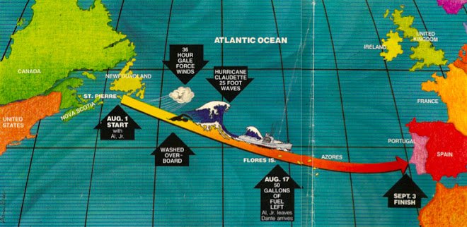
Just remembered....a 26' Groverbuilt boat crossed the Atlantic


Groverbuilt Boats


About Al Grover

In 1985, Al Grover and his two sons were the first to successfully cross the North Atlantic in an outboard powered boat. The crossing took them from Newfoundland to Portugal, in a 26' Groverbuilt boat custom outfitted with two 65 h.p. Evinrudes and one 9.9 Evinrude. Al Jr. accompanied him from Newfoundland to the Azores, and Dante, from the Azores to Portugal.
 

Attachments

  • grover.jpg
    grover.jpg
    44.2 KB · Views: 1,759
  • mapoftransatlatlantic.jpg
    mapoftransatlatlantic.jpg
    102.3 KB · Views: 143
Last edited:
BTW, San Diego to Cabo is pushing 900 miles with, in some instances, decent stops several hundred miles apart.

For you San Diego to Cabo is 900 miles. Lots of blue water.

I'm planning that trip right now. For me San Diego to Cabo will be... (and this is of course not finalized yet), but fuel stops are...

Ensenada
Turtle Bay
Magdelna Bay

Yes, you can cruise this offshore, or you can hop around and see the sights. Each to his own methods.

You can cruise the whole way and fill up in Cabo, Its great that you have the range. I do not, so I'll buy fuel along the way.

You will certainly pay less for fuel since you can pick and choose, but we'll still both be sipping margaritas at the same marinas in the end :)
 
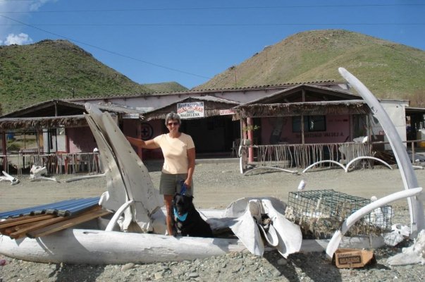
The first time from San Diego to Cabo, we did it in 2 stops: Turtle Bay and Santa Maria. The last time, we wanted to explore the coast. We stopped 9 times over a 32 day period with the longest leg from Bahia Asuncion, where we traded yellow-fin tuna for lobster and Mag May (220 miles). :thumb:

Kevin: Turtle Bay and Mag Bay are both good fuel stops. Turtle Bay is a
great dusty Mexican town. Mag Bay if you hit it right, the whales are not to be believed.

For us, the stops/people are why we cruise. :)

BTW, San Diego to Cabo is just under 800 miles. :hide:
 

Attachments

  • Pictures 134.jpg
    Pictures 134.jpg
    114.6 KB · Views: 89
  • MADAGAS 20.jpg
    MADAGAS 20.jpg
    128.5 KB · Views: 103
Last edited:
The first time from San Diego to Cabo, we did it in 2 stops: Turtle Bay and Santa Maria. The last time, we wanted to explore the coast. We stopped 9 times over a 32 day period with the longest leg from Bahia Asuncion, where we traded yellow-fin tuna for lobster and Mag May (220 miles). :thumb:

Kevin: Turtle Bay and Mag Bay are both good fuel stops. Turtle Bay is a
great dusty Mexican town. Mag Bay if you hit it right, the whales are not to be believed.

For us, the stops/people are why we cruise. :)

BTW, San Diego to Cabo is just under 800 miles. :hide:

Thanks for the insight Larry!
 
The first time from San Diego to Cabo, we did it in 2 stops: Turtle Bay and Santa Maria. The last time, we wanted to explore the coast. We stopped 9 times over a 32 day period with the longest leg from Bahia Asuncion, where we traded yellow-fin tuna for lobster and Mag May (220 miles). :thumb:

Kevin: Turtle Bay and Mag Bay are both good fuel stops. Turtle Bay is a
great dusty Mexican town. Mag Bay if you hit it right, the whales are not to be believed.

For us, the stops/people are why we cruise. :)

BTW, San Diego to Cabo is just under 800 miles. :hide:

Spot on Larry. Turtle Bay is like a world unto itself. Glad to hear from someone who has done that route real cruiser style. I did it once way too many years ago as crew on a sail boat intent on getting to Cabo ASAP. Other than Turtle, never stopped to smell the roses, but it wasn't my decision to make by a long shot, gonna have to go back sometime.
 
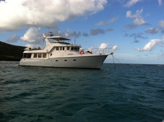
In the times I have done the Baja trip I had done it in One stop.. Mag Bay for one nights rest.. and last year on the Nordhavn with stops in Ensenada, Isla San Beneto, Turtle bay then on to San Jose Del Cabo to Bahia Muertes then to LaPaz.
We didnt stop for fuel after Ensenada which in my opinion is the way to go if at all possible. Fuel in the smaller towns in Baja is still suspect.. and when you see the "fuel dock" at Turtle Bay first hand anyone should question the quality of fuel just by looking at the operation.
When I take my Ocean Alexander to Mexico my plan is to fuel in Ensenada and then in one of the Cabo's... preferably San Jose.

I just spent a couple days last week while in the BVI's dealing with a bad load of fuel that was taken aboard in the Dominican Republic... luckily it was gas in the tender and not in the big boat!... still it was a mess and cost a high pressure fuel pump to the tune of $ 375.00... and I had do dispose of 10 gallons of fuel that had a boat load of water and crap in it.

It is 700 miles between Ensenada and Cabo San Lucas plus reserves to make it safe so your boat needs to be able to do a minimum of 800 miles.

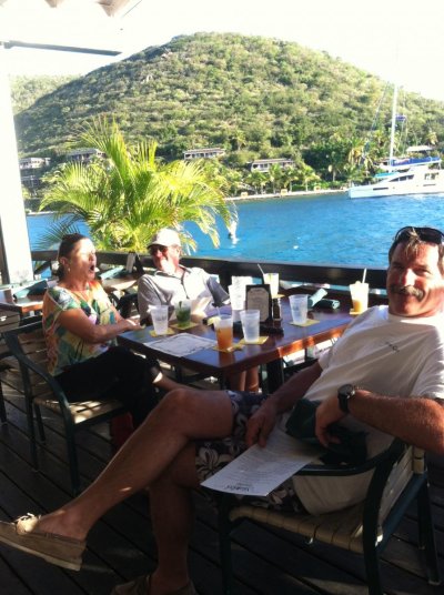
I have added a pic of the passagemaker that did the above mentioned trip and of your truly doing what I do best.... spinning yarns and telling war stories in the bar at Saba Rock across from the Bitter End Yacht Club

HOLLYWOOD
 

Attachments

  • photo (2).jpg
    photo (2).jpg
    121.1 KB · Views: 97
  • photo(2).jpg
    photo(2).jpg
    166.4 KB · Views: 105
Larry, post #22 bottom picture, was that taken in Mexico?
 
Larry, post #22 bottom picture, was that taken in Mexico?

No it's not. The first one is from Mag Bay as is this one and the 2nd one is from Turtle Bay.
 

Attachments

  • Pictures 092.jpg
    Pictures 092.jpg
    119.7 KB · Views: 97
  • Pictures 042a.jpg
    Pictures 042a.jpg
    98.7 KB · Views: 82
Love that 57! :smitten:
Me too!.. favorite boat so far... fast easy on fuel.. great engine room.. very well built.

The Admiral finally "got it" on this last trip why I have been pushing a Nordhavn..

Planning more time aboard ASAP

HOLLYWOOD
 
Me too!.. favorite boat so far... fast easy on fuel.. great engine room.. very well built. The Admiral finally "got it" on this last trip why I have been pushing a Nordhavn.. Planning more time aboard ASAP HOLLYWOOD
:thumb::thumb:
 

Latest posts

Back
Top Bottom