Visualizing bottom contours

The friendliest place on the web for anyone who enjoys boating.
If you have answers, please help by responding to the unanswered posts.

cruiserChick

Senior Member
Joined
Jan 20, 2016
Messages
104
Location
United States
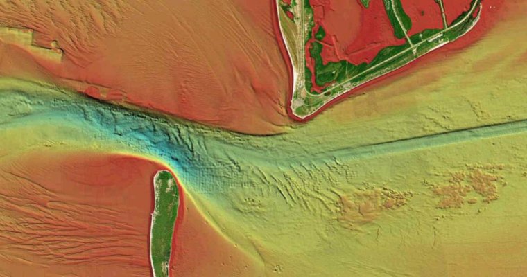
Has anyone else ever experienced that moment when you're going in an inlet, the waves and wind have picked up and all of a sudden you need to be able to just glance at the chartplotter and REALLY quickly see the bottom contours?

Or been out looking for a good place to fish or dive?

Navionics just released Relief Shading. It makes it really easy to see bottom contours. Check it out here:
https://bit.ly/3e9cHn6
 

Attachments

  • ReliefShading-Relief_Shading_Cartography.jpg
    ReliefShading-Relief_Shading_Cartography.jpg
    80 KB · Views: 25
Assuming the data is current....


99% of the time you are better off lookig at the channel markers or trying to locate them to stay where you belong.


I guess if you are an expedition type...it could come in handy if you trust the data over having nothing.


If you can overlay navaids on it, different story.


For sports I can see some liking it so they can match it to depth sounder or sidescan readings.
 
Last edited:

Latest posts

Back
Top Bottom