paper charts

The friendliest place on the web for anyone who enjoys boating.
If you have answers, please help by responding to the unanswered posts.
I know several people who drive around 1,000 ft. long ships for a living. They don't carry paper charts on their personal boats.
 
Also, using an electronic calculator to do your sight reduction is kinda cheating, isn't it? :)

Actually it is. But that's how we were trained. Guess that's the only remaining electronic when we face it. Now, we did have to actually do it manually in class. Oh my, can you imagine the nightmare of all those who hadn't done any math for years. Frankly, I felt like half the class if it came to it would just follow the sun with the expectation they'd eventually hit land somewhere, much like the explorers did.
 
I know several people who drive around 1,000 ft. long ships for a living. They don't carry paper charts on their personal boats.

There are a lot of people who do a lot of things on their boats, doesn't make it right.
 
There are a lot of people who do a lot of things on their boats, doesn't make it right.

Not so much right or wrong, just a function of what some pro mariners do.

....and it certainly doesn't make it wrong.

the carrying of paper or not is not right or wrong, just statements saying that electronic charts aren't as good or GPS loss is an issue is incorrect....and that's all I want to keep straight.
 
Last edited:
There are a lot of people who do a lot of things on their boats, doesn't make it right.

Not right or wrong, but the best there is in modern times, just as its better to have A/C on big boats. Imagine a current shiping company insisting on paper charts instead of modern electronics.
 
There's a big difference whether we are talking large commercial ships vs. a small recreational boat with a single helm and single GPS. OK sure, I could pull out my cell phone and assuming I have a signal it can be an electronic backup. But I could argue whether a 5" phone screen is superior to a D size paper chart especially in unfamiliar waters.
 
There's a big difference whether we are talking large commercial ships vs. a small recreational boat with a single helm and single GPS. OK sure, I could pull out my cell phone and assuming I have a signal it can be an electronic backup. But I could argue whether a 5" phone screen is superior to a D size paper chart especially in unfamiliar waters.

Have it on a pad or laptop with GPS built in or USB puck.... you just don't know what is available and how easy/reliable this type nav is.

You can download charts...not dependent on wifi or cell service. You might have a phone with a real GPS chip in it so service is not required.

Some of us have been using it as our primary nav for a decade or more.

I have this stuff on my phone and tablet so even when talking to fellow boaters well away from a marina, I show them on my phone good anchorages or marina approaches or shoaling areas without knocking over everyone's drinks rolling out that D sized chart. :D
 
Last edited:
There's a big difference whether we are talking large commercial ships vs. a small recreational boat with a single helm and single GPS. OK sure, I could pull out my cell phone and assuming I have a signal it can be an electronic backup. But I could argue whether a 5" phone screen is superior to a D size paper chart especially in unfamiliar waters.

"Big boats".....yes.
 
OK mybe I'm too out of date. On my boat, I have a single Garmin GPS. I have a cell phone, no tablet, sometimes a laptop that needs wifi by cell or other source. So I still carry paper charts. And in my particular example on my new to me boat after not boating for many years, when my Garmin died in unfamiliar waters, the quickest and best solution for me at the time was to pull out a chart book. Took less than 30 secs to find my position on the chart and navigate to our intended destination. If I had experience with using phone apps, maybe that would have worked but even though I had them on my phone, I had no real experience using them. Keep in mind, I'm a recreational boater on a rather small boat, so I don't travel thousands of miles a year like many of you do. For the near future at least, there will still be chart books with me on my boat.
 
OK mybe I'm too out of date. On my boat, I have a single Garmin GPS. I have a cell phone, no tablet, sometimes a laptop that needs wifi by cell or other source. So I still carry paper charts. And in my particular example on my new to me boat after not boating for many years, when my Garmin died in unfamiliar waters, the quickest and best solution for me at the time was to pull out a chart book. Took less than 30 secs to find my position on the chart and navigate to our intended destination. If I had experience with using phone apps, maybe that would have worked but even though I had them on my phone, I had no real experience using them. Keep in mind, I'm a recreational boater on a rather small boat, so I don't travel thousands of miles a year like many of you do. For the near future at least, there will still be chart books with me on my boat.


So often we fall into the “right way” or “wrong way” attitude in these discussions. Most of the time, it comes down to preference.

I like paper charts for a variety of reasons. I also like my electronic charts for a number of reasons. They each have advantages and disadvantages.

Just because someone uses electronic charts and never uses paper doesn’t mean they lack “seamanship”. Likewise, someone that likes to use paper for some things isn’t ignorant of modern tech.

I usually have an iPad on board with current charts downloaded. I have a GPS dongle for the iPad. So if my integrated MFD and GPS go down, I have a very good backup electronic system. I also have my phone with its built in gps. I have redundancy. I don’t really view my paper charts as part of that redundancy. They serve a different purpose.
 
FYI, the raster charts are no longer being updated in some areas of the US. Maybe all areas; I haven't really been following the notices.

To me, this is a far bigger change than paper to electronic. We're abandoning centuries of work by professional cartographers who actually visited the places they were charting.
 
My point is that the lack of a GPS signal only renders the position info disabled...not the charting function depending on the plotter.

So the people worried about electronic charts and problems with the GPS system obviously don't understand the connection between the two.

If the system goes down...everyone reverts to position plotting manually...whether on electronic charts or paper ones. And some of us with laptop nav can plot just as easily on an electronic chart as they can on a paper one.

Yes as long as you know where you are on the chart. One reason I plot my position on paper or my cell notes. Also, we had the mfd light fail so gps signal does not have to go down to lose its utility.
 
There are a lot of people who do a lot of things on their boats, doesn't make it right.
or wrong.
The main difference: after you run aground relying on "the thing", it`s easier to take a paper chart outside than a screwed down gps, and wave it at the shallows saying loudly, " Here, see for yourself, you bastard".
 
It does not hurt to have a series of charts, accurate compass and a depth sounder along with all the fancy navigation electronics you want.
It is all a personal and financial choice.

We all know, we can buy the most up to date electronics today and tomorrow they will be 'old hat'.
Advice?: If it works for you and does what you want it to do, live with it?
 
Last edited:
Yes as long as you know where you are on the chart. One reason I plot my position on paper or my cell notes. Also, we had the mfd light fail so gps signal does not have to go down to lose its utility.

True...but only a fool would not have a backup system and only an beginner navigator doesn't always have a good idea of their position if in waters or situations like patchy fog could be critical.

The argument that broken stuff doesn't work ranks right up there where charts have blown overboard and that amatuer navigators need to improve skills.


OK.... have fun with the topic
 
FYI, the raster charts are no longer being updated in some areas of the US. Maybe all areas; I haven't really been following the notices.

To me, this is a far bigger change than paper to electronic. We're abandoning centuries of work by professional cartographers who actually visited the places they were charting.

"Centuries of work".......much of which is no longer accurate.
 
In some cases, aren't electronic charts derived from the paper charts? I find the same inaccuracies in both at times. One area I sometimes boat in says there should be 2-3' of water and yet it's consistently 30' over a large area. It's not an area that is dredged as far as I know.
 
In some cases, aren't electronic charts derived from the paper charts? I find the same inaccuracies in both at times. One area I sometimes boat in says there should be 2-3' of water and yet it's consistently 30' over a large area. It's not an area that is dredged as far as I know.

It doesnt mean they just copied an old chart, but just means theyre both inaccurate somehow.
 
I don't recall anyone posting this link:


https://nauticalcharts.noaa.gov/charts/farewell-to-traditional-nautical-charts.html


Good FAQ found on page.
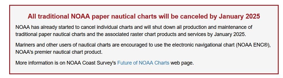
Interesting read. The bottom line is paper charts are going away. Existing paper charts will, over time, become more and more outdated (inaccurate), more quickly is some places such as the ICW. Still, I like them for their ability to show a much broader view of a waterway but, for navigation, they are clearly inferior. All this hoohah about electronics failure goes in the same bin as worrying about a lightning strike. Having a backup leaves no worry at all. And, as one poster observed, even if GPS crapped out, the chart is still there but, as opposed to the same paper chart, will be more accurate. ENC charts are updated weekly. Paper charts in hand, never.
 
There was and may still be a tight relationship between raster and paper charts produced by NOAA. They look the same to me. As most of us already know the paper / raster vs vector debate will be moot in the US in just over 3 yrs. I'll miss them, especially the electronic raster charts. https://www.nauticalcharts.noaa.gov/charts/noaa-raster-charts.html


In some cases, aren't electronic charts derived from the paper charts? I find the same inaccuracies in both at times. One area I sometimes boat in says there should be 2-3' of water and yet it's consistently 30' over a large area. It's not an area that is dredged as far as I know.
 

Attachments

  • Raster ending.JPG
    Raster ending.JPG
    63.8 KB · Views: 21
I like using both, but neither is just relegated to being a backup.

Neither paper nor electronic are mutually exclusive. For voyaging a good compromise is to keep wide area (coastal) paper charts for seeing the big picture and then rely on electronics for details in harbors, rivers, channels, etc.

Plus for those of us who are romanticists, it’s wonderful to lean over a big chart with dividers and a parallel rule, drawing a course with a pencil, teaching traditions to your kids.
 
Paper charts are often cited as being great backup. I tend to agree and carry them for that reason. However they have their failure points as well. I once lost a critical paper chart overboard back in the day when I didn't have electronic gizmos. It was a hot day and I had the leeward wheelhouse door open. A deckhand unthinkingly opened the windward door and the chart tore loose from it's tape moorings and was gone. And then there is my own clutzyness with coffee.

As to electronic backup I like most here have that covered. I might be to the extreme. When we go out on our recreational boat there are in addition to the dedicated plotter between us two laptops, two phones and two tablets. Loaded with a variety of software Coastal Explorer, OpenCPN and Navionics. Additionally a variety of GPS sources. The dedicated plotter, a puck, a handheld that can feed the laptops, a 2nd handheld in the ditch bag, AIS output, Garmin InReach and all the phones and tablets have built in GPS. We have redundancy upon redundancy.

It has been said several times in this thread that any plotting a skilled navigator can do on paper can be done on a plotter. While technically true I am much faster with divider, compass (the drawing kind) and a rule or triangles than I am doing the same plotting on an electronic device. Especially a touch screen MFD. Yes, I do have room to use a paper chart.

As long as I can I'll still carry some paper charts. Not as many as I did when working on the water because they are spendy and I'm footing the bill, not my employer.

I have one huge reason for some paper charts aboard. My sweetie prefers paper charts to electronics for planning. She's happy to use electronics running the boat, but wants paper when planning the day's run. I don't need any better reason than that to carry paper charts.

In addition to my own preference and comfort level there were some advantages on a work boat to paper charts. Having to do with new hires in whom I had not enough trust regarding their background and training. 1st I would hand them the task of updating the charts from the local notices to mariners. I knew in very short time if they had any real skill in reading charts. If not then some education was necessary. Once out on the water I would start GPS based tracking then cover up the electronic screens. Ask them to navigate at first an easy stretch by range and bearing. Then uncover the screen and compare the plots on paper to the screen. Maybe more education was needed. It's one thing to be able to pass the charting module on the master's exam and another to have the skills to navigate by traditional methods. And yet another to have kept those skills up to date. So I still occasionally break out a paper chart and do it the old skool way to keep my skills up. And I like it. It just feels 'right'.

All of that said I do navigate most of the time with electronics. It's easier and less stress. That's what recreational boat is all about.

But I still do some deliveries and relief work where I have to be out in less than ideal conditions. While running at night in heavy weather when the boat is doing it's best to throw me from one side of the wheel house to the other gimmie electronics any time. Plotting on paper is a real problem in those conditions. When I'm trying to enter a harbor at night in a blizzard with all the ATONs caked in snow, the radar and search light can't penetrate the snow gimmie a GPS talking to a plotter or I'm anchoring up and waiting for daylight.
 
My understanding is that the US vector charts were digitized from the original raster charts.

Clearly we don't want our tax dollars spent updating both sets of charts forever. Getting rid of the raster is the right thing to do. I wish they'd done a better job digitizing, but that's behind us now.

None of this impacts whether or not you can continue to use paper charts. You will still be able to order paper charts. They can be up to date as of the moment they're printed, and they'll be available in innovative form factors.
 
I navigate exclusively with my chartplotter, while recording my position periodically in my paper log. However I have at the helm a full size chart of my usual cruising area under glass. I rarely look at this when by myself - especially since we tend to cruise familiar waters. However with friends/family on board when they ask where we are going, this is what we view.

It covers the entirety of the voyage, with no scrolling or zooming or leaning in to a small 16" MFD. We can mark our route, or have the kids do so, or make notes, with "glass pens" that write clearly on the glass and are easy to erase.

It is fun, interactive, easily referenced and does not interfere with navigation.

It's not the only reason to have paper charts, but by far the most fun reason.
~A
 
I like using both, but neither is just relegated to being a backup.

Neither paper nor electronic are mutually exclusive. For voyaging a good compromise is to keep wide area (coastal) paper charts for seeing the big picture and then rely on electronics for details in harbors, rivers, channels, etc.

Plus for those of us who are romanticists, it’s wonderful to lean over a big chart with dividers and a parallel rule, drawing a course with a pencil, teaching traditions to your kids.

:thumb:
and the sextant too
 
I also like the large paper chart for planning a cruise or for a wide area view of where we are. I'll use the GPS and plotter for navigation, but zooming way out or panning with the plotter does not equal the overall view of a large chart. Maybe I need a 65" display like the TV in my living room!
 
Back
Top Bottom