You are using an out of date browser. It may not display this or other websites correctly.
You should upgrade or use an alternative browser.
You should upgrade or use an alternative browser.
Kent Narrows
- Thread starter menzies
- Start date
The friendliest place on the web for anyone who enjoys boating.
If you have answers, please help by responding to the unanswered posts.
If you have answers, please help by responding to the unanswered posts.
wkearney99
Guru
- Joined
- Feb 17, 2018
- Messages
- 2,164
- Location
- USA
- Vessel Name
- Solstice
- Vessel Make
- Grand Banks 47 Eastbay FB
I've seen 4'6" at low tide coming out of the north end, where the channel makes it's turn to the west. We need 4' so it was a bit puckering. I was near the starboard side of the channel due to other traffic. Others report 6'+. I'd aim for high tide if you're at all concerned.
We were headed from St. Michael's to Langford Creek, up off the Chester (nice afternoon spot).
We were headed from St. Michael's to Langford Creek, up off the Chester (nice afternoon spot).
jskinner30PII
Senior Member
I remember 7' in the channel at Kent Narrows a couple weeksago coming back from St Michaels to Middle river. I think they repositioned G3marker last year?
It’s not much difference time wise depending on how fast yourun to leave Miles river and go out Eastern bay to Chesapeake bay and head up bay to middle river.
At 17 knots it was 20minutes longer going down the bay instead of using the narrows. The narrows hasa good bit of 6 knot speed limits through the area.
wkearney99
Guru
- Joined
- Feb 17, 2018
- Messages
- 2,164
- Location
- USA
- Vessel Name
- Solstice
- Vessel Make
- Grand Banks 47 Eastbay FB
On plane, yeah,for us it adds about 25 minutes to go around. We were heading up the Chester so it would have added at least an hour and half. If not for that I'd have gone around.
You definitely, absolutely, want to follow the markers through that area. Do not deviate. They reposition the markers each season, based on conditions and dredging.
You definitely, absolutely, want to follow the markers through that area. Do not deviate. They reposition the markers each season, based on conditions and dredging.
danderer
Guru
I used to do it with a 5' draft sailboat. The keel was a nice 'bumper'. There have been too many anecdotal reports of folks touching in various places (sometimes hard) over the past couple of years so that I don't bring the current boat through it. Going down the Eastern Bay only adds a couple hours and takes away a lot of stress.
jskinner30PII
Senior Member
Menzies,
That's a sweet ride you have. I would go out Eastern bay. So it takes an extra hour? With a boat like yours I'd just enjoy the added time on board.")
That's a sweet ride you have. I would go out Eastern bay. So it takes an extra hour? With a boat like yours I'd just enjoy the added time on board.
wkearney99
Guru
- Joined
- Feb 17, 2018
- Messages
- 2,164
- Location
- USA
- Vessel Name
- Solstice
- Vessel Make
- Grand Banks 47 Eastbay FB
At 8 knots you're looking at 3:48 through vs 4:58 going around, an hour longer. At least according to Navionic's online app..
The one question that hasn't been asked is debris conditions. I've not ventured out beyond the Severn since the rains have washed loose such much junk. What's the debris situation like through the Narrows?
The one question that hasn't been asked is debris conditions. I've not ventured out beyond the Severn since the rains have washed loose such much junk. What's the debris situation like through the Narrows?
I was following an unknown draft sailboat through the bridge when he suddenly reared up and stopped hard aground. I doubt he drew more than 6'. I was in a 4' draft full keel sailboat and managed to stay in 6-1/2' of water after the other one went aground, but I was 50' or so over and he may have hit a shallow spot.
So be careful and as others have noted don't go at low tide.
David
So be careful and as others have noted don't go at low tide.
David
chc
Senior Member
- Joined
- Jan 5, 2011
- Messages
- 358
- Location
- USA
- Vessel Name
- Scooter
- Vessel Make
- 1984 Californian 34 LRC
Frankly, with the debris issue in play, I think I'd be inclined to go out Eastern Bay, then up the Bay proper. The Chester takes a stiff turn in the very spot you will be exiting the Narrows channel; an ideal spot to dump stuff. You will also have more options; both scenic, and otherwise as you come up the Bay. Are you really aiming for Hart-Miller? or is that just a reference for another destination; ie Middle River, etc. Plan going around Hart-Miller, not thru the cut
brewster812
Member
My boat is berthed at Mears Point Marina on the Narrows. I draw 4’ and so far this year have not seen less than 4’ below my keel transiting the nort channel. Pay close attention to the navaids, not your chart plotter, and you should be fine.
OP
OP
menzies
Guru
...Are you really aiming for Hart-Miller? or is that just a reference for another destination; ie Middle River, etc. Plan going around Hart-Miller, not thru the cut
We are leaving St Michaels tomorrow (Wednesday) and want to be in Baltimore on Thursday to spend a day before our guests take an Uber to PHL for their flight back to Ireland on Friday.
So, reading the Chesapeake Bay Magazine cruising guide, Hart-Miller seems a nice anchorage for the night giving us an easy run in on Thursday. Looking at the chart I was thinking of trying the south approach (slowly), but will take advice on that.
Or do you suggest a better anchorage around there, either shore?
Last edited:
ranger58sb
Guru
We went down to Solomons last Thursday. observed very little debris, mostly at the mouth of the South and West Rivers. One the way back yesterday, wifey saw two relatively small/short chunks southwest of the WR1 just before we started through the crab pot field... IOW, not much of a deal.
Swan Creek, eastern shore, north end of Rock Hall, would be a better anchorage than Hart-Miller, I think, and that doesn't take you north of the Patapsco entrance. The (small) restaurant at Osprey Point marina has been outstanding, and there are other options if you want to go ashore.
(You'll see boats crossing Swan Point Bar northwestward using the range that starts just north of R4, the taller range marker will be behind you, near Grays Inn Creek on the chart. Given your draft, I don't think I'd try that unless following a local boat of known similar draft, and at high tide. I think safer to head further south and then around G3 before turning northwest. It's not really a much further distance, in the grand scheme of things...)
Bodkin Creek could be another decent anchorage, western shore, just near the south entrance to the Patapsco. If it's useful, the restaurant in there at Pleasure Cove Marina used to be called the Cheshire Crab, decent at the time, but we haven't been in there for a while...
-Chris
Last edited:
danderer
Guru
Hart-Miller has little-to-no protection except from the east. Given the frontal passage predicted for tomorrow night I'd personally choose to spend the evening somewhere else.
Baltimore Yacht Club are friendly folks just inside the mouth of Middle River. You might try them for reciprocal privileges.
Baltimore Yacht Club are friendly folks just inside the mouth of Middle River. You might try them for reciprocal privileges.
wkearney99
Guru
- Joined
- Feb 17, 2018
- Messages
- 2,164
- Location
- USA
- Vessel Name
- Solstice
- Vessel Make
- Grand Banks 47 Eastbay FB
Heh, the Rock Hall harbor has a channel that goes across the harbor or hard to port along the docks. Best bet is stick to the port channel. For the center channel there's only the the start/end (2E/4E) markers and nothing in-between. It's easy to miss the starting buoy.
First time we went anywhere was into Rock Hall, up from Annapolis. Folks on the shore were WAVING THEIR ARMS (to port) and the wife asked "is the water supposed to be this brown behind us?" Thankfully we avoided getting stuck in the mud.
When at Waterman's do not miss the sweet potatoes. They slow roast them all day in the oven. They're buttery soft inside as a result. I repeat that method whenever I smoke or otherwise slow roast something on my Big Green Egg grill at home. Soooo tasty.
Attachments

ranger58sb
Guru
Yep, if not anchoring, the Waterman's side can be good. On a weeknight, you might not get so much noise from the restaurant.
DO GO AROUND! Make the circle, starting to port and then around. The cut-through isn't for the faint of heart... and most of the locals who get through there are in relatively shallow-draft Chesapeake Bay deadrise workboats.
-Chris
DO GO AROUND! Make the circle, starting to port and then around. The cut-through isn't for the faint of heart... and most of the locals who get through there are in relatively shallow-draft Chesapeake Bay deadrise workboats.
-Chris
FootballFan
Senior Member
Came in South channel couple weeks ago, just a little under 6' draft. No issues, plenty of water all the way in. The issue is the north channel. I have not been out the north side in this boat. Have been told I am "probably" ok at high tide.
There is a bridge in the narrows - not sure if you have to open it or not. If you do have to open it - and you don't hit it right on the half hour you have lost a lot of the advantage of cutting through the narrows.
There is a bridge in the narrows - not sure if you have to open it or not. If you do have to open it - and you don't hit it right on the half hour you have lost a lot of the advantage of cutting through the narrows.
OP
OP
menzies
Guru
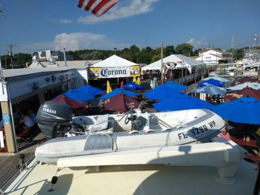
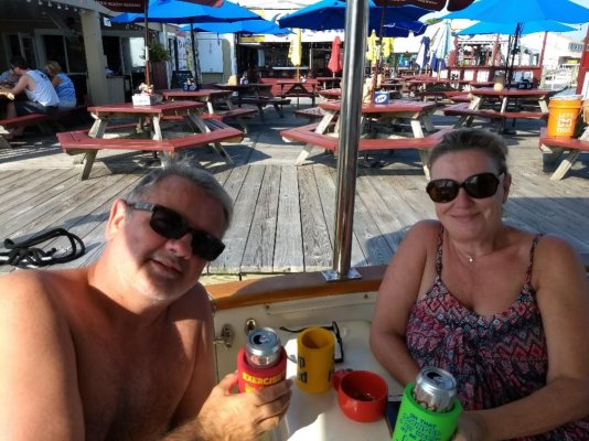
All tied up. We are sitting in the cockpit drinking beer while five feet away they are drinking the same beer at bar prices!
Do you think it will be too cheeky to crank up up the grill to do the steaks tonight, the breeze is blowing into the bar.
Do you think it will be too cheeky to crank up up the grill to do the steaks tonight, the breeze is blowing into the bar.
Attachments
wkearney99
Guru
- Joined
- Feb 17, 2018
- Messages
- 2,164
- Location
- USA
- Vessel Name
- Solstice
- Vessel Make
- Grand Banks 47 Eastbay FB
There is a bridge in the narrows - not sure if you have to open it or not. If you do have to open it - and you don't hit it right on the half hour you have lost a lot of the advantage of cutting through the narrows.
Last time going through we got lucky and arrived there at 11:50, making for a short wait for the noon opening. They don't dawdle on closing it, either.
Current wasn't awful so it wasn't hard to keep the boat on station. But then I don't recall were we were regarding the tide change.
Similar threads
- Replies
- 33
- Views
- 5K
Latest posts
-
-

-

-

-

-
-
 Fixing boats in Exotic Places - are new boats really that bad?
- Latest: HeadMistress
-
-

-
