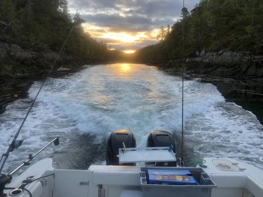
Inside Passage Travel Route

The friendliest place on the web for anyone who enjoys boating.
If you have answers, please help by responding to the unanswered posts.
I know the OP had little intention of this thread turning into what it has. Sorry Bones. I was born in Alaska and have spent a significant amount of my life in the small, isolated communities spread across Alaska. I can empathize with the people of these towns. They have recent history to back up their concerns. Alaska lives and dies by the influx of people from out of state, it always has. It’s three main sources of income come from fishing, tourism & oil/gas. All of which employ thousands of non residents. It’s a scary time for sure.

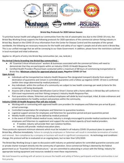
Some interesting information:

IMG_6701.jpg
 
Last edited:
Bones -

I am planning this trip, too, and like your brother have spent many hours researching various route options and the must-see-but-not-too-widely visited anchorages. For me, the Hamiltons’ book “Cruising the Secret Coast” and the Douglasses’ series of “Exploring the . . .” guides are generally the best, mainly because they are so comprehensive. (The Hamiltons’ is pretty limited geographically, but gets into pretty remote territory.) The Wolferstam series of guides is really great for as far up the BC coast as they go. For a lot of the inlets along the further north BC coast, Waggoners has some pretty (surprisingly) good anecdotal information compiled from cruising reports, etc. And, of course, there’s always that 50 Best Anchorages of the Inside Passage book.

I am a US citizen, and my keep my boat in Sidney, BC to be close to my cruising grounds. I came up to do some work on my boat in Sidney on March 6 in preparation for a trip north beginning later this spring - mid-May or so. As the work was underway here in Sidney (some electrical and mechanical refitting), the US/Canada border closed. As I had rented out my home in the US in preparation for the multi-month trip, I didn’t have a lot of great options for sheltering in place. I chose to remain in BC with the boat.

I can confirm what other Canadians are saying. Recreational boating in Canada is pretty much non-existent right now.

That coastline will always be there for us. Keep on planning.
 
I can confirm what other Canadians are saying. Recreational boating in Canada is pretty much non-existent right now.

I find in many discussions like this and other topics, folks reply based on where they geographically are and forget there might be more to the planet than just their location. I get this all the time on forward looking sonar, particularly from the East Coast bunch.

Since my boat has been in refit, I hang out at a local marina, usually roughly an hour a day, sometimes longer sometimes shorter. I relax, read, snooze, watch the comings and goings of boats, sea lions, harbour seals, seagulls and eagles. I also people watch, follow the coast guard on Marine Tracker when they go out, ditto the S&R guys, watch coast guard over flights and Canadian military surveillance flights.

And I'm here to tell you that activity at French Creek has increased, not decreased. Most of the guys and some gals going out are sport fishing, probably 1/3 of the boats at this marina are sport fisher guys, but another larger majority are boat trailering and putting in at FC. Another 1/3 of boaters are commercial fishermen, and the remainder are pleasure power and sailboaters.

But the sport fishers guys/gals are flocking out like never before. On a beautiful sunny week day, I might see two trailers in the lots in our pre-pandemic life. Now I can see twenty trailers in the lot, with some putting in and some taking out. Another smaller group are commuters to Lasqueti Island from FC.

We don't have the lockdown requirements here in BC on the water as much as others do in other locations. If my boat wasn't in refit, I'd be over in Desolation Sound at anchor enjoying solitude. I have been using Marine Tracker to see the boating traffic to DS and for the last week + there was only one boat broadcasting AIS and staying in the sound and that was a boat named Serenity. Today I just checked DS out again, and there are currently 4 boats. I realize there will be other boats not transmitting AIS there but in the summer when you look at DS on Marine Tracker there are 50 + boats in the area broadcasting AIS.

Here is the latest video from the couple living on MV Freedom, a 43 Nordhaven. They are currently cruising the San Juans and for some in Washington state who have wanted to cruise but haven't because of your perception of the rules, check this video out:
 
Another route choice occurred to me.
East or west side of Queen Charlotte Strait.
I don’t usually do either one as I like to make the run diagonally northbound from west to east. I like to anchor at Allison Harbour near Cape Caution.

Only downside is the cruise ships dump their holding tanks there. Huge masses of brown water.


Say it ain't so!:nonono:
 
Say it ain't so!:nonono:

Having been on a cruise in Jan/Feb this year, we had a Q & A with the officers. One Q was ?What happens to the contents of the black water tank?
A: it is treated to the extent that you could drink it.
Q ?Where does our drinking water come from?
A: We make 500 m³ of fresh water per day. NOT from the cleaned up Black water.

This ship was only a few years old, but I recall watching the fish feed at the side of a cruise ship while dumping galley waste in harbour somewhere in the Carribean 20 or 30 yrs ago. I have no doubt cruise ships flushed their black tanks overboard as a matter of routine in those days.

Nowadays, not so much.
 
koliver and Portage Bay,
I shouldn’t have said that as I really don’t know for sure but some people said it was but mostly I remember seeing it. It was absolutely the right shade of brown. And a huge amount. Way more that what a whale could produce. At first that’s what I thought it was but people told me it was cruise ship dumping.
I talked to Chris and she dosn’t remember it so it was over 20 years ago.
Like I said though I shouldn’t have mentioned it. Sorry

Re which side of Queen Charolette Strait one travels on is one of the few choices re routes north.
 
Last edited:
Say it ain't so!:nonono:

Another route choice occurred to me.
East or west side of Queen Charlotte Strait.
I don’t usually do either one as I like to make the run diagonally northbound from west to east. I like to anchor at Allison Harbour near Cape Caution.

Only downside is the cruise ships dump their holding tanks there. Huge masses of brown water.


I have seen this brown goo.....

So how is Allison Harbour? On of the bays I want to visit. We normally shoot from Port McNiell to Fury Cove.
 
I prefer Allison Harbour to nearby Skull Cove as it has very good holding, more swing room, and is better protected. I haven’t seen any brown goo.
 
ASD,
I consider Allison Harbour bullit proof .. almost. Would only need to be wider to be so. But I've never seen the wind blowing across the harbor.
 
So how is Allison Harbour? On of the bays I want to visit. We normally shoot from Port McNiell to Fury Cove.

Miles Inlet. One of those magical places that makes you wonder why you skipped it all the other trips.
 
Back
Top Bottom