How does radar affect my body?

The friendliest place on the web for anyone who enjoys boating.
If you have answers, please help by responding to the unanswered posts.
I know most boaters mount their radar high for better operation and less obstruction. I get it. However I don't want my radar up on my mast. It makes it very difficult to lower the mast, also makes the dome susceptable to damage while lowering it.

I am debating mounting it just below the windscreen on my flybridge. I know I will lose some, if not all my rear looking capacity and that doesn't concern me. My issue is what might the radar do to my body, or the body parts of the Admiral. We are both in our seventies so are not too concerned about reproduction but there are other things which might concern us (Cancer, eye damage, nerve damage, etc). There used to be a lot of worry or discussion about cordless phones cooking your brain, I have not heard much of this lately though.

Any thoughts ?

pete


Since the OP says that it's acceptable to lose some or all of his rear-looking capability, why not see if the radar can be programed not to transmit in that direction and thereby not have to worry about the difficulty in lowering the mast? Also, not to be picky, but it's "affect" not "effect" in this case.
 
This concern has been around the waterfront for years. When considering how cautious to be around recreational marine radar energy, a couple of variables come up:

1) Oncologists and others who study cancer agree that no two people react the same way to carcinogens, radiation or other risk factors. In other words, low amounts of microwave energy may not bother one person, but could accelerate cancer in someone with different risk factors in play.

2) Some microwave emitting devices, like radars, are dirtier than others. A manufacturer's literature may claim their product emits "X" amount of energy, but the end user has no way of knowing whether that was really true when the device came out of its box, much less how hot it can get after being installed and in use for a few years.

I'm with Tom, Dan and others above. It makes sense to avoid unnecessary risk. Radar performs better when it's placed up high anyway. When running a boat with the dome mounted below the flybridge windshield, my practice is to keep it totally powered-off, or else run from the lower station.
 
I don't know, I don't have one of those either! I don't remember ever being in a situation of being rear-ended on the water, but I guess it's possible.

Call it USCG recognition camera. LOL
 
Like I said I only have 1 display. If I use just the radar screen, my boat is in the center. If I use the chart overlay, my boat is at the bottom of the screen as it normally is using GPS, and the radar returns are shown on top of it, hence, no real radar images astern.


OK, 1 display, however, you have a choice as to how you make it display. If you setup your GPS/plotter to "offset" to allow more of a "forward" view, that will also make the radar align with that when overlaid. It can be changed. Different preferences, fine.:thumb:
Where I boat, we often get very thick fog. Sometimes can hardly see past the bow of the boat. Often, smaller fishing type boats are out fishing or travelling at planing speeds :banghead: to and from fishing even in thick fog. Being aware of them, even coming up from behind is a good thing!!:dance:
Now I know, it is best to avoid low visibility, but some locales have fog almost every AM often to 2-3 PM before it clears. Also, there are many open water or exposed passages where it seems it is either windy with accompanying large waves or calm and foggy. I like having a radar I can trust and see most of what is (all) around me. Maybe a thermo imaging camera would help, but another expensive piece of equipment.:angel:
I don't think a "normal" camera would really be all that helpful for my boat and situation.

Thanks Tom. I didn't think about offsetting my GPS display. I will play with that next time out, hopefully tomorrow. Thanks for the tip.
 
I knew we can offset our radar fwd but I will have to read up on offsetting the Chart GPS fwd.
 
I'm fairly new to radar so please correct me if I am wrong. I only have a single display, so when I use radar I use it in overlay mode over my GPS chart.


Forgive me for sounding like a Luddite, but your overlaid radar/GPS poses multiple problems:


As you say, 200 degree coverage;


Multiple images on a single display likely to obscure detail


You seldom want the same ranges on radar and chart plot.


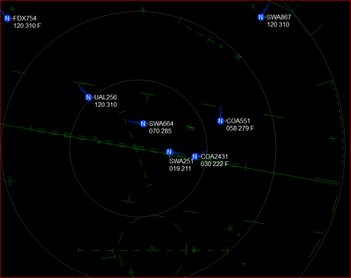
The air traffic radar systems I worked with for 40 years remove all terrain and navigational distractions and then place short line segments and corners at locations which are operationally significant. All detailed information re: terrain, navaids, routes, frequencies, is provided at nearby displays which can be referenced if needed.


Nothing is permitted to obscure radar targets. Also true on my boat. (This is not a brag; I have old analog radar and relatively inexpensive chart plotting running on a "retired" PC.)
 

Attachments

  • video map.png
    video map.png
    28.9 KB · Views: 30
Last edited:
If the radar has a magnetron, it DOES have some danger.
 
Forgive me for sounding like a Luddite, but your overlaid radar/GPS poses multiple problems:


As you say, 200 degree coverage;


Multiple images on a single display likely to obscure detail


You seldom want the same ranges on radar and chart plot.


The air traffic radar systems I worked with for 40 years remove all terrain and navigational distractions and then place short line segments and corners at locations which are operationally significant. All detailed information re: terrain, navaids, routes, frequencies, is provided at nearby displays which can be referenced if needed.


Nothing is permitted to obscure radar targets. Also true on my boat. (This is not a brag; I have old analog radar and relatively inexpensive chart plotting running on a "retired" PC.)

With 1 display I have the choice of radar, GPS, or both. I guess I could use my phone for GPS, but not likely to do that.
 
With the overlay, both gps and radar are stable images. Interesting to see how far off some nav buoys are from the gps charts
 
For a stable overlay, the gps/chartlplotter needs a higher degree of compass input to stabilize heading at slow preeds ( well at least it used to back when I was installing these newer overlay MFDs.
 
With the overlay, both gps and radar are stable images. Interesting to see how far off some nav buoys are from the gps charts

Some buoys are moved to reflect changes in depth to mark "best water"....

Some buoys mark charted channels and have permanent positions and the channel is dredged to match the charted channel.
 
For a stable overlay, the gps/chartlplotter needs a higher degree of compass input to stabilize heading at slow preeds ( well at least it used to back when I was installing these newer overlay MFDs.

Compass input is from AP, not gps
 
Some buoys are moved to reflect changes in depth to mark "best water"....

Some buoys mark charted channels and have permanent positions and the channel is dredged to match the charted channel.

I get all that, just saying that w/o seeing them on radar, you assume the GPS charts are accurate.
 
Compass input is from AP, not gps

OK, doesn't matter where the input is from as long as it is not just GPS at slow speeds....even in the old days without a compass input overlays worked as long speed was up and GPS could transmit a steady course.

As far as buoy locations, I believe you are missing the point, no buoy position is absolute as charted, in deeper water and a current their position circle can seem pretty wide....so many charts I have used are extremely accurate, buoy positions are not a good measure of accuracy. Unless NOAA raster or vector charts I wouldn't be surprised at inaccuracies.
 
Last edited:
OK, doesn't matter where the input is from as long as it is not just GPS at slow speeds....even in the old days without a compass input overlays worked as long speed was up and GPS could transmit a steady course.

As far as buoy locations, I believe you are missing the point, no buoy position is absolute as charted, in deeper water and a current their position circle can seem pretty wide....so many charts I have used are extremely accurate, buoy positions are not a good measure of accuracy. Unless NOAA raster or vector charts I wouldn't be surprised at inaccuracies.

I never said the charts are inaccurate, or at least that's not what I meant. I was just pointing out that buoy location can vary quite a bit for many reasons as you and others pointed out. With radar on, I see where the buoy actually is vs. the chart.
 
I never said the charts are inaccurate, or at least that's not what I meant. I was just pointing out that buoy location can vary quite a bit for many reasons as you and others pointed out. With radar on, I see where the buoy actually is vs. the chart.

That is good, wasn't sure exactly what you meant.

A lot of inlets have uncharted buoys but are marked inlets. As long as you can find the buoys, many aren't all that dangerous and the " local knowledge only " on the chart or guide is way overkill that a quick call to a local captain can fix.
 
As a former microwave tech, the medical risks of microwave exposure are lowered sperm count and cataracts. One of my friends was crawling around a large rig and went past an open waveguide transmitting 700 watts of power and within two weeks, needed cataracts surgery. I've had both eyes fixed and a vasectomy, so if I were around a newer radar, I probably wouldn't worry too much, but I wouldn't do it intentionally. Who knows what other side effects could arise...
 
Compass input is from AP, not gps

In every case I have seen, but at least generally, AP's require heading input from one or more devices -- typically a fluxgate compass but at least sometimes from a satellite (gps) compass -- that is how much Simrad AP28 with both a fluxgate and Furuno SC50 satellite compass is configured. As long as it is getting a heading from the sat compass, it will use that, and if not, then the fluxgate. I see no reason it could not be configured to take heading from a GPS that puts out that sentence (or from an MFD that calculates heading), but as pointed out above, that heading would not be reliable/stable at slow speeds.
 
As a former microwave tech, the medical risks of microwave exposure are lowered sperm count and cataracts. One of my friends was crawling around a large rig and went past an open waveguide transmitting 700 watts of power and within two weeks, needed cataracts surgery. I've had both eyes fixed and a vasectomy, so if I were around a newer radar, I probably wouldn't worry too much, but I wouldn't do it intentionally. Who knows what other side effects could arise...


That same guy also walked in front of: a television, a smartphone, a toaster, and othe devices.
 
Correct me if I’m wrong. Radar is a beam. The beam widens as it gets farther away from the source. There’s also some scatter as the beam isn’t completely focused. So if you don’t want to be subject to that energy not only height needs to be considered but also width of the beam and distance you get get to on your boat. Perhaps sitting at your helm inside with the radar right over your head when the pilot house is aft you have negligible exposure. But someone in the bows as you inch through fog or coral heads could be in the beam. Believe due to the nature of the beam the inverse square law doesn’t strictly apply. Is that correct? Believe different radars have different beam widths. Is that correct?
 
In every case I have seen, but at least generally, AP's require heading input from one or more devices -- typically a fluxgate compass but at least sometimes from a satellite (gps) compass -- that is how much Simrad AP28 with both a fluxgate and Furuno SC50 satellite compass is configured. As long as it is getting a heading from the sat compass, it will use that, and if not, then the fluxgate. I see no reason it could not be configured to take heading from a GPS that puts out that sentence (or from an MFD that calculates heading), but as pointed out above, that heading would not be reliable/stable at slow speeds.


Generally correct. The point is that there are two different pieces of data, and they are often confused; Heading, and Course Over Ground (COG).


Heading comes from a heading sensor, either a fluxgate/rate compass, a sat compass, or a gyro (though unlikely on any of our boats). Heading is where you boat is pointing, irrespective of boat movement.


COG comes from a GPS, and describes direction of movement relative to the earth's surface. Because COG is calculated based on successive position points, it is invalid (or acts crazy) if you are not moving.


For radar overlay to work properly, you need a source of heading (not COG) info. But to add to the confusion, some plotters will use COG as a proxy for HDG. It mostly works a bunch of the time, as long as the boat is moving, and as long as there isn't too much current creating a difference between HDG and COG.
 
Correct me if I’m wrong. Radar is a beam. The beam widens as it gets farther away from the source. There’s also some scatter as the beam isn’t completely focused. So if you don’t want to be subject to that energy not only height needs to be considered but also width of the beam and distance you get get to on your boat. Perhaps sitting at your helm inside with the radar right over your head when the pilot house is aft you have negligible exposure. But someone in the bows as you inch through fog or coral heads could be in the beam. Believe due to the nature of the beam the inverse square law doesn’t strictly apply. Is that correct? Believe different radars have different beam widths. Is that correct?


Yes, the beam is shaped. All project 12 to 15 deg above and below horizontal (vertical beam width), and anywhere from a couple of degrees to less than one degree side to side (horizontal bean width). The horizontal width is a function of the antenna width. So a 24" dome projects a wider horizontal bean than a 6' open antenna, and even narrower for an 8' or 12' antenna.


So whatever energy the radar emits, it first gets spread out over the beam shape. The smaller the beam, the more energy within it's area.


But once the energy departs the antenna, in whatever shape and concentration is holds, the energy level falls off as the square of the distance. So that's still true too.


This is all a really good explanation if why it's important to look at the specs fro a particular device to assess the safety risk. You can't just compare the military installation that fries turkeys with their radar, a guy working by a wave guide, and a radar at eye level (or waste level :eek:) because they are all different and unknown power levels, beam shapes, and distance to target.


As an illustration, I recently installed a satellite dome. The safe distance to a radar is roughly 1m or less. The safe distance to the sat dome is 30m. I was really surprised. It never occurred to me it would be so much, but when you think about it, the whole point of the dome is to concentrate the signal into a very narrow beam so it can run a long distance.
 
Correct me if I’m wrong. Radar is a beam. The beam widens as it gets farther away from the source. There’s also some scatter as the beam isn’t completely focused. So if you don’t want to be subject to that energy not only height needs to be considered but also width of the beam and distance you get get to on your boat. Perhaps sitting at your helm inside with the radar right over your head when the pilot house is aft you have negligible exposure. But someone in the bows as you inch through fog or coral heads could be in the beam. Believe due to the nature of the beam the inverse square law doesn’t strictly apply. Is that correct? Believe different radars have different beam widths. Is that correct?

If I remember right all radiation goes by the inverse square law. The owners manual probably mentions it.
 
Open array antennas generally have a more focused beam but the antenna design has a lot to do with the broadcast pattern. On a 5 foot open array antenna, at 15 miles out, the beam spread would be about 100 yards.

All directional antennas have "side lobes" where the majority of the signal goes out one direction, and there are two approximately half power lobes on either side of the primary beam. Regardless, radar has to be quite directional, or the receiver would be overloaded by a lot of spurious returns.

You will get some reflected radiation if you have other posts (metallic objects) mounted in the beam, even though most systems will let you momentarily turn off the beam as it passes the antenna mast, or other reflective objects.

Unfortunately, I don't have any hands on experience with 3D wideband radars but they use a lower broadcast power level, so their danger should be greatly reduced.

The way Radar works is it broadcasts a narrow beam with one directional antenna, and a secondary antenna a few degrees off of the broadcast antenna picks up the reflected signal. The degrees between the two antennas is how they set the range, since a distant target would require a greater time for the signal to get to the target and bounce back. Some systems slow down the rotation speed to adjust range, others adjust the delta angle between the two antennas.
 
The RADAR can only see to the curvature of the earth. That distance is determined by the height of the antenna, power and the height of the target.
Anything beyond that point, you are looking at the weather coming at you or behind you.

Interestingly, that curvature is one way Columbus used to prove the world was round and not flat. He watched the ships get smaller and disappear over the horizon. and The ships would get larger as the reappeared, returning. I missed that part on an exam way way back in the 6th or 7th grade.
 
Last edited:
Back
Top Bottom