Granted, few people cruise in truly unfamiliar waters. Charts, whether electronic or paper, are tools in an overall navigation system that includes human (helmsman) interpretation and judgement.
Most recreational cruisers have encountered range markers - big orange boards with vertical stripes where ships align the stripes to visually confirm they are within the channel. Range boards are not practical at many Pacific Coast bar crossings either because geographic limitations, or because they are likely obscured by fog or darkness. Directional lights are used instead.
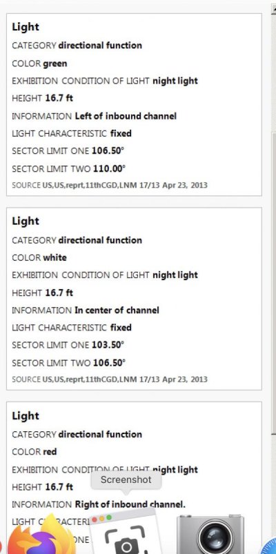
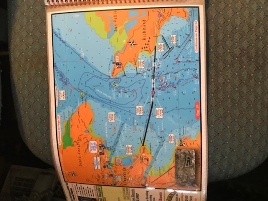
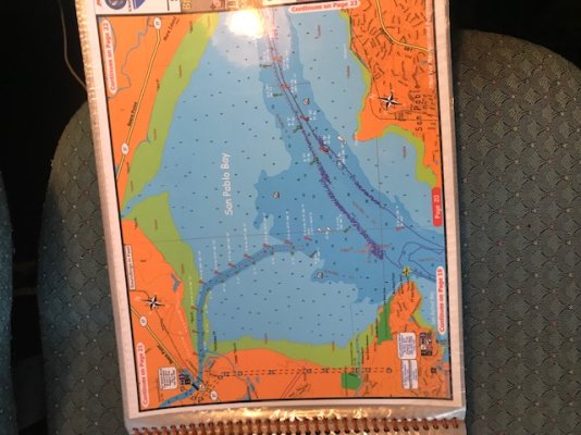
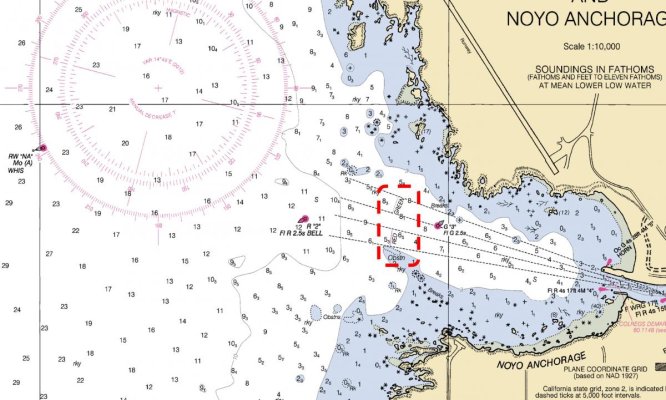
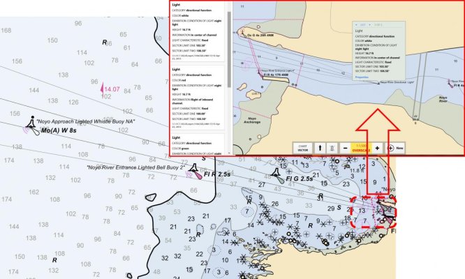
Attached are three screenshots of the exact same area: the approach to Ft Bragg California (Noyo River) - sea buoy shown to the west. Because there is almost aways at least a moderate 4-foot swell running from the NW, there are (1) breakers on either side of the approach once you get within 0.5 nm of the bridge; and (2) refractive waves in addition to the swell. It adds-up to a pretty active ride with the boat moving along X, Y, and Z axis with a lot of pitch and yaw that makes following an electronic highway/trackline on an MFD impossible. The USCG maintains a directional light that shines in three sectors: WHITE if you are within the narrow channel; GREEN if you are too far north and need to make a starboard correction; and RED if you are too far south and need to make a port correction. Because this is a visual/hand-steer approach, the range light remains highly relevant despite highly accurate vessel navigation systems.
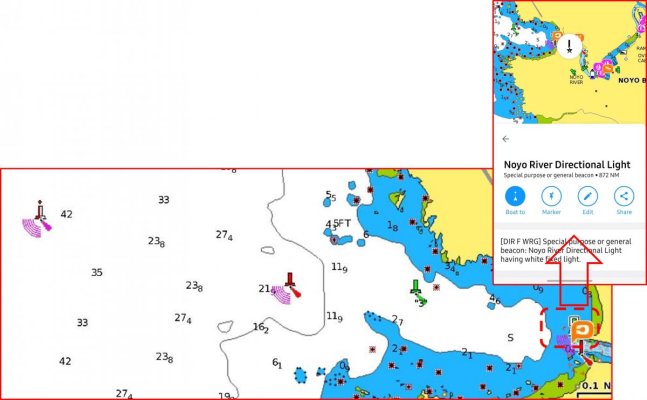
So, if you've never been to Ft Bragg, how would you know about this directional light? The first picture - the RASTER display, shows this pretty well. The second screenshot, the VECTOR display, is a classic case of lots of data but little information. You have to pull-up the properties on the light and it tells you that from 103.5-106.5 degrees bearing the light is white, from 100.5-103.5 degrees the light is red, etc. The final screenshot - the NAVIONICs display, doesn't even tell you that much. Just says there is a directional light with no additional information (though at one zoom level, there is a tiny red/green indicator without explanation, but its not shown at all zoom levels).
Whats my point? Several-fold
- Use Case. Really depends on how you plan to use your boat. Even if you cruise to new areas, if you are generally in the same type of environment (say, cruising the California Delta or Great Loop), the destinations and information are more similar than not. Encountering broadly unfamiliar conditions (such as a sectored range light at Ft Bragg) is unusual.
- If you plan to cruise to out-of-the-way places, you really need as much information as you can possibly carry. In the above example, the Navionics display is useless, and possibly dangerous to rely on.
- The base information should be the same but its not, or its represented in a manner that is not easily digested. In this case, the RASTER is the best, but often the VECTOR will have more information......but you may have to dig deep and interpret.
- In this example, the highly variable charts are not due to update accuracy, but purely how the information is represented. All three are likely accurate, but the NAVIONICs display is dangerously incomplete. It really means the helmsman needs to be the final interpreter of information, not blindly follow a highway-view on an MFD/PC/Whatever.
Peter
")