Reply
 
Thread Tools Search this Thread Display Modes
 
Old 03-20-2018, 02:17 PM   #21
Guru
 
caltexflanc's Avatar
 
City: North Carolina for now
Join Date: Aug 2011
Posts: 6,348
Quote:
Originally Posted by BandB View Post
That's why all performance and speed testing consists of two runs in opposite directions, running from Point A to Point B and back and they average the speeds on the runs. Typically very little difference but always some.
True but you don't do that when cruising.
caltexflanc is offline   Reply With Quote
Old 03-20-2018, 02:34 PM   #22
Guru
 
BandB's Avatar
 
City: Fort Lauderdale. Florida, USA
Join Date: Jan 2014
Posts: 21,449
Quote:
Originally Posted by caltexflanc View Post
True but you don't do that when cruising.
Well, you do over a long enough period of time so that ultimately you have averages. We cruised this morning part of the way with the gulf stream and wind currents with us so we were running around 2 knots faster than our norms at the same RPM. Had we headed directly north instead of angling across, we would have picked up more. We will experience the opposite on our way home tomorrow. On a 160 nm crossing at 35-37 knots, it could make a difference of 15 minutes or so.

Cruising up and down the east coast, one definitely experiences it if they get out in the gulf stream. Every once in a while we'll run across a sailboat taking full advantage. I know one former sailor, now more a trawler type in a Grand Banks who loves to use the Gulf Stream on his trips north even though its often rougher.
BandB is offline   Reply With Quote
Old 03-20-2018, 05:24 PM   #23
Guru
 
Alaskan Sea-Duction's Avatar
 
City: Inside Passage Summer/Columbia River Winter
Vessel Name: Alaskan Sea-Duction
Vessel Model: 1988 M/Y Camargue YachtFisher
Join Date: Jul 2012
Posts: 8,041
Quote:
Originally Posted by dhays View Post
After sailing for 50 years in an area with lots of tidal current, I always want to know boat speed.

My current boat doesn't have any boat speed indicator, only GPS SOG. It honestly drives me crazy. Just as I wanted to see boat speed when trimming my sales, I would like to see boat speed when adjusting trim tabs or figuring out the best rpm/speed/distance combination. The current here, even at supposedly "slack" tide and change significantly in the space of 20 yards.

I understand the reasons and reasoning behind the POs decision to not add boat speed. Even Trevor from North Pacific feels that it simply isn't needed and he grew up boating in BC and is a pilot, so he understands the vectors involved. However, I think someday I will likely add boat speed to my boat.
I have the DART Datamarine system installed on my boat with a little finned wheel. It also provides depth, water temp and a distance log....
Alaskan Sea-Duction is offline   Reply With Quote
Old 03-20-2018, 05:29 PM   #24
Guru
 
psneeld's Avatar
 
City: Ft Pierce
Vessel Name: Sold
Vessel Model: Was an Albin/PSN 40
Join Date: Oct 2011
Posts: 27,736
Quote:
Originally Posted by dhays View Post
After sailing for 50 years in an area with lots of tidal current, I always want to know boat speed.

My current boat doesn't have any boat speed indicator, only GPS SOG. It honestly drives me crazy. Just as I wanted to see boat speed when trimming my sales, I would like to see boat speed when adjusting trim tabs or figuring out the best rpm/speed/distance combination. The current here, even at supposedly "slack" tide and change significantly in the space of 20 yards.

I understand the reasons and reasoning behind the POs decision to not add boat speed. Even Trevor from North Pacific feels that it simply isn't needed and he grew up boating in BC and is a pilot, so he understands the vectors involved. However, I think someday I will likely add boat speed to my boat.
Been sailing all my life too and a little racing....but once GPS came about, figuring speed through the water fell off my plate.... trimming to go faster seemed more accurate on the GPS than an often unreliable paddlewheel or water currents that changed constantly or surges with waves/tide.

Simple math solved my dilemma ..... but I know a lot of sailors who believe water speed is still essential for their way of sailing.....

Hot off the press...this is what a professional mariner thought of my posts on this subject...

"But but but ... it feeds those who need to know and debate propeller slip and over propping. It lets them compare the "efficiency" of various buttock lines and skegs vs bilge keels and the impact of sunlight and synthetic lube oil on vessel speed at noon vs morning.

Geez man, how can you not lie awake worrying about that stuff?"
psneeld is online now   Reply With Quote
Old 03-20-2018, 06:30 PM   #25
Guru
 
caltexflanc's Avatar
 
City: North Carolina for now
Join Date: Aug 2011
Posts: 6,348
Quote:
Originally Posted by BandB View Post
Well, you do over a long enough period of time so that ultimately you have averages. We cruised this morning part of the way with the gulf stream and wind currents with us so we were running around 2 knots faster than our norms at the same RPM. Had we headed directly north instead of angling across, we would have picked up more. We will experience the opposite on our way home tomorrow. On a 160 nm crossing at 35-37 knots, it could make a difference of 15 minutes or so.

Cruising up and down the east coast, one definitely experiences it if they get out in the gulf stream. Every once in a while we'll run across a sailboat taking full advantage. I know one former sailor, now more a trawler type in a Grand Banks who loves to use the Gulf Stream on his trips north even though its often rougher.
No, only if you come back on the same exact route with the same exact current running at the same times of passage.
__________________
George

"There's the Right Way, the Wrong Way, and what some guy says he's gotten away with"
caltexflanc is offline   Reply With Quote
Old 03-20-2018, 06:50 PM   #26
Guru
 
dhays's Avatar
 
City: Gig Harbor
Vessel Name: Kinship
Vessel Model: North Pacific 43
Join Date: May 2015
Posts: 9,045
Quote:
Originally Posted by psneeld View Post
Been sailing all my life too and a little racing....but once GPS came about, figuring speed through the water fell off my plate.... trimming to go faster seemed more accurate on the GPS than an often unreliable paddlewheel or water currents that changed constantly or surges with waves/tide.

Simple math solved my dilemma ..... but I know a lot of sailors who believe water speed is still essential for their way of sailing.....

Hot off the press...this is what a professional mariner thought of my posts on this subject...

"But but but ... it feeds those who need to know and debate propeller slip and over propping. It lets them compare the "efficiency" of various buttock lines and skegs vs bilge keels and the impact of sunlight and synthetic lube oil on vessel speed at noon vs morning.

Geez man, how can you not lie awake worrying about that stuff?"
I think he has it right. It is an obsessive problem for me most definitely.

You can only imagine what it was like on the sailboat! I'd mess around endlessly trying to wring another 1/10th of a knot out of the boat. Yeah, it drove my wife crazy.
__________________
Regards,

Dave
SPOT page
dhays is offline   Reply With Quote
Old 03-20-2018, 06:59 PM   #27
Guru
 
dhays's Avatar
 
City: Gig Harbor
Vessel Name: Kinship
Vessel Model: North Pacific 43
Join Date: May 2015
Posts: 9,045
Quote:
Originally Posted by Alaskan Sea-Duction View Post
I have the DART Datamarine system installed on my boat with a little finned wheel. It also provides depth, water temp and a distance log....
That would be nice. What I'd really like is a RayMarine unit that will integrate with my MFDs and autopilot. That is what I had on my last sailboat and it was a very nice setup.
__________________
Regards,

Dave
SPOT page
dhays is offline   Reply With Quote
Old 03-20-2018, 07:18 PM   #28
Guru
 
cafesport's Avatar
 
City: Miami
Join Date: Jul 2013
Posts: 777
Quote:
Originally Posted by psneeld View Post
please explain how the difference between the 2 are for collision avoidance?

at least how stw is important....


Stw is preferable to sog for collision avoidance because the rules of the road apply to how a vessel appears visually, not how the vessel appears or moves on a radar. A ground stabilized radar at times can show a very deceptive aspect which could actually result in rather than prevent a collision. Consider the following night time scenario: Hull down, over the horizon you pick up a glow followed three minutes later by a set of masthead lights just off the port bow. You venture up 10’ to the flybridge with your 7x50’s and now you can see intermittently a pair of red and green sidelights. Your course is 000 true, but there is a strong outgoing easterly tide and you are crabbing along at 040. Looking at your ground stabilized radar in relative motion shows a confusing picture. You observe two vectors converging in a crossing situation very close and very soon. According to your radar the other vessel is making a cog of 140 even though his lights clearly show him to your north and heading 180. If you have and can use stw as opposed to sog the radar picture will match the one you see out the window. Why, because it doesn’t compensate for the current which is having the same effect on both boats.The tcpas and cpas will remain the same, but you can immediately recognize that you are in a head on situation passing port to port, not a potential collision in a crossing situation which requires a different set of actions. Most recreational vessels don’t have Doppler transducers or paddle wheels which are properly calibrated to provide the correct info to their radars, but it sounds like the op’s new set up may. I only mentioned it because if true he might want to take advantage of it.
__________________
Via iOS.
cafesport is offline   Reply With Quote
Old 03-20-2018, 08:10 PM   #29
Guru
 
psneeld's Avatar
 
City: Ft Pierce
Vessel Name: Sold
Vessel Model: Was an Albin/PSN 40
Join Date: Oct 2011
Posts: 27,736
Ok, but doesnt both radar and AIS calculate collision based on points over ground?

2 objects in the same place at the same time?

Rarely do small boats give a constant visual of lights at sea in all but calm conditions to worry about the transition back and forth of nav lights...if on that border, most would assume the worst and manuever accordingly. I would never use the sectors for collision as much as constant bearing decreasing range...the real indicator in my mind of a collision.

Bigger ships that I served on strictly ran radar and maneuvering board plots of constant bearing decreasing range so not really either sog or stw mattered in my mind. But that was way before much of the last 2 decades of tech happened, but they didn't worry anout lights all that much in determining actual collision, and open ocean currents really werent all that interfering.

I understand what you are saying, just never saw any practical use including collisions for stw. Guess I have never been in areas with that much current and such slow speeds that would cause that much crabbing and make it that confusing. Usually in those areas, bigger vessels are following traffic schemes or channels and smaller vessels can close pretty close before it becomes a situation.

But yes........ if the tech is there....it would be handy....but I have never experienced nav gear that sophisticated.
psneeld is online now   Reply With Quote
Old 03-20-2018, 08:52 PM   #30
Guru
 
BandB's Avatar
 
City: Fort Lauderdale. Florida, USA
Join Date: Jan 2014
Posts: 21,449
Quote:
Originally Posted by caltexflanc View Post
No, only if you come back on the same exact route with the same exact current running at the same times of passage.
Yes, you still have averages. May not be with offsetting routes, but they're still averages and if you cruise enough then they're representative. They've not performance test type runs. We've found the accumulation of our data very interesting with the variations. We do have some two way runs like performance tests and our overall averages don't vary much from them.
BandB is offline   Reply With Quote
Old 03-20-2018, 09:05 PM   #31
Guru
 
dhays's Avatar
 
City: Gig Harbor
Vessel Name: Kinship
Vessel Model: North Pacific 43
Join Date: May 2015
Posts: 9,045
Quote:
Originally Posted by psneeld View Post
I would never use the sectors for collision as much as constant bearing decreasing range...the real indicator in my mind of a collision.


I benefit from all the advice and perspective of you folks that have so much more experience than I will ever have. As I read these discussions I learn a lot, and once again, have to thanks you folks for contributing.

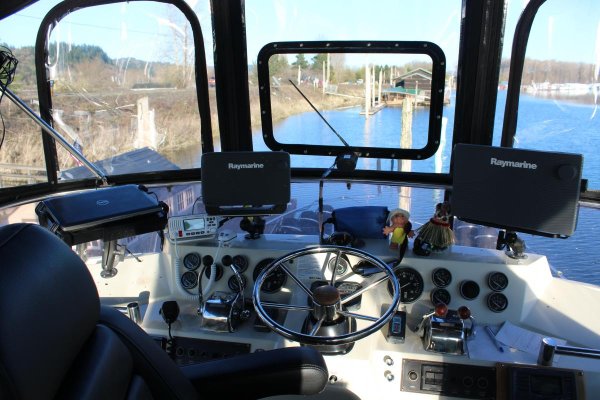
Anyway, I really like the radar and AIS collision avoidance features of my RayMarine system. I use it a fair amount to set targets and train them. However, when trying to make a decision as to the potential of a conflict, I have a hand-held compass at hand and check bearings. That will usually be the determining factor to tell me if I want to change course or not on a clear day.
__________________
Regards,

Dave
SPOT page
dhays is offline   Reply With Quote
Old 03-20-2018, 09:13 PM   #32
Guru
 
Alaskan Sea-Duction's Avatar
 
City: Inside Passage Summer/Columbia River Winter
Vessel Name: Alaskan Sea-Duction
Vessel Model: 1988 M/Y Camargue YachtFisher
Join Date: Jul 2012
Posts: 8,041
Quote:
Originally Posted by dhays View Post
That would be nice. What I'd really like is a RayMarine unit that will integrate with my MFDs and autopilot. That is what I had on my last sailboat and it was a very nice setup.
That is exactly what I have done. All Raymarine MFD, AIS and AP. Mt 2 MFDs are tied together. eS127 and a c97. Not sure if I like having one as a slave and the other as the master.
Attached Thumbnails
IMG_0533.jpg  
Alaskan Sea-Duction is offline   Reply With Quote
Old 03-21-2018, 05:27 PM   #33
Senior Member
 
Join Date: Nov 2011
Posts: 392
Nautical miles vs statute miles?
MVDarlin is offline   Reply With Quote
Old 03-21-2018, 05:30 PM   #34
Senior Member
 
Join Date: Nov 2011
Posts: 392
Also, boat operates with constant minor corrections of rudder to go "straight", and in heavy seas the up and down action climbing waves and trouhgs makes a water "distance" longer than the same distance over flat land.
MVDarlin is offline   Reply With Quote
Old 03-21-2018, 05:38 PM   #35
Guru
 
AlaskaProf's Avatar
 
City: Tacoma, WA & Ashland, OR
Vessel Name: boatless, ex: Seeadler
Vessel Model: RAWSON 41
Join Date: Jun 2016
Posts: 2,159
Quote:
Originally Posted by MVDarlin View Post
Nautical miles vs statute miles?
Really? You have to ask? Unless you are using charts from a gas station, it will be calibrated in NM. And you can measure on any meridian without having to find the scale.
AlaskaProf is offline   Reply With Quote
Old 03-21-2018, 06:05 PM   #36
Senior Member
 
City: Green Country
Join Date: May 2015
Posts: 243
Hummmm....720 ft per mile?
MRRiley is offline   Reply With Quote
Old 03-21-2018, 06:21 PM   #37
Guru
 
psneeld's Avatar
 
City: Ft Pierce
Vessel Name: Sold
Vessel Model: Was an Albin/PSN 40
Join Date: Oct 2011
Posts: 27,736
most waterway guides for the Atlantic and Gulf intracoastal and intracoastal waterway charts while still using lat/long are marked/refetenced in statute miles.

arent the inland rivers marked/ referenced statute miles also?
psneeld is online now   Reply With Quote
Old 03-21-2018, 06:31 PM   #38
Guru
 
AlaskaProf's Avatar
 
City: Tacoma, WA & Ashland, OR
Vessel Name: boatless, ex: Seeadler
Vessel Model: RAWSON 41
Join Date: Jun 2016
Posts: 2,159
Quote:
Originally Posted by psneeld View Post
most waterway guides for the Atlantic and Gulf intracoastal and intracoastal waterway charts while still using lat/long are marked/refetenced in statute miles.

arent the inland rivers marked/ referenced statute miles also?
How quaint!
AlaskaProf is offline   Reply With Quote
Old 03-21-2018, 07:10 PM   #39
Guru
 
BandB's Avatar
 
City: Fort Lauderdale. Florida, USA
Join Date: Jan 2014
Posts: 21,449
Quote:
Originally Posted by psneeld View Post
most waterway guides for the Atlantic and Gulf intracoastal and intracoastal waterway charts while still using lat/long are marked/refetenced in statute miles.

arent the inland rivers marked/ referenced statute miles also?
Yes, they are, and drove us crazy. Loopers are statute people it seems. To me, "nautical" ties to maritime and water so if I'm in a boat, I only talk nautical and knots.
BandB is offline   Reply With Quote
Old 03-21-2018, 07:35 PM   #40
Guru
 
caltexflanc's Avatar
 
City: North Carolina for now
Join Date: Aug 2011
Posts: 6,348
The reason statute miles are used on inland waterways, is the lat/lon are not factors in navigation. Think about it, NM really only ties to places where lat/lon is a factor.
__________________
George

"There's the Right Way, the Wrong Way, and what some guy says he's gotten away with"
caltexflanc is offline   Reply With Quote
Reply

Thread Tools Search this Thread
Search this Thread:

Advanced Search
Display Modes

Posting Rules
You may not post new threads
You may not post replies
You may not post attachments
You may not edit your posts

BB code is On
Smilies are On
[IMG] code is On
HTML code is Off
Trackbacks are Off
Pingbacks are Off
Refbacks are Off


» Trawler Port Captains
Port Captains are TF volunteers who can serve as local guides or assist with local arrangements and information. Search below to locate Port Captains near your destination. To learn more about this program read here: TF Port Captain Program


All times are GMT -5. The time now is 10:33 AM.


Powered by vBulletin® Version 3.8.8 Beta 4
Copyright ©2000 - 2023, vBulletin Solutions, Inc.
Search Engine Optimization by vBSEO 3.6.0
Copyright 2006 - 2012