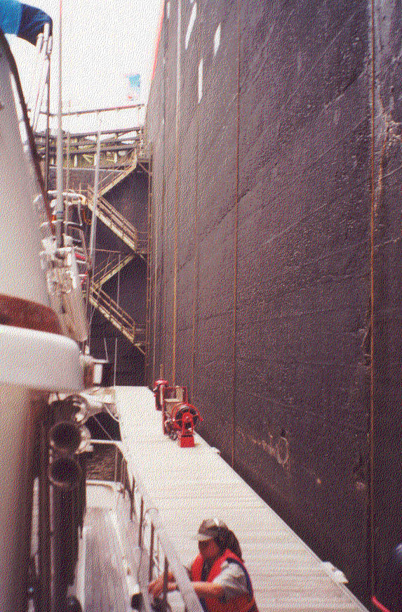
Cruising the New York Canal System

The friendliest place on the web for anyone who enjoys boating.
If you have answers, please help by responding to the unanswered posts.
The Ottawa River is as nice as the rest of the trip. There are nice marinas, one very large hotel made of logs and the Carillon Lock. The Carillon is one of the largest locks in North America. It is 65' deep and has a floating dock.

Carrillon1.jpg
Here is another picture of the Carrilon Lock. Great trip up to Ottawa and then down the Rideau Canal. CarillonLock1.jpg
 
If the weather is hot, I suggest you spend the night on the upper level if you stay there. We stayed on the lower level with several other boats and there was zero air movement down there. A very sweaty, mosquito filled night.
 
If the weather is hot, I suggest you spend the night on the upper level if you stay there. We stayed on the lower level with several other boats and there was zero air movement down there. A very sweaty, mosquito filled night.
Good suggestion for most locks. The taller they are the more important.
Obviously other factors to consider but worth adding to the thought process.
 
If you are really adventurous you could continue on into Canada and even make a "small" loop from Cape Cod to NYC, up the Hudson to Lake Champlain to Quebec and back down the coast to MA. Or go in the reverse direction. Something to think about.


Anyone thinking about this should note that it is over 1,200 miles from Sorel, where the Richelieu River meets the St. Lawrence, to Massachusetts. It includes the roughly 250 mile passage from Cable Sable to Massachusetts, so you need a life raft and other preparations for an ocean passage. Also half of the trip is in fog country, so you'll want to have and be proficient with radar.


It's a beautiful trip, but quite different from the canals. See https://issuu.com/cruisingclub/docs/voyages_2020 starting at page 94 for our trip in Fintry. I recommend doing it clockwise, with the current in the Richelieu and Saint Lawrence, which is important around Quebec City.


Jim
 
Anyone thinking about this should note that it is over 1,200 miles from Sorel, where the Richelieu River meets the St. Lawrence, to Massachusetts. It includes the roughly 250 mile passage from Cable Sable to Massachusetts, so you need a life raft and other preparations for an ocean passage...

You don't have to make that crossing directly. You can keep going up the West coast of Nova Scotia. From Yarmouth to Northeast Harbor (ME) is almost exactly 100 NM. Or continue up to Tiverton, then cross to Grand Manan, about 35 miles. An easy day trip even on a trawler. Another 35-mile day puts you at Roque Island, and you can enjoy the rest of the coast of Maine on your way down to MA.
 
You don't have to make that crossing directly. You can keep going up the West coast of Nova Scotia. From Yarmouth to Northeast Harbor (ME) is almost exactly 100 NM. Or continue up to Tiverton, then cross to Grand Manan, about 35 miles. An easy day trip even on a trawler. Another 35-mile day puts you at Roque Island, and you can enjoy the rest of the coast of Maine on your way down to MA.

Agreed. I've done a little looking at the Downeast loop and honestly, the area that concerned me most was the outer end of the St. Lawrence and the Gaspe Peninsula. It's a very remote area, not a lot of places to get fuel, etc. I remember seeing one stretch that was potentially very close to the limit of my comfortable fuel range (at slow cruise) unless truck delivery could be arranged for fuel (not always so easy for gasoline). The crossing further south was easy, I had no trouble finding a route short enough that making the crossing on plane would be an option (Yarmouth to NE Harbor sounds familiar for that one).

As far as the actual water encountered, nothing about the route struck me as concerning in terms of boat capability provided you've got radar and keep on top of the weather. I'd have no qualms about doing it in my boat.
 
Be careful. Neither Roque nor Northeast Harbor are places you can go directly from Canada. If you are coming from Canada, you must enter the US at a port of entry, which, as a practical matter would be Eastport, Bar Harbor, Portland, or Boston. Other places are listed, but when you telephone in advance as required they tell you to go to one of the those.


Jim


Good catch. Looking at it, Eastport looks like a slightly shorter crossing (~92 nm), Bar Harbor looks like about 97nm (similar to NE Harbor). Still no problem to do a single day crossing for most boats and certainly no fuel range concerns.
 
Yes, a 100 mile crossing in daylight would be OK without a life raft if the weather were benign and you had a good dinghy.


One additional fuel difficulty is that recreational marine fuels are taxed in Canada like highway fuels. Fishermen pay less, so you need to find places that sell to pleasure boats.


I'd be happy to lend you the half dozen guidebooks from our 2018 trip.


Jim


Even the 100 mile crossing doesn't actually put you 100 miles offshore, as it's basically across the mouth of the Bay of Fundy (with an intermediate island to pass along the way).


I won't be in a position to do the trip in the near future (and would probably want a life raft on board for it anyway), but it's certainly an easier run to plan than a 250 mile open ocean crossing. I know CaptTom has done the trip before.
 
Been to lunenburg and did Cabot, lighthouse and Evangeline trails on the bikes. Was impressed by current flow and tidal range. Would think it would produce a significant set. How do folks time it?
 
The Ottawa River is as nice as the rest of the trip. There are nice marinas, one very large hotel made of logs and the Carillon Lock. The Carillon is one of the largest locks in North America. It is 65' deep and has a floating dock.

Carrillon1.jpg


Don't forget the stair step locks in Ottawa. They are another highlight.
 
Been to lunenburg and did Cabot, lighthouse and Evangeline trails on the bikes. Was impressed by current flow and tidal range. Would think it would produce a significant set. How do folks time it?
Avoid it where possible. There is a lot to be said for leaving Shelburne and heading for Portland.

That's the challenge that may not be apparent from looking at the charts. Both the Gaspe area and the SW tip of NS are treacherous waters because of the changing currents.

There is more current in places than the Gulf Stream at its max. Lots of big eddies in the St Lawrence It doesn't take much breeze to set up really nasty waves where it's wind against current, and they appear out of nowhere when there's a tide change.
 
Thanks to everyone for their replies! Appreciate the advise and wisdom as always.

Scott

Andiamo
2004 Mainship 390

You certainly got the firehose information treatment. First, the internet claims your 390 has an airdraft of 19' 2'. You should be able to go up the "northern Erie Canal" without fiddling with your Andiamo. It takes you into Canada and a number of very interesting cruising opportunities.

Should you decide to go the historical or Western Erie Canal that dumps you into Lake Erie you will have to adjust Adiamo. Again the internet says you can take your radar mast down, which brings you to 16' 4" and not low enough. Per the internet when you take your bimini down your airdraft will be 14' 6", which will allow you to take the western Erie and sing the song.

If you have the time I suggest Canada and the Rideau Canal. It will be something you will bore you great grand children with for a long, long time.

Mike
 
Yes, a 100 mile crossing in daylight would be OK without a life raft if the weather were benign and you had a good dinghy.

Speaking completely from ignorance since I am unfamiliar with the local conditions, but 100 Nm coastal/slightly offshore passage doesn’t seem that daunting unless you have unrealistic expectations/time schedule.
Hundreds of folk do West End, Bahamas to Fort Pierce, FL (100 NM) across/with the GS every week in all manner of craft from small sail to center consoles. Don’t try this in a stiff N. Wind however. Coming from one who doesn’t carry a life raft; Not sure any dinghy adequately replaces a true life raft, so best to plan carefully!
 
Agreed. I've done a little looking at the Downeast loop and honestly, the area that concerned me most was the outer end of the St. Lawrence and the Gaspe Peninsula. It's a very remote area, not a lot of places to get fuel, etc. I remember seeing one stretch that was potentially very close to the limit of my comfortable fuel range (at slow cruise) unless truck delivery could be arranged for fuel (not always so easy for gasoline).

We did the Down East Loop and those areas were actually far less "remote" than they appeared. There are recreational marinas at reasonable distances. The link above is the blog I created along the loop back in 2016.

Before that, we crossed the Bay of Fundy in our 28' gas-powered express cruiser. Fuel certainly was a concern, since we had about a 100NM range. We brought four, six-gallon gas cans, and a couple of times had to get a ride into town to fill them. People were always offering to help, and it really turned out to be easier than I thought it would. But it did convince me that my next boat would be a diesel, and have a much longer range!


That's good to know! We're still a ways away from having a summer where we can get out there, but more info is always good. I figure our range (with comfortable reserve) as about 150nm at 17 kts, 350nm at 6.5 kts in decent (but not dead calm) weather conditions. Fortunately, as thirsty as the gassers are, we have pretty generous fuel tankage compared to many boats this size. Should definitely be manageable in that area, just takes a bit of planning.
 
That's good to know! We're still a ways away from having a summer where we can get out there, but more info is always good. I figure our range (with comfortable reserve) as about 150nm at 17 kts, 350nm at 6.5 kts in decent (but not dead calm) weather conditions. Fortunately, as thirsty as the gassers are, we have pretty generous fuel tankage compared to many boats this size. Should definitely be manageable in that area, just takes a bit of planning.

And a bit of "planing" because 17 knts is more fun than 6 knts, despite the cost.
 
You certainly got the firehose information treatment. First, the internet claims your 390 has an airdraft of 19' 2'. You should be able to go up the "northern Erie Canal" without fiddling with your Andiamo. It takes you into Canada and a number of very interesting cruising opportunities.

Should you decide to go the historical or Western Erie Canal that dumps you into Lake Erie you will have to adjust Adiamo. Again the internet says you can take your radar mast down, which brings you to 16' 4" and not low enough. Per the internet when you take your bimini down your airdraft will be 14' 6", which will allow you to take the western Erie and sing the song.

If you have the time I suggest Canada and the Rideau Canal. It will be something you will bore you great grand children with for a long, long time.

Mike


Well I really have appreciated everyone who provided feedback to this open ended initial question. Our plan is to go up the Hudson to the Erie canal then Lake Ontario via Oswega canal. Then enter St Lawrence at Kingston traveling north of Montreal to Sorel-Tracy where we’ll pick up the Richelieu river heading south to Lake Champlain and back to the Hudson.

Scott

Sounds like a great cruise. Have fun.
 
Sounds like a great cruise. Have fun.

How about towing service on such a trip. We have go to US. Last year on our trip to Maine we added SeaTow to our Boat US subscription and that turned out to be a winner!
 

Latest posts

Back
Top Bottom