Cruise from Racine,WI to Buffalo, NY

The friendliest place on the web for anyone who enjoys boating.
If you have answers, please help by responding to the unanswered posts.

Speedsailor

Member
Joined
Mar 13, 2021
Messages
17
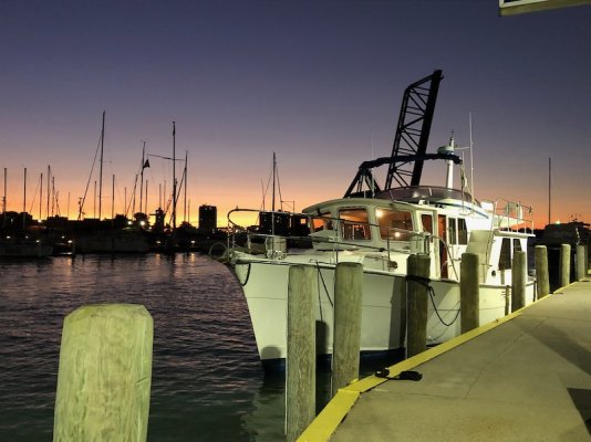
Hi all, I'm pre planning a cruise and not sure how long it will take. I closed on a new to me Camano 31 a couple of months ago and in pre planning stage. I need to make this cruise fun and successful as possible so I don't want to push too hard or go to fast. My question is how long will it take to get from Racine to Buffalo US side route and waiting for fare weather to cruise. We plan on leaving Racine June 14th-ish. I have been sailing small sailboats on lakes for years and scared my wife too many times so she won't step foot on a sailboat any more. My wife wanted a houseboat on Lake Mead but pushed her to a trawler. For fuel cost I will be cruising at about 6-8 kn and will be marina hopping most of the time to make it comfortable for my wife she's a little nervous about the trip. I have a couple of close friends wanting to do the Erie Canal with me and will relieve my wife in Buffalo. I don't have any hard time constraints but would like to be back to Boulder City Nv by November for the holidays. Our ultimate destination is Deltaville Va. If we don't make it that far I will put the boat on the hard and continue later next year.

Paul
 
For a very rough calculation, you can use Google Earth to determine the distance between the 2 cities, choosing whichever route you want. Divide the distance by average speed in knots, then divide that by the approximate number of hours you think you'll travel, and that will give you the minimum number of days.

On the actual trip, your time will be impacted by weather, the actual route chosen, and the distance between marinas, especially along the coasts of the Great Lakes. You may only get in half days as it's just too far to the next marina to make it in day light. Or, you may come upon a particular town or city where you decide to stay for a day or two.

When I was planning a route, I subscribed to Navionics and used it to plan the trip, having marinas shown helped determine the legs of the journey.
 
Welcome aboard TF
An alternative you might want to keep in your back pocket would be through Canada - if the border opens by then.
Georgian Bay and the Trent Severn canal to Lk Ontario. Cross Lkk O and pick up the NY canals in Owsego will still get you to the Hudson & NYC. The scenery will be spectacular and the Cruise of a lifetime. The other advantage is more protected waters than open lake running on Great Lakes can be difficult at times.
Agree with John Navionics is a very useful tool. The Actice Capt listing, reviews etc alone are worth it. Put it on a tablet and you have a backup chart plotter.
 
Last edited:
Given the newness of the boat to you, and your wife's apprehensions, I suggest you get a copy of the Waterway Guide Great Lakes edition, and both of you read it thoroughly and study it together. Let her pick out some stops that sound good to her.

My other suggestion is to break the trip up into very short segments of a few hours a day, and only in good weather. I'd take the long way around Lake Michigan, keeping the shore in sight as much as possible. Allow extra days for weather and extra days to spend a couple nights or so enjoying a town or area you find attractive.

The idea is to have fun, that's why it's called "pleasure boating".
 
I purchased loopers companion guide, great lakes waterway guide and richardsons charts for the Great Lakes. I put navionics on my phone but my phone is too small or my fingers are too big to try to plot anything. I'll buy a tablet soon to practice. The electronics on the boat are from 2001 they all work, I'm not ready to upgrade them yet (time and money) I hope to get by with navionics and active captain. Loopers companion guide has charted 40 travel days from Racine to Buffalo at hull speed. To make up time I can run the camano at double hull speed when weather is nice. My fuel burn will go from 1.5gph at 6kn to about 9 gph at 12 kn. I hope I don't run that fast that often. I estimated about 30 days added for weather delays and a few weeks added for sight seeing and possible mechanical issues. I hope to get to Buffalo in 90 days. Is this a realistic float plan. Any input from those that have done this route would be greatly appreciated. We plan to do the loop a few years down the road and take the northern route. The Camano doesn't have a windlass installed yet so I'm a little leary about anchoring out, I never had a windlass on my sailboats but there anchors were smaller. I planned to install one myself at the end of the trip I don't have enough time beforehand to install one. Is it worth the expense to have the yard install one before I get to the boat? I won't be able to get to Racine until June 1st and have 2 weeks planned for shake down runs in Racine before we head out.
Paul
 
You sound like a very prudent mariner to me. The one thing I will emphasize is to get your wife involved now in the planning process. This is critical to a happy experience for both of you.

The more you can get her involved in the planning and the eventual running and maintaining of the boat the better. Can she accompany you to Racine for the shake down period? Perhaps take some lessons? Ideally, she should know the boat as well as you do.
 
George,
She will be there with me. I hope to teach her some docking and weather permitting we will go out every day we can for the two weeks at Reefpoint Marina. I'll need the docking training also on the new to me boat. If she's not comfortable we might stay on Lake Michigan all summer and try next year to head south. I hate the idea to leave the boat in Racine for another winter. I am thinking about paying lessons for her for a couple of days at Reefpoint. A third option is to ship it, we looked into shipping but the cost is close to cruising it without all the fun so we decided against that. I have been trying to get input from her on destinations but she thinks boat books and charts are to boring. She is excited about Mackinac island and Put in Bay also have friends that live in Buffalo NY.
Paul
 
I came around from Grand Haven, MI, to western Lake Erie last October with very little weather delay, but I think that was unusual. Racine is not much different through Lake Michigan. I’ll second staying off the big, open water and in the more protected islands and waterways of the Trent Severn route. Meet your Erie Canal pals on Lake Oneida!
 
I'll have to take another look at the northern route I just discounted b/c of the covid restrictions.
 
Goggle Earth is a great tool to plan your trip. I use the satellite mode and the ruler icon for distance measuring. My preferred stops for this trip would be Washington Island, Beaver Island, Mackinaw Island, Presque Isle (Rockport Anchoring out), and then it get kind of ho hum much like Racine up to Washington Island. You cross Saginaw Bay from Oscoda to Port Austin, or if you want a shorter run between land (29 miles Oscoda to Port Austin) you can go to Tawas-Charity Island- Caseville ( 8 miles then 8 miles). You will want to avoid the shoreline from Port Austin Lighthouse down to Lexington. Stay well offshore as the rocks and sandstone bottom come up and down all over that area. From Port Huron to Toledo you will be getting a 2 knot bump from the current, so plan on making better time in this leg. Unless you are stopping somewhere just stay in the Freighter Channel as it is the straightest line and 29 feet deep throughout. Nicer stops in the rivers would be St. Clair in the St. Clair River, and Wyandotte or Grosse Isle in the Detroit River. From Grosse Isle you should make the run to Put In Bay (Bass Islands) this is weather permitting. Lake Erie is the worst of the Great Lakes for whipping up quickly and having steep short period waves. From The Bass Islands you city hop to the canals (Welland/Erie). If I were making the trip myself I would get to the Michigan shore by either seeing friends in Chicago first, or just making the 60 mile run across the lake. Nothing against Wisconsin as it is an incredibly beautiful state, but the Lake Michigan Shore is lights out almost the whole way up, and certainly from Pentwater up. If you get to Beaver Island (the place time forgot) you might even consider taking your wife to Harbor Springs (29 miles) for some shopping and a nice dinner. Then head north to Sturgeon Bay for a night on the hook, then off to Mackinaw Island. You have a wonderful trip ahead of you. The water will be a little chilly for swimming in mid-June, but it is doable with an onshore breeze and a hot air day in the shallows off the beaches. We are having a mild winter and I would expect the water to warm up quickly this year unless Spring has some surprises in store for us. Water levels will be down 9 inches from last year which will make many more harbor spaces available from the flooded and closed harbors of last year, but still plenty for keeping that propeller nice and straight. Good Luck. You won't need it, but good luck anyways.
 
Last edited:
Wow, thanks for that info I had to write it down in pencil and follow on the waterway guide and Google maps
 
One reason I recommended the Waterway Guide is that there is a lot about the towns and areas of interest. Another very useful tool is a road atlas and/or maps of the states you will be visiting. There will be times when you might want to get off the boat rent a car and explore. A night at a hotel might be welcome now and then as well.
 
You guy's are good at reading between the lines on how to keep a spouse happy. When we met I was in the Navy living on an old wooden sailboat in Charleston Sc she still remembers the huge microburst we took and laid the boat on its ear, water came flooding in until the the boat rounded up righted itself after that she wouldn't step foot on my sailboats unless there was no wind and we just motored to an island or anchorage We were forced into early retirement because of covid, I was laid off after 23 years and Lisa decided to take an early teacher pension. We sold our motorhome to fund the Camano and cruising, my wife was sad to her motorhome go but I was kinda tired of competing for campsites and fueling the v10 was getting close to trawler fuel costs(5MPG most of the time while towing my dinghy). The places we visited I would check with the nearby marinas and almost all of them had transient space available even when the campgrounds were full. We plan to home port the boat at Deltaville Marina and spend winters in Florida with the other snow birds. If I can make this cruising time successful I plan on buying a bigger trawler in 4 years. I do have a few hotel stays planned and also letting her take a break and fly home when she wants too, my goal is to get past the erie canal so we can use the boat in the winter. If we can't make it I'll just put it on the hard for the winter near where we end up and continue later.
 
My pace picked up dramatically once I escaped Lake Michigan including one day jumps from Oscoda to Port Huron and Port Huron clear to Sandusky, Ohio. Wouldn't want to do it that way too often, but it was nice to make time in good weather. Both of those days were run first to last light and at 8 knots.
 
Was that a 100 nautical mile run, pretty impressive. If I can get good weather I would hope to push the camano to 12 kn on some runs. Talking to previous camano owners they average 70 nm per day.
 
Crossing the northern part of the loop is nice however, I would not take in a new to me 31 footer trawler and a scared wife. I am not trying to scare you but bad whether can make that part of the loop real nasty. I would recommend hiring a seasoned captain for that part of the water (the wife can come along) than dump the captain and continue down to VA with a happier wife.
Small trawlers are a lot worst than small sailboats in bad weather as far as I am concerned for a first time trawler owner. Whatever path you choose, i wish best of luck on your journey.
Regards,
 
Was that a 100 nautical mile run, pretty impressive. If I can get good weather I would hope to push the camano to 12 kn on some runs. Talking to previous camano owners they average 70 nm per day.

As I recall, those consecutive days were 118 and 125 statute miles. Some sections of the St. Clair and Detroit Rivers were running at 4 knots. It was easy running after crossing Saginaw Bay as the sun came up and I made Port Huron not long after sunset, but despite the boost from the current, I arrived in Sandusky well after dark. Grateful to have made it intact.
 

Attachments

  • IMG_6205.jpeg
    IMG_6205.jpeg
    154.5 KB · Views: 25
Some advice that took me 25 years to learn.

Short trips to start. Be a fair weather sailor.
The boat is new to both of you. Allow both of you to learn each others reactions to the way the boat handles when things go wrong, and things will, in clear calm weather.

Regarding boat handling issues. I purchased extra lines and keep bow, 2 spring and stern lines, port and starboard, always “on cleat” and ready so there’s no issue when we approach docks from port or starboard. Fenders too! Best $250 you could ever spend.
Review your dock approaches well before you are near the dock.

While you may be captain, the admiral outranks you and has final say. If weather looks iffy, don’t leave the dock. When you are planning the day, BOTH of you listen together to 3 sources of weather reports. If two are reporting any suspected bad weather, don’t go. If the admiral, who is also chief safety officer, indicates for 1 microsecond, any hesitation whatsoever, LISTEN to her. Don’t try to reassure, just listen and stay put.
That kind of attention to her concerns outweighs all other concerns about docking, boat handling, etc. Boat handling and related issues will be learned together.

Sorry if this sounds preachy.
 
Hi there,
I would suggest getting a membership to the Great Lakes Cruising Club, 'GLCClub.com'. The club is over 80 years old and has a great wealth of information on the Great Lakes and the connecting waterways. The Harbor Reports are worth their weight in gold. The club has over 1100 Harbor Reports that cover port, marinas and anchorages, with approaches laid out and what services are available in each place. Each Harbor Report also lays out the surrounding ports/anchorages with distances in Nautical Miles. All of the reports are updated by the members as new information is gained through member travels.

We have been members since 2013 and have used the Reports extensively. Well worth the price of admission.
 
Last edited:
A few more unsolicited points.

1. Plan this trip with your wife at your side, or at least go over the trip in its entirety and explain why it is laid out the way it is. Justify your decisions and let her challenge anything she wants. I would also ask something like " this harbor has such and such, but I see this has this and that, which do you think you prefer?"

2. Fair weather sailor suggestion is a good one. You should know how to read the weather and be able to accurately predict what the next four hours looks like. I think your longest run from port to port is only about 39 miles (you check your route), this puts you no more than 20 miles from a harbor worst case. At 10 miles per hour you are a couple hours from a harbor. GL weather is primarily SW winds that build in the afternoon. A southwest wind at 20 mph is common. It gets a little choppy, but usually is no big deal. If there is weather approaching west or southwest you better know when it is going to arrive. If you get an E or NE winds, rent a car for three days. Three day blows from this direction are occasional and you are going NOWHERE until it's over.

3. Draw a line across US 10 in Michigan. Everything north of that line from Wisconsin to Canada is arguably the finest cruising grounds in the world.No salt, nothing has you in mind for dinner, clear cool water, quaint little towns. The only water born hazard are cuts from the zebra mussels that are invasive from.........the ocean. Take your time if you do not plan on coming back this way anytime soon. You will never see something like this anywhere else.
 
I'm very familiar with the northern reaches of Lake Michigan and Green Bay.
Regarding winds...it depends on which side of which lake you're talking about. Fetch is the big factor.

If you want to see the best of Wisconsin's Door County, you'll have to cut through Sturgeon Bay to get onto Green Bay. Sturgeon Bay is nice by itself, but it's a middling size town (lots of marinas, boats, shipyards, etc. Several extremely charming little towns on the west side of Door county...Sister Bay and Fish Creek come to mind. Nice anchorage at Peninsula State Park. At the end of Door County hang a right for a night on Washington Island on your left. Next day finish the transit of Death's Door (great name)and head for Beaver Island. Then on to Mackinaw Island.

If I wanted to do the Michigan side I'd still head north to Sturgeon Bay. The next calm day I'd cut straight across Lake Michigan to Frankfort (shortest possible distance/exposure on the open waters of the Lake). Fog is possible, but not a problem with radar....and there is very little pleasure boat traffic crossing the big Lake in June. (There are the occasional freighters and Lakers transiting the east side and west side shipping lanes). Frankfort is a nice town with lots of restaurants, two good marinas and great anchorage. We had a slip there for several years. Great beach. Eat at Dinghy's for one meal. From Frankfort you could anchor one night at South Manitou Island (remote). After that there's a string of great stops on the trip north to Mackinaw Island.....Leland (fish Town), Charlevoix, Petosky, and Harbor Springs. You could duck into Big traverse Bay for more charming stops, but the distances would eat up a lot of time. Beaver Island is OK, but not much there.

I've done the east side of Michigan once. Nice but not the same as the northwest corner ...the playground of Detroit and Chicago's wealthy.
 
Last edited:
If possible a great way to get the first mate (or admiral in some cases) engaged is to have them participate... how less important just find a portion of the routine tasks.
My admiral has taken the USPS Wx course and maintains a keen interest in the Wx, upcoming days fcts and any impending dangers.
When cruising and open waters we are focused on Wx facst and jointly discuss fcsts and how they might impact our plans. We each feel empowered to call a veto (or at least a desire to stay put for a Wx day) without reprisals. We are both open to discussion and inputs and try to make it a joint decision. Safety and comfort are keys... but neither of us are afraid of a little rough going as long as it can be done safely.
 
We spent four weeks bringing our trawler from Sodus Bay, NY, to Lake Michigan via the 1000 Islands and the Trent-Severn. Wonderful trip. Great weather. 6-7 knots cruising speed. 1000nm.
 
Several years ago when I was still sailing I boat a 36' C&C in Buffalo. It took me 7 days to get it back to Traverse City, MI. 6 days to get to Mackinaw City. We travelled at 6.5 knots. Based on that I would say 7-8 days on your boat with good weather. You might do a little better since I was fighting the current going up river in the St. Clair and Detroit river
 
Bill

I may be making a similar cruise this summer from Sturgeon Bay. Route depends on what Canada does. I live near Deltaville and can provide local knowledge.
Have a great trip. We will keep a lookout for you.
 
I suggest you go up the Michigan side of Lake Michigan. Nice towns and inlets every 15 miles or so. If you don't want to cross the lake from Racine, just head down to Chicago and go along the southern end of the lake.


Door Count is very nice but I'd hate to miss all those Michigan harbors.


Spend some serious time in the Traverse City/Charlevoix/Harbor Springs area.


An area you absolutely don't want to bypass is Les Cheneaux islands near Mackinac. Gorgeous area and very peaceful. If Canada is open, do the North Channel and Trent Severn. Otherwise just make time down the Michigan side of Huron.


90 days is plenty of time to that cruise with plenty of days for exploring and relaxing.
 
First, I strongly second the suggestion that you join the GLCC. Their harbor reports are mostly pretty good, but, more important, they have members in most harbors that act as local contacts, friends, helpers in times of trouble. We needed them only once on our 2018 trip from Boston up the Saint Lawrence to Isle Royale and back, but it was well worth the membership fee.


Second, Navionics is fine, but I highly recommend OpenCPN for your chart plotter. The fact that it is free is certainly nice, but much more important is that it is the easiest and best charting software I have used -- and that includes most of the well known brands.


Third, you plan on running only during the day. I suggest that once you get comfortable with the boat, you consider overnights. It more or less triples your daily mileage. I find it easier at night since a vessel's lights will tell you exactly where she's headed. The big ships, of which there are many, stay in their well charted lanes and you simply stay out of the lanes.


Fourth, get at least an AIS receiver or, worst case, a phone or tablet that will pick up marinetraffic.com or vesselfinder.com to see what is out there and where it is going.


Jim
 
AIS receiver and chart plotter is on my top list when I get to the boat.. The electronics on the Camano are from 2001. I plan a full electronic refit next year. We plan to marina hop along michigan and do day runs, I promised my wife I wouldn't leave sight of land. We'll probably spend more time in town's than anchoring out until she's comfortable. I looked at the greatlakes cruising club I was hesitant to join but on a second recommendation I'll join this week. The Les Cheneaux islands look amazing, looks to be nice sandy bottom also. We hope to do the loop in 4 years and will take the northern route. I also want to go to Green Bay at that time.

Paul
 
What dock at Reefpoint? Lenny the Dockmaster is a great guy
 
Back
Top Bottom