Any recommendations on supplies for a cold voyage?

The friendliest place on the web for anyone who enjoys boating.
If you have answers, please help by responding to the unanswered posts.
Not cold weather related, be sure you have a good hand bearing compass paper charts and parallel ruler. They should be onboard anyway but this would be a great opportunity to teach your son about navigation without electronic crutches. Teach him how to plot a fix and follow the route your broker has laid out. You can always keep the chart plotter and other modern trappings running for your own use, but I would really encourage him to take ownership of the navigation. It is a great learning experience he will never forget.
 
Not cold weather related, be sure you have a good hand bearing compass paper charts and parallel ruler. They should be onboard anyway but this would be a great opportunity to teach your son about navigation without electronic crutches. Teach him how to plot a fix and follow the route your broker has laid out. You can always keep the chart plotter and other modern trappings running for your own use, but I would really encourage him to take ownership of the navigation. It is a great learning experience he will never forget.

I second the motion! :thumb:
 
Make sure their is a clear understanding of who the Captain is.
 
Sorry to be late on this discussion. Am doing a delivery and here in NC/SC internet can be spotty. When running/delivering a new to me boat, I bring my own navigation tools. I bring a PC running Coastal Explorer so that I know I have up to date charts. I also have two iPads. One runs Navionics and the other runs Garmin stricktly forthe Active Captain content. I bring my own Binocs, a stabilized Cannon set.
 
Sorry to be late on this discussion. Am doing a delivery and here in NC/SC internet can be spotty. When running/delivering a new to me boat, I bring my own navigation tools. I bring a PC running Coastal Explorer so that I know I have up to date charts. I also have two iPads. One runs Navionics and the other runs Garmin stricktly forthe Active Captain content. I bring my own Binocs, a stabilized Cannon set.


Great suggestions on ensuring that there are some nav tools on board. From a practical standpoint, do you really want to drop a lot of money on charts for a region that you will only use for a couple days? Ask the broker what is on the boat. On the last boat we bought, there was a pretty good set of up to date charts on it already as well as the basic nav tools.

The suggestion for a pair of binoculars is one of the best so far in this thread. I have had the same set of stabilized binoculars that have been with us for three boats. Very old at this point but they get a lot of use. Bring some if you have them, buy some if you don't as it will be a great long term investment. They will be very helpful since all the areas you will be in are new to you.
 
On the West coast, your waters are generally deeper and your coastline is often rock. It probably means your charts are more static than over here in the east. Paper charts may be more reliable there compared to here.

The best way to have up to date charts is to have electronic charts. Coastal Explorer alerts you when there are new charts for your region. That is why I use PC navigation. Navionics allows you to update charts daily on the iPad and the Navionics chart chip for a chartplotter can be updated anytime you have fast internet. If you want to keep our paper charts up to date using the Notice to mariners, good luck with that.

To run the Atlantic ICW there are about 220 charts you would need. They are updated weekly in the Notice to Mariners for two different US Coast Guard districts. When you get a new chart you have to go back through all the LNTMs to see if there were changes. And if you miss any one week of the LNTMs, then you do not know if you have all the correct information. There is no way that one can honestly say that one keeps paper charts up to date here on the Atlantic ICW.

Hurricane Matthew made changes to several key sections of the route. The USACE and USCG moved nav aids and ran survey transits immediately and had new content available within days. The electronic charts were up to date by the time went south 9 days after the hurricane. Now on my second ICW run this fall and have found lots of further updates since I passed through these waters 6 weeks ago.
 
On the West coast, your waters are generally deeper and your coastline is often rock. It probably means your charts are more static than over here in the east. Paper charts may be more reliable there compared to here.

The best way to have up to date charts is to have electronic charts. Coastal Explorer alerts you when there are new charts for your region. That is why I use PC navigation. Navionics allows you to update charts daily on the iPad and the Navionics chart chip for a chartplotter can be updated anytime you have fast internet. If you want to keep our paper charts up to date using the Notice to mariners, good luck with that.
.


It is true that the waters I am in don't change that much. I have copies of old charts from the 70s and there isn't much difference between those and the current charts. The things that have changed are the Nav aids.

This is why I would be tempted to make the trip the OP is going to do with the charts that may be on the boat as well as his iPad app of choice. I have the free version of SEAiq for the iPad that is a great little app for using the NOAA charts. That way he won't be buying charts that he will never use again.
 
Bring a crockpot, fill it with a good stew and draw out as needed. Keep away from a schedule. If things turn dicey, stay put until conditions are Perfect.
 
On the West coast, your waters are generally deeper and your coastline is often rock. It probably means your charts are more static than over here in the east. Paper charts may be more reliable there compared to here.

Just keep in mind that even though a chart has a relatively current date on it doesn't mean that it's based on current survey data. It should reflect current Nav Aids, but the bottom survey could still be very old and primitive. There was one area in SE Alaska where we were last summer where the survey was from pre-1900. But it was still reasonably accurate, to your point about rock not changing much.

But that's not the case in Prince William Sound. The big earth quake in the 60s seriously rearranged the ocean floor in many areas. Maybe some of our members from the area can tell us more. I only know what I've read.
 
Two sailboats found a large rock at the entrance to the Tacoma Yacht Club basin before the Winter Vashon Island Race this year. There has been a lot of work on the breakwater peninsula for environmental mitigation (super fund site). Somehow a large rock ended up where no rock had been before. One boat hit it a glancing blow with its keel. Another hit it's keel hard, coming to a dead stop at around 5 knots.

So occasionally things do change, but around here they usually don't. Also the survey data for much of the Puget Sound is at least 40 years old with some sections being over 100 years old. Fortunately the places that will tend to change are surveyed more often and any waterway maintained by the Army Corp of Engineers is surveyed a bit more frequently.
 
Seconding the best advice I've seen on this thread:

Dont bother fitting out and provisioning for what is actually six hours of travel--followed by "de-provisioning" for haulout. Dress appropriately, bring nav tools and charts, pick up some deli and spend the night dockside at Anacortes.

Good marina, good restaurants, stores, and tech support if you should actually shake something down on your shakedown.

Second day, grab a Starbucks' and head down the Swinomish Channel, you'll be in Seattle for lunch.

One caution: if the yard which is lifting your vessel is inside the Chittenden Locks, stop by there on your way north and see how that works before confronting this challenge. The locktenders are always helpful with newbies, but this is a very public place to display your seamanship, or lack thereof.

Bon voyage,

'prof
 
Last edited:
Are you still planning the trip this weekend? The weather is not looking favorable.
 
Are you still planning the trip this weekend? The weather is not looking favorable.

Yup, arriving tomorrow. I just looked at the weather. Not ideal, but based on the current forecast it looks like we should be okay if we get going early Saturday morning. This way, we should stay south of the worsening weather. I'm thinking we try to make it to Everett on Saturday.

Thoughts?

Thanks,
Mike
 
This time of year, the weather is erratic and the forecasts move around. There are systems on both sides of your window so hopefully the current forecast holds.
 
Saturday looks like a reasonable day on the Strait of Georgia BUT keep in mind that the forecast has been changing significantly even within 12 hours. I'm planning on heading across the strait on Saturday so I've been keeping a close eye on weather.

Keep an eye on the Halibut Bank weather buoy and the Entrance Island and Merry Island lightstation reports. They aren't where you're going, but they'll give you some idea of how conditions are on the strait.
 
Hi Everyone, quick update. Yesterday we traveled from Point Roberts to Port of Everett. Took 5 hrs and 12 minutes. Not sure what our average speed was, but I'm guessing around 17 knots. Conditions weren't bad. Wind was about 10 to 15 knots and seas between 1 and 3 feet.

This morning we left the Port of Everett at 12:30pm and we're on our way to Seattle. Forecast said 20 to 30 knot winds from the North (so coming from behind us) and seas between 2 and 4 feet. Right now we're at 47° 53.8 N and 122° 21.2 W and the conditions are gorgeous and sunny. Little if any wind and seas less than one foot. Would be nice if it stayed this way!

Thanks for everyone's help in preparation for the trip. Special thanks to the other ST44 owners for answering some ST44 related questions. Specifically, Sojourn4, rclarke24 and especially CeeBee for taking my call at the fuel dock!

Boat has ran flawlessly. Biggest issue was our HVAC system. The thermostats on the Crusair controls show 55 degrees when it feels like 70, so they keep pumping out heat. I could have done Bikram yoga in my room last night! All three controllers in the boat essentially are behaving the same.

Other than that, boat has been great. Comfortable and quiet. Biggest learning curve is the electronics. We are also using paper charts to learn navigation in case the plotter craps out.

Our broker, Don Margraf, who runs the Denison office in San Francisco, is with us and he's been incredible. Couldn't imagine a better broker. When we got into Everett, we spent a good deal of time practicing docking (myself, my wife and son) and he's unbelievably calm and patient. Very good teacher.

Well, that's my update for now.

HAPPY NEW YEAR to everyone!

Best,
Mike
 
Happy new year, wish you the best for your trip.
Be safe!
 
Hi Everyone, quick update. Yesterday we traveled from Point Roberts to Port of Everett. Took 5 hrs and 12 minutes. Not sure what our average speed was, but I'm guessing around 17 knots. Conditions weren't bad. Wind was about 10 to 15 knots and seas between 1 and 3 feet.

This morning we left the Port of Everett at 12:30pm and we're on our way to Seattle. Forecast said 20 to 30 knot winds from the North (so coming from behind us) and seas between 2 and 4 feet. Right now we're at 47° 53.8 N and 122° 21.2 W and the conditions are gorgeous and sunny. Little if any wind and seas less than one foot. Would be nice if it stayed this way!

Thanks for everyone's help in preparation for the trip. Special thanks to the other ST44 owners for answering some ST44 related questions. Specifically, Sojourn4, rclarke24 and especially CeeBee for taking my call at the fuel dock!

Boat has ran flawlessly. Biggest issue was our HVAC system. The thermostats on the Crusair controls show 55 degrees when it feels like 70, so they keep pumping out heat. I could have done Bikram yoga in my room last night! All three controllers in the boat essentially are behaving the same.

Other than that, boat has been great. Comfortable and quiet. Biggest learning curve is the electronics. We are also using paper charts to learn navigation in case the plotter craps out.

Our broker, Don Margraf, who runs the Denison office in San Francisco, is with us and he's been incredible. Couldn't imagine a better broker. When we got into Everett, we spent a good deal of time practicing docking (myself, my wife and son) and he's unbelievably calm and patient. Very good teacher.

Well, that's my update for now.

HAPPY NEW YEAR to everyone!

Best,
Mike

I'm glad it's gone so well and I love to hear such comments about brokers. I dislike when people here act as if they're all bad, and clearly yours is not.
 
Glad it worked out, especially the broker, way above and beyond expectations.
When the weather was looking iffy I thought of suggesting extra undershorts supplies, but you got there without needing a change.
 
Excellent news on your trip. I hope that the rest goes as smoothly. FWIW, Everett was the first place I docked a power boat when we did the sea trial on our NP43.
 
We drove right by your Nordhavn after going through the locks. Beautiful boat!

Yes, just diagonally across from CRS. Glad you made it through OK.

Re your thermostats, we had a similar issue on our Grand Banks. Assuming it's a Cruise Air system, the thermostats are either integral to the control panel, or remote probes. The remote probes work a bit better, and are supposed to be located in or near the return air flow. That's what we have on the Nordhavn.

On our Grand Banks it used the temp sensor in the control, and it was heavily impacted by external temp. The cavity that the control was mounted into was uninsulated (typical for a boat), and seemed to sense the temp of the cavity more than the living space. When the sun was shining on that side of the boat, the AC would run until the Salon was a meat locker. Sounds like you have the opposite problem with the external cold tricking the temp probe. Installing remote probes might solve the problem.
 
Mike,

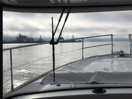
Any scenery at the Navy Pier?

Bob
 
Mike,

Any scenery at the Navy Pier?

Bob

At Port Everett or Seattle? I have nice pics of both, but only have my phone. I'll post a bunch when I get back to my computer.

Best,
Mike
 
:popcorn::popcorn:
At Port Everett or Seattle?
Best,
Mike

Really no Navy presence, in Seattle, though I have dim memories of "family day" on the Bon Homme Richard at Pier 91. Pop tells me there were three Essex-class carriers there at the time.
 
:popcorn::popcorn:


Really no Navy presence, in Seattle, though I have dim memories of "family day" on the Bon Homme Richard at Pier 91. Pop tells me there were three Essex-class carriers there at the time.


IMG_0788.JPG

Just trying the iPhone App for the first time. Let's see if you can see the Navy ship pics in Port Everett. Didn't really get much closer than this.
 
Back
Top Bottom