Slow Hand 2023 To Lake Superior and back

The friendliest place on the web for anyone who enjoys boating.
If you have answers, please help by responding to the unanswered posts.
Nice Ted! You worked that cold front nicely. Being under way before first light is the absolute best. It’s like getting the jump on the rest of the world. Enjoy your photos. Keep ‘em coming.

Thanks!

Ted
 
Underway at 3 AM before the tide turns
A man on a mission, admirable. Enjoying following along vicariously.
Do you have good night vision? I have it and like the solitude of traveling at night.
 
Do you have good night vision? I have it and like the solitude of traveling at night.

Yes, I have good night vision and situational awareness. I did a fair amount of night charters and often moved the boat to different cities at night. Also like the fact that most people who can't drive a boat, are at the bars drinking while I'm out on the ocean.

Ted
 
Yes, I have good night vision and situational awareness. I did a fair amount of night charters and often moved the boat to different cities at night. Also like the fact that most people who can't drive a boat, are at the bars drinking while I'm out on the ocean.

Ted

Do you use a FLIR or other night vision device?
 
Do you use a FLIR or other night vision device?

No. I usually cruise at 6 knots at night. In areas where I'm likely to see crab or fish pot markers, I have a very bright spotlight.

20230508_114152.jpg

I'm also really good with my radar. Coming out of Galesville, MD on Saturday morning, the seas were slight, and I was picking up the crab pot markers on the 1/8 mile range setting.

Ted
 
After a 6 day pause visiting friends in Brick, NJ, Slow Hand is bank underway and on schedule to be at the opening of the Erie canal on Friday May 19th.

Dawn of a new day behind the barrier island on the NJ ICW.
20230515_054236.jpg

The Point Pleasant canal runs about 1.5 miles connecting the Metedeconk river with the Manasquan river and the Manasquan inlet to the Atlantic. Tidal currents can reach 2.5 knots through the canal. Timing the currents below 1 knot makes the passage more pleasant, especially with opposing traffic.
20230515_065620.jpg

20230515_065750.jpg

Screenshot_20230515_070242_Aqua Map Marine.jpg


Manasquan inlet to lake Atlantic.
20230515_072721.jpg

The ends of the breakwaters are made with steel reinforced concrete dolos.

https://en.m.wikipedia.org/wiki/Dolos

The system works really well as an interlocking breakwater and has been in place for 40 years.
20230515_073101.jpg

20230515_073106.jpg

Screenshot_20230515_091742_Drive.jpg

A typical image of homes on the Jersey coast.
20230515_073630.jpg

Ted
 
The Point Pleasant canal runs about 1.5 miles connecting the Metedeconk river with the Manasquan river and the Manasquan inlet to the Atlantic.

Beautiful stuff, Ted. I have been planning to run the Intracoastal Waterway clear through Manasquan, but read plenty of reports warning against it. You fearlessly ran it and it sounds like it is your routine. No problem. Am I reading that right, or do you only proceed through parts at certain tides?
 
Ted...nice!

Every time I had to go through Manasquan it was like a washing machine.... :eek::D
 
Beautiful stuff, Ted. I have been planning to run the Intracoastal Waterway clear through Manasquan, but read plenty of reports warning against it. You fearlessly ran it and it sounds like it is your routine. No problem. Am I reading that right, or do you only proceed through parts at certain tides?

I come down the Delaware Bay, in the ferry channel at Cape May, and anchor next to the USCG station for the night. Then out the Cape May inlet and up to Barnegat inlet. Barnegat inlet to Manasquan inlet is doable in any tide state, provided you follow the channel markers. I haven't done below Barnegat inlet on the ICW.

Ted
 
Ahh, so you're running outside from inlet to inlet. Got it. What's your draft? Have you looked at running the ICW the whole way up to Manasquan?
 
Ahh, so you're running outside from inlet to inlet. Got it. What's your draft? Have you looked at running the ICW the whole way up to Manasquan?

Draft is 4.5' +/-. I've looked at it, but have been able to pick a two day weather window to go down Delaware Bay and up to Barnegat inlet, so far. I'm sure it's doable, but there will be some places I need to transit on the upper half of the tide cycle. Would rather spend my extra days elsewhere.

Ted
 
Ted...nice!

Every time I had to go through Manasquan it was like a washing machine.... :eek::D

Massive tidal flow and opposing wind are an absolute bitch in that inlet.

Ted
 
New York Harbor is a busy place!

20230515_141017.jpg

20230515_141138.jpg

Lots of big boats up close and personal. If you listen on channel 13 (bridge to bridge), you get an appreciation for how much commercial traffic there is. You will also hear professionals that are far more courteous than their recreational counterparts.
20230515_141242.jpg

20230515_135224.jpg


And then standing tall, surrounded by all the confusion, is the Lady.
20230515_143031.jpg


Next to the Lady is Ellis Island, where the legal immigrants came to enter the country.
20230515_143659.jpg


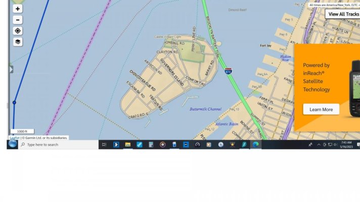
Tonight I'm anchored behind Ellis Island. A better spot than behind the Statute of Liberty with the forecast SW wind. It's pretty rolly now with all the boat wakes, but not bad after dark.
20230515_171324.jpg


Across the water is the NYC skyline. Impressive near sunset and maybe more so when illuminated at night.
20230515_171250.jpg


While I'm not much of a city fan, I encourage you, should you come this way, to spend a day at Ellis Island and visit the Statute of Liberty. The National Park Service has done an amazing job restoring Ellis Island with some 5,000 pictures of the place and people who passed through it.

Ted
 
I just saw that big pink ONE in Jacksonville 5 days ago.PXL_20230510_121626581.jpg
 
Ted, I was looking at a map of the area you are in and saw
Chincoteague road on Governor's Island. Wonder how that
name came to New York? Small world indeed.
For those who don't know, Chincoteague is a very small town
on a barrier island off of Virginia's Eastern Shore.

Jim
 
Ted, I was looking at a map of the area you are in and saw
Chincoteague road on Governor's Island. Wonder how that
name came to New York? Small world indeed.
For those who don't know, Chincoteague is a very small town
on a barrier island off of Virginia's Eastern Shore.

Jim

I looked and Google looked, neither of us could find it. But I'm sure they would say it was a New York street before it was a town in VA. :rolleyes:

Ted
 
And one more pic of NYC.

20230515_204318.jpg

Ted
 
Govenors island used to be USCG (I think Navy or other DOD ownership prior to USCG) and Chincoteague is not unfamiliar to the USCG but not sure if the street was named prior to USCG occupancy.

It's where I got my indoctrination physical to join the USCG in 1977.

Just looked at a current map of the island, didn't see a Chincoteague Rd on there...where was it?
 
Last edited:
Impressive set of pix, Ted!
 
Left Ellis Island this morning at 4 AM to catch the inbound tidal current and have a quiet transit on the George Washington bridge. As the sun was rising, I was treated to this very odd site:

20230516_060601.jpg

Ted
 
Here is a screenshot from Garmin of Ted's route showing Governor's Island.
Previous USCG ownership explains a lot of things.
Great pictures as usual, Ted!
Jim
 

Attachments

  • Ted's trip.jpg
    Ted's trip.jpg
    80.5 KB · Views: 26
Left Ellis Island this morning at 4 AM to catch the inbound tidal current and have a quiet transit on the George Washington bridge. As the sun was rising, I was treated to this very odd site:

View attachment 138880

Ted

Did you see that with eyes or just the camera, and have you determined what caused the burn effect? Makes for a nice picture.
 
Did you see that with eyes or just the camera, and have you determined what caused the burn effect? Makes for a nice picture.

First saw it with my eyes, then took the picture.

My guess is smoke or steam that radiated the sun better than the clouds, sort of like a florescent light bulb. You can see smoke or steam above the clouds that wasn't back illuminated by the sun. I'm wondering if the high moisture content in steam would explain it.

Ted
 
As you travel North up the Hudson River, the flat lands give way to the Palisades and eventually a more mountainous landscape.

20230516_064436.jpg

20230517_061730.jpg


At 1,300' the Bear mountain (left) dwarfs the Bear mountain bridge.
20230517_063238.jpg


In this picture you see the Bear mountain bridge. Below the bridge to the right is a CSX freight train. In front of the train is a tug pushing a raft of barges. :eek:
20230517_064522.jpg


AIS is your friend! There is a modest amount of tug and barge traffic on the Hudson river up to Albany. You will also see a ship on occasion. The tugs monitor channel 13 and are polite and professional. Occasionally in the corners such as Bear mountain bridge and West Point, they appreciate setting up passing arrangements before coming face to face.
20230517_064836.jpg


West Point Military Academy sits overlooking the sharpest corner in the middle Hudson River. West Point is rich with history from George Washington and the colonies blocking the British from coming down the Hudson river to attack New York city to the present day Military Academy. If you're in the area, it's well worth taking the tour of West Point. No, you can't dock or dinghy ashore.
20230517_074107.jpg

Ted
 
Where are you planning to stage for the Erie canal? I hear Waterford docks are already full (not rafting yet) and sounds like the wall is going to fill up today possibly.
 
Back
Top Bottom