Navigation In Depth

The friendliest place on the web for anyone who enjoys boating.
If you have answers, please help by responding to the unanswered posts.
Joined
Dec 16, 2007
Messages
1,045
Location
U.S.A.
Vessel Name
Old School
Vessel Make
38' Trawler custom built by Hike Metal Products
I saw this in Soundings yesterday:
Soundings Online Mobile - Soundings Dispatches
It got me to thinking, if you're traveling to or passing through waters never travelled before, how would you handle safely navigating to your planned next stop if all electrical equipment went out? I'm used to just following a pre-planned route on Coastal Explorer, but what if its no longer available? I also carry paper charts and could probably muddle my way through. One of the reasons I bring this up is our recent trip from the slip to Bay St. Louis, MS. Lake Ponchartrain was no problem, but past there was new territory. Getting to the Gulf ICW from past the Interstate 10 bridge was interesting, skinny water in a narrow channel, then into the Rigolets which is deep but with channel markers few and far between.
Just thinking about it makes me want to take an in depth navigation class.

What you bring up is becoming a common malady of the new class of boaters. Back when I started boating the only real choice in navigation was the compass-maybe a depth finder or lead line and charts. That was all you needed and with a little care and education it worked even in heavy fog. The basics sometimes called Jackass navigation included knowing how to use the charts the compass a protractor straight edge tide tables and a good time piece etc.. Today too many are completely reliant on electronics so much so they are not aware when and if they are being lead astray not that uncommon. I suggest you enroll in CGAUX or Power squadron basic navigation courses and practice what you learn. Cover your plotter use it for intermitent position checks while you navigate with the chart and compass depth finder etc. and get used to navigating rather than letting the machine have all the fun.
 
One of our club members has a 40' sailboat and has been boating in these waters and in BC for decades. To this day he uses paper charts and the only "instruments" on his boat are a VHF radio, a depth sounder, and a magnetic compass. He and his wife have sailed in the fog, in storms, and to places they'd not been before with only these navigation tools on their boat. To my knowledge they've never had a problem or ended up where they didn't want to be.

We have the routes and courses we use most frequently plotted on the charts in our big chartbooks complete with the headings to steer going either direction. We keep the relevant chartbook on the chartboard next to the helm and opened to the relevant chart. Every now and then we'll practice by running a few legs on the compass alone.

It's tricky here because of the strong currents which have to be compensated for. But it's no different than plotting courses and headings to fly in an airplane when you know the wind speed and direction. The times we've done it in the boat we've been surprised at how close we've come to accurately hitting the waypoints.

It's not rocket science. In fact it's very easy. But like everything else, it takes practice, practice, practice. Much easier to take the lazy way out and simply follow the lines and arrows on the plotter screens.:)
 
Last edited:
Would never, ever leave on a cruise in new waters without my chart books, binoculars and a cruising guide for that area. GPS and radar are great and I use it but I enjoy plotting and navigating the old fashion way on my charts....double redundancy.
 
Unless you have another competent crew person and can reasonably ascertain speed plus set and drift, non electronic nav is not for the modern boater.

Even with all the navigation courses under the sun.

Not saying they don't help...they certainly should convince you that without electronics, travel by boat in unfamiliar and even worse, limited visibility is now a totally different animal.

Sure I have done it, practiced running depth contours, have made hand speed logs, etc..etc.

Am I gonna risk my home traveling in such situations? Nope....

I make darn sure I can power both primary and redundant electronic nav systems (speed, depth, position) from independent sources and would plan on staying put if all else fails.

I have been professionally navigating since 1977.....I'm good...but only an astronomical few (not including me) are good enough and prepared enough to carry on with no electronics in all situations and risk anything.
 
I too am capable of navigating without help from the electronics. But sometimes the result of careful navigating is the decision to "not go" into that port, inlet, channel, unknown area, whatever, under the present conditions.

I try to nav in a manner that I am comfortable without the electronics, then look over to the electronics for confirmation. This way I am always testing my skills.

To the OP- However you do it, classroom, self-study, whatever... Try to develop nav skills so you can run without electronics. A towel over the plotter is a wonderful tool!!

Story on point: Piloting a relatively slow boat through the NC sounds. In a relatively open area and a big sport cruiser passes us at about 25-30kts. As he gets ahead, I see him turning too soon to pass a bar. I call on the radio using vessel name as I had read it as he passed. "so-and-so, you are heading to a bar.." Response, "we are on course according to our plotter..." He piles it up, mud spraying from the props. We slow down and ask if anyone is hurt or if he is flooding. Response: no one hurt, no flooding. We ask if he needs emergency assistance, response: no. He calls towboat and we say goodbye and motor on.
 
I may be an old timer and did it for years without modern electronics but I sure do enjoy the modern navigation equipment.
 
I'm surprised at some of the replies. People have been crossing oceans in boats for about 800,000 years. I don't think GPS's were around then.

Yes it is more difficult without our electronic toys. But it's far from impossible. In my younger days I explored plenty of water in a 16 foot boat with just a compass and a road map. No depth sounder or marine charts. I'd just proceed slowly when I wasn't sure about the depth, and occasionally run aground , but never hard enough to do serious damage. Well - maybe once.
It certainly didn't stop me from enjoying myself out there.
 
Time marches on. Schools no longer teach cursive writing, multiplication and division have been replaced by calculators (hmm, where's my slide rule?), the government no longer prints charts, most charts are long out of date, I can't find my sextant, etc., etc.

Plotting and positioning can be done with chartplotters, iPads, other tablets, and computers/laptops. I am a captain and spent many hours in school learning navigation and used dividers, parallel rules, etc., until I thought my eyes would fall out. Do I use it today? No, I don't. I have full size charts for everyplace we cruise and I don't know why as I never use them.

With battery longevity what it is I can get through any day with a total loss of power to my chartplotter. I'll just dip into my other electronic resources. Tomorrow is coming and I look forward to even better technology than today.

OK, fire away, but don't hit my new deck shoes.

Howard
 
I make darn sure I can power both primary and redundant electronic nav systems (speed, depth, position) from independent sources and would plan on staying put if all else fails.

We absolutely have redundant everything. We have charts available on different computers and even tablets. The odds of us being totally without are less than the odds of someone using paper having it fly overboard. Can we navigate the way people did it decades ago? Yes, but not as experienced as they were at it. We navigated on a lake for decades with no electronic tools. Then got our first boat with radar. The first time we got caught out in a downpour, unable to see in any direction, the radar was suddenly worth many times what it cost. People assume those of us who are equipment heavy use it because we can't navigate any other way. No, we use it because it gives us information that's not available any other way. People who swear by paper charts forget how quickly they are outdated. You navigate the ICW today using one year old paper charts that you haven't marked to update and you will get into trouble. Oh and we do have software that does update our paper charts so we do print current charts for the days run, just in case.

Oh, and for the record, I learned to use a sliderule in Middle School. I don't carry one of them around today either.
 
When I was in the USCG, we navigated by Pelorus, Magnetic Compass, RDF, radar, and some new gadget called Loran A.....which we all figured was a passing fad. Then, I got out of the Coast Guard and left boats completely for a looooooooooooong time. Then, when I started looking for a boat to retire with I find out that paper charts are obsolete? Scared the HELL out of me. Not only do I not know how to use todays electronics, I don't even know what's available! Fortunately I have an unlimited license Captain brother-in-law who's gonna show me the new ropes, I'm also enrolling in CG aux and power squadron nav courses to refresh my skills. Already have my parallel rulers/dividers/compass/etc.
 
Take a course. The Coast Guard Auxiliary and Power Squadrons offer navigation courses. I seldom turn my navigation electronics on. Using charts for navigation is easy. The basics are pretty simple. Buy a chartkit for your area and start using it. Learn to identify land marks and nav aids. Then steer toward them using time, speed and compass course. You will quickly find that getting the big picture is easier with actual charts than with a plotter.

Another nice nav tool is your radar since it gives precise distances and bearings to things. A single radar bearing can tell you exactly where you are as long as you know what you are taking the bearing to. That is where the charts come in.

The above is not meant to say that navigating in fog or at night without a gps and chart plotter isn't stressful. It is, but it isn't all that hard.
 
Some really interesting replies, and as one said earlier, people have been navigating the oceans well before all the e-gear was available.
Still, doesn't make me want to ignore it. Heck, crews used to row boats too, but I prefer a motor:D

We used to practice basic nav, and comparing them to the e-nav crap on the boat. Was always interesting to see the outcomes. Some great, others not so:banghead:

I'm all about the simplest, easiest and least problematic means of navigation, and as psneeld stated, redundancy for me will be key!

The decision to stay put is wise, but I think more about "what it" while underway. Sometimes it's improvident to remain where you are. At that point, you better be able to figure out a way out, at least that's my position on it.
 
On our PNW boat we have two full size dedicated plotters, Furuno and Echotec, a self-contained Standard Horizon plotter, two iPads with charting and nav apps, and an iPhone with a GPS charting app. All three of the DC-powered plotters are on separate circuits and all the other stuff is battery powered with several ways to charge them up. So we never even think about the possibilty of being without electronic navigation of some sort.

But we both like paper charts, me from flying and my wife from her Navy experience as well as flying, and we like knowing that we can navigate anywhere we want to go using our charts and manual navigation tools. It's a skill we doubt we'll ever have to actually use other than trying it now and then for fun.

But it gives us that much more confidence when we're running the boat knowing that if the boat's batteries all blew up on a foggy day it wouldn't leave us wondering how we were going to find our way from Point A to Point B via Point C.

I'm currently producing a video about go-arounds and what flight crews need to do to be prepared to do them correctly and safely. One of the major points we're stressing is being ready for the unexpected. My wife and I both approach our boating the same way.
 
Take a course. The Coast Guard Auxiliary and Power Squadrons offer navigation courses.
Using charts for navigation is easy. The basics are pretty simple. Buy a chartkit for your area and start using it. Learn to identify land marks and nav aids.

That's where we started w/ USPS Piloting / Adv Piloting - most enjoyable courses I've taken. We crossed great Lakes w/ chart & compass...
HOWEVER - I do love having a GPS & multi-function display:).

When planning a new route I haven't done before I like to do it on charts - it gives me a much better "feel" for the route.
My practice is to plot my courses on my charts & determine my waypoints there. When I am comfortable w/ the route (frequently make adjustments to fine tune) I record the waypoints, compass & true course heading, distance & chart # or Page # in the chart book into my log book - under routes - then I transfer waypoints to the GPS
I compare the "paper" route, distances, headings w/ the GPS to ensure I didn't have an enrty error.
I like having the log book, chart & multi-function display together - any electronic issue switching to "old school" is rather seamless.

A little extra work - if you consider piloting & route planning work - personally I enjoy the time spent w/ charts planning... don't consider it work... I find the pre-planning part of the joy I cruising.

I have copied many of the repeat routes to the computer and can share waypoints & routes w/ others joining in the cruise or wanting to do it on their own at a later time.

The "old" USPS Piloting / Adv Piloting dealt w/ paper only - they now cover both charts & GPS to reflect current technology.
 
Last edited:
For thousands of years ships wound up on reefs and beaches all the time.

Explorers had their small boats go ahead with leadlines.

Give me a break...I know what most modern mariners can do if they come from good roots...but to say you are headed through unknown reefs at night or in low vis...or even down the ditch without a depthsounder...and having fun doing it?

Please...I know better.
 
Last edited:
As per other posters used to do it 'the classic' way. Heck even did solestial for Canada to Hawaii in pre-GPS days (found it by the way :)).

I also sure like chart plotters - a pretty dang good invention!

Doesn't mean I don't have lots of backups -multiple chartplotters (PC and iPad), multiple GPSs - as I have seen (shock) things break on a boat!

And I do always have the paper charts out while underway too. Maybe just the ultimate backup, a familar old friend, or something else.

I do always challenge where the chartplotters/GPSs say I am though. Like others I have experienced where it shows me on land, on the wrong side of a channel. 50' out can be a big problem sometimes if you aren't looking.
 
...Story on point: Piloting a relatively slow boat through the NC sounds. In a relatively open area and a big sport cruiser passes us at about 25-30kts. As he gets ahead, I see him turning too soon to pass a bar. I call on the radio using vessel name as I had read it as he passed. "so-and-so, you are heading to a bar.." Response, "we are on course according to our plotter..." He piles it up, mud spraying from the props. We slow down and ask if anyone is hurt or if he is flooding. Response: no one hurt, no flooding. We ask if he needs emergency assistance, response: no. He calls towboat and we say goodbye and motor on.

local knowledge is a wonderful thing
 
Take the courses like the USCGAux Basic Coastal Navigation and Advanced Coastal Navigation. You will learn something that will save your butt one day, even if you never pick up a paper chart again.
 
Take the courses like the USCGAux Basic Coastal Navigation and Advanced Coastal Navigation. You will learn something that will save your butt one day, even if you never pick up a paper chart again.

:thumb::thumb::thumb:
 
I'm steeping into this quagmire late but...

I do not carry paper charts any more.

What I have is a thing called redundancy.

2 gps, 2 chart chips, 2 depth sounders, on 2 separate breakers.

Plus an IPAD with Maxsea and charts downloaded.

If all that will not work I'm in deep kimche anyway

The reality of needing paper charts is unclaculatably small

That said I agree with the need for navigation training. While I didn't take any formal boat navigation training, I'm a land and seaplane pilot, and the training and experience navigating an aircraft directly correlates to boat navigating in most respects.
 
Last edited:
:thumb::thumb:::thumb:

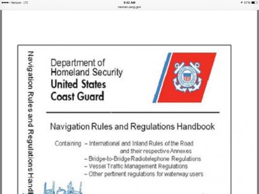
And, the latest edition of the USCG navigation rules and regulations, which is required to be carried on board can now be carried in electronic format.


Howard
 

Attachments

  • image.jpg
    image.jpg
    84.9 KB · Views: 63
I met a sailor in Horta in 1981 who was on his second lap around the world. His nav suite consisted of an am radio, a compass, a set of ocean scale charts, a sextant and a stopwatch. Oh and his boat was 28' long.


Via iPhone.
 
He was trying to get from Cuba to the USA and clearly got lost.
 
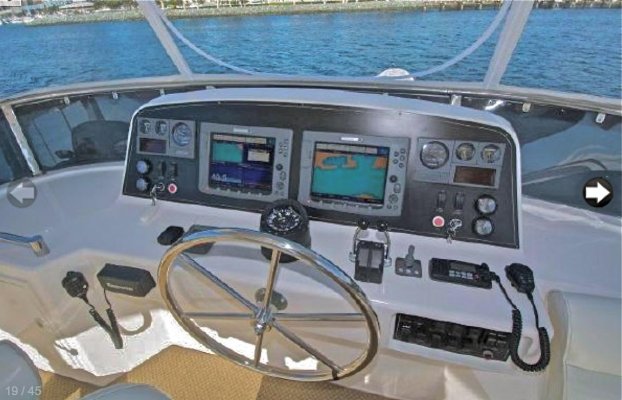
Although I have paper charts on board, I never refer to them. When a long cruise (to us) is only 70 miles, there's no need. I can't say enough about the electronic charts as they are so easy to use.
 

Attachments

  • Instrument Panel 2.jpg
    Instrument Panel 2.jpg
    112.9 KB · Views: 77
good reason to have a depth sounder separate from the plotter. With a depth sounder and charts you can easily stay out of trouble.


Without a depth sounder you are reduced to taking bearings and that can be cumbersome in shallow waters. Not a big deal when offshore though, until the fog comes in.
 
Keep in mind that GPS works only through the good graces of the US military. If a serious conflict occurs somewhere in the world, the consumer GPS channels will be disabled or scrambled, leaving function only to the military channels. Their opponents don't have access to those channels and will be back on paper charts!!

You'll know when something bad is going on somewhere in the world when your gps no longer gives a position. And that means every gps on your boat.

That's how I understand it to work, but someone more knowledgeable can correct me...
 
Back
Top Bottom