Propnut
Senior Member
I’m in the process of updating my electronics. I have a Raymarine Smartpilot autopilot that works great, so I’m not replacing it.
I plan to install a AIS transceiver and I think I want a Garmin 9” or 12” chart plotter. Do I understand correctly that with some of the Garmin units I can display and control the chart plotter from an ipad and use the iPad when operating from the lower station?
I’m confused about the VHF?
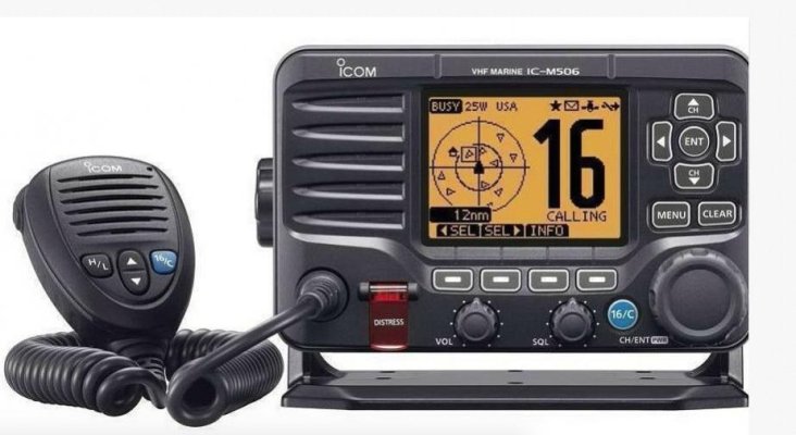
I want one VHF radio with remote mike capability( hardwired or wireless?)and all the nice bells and whistles like intercom, hailer,etc., but is there any advantage of buying a radio with a AIS receiver if I have a AIS
Transceiver connected to the chart plotter?
What are you experienced guys using and happy with?
Any recommendations as to a good setup is appreciated, since I have no experience with AIS , wi-fi chart plotters or VHF radios with remote mics.
Thanks in advance for your recommendations.
I plan to install a AIS transceiver and I think I want a Garmin 9” or 12” chart plotter. Do I understand correctly that with some of the Garmin units I can display and control the chart plotter from an ipad and use the iPad when operating from the lower station?
I’m confused about the VHF?
I want one VHF radio with remote mike capability( hardwired or wireless?)and all the nice bells and whistles like intercom, hailer,etc., but is there any advantage of buying a radio with a AIS receiver if I have a AIS
Transceiver connected to the chart plotter?
What are you experienced guys using and happy with?
Any recommendations as to a good setup is appreciated, since I have no experience with AIS , wi-fi chart plotters or VHF radios with remote mics.
Thanks in advance for your recommendations.

")